
I plan to post two sets of maps covering the development of Manningham Lane in the 1830s, based on material in the Local Studies Library. Historically, in the 18th century, a roadway called Manningham Low Lane extended to Clock House, centre of the Jowett estate, and on to Frizinghall. The road was amended around 1815 and became a section of a turnpike. The Carr Syke toll house was constructed in 1816 near today’s Bradford Grammar School location. Manningham Lane, as it now was, travelled through farmland from Bradford in the direction of Shipley.
The growing population of Bradford must have placed enormous pressure on the housing stock. For landowners, house construction must have become more profitable than farming, quarrying or mining. The first map shows the sale of land in between Manningham Lane and Lumb Lane. Unusually it is dated, 1833, and the landowner is named, John Stead. There is absolutely no doubt that house construction is intended since the vendor is constructing a main sewer, although his agents plan to recoup some of the costs from purchasers of individual plots.
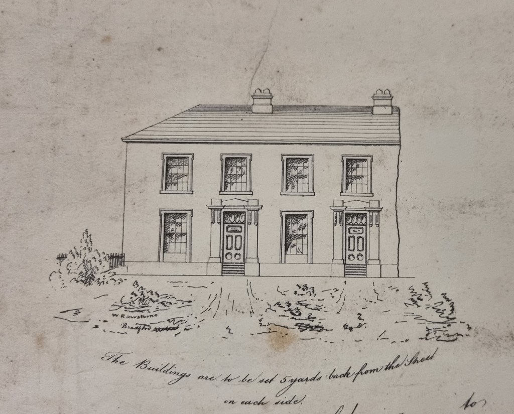
The house drawn on the map looks like an end terrace. It’s not immediately obvious if the appearance is hypothetical or represents buildings under construction. This is a topic I’ll return to later. I cannot find any mention of John Stead in Cudworth, although Isaac Stead and Benjamin Stead are earlier Manningham names. It is possible that John Stead was basically a builder or developer whose period of ownership may have been fairly brief. Where is the land exactly? Helpfully it is sandwiched between two plots owned by Rev. Godfrey Wright.
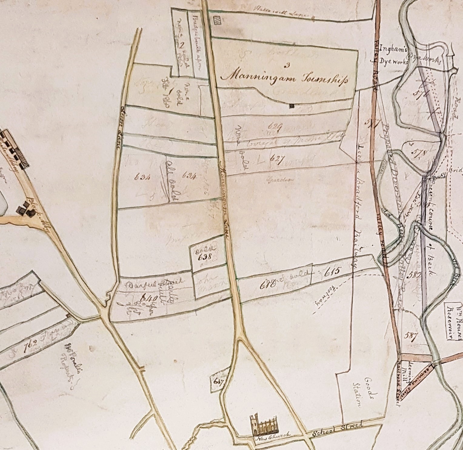
The land owned by Godfrey Wright is well-recorded. This is a detail of a hand-drawn map of his properties in Bradford, Horton and Manningham, probably originally dating from the 1820s. On the left you can see Lumb Lane branching off Westgate and Manningham Lane bisects the map in the middle. (On the right you can see the work being undertaken to straighten the meanders of the Bradford Beck). There are two areas between Lumb Lane and Manningham Lane which are enclosed by Godfrey Wight’s land. The upper seems the more probably since there is a roughly horizontal line which could well indicate a path preceding the line of the ‘intended street’ on the first map.
I assume that the intended street is Victoria Street and that Hanover Square was shortly to be built on Godfrey Wright’s land immediately to the north. Cudworth mentions that Victoria Street and Hanover Square were the first developments in this area. Hanover Street was first laid out around 1840, and Victoria Street is first mentioned in the Bradford Observer in 1838.
Today only a setted stub of Victoria Street is left running between the Bradford Arms and the Job Centre. Any houses originally built have been demolished and the whole area redeveloped again. It is not possible to say if the house drawn on the original map was ever present or not. There are undemolished Victorian houses nearby, like those in Eldon Terrace, but these are larger and built for wealthier householders. The question could be resolved by a Victorian photograph of Victoria Street and I shall keep my eyes open when I work on the LSL’s large photographic collection.
Having reached this conclusion local historian and photographer Kieran Wilkinson kindly provided another, and very persuasive, theory. He speculates that the piece of land in the first map was used for the site of St Jude’s Church. He feels that the shape of the mapped plot is a better fit for St Jude’s, and he has found a press item from 1838 indicating that the St Jude’s site was sold by John Stead. St Jude’s was constructed in 1840-41 and was notable for being in the Anglo-Catholic wing of Anglicanism. The Local Studies Library has a plan of the area after the construction of the church so you can make your own mind up.


There were houses in Victoria Street still in the late 1950s as that’s where my family rented rooms when they came over from Ireland, before moving across the road to Springfield Street, and from there to Ravenscliffe.
LikeLike