
A number of old maps and photographs in the care of the Local Studies Library, reveal the presence of old corn mills. I am by no means expert on this topic, but my understanding is that, in the medieval and early post medieval periods, the Lord of a Manor had the right, indeed the exclusive right, to operate a mill. The grain of his tenants had to be ground at the Lord’s mill, which I assume was a source of considerable profit. Modern Bradford contains a number of Lordships: old Bradford itself, Manningham, Bowling and Horton, so mill remnants are to be expected. Since waterpower was available in such constructions subsequent conversion of the building to textile processing was quite feasible.
The Lord of the Manor of Bradford once had the right to a corn-milling monopoly at the Soke Mill (later known as Queens Mill) which had stood above Aldermanbury for centuries. I believe that the district was once called St Helena. At one time the mill was divided between flour and worsted production, but the old goit which drew water from the Bradford Beck, and supplied it to the mill, is today culverted. (Modern Goitside, which runs parallel to Thornton Road, must be one of the city’s most neglected areas.) Bradford Corporation bought out the Lord of the Manor’s right in 1870 and almost immediately clearance of much property in this area began, and Godwin Street was created.
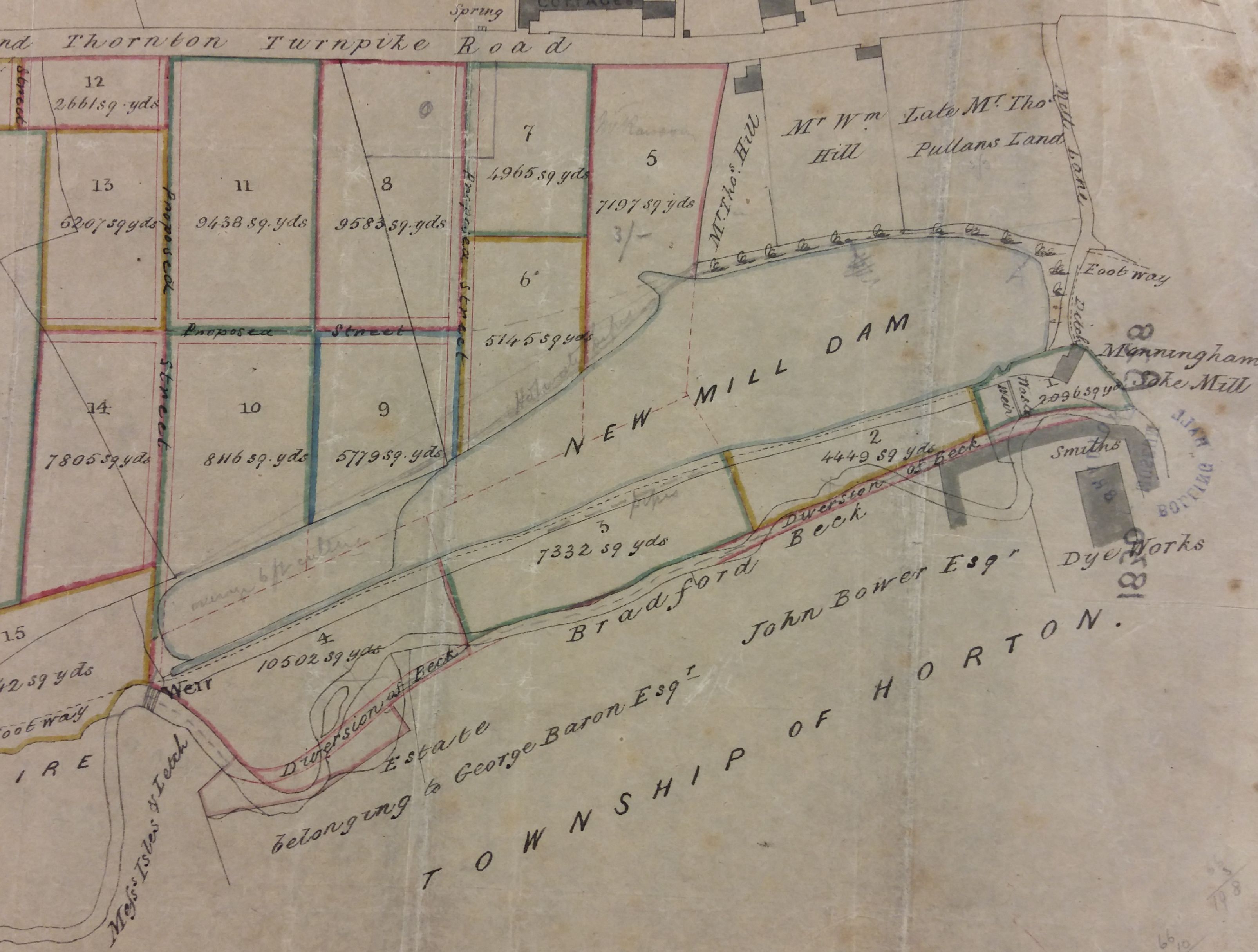
Today Thornton Road and City Road form a prominent junction. The first Ordnance Survey map, c.1850, shows that immediately south-west of the junction was New Mill Dam, part of which is shown on this plan from the LSL Reserve Collection. To the right of the dam, Mill Lane led to the Manningham Soke Mill. This was marked as ‘not in use’ at the time of the first OS map and I imagine that the use of a water-mill to grind corn, must surely have ceased many years earlier.
This is a complicated map, and I’ll leave you to work out where you are, only hinting that the railway tracks are a help and date this map to the 1840s. The next detail relates to my topic.
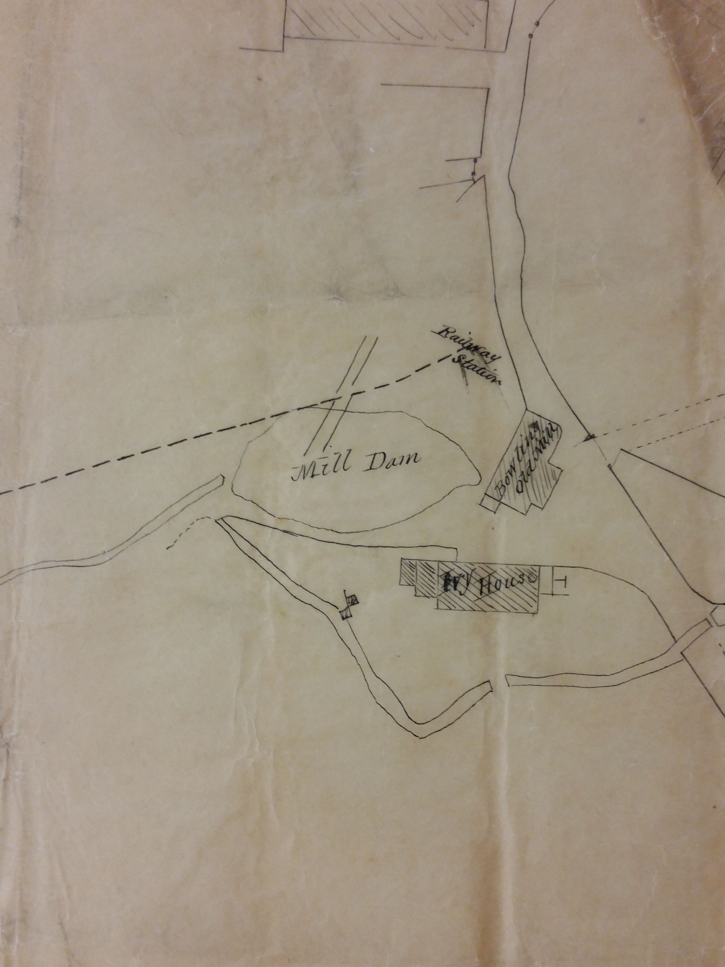
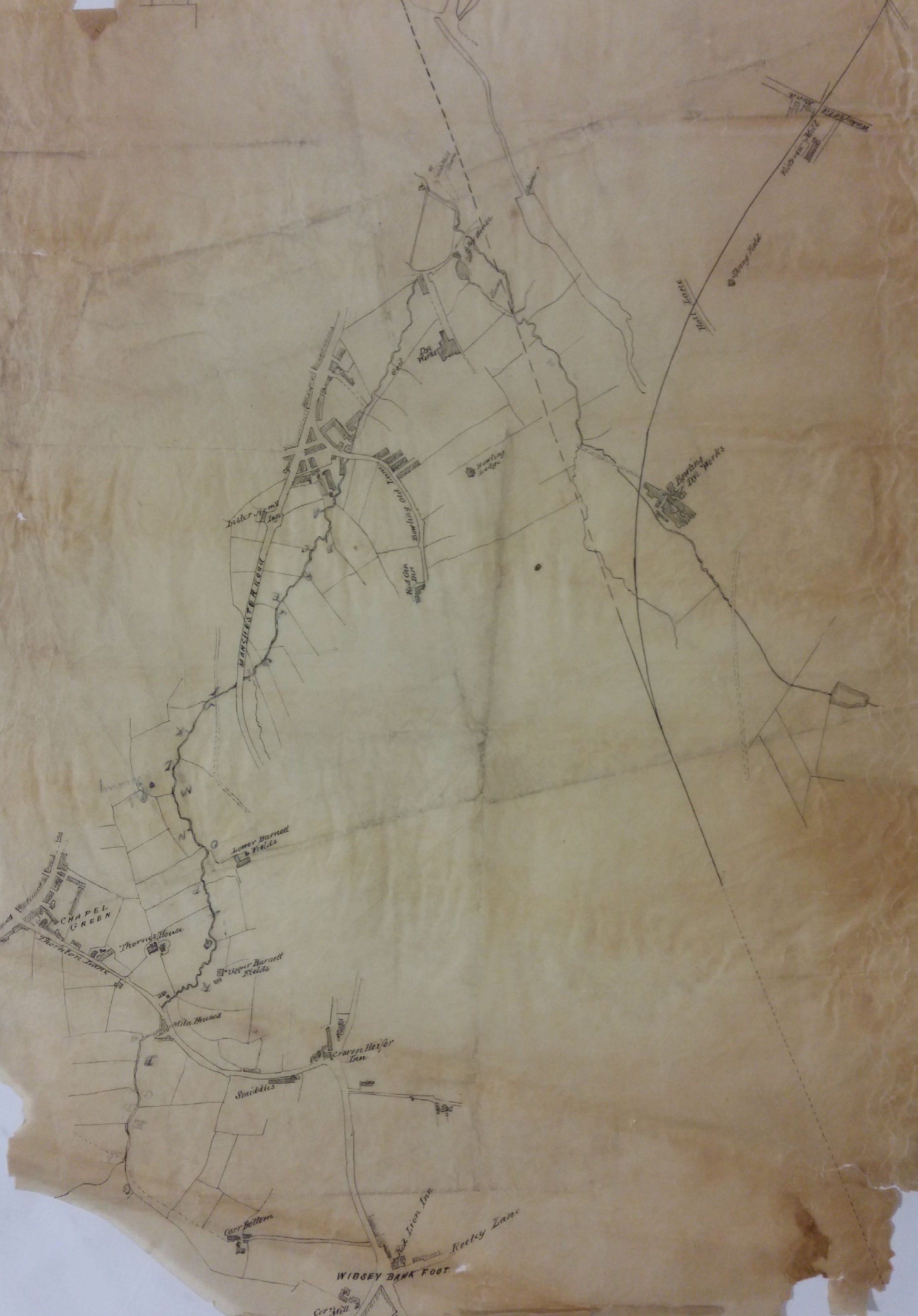
Bowling Old Mill was marked as a corn mill at the time of the first OS map. The Low (or Law) Beck joined the Bowling Beck above the mill. After their junction the result, called Bowling Mill Beck I believe, then went under Cuckoo Bridge to join the Bradford Beck itself. Cudworth records that in 1816 there were two water corn mills in Bowling: I think that the one in this map is ‘Lady Well Close, Mill Home’. In the late eighteenth century, it was in the occupation of Reuben Holmes. Later it was occupied by Jonas Jennings. Jennings was still in occupation in 1834 and John Green Paley was recorded as the owner. The mill goit ran through the field known as Mill Holme. By the time Cudworth was writing in the 1890s the whole site was demolished and occupied by Ivy Mill and some coal shoots in Mill Lane.
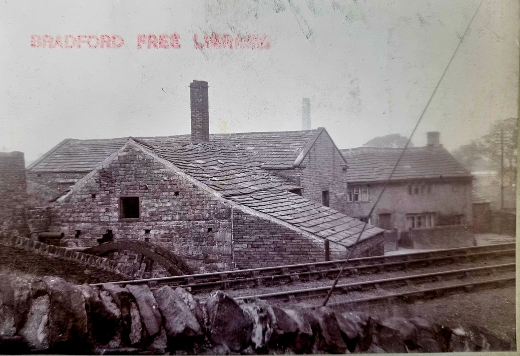
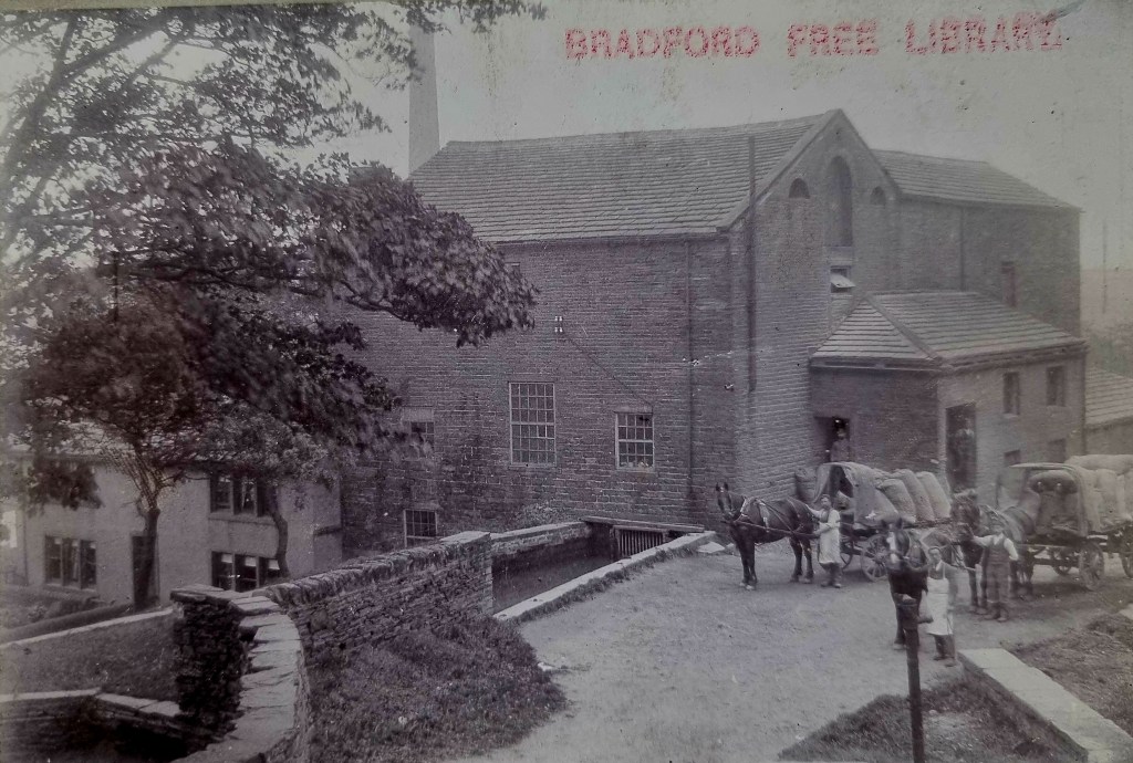
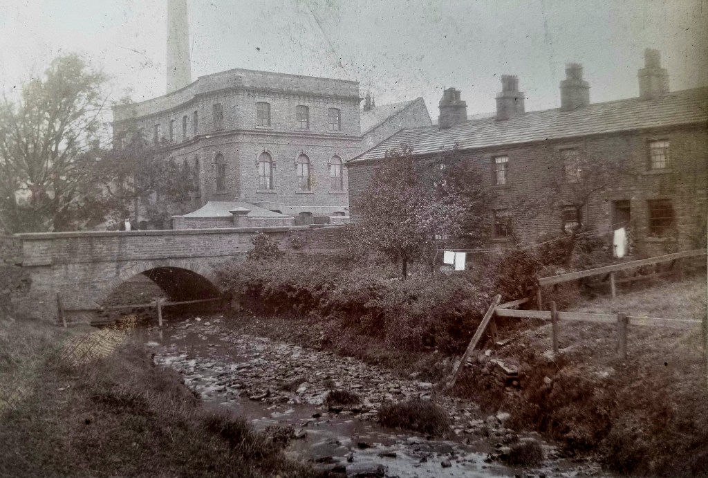
I now move to a photograph. Old photos can be difficult: you have to identify where and what they are, find them on a contemporary map, and then (often most difficult of all) locate them in the modern city. This image photo is labelled ‘The Old Corn Mill’, Beckside. At one time it was clearly powered by an overshot waterwheel, but no water was flowing when the image was captured in the late nineteenth century. The presence of the railway line is a big help in locating it, and I’ve included a detail from the 25” OS map which shows its situation. It was in Great Horton close to Beckside Mill.
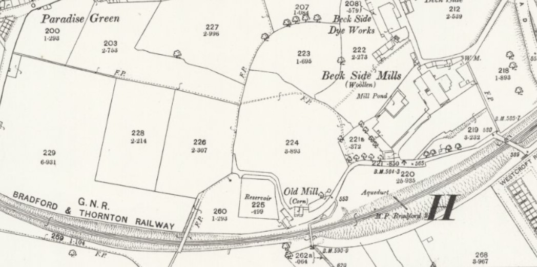
The Horton Beck provided the water for the Old Mill. A little further down stream, out of sight, was a second corn mill called the New Mill. I assume that the Old Mill was a manorial mill like the Bradford Soke Mill. William Cudworth records that in the nineteenth century the Lord of the Manor of Horton was Sir Watts Horton and then, after his death, his son in law Captain Charles Horton Rhyss. His property came up for sale in 1858 when William Cousen of Cross Lane Mill purchased the lordship. The Old Mill, its farm, and the water rights went to Samuel Dracup a noted textile engineer. He, it appears, eventually converted Old Mill to be a textile mill.
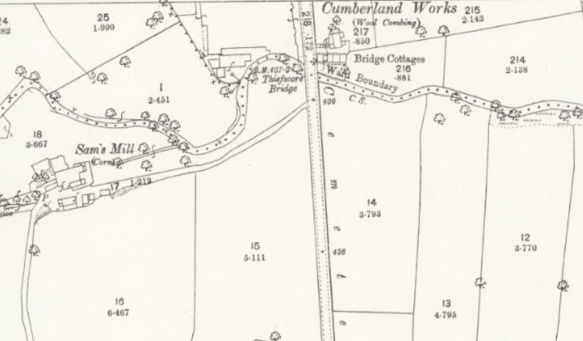
Further north, but still in Horton, is my final mill – Sam’s Mill. The Reserve Collection has late nineteenth century photos of the mill itself and nearby Thiefs Score Bridge, Cemetery Road. The detail from the first OS map shows the relationship of the two. I understand from my contacts that elements of both Horton Mills survive. I must go to look: local history is not purely a library activity!

Many thanks for the info regarding the Soke Mills and in particular the one at Beckside, Horton. This was my old stamping ground when I was a boy. As you say you intend to go and investigate I fear that this may not be possible as ‘Old Corn Mill Lane’ has a steel barrier across it’s entrance by it’s junction with Westcroft Rd and Arctic Parade. I contacted you some months ago regarding a similar problem with all the land at the other side of Arctic Parade (literally behind you if you were stood at the Corn Mill barrier) all the way down what was Toby Lane including Town End, the old station and the coal drops down to Estcourt Rd – All locked and barriered off. I did not receive a reply to my enquiry and hope you will be kind enough to let me know your observations on this matter. It causes me great sadness that I cannot revisited these places that mean such a lot to me.
Yours sincerely Chris Robertshaw
LikeLike