
2.171 MAN c1855 APS
Material: tracing paper Scale: unk
Size: 45* 35 cm Condition: poor
Many maps and plans in the Local Studies Library reserve collection include very little information indeed. This plan in particular encompasses several puzzles, although I won’t call them mysteries since they wouldn’t baffle someone with greater knowledge of Bradford in the nineteenth century than I possess. So, what information is available?
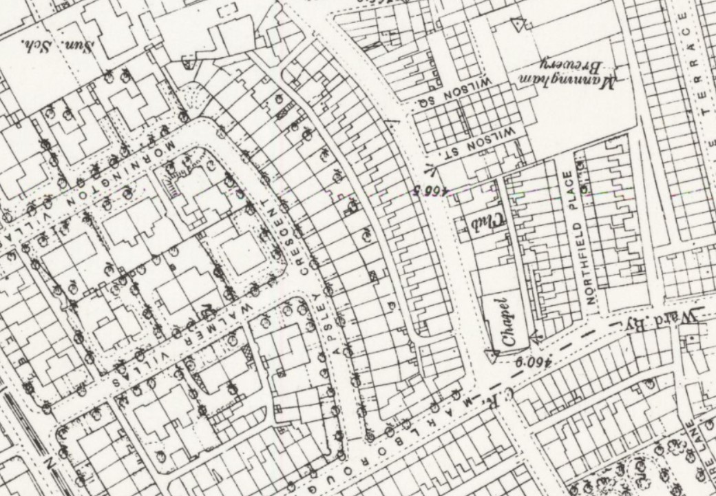
The plan detail I have provided is clearly annotated ‘Lumb Lane’ and ‘Greenfield Chapel’. Elsewhere are the words ‘Draft 97’, and a word ending in ‘al’ which is scratched through. The other half of the crescent is also present, but unannotated. My conclusion was that the plan showed an unnamed curved terrace row in Lumb Lane near Greenfield Chapel and the junction with Marlborough Road. This is Apsley Crescent, which conveniently is still present today. The overall topography of the area is well shown in this detail from the 1890 25” Ordnance Survey map. The almost obliterated word ending ‘-al’ is marked as ‘Club’ on this map.
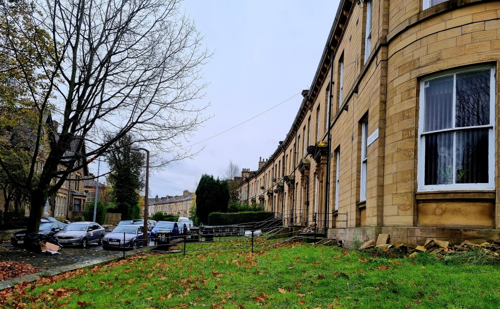
If you want to see Apsley Crescent walk up either Mornington Villas or Walmer Villas from Manningham Lane. The Crescent is at the end of both road and provides a link (for pedestrians only) with Marlborough Road. Do you see the connections with the victor of Waterloo? Apsley House was the London home of the Duke of Wellington. His father and elder brother were Earls of Mornington. Finally, Walmer Castle in Deal was his official residence in his capacity as Lord Warden of the Cinque Ports. Mornington and Walmer Villas amply justify their names and are lined by distinctive, stone-built, detached residences. Apsley Crescent is a curved terrace of some distinction, although several of the individual properties would benefit from conservation.
In the OS map Lumb Lane is not named but it crosses the named Marlborough Road by the chapel. Today this crossing divides Carlisle Road from Marlborough Road, and the long disused Greenfield chapel is at the Lumb Lane, Carlisle Road corner.
In my index notes on the reserve maps, I have noted that Greenfield Chapel was built by the Congregationalists. Oddly I have recorded two dates for this, the 1850s and 1876. There is a datestone built into the structure with the name of Rev. J C Miall, and the date 23 October 1876. This is described as a ‘memorial stone’ rather than a foundation stone, however. William Scruton states that Greenfield Chapel was erected in 1852 but provides no further details. Rev. Miall was the famous pastor at Salem Chapel, Manor Row. Presumably Greenfield was a daughter foundation and in 1853 the Bradford Observer records his name linked with that of Greenfield Chapel’s first minister, Rev. F Stephens. The OS maps are no help in dating. None of the developments mentioned are present in 1852, but everything is in place by 1890.
Apsley Crescent itself was probably in existence by 1855. The previous year architects Andrews & Delaunay were advertising in the Bradford Observer, seeking contractors for this development. It may have been the recent death of the Duke of Wellington in 1852 that initiated a small bout of sympathetic nominal commemoration. On the other hand, someone in the Council may have had a passion for great British generals: after all there is Marlborough Road and a nearby Blenheim Street too.

Just to say thanks for the info and thought the address of Apsley House was maybe worth a mention. I mean –
‘1, London’
how great is that ?!
LikeLike