X38 NOR c.1843 PLA
Size: 23” * 29” Material: Paper
Scale: 1” to 1 chain Condition: good
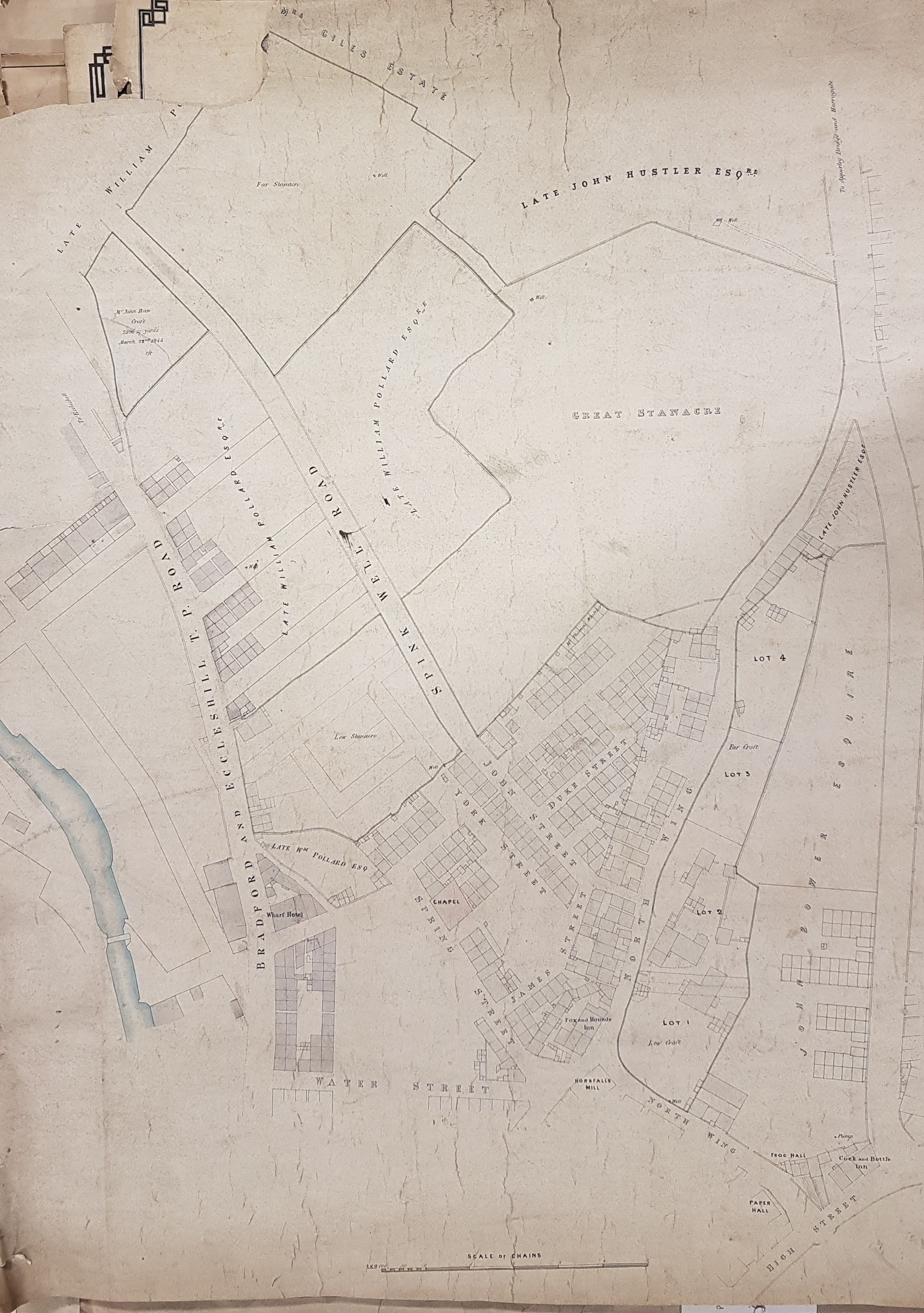
This is an undated, but detailed, sale plan of the area around North Wing. Horsfall’s Mill is marked, as is Paper Hall and the Fox & Hounds Inn. Local landowners include: the late William Pollard, the late John Hustler, and a John Bower.
A good place to begin is with Paper Hall at the bottom right of the plan. This seventeenth century construction, one of the city’s oldest domestic buildings, is still extant although its surroundings have changed out of all recognition. North Wing then opened off ‘High Street’ which is the modern Barkerend Road. In the first Ordnance Survey map of the area, c.1850, the whole area east of North Wing is somewhat more developed which indicates that our plan is earlier, but perhaps not hugely earlier. The Fox & Hounds Inn is believed to have been built in the early nineteenth century and was, I understand, demolished during the creation of the Shipley Airedale Road.
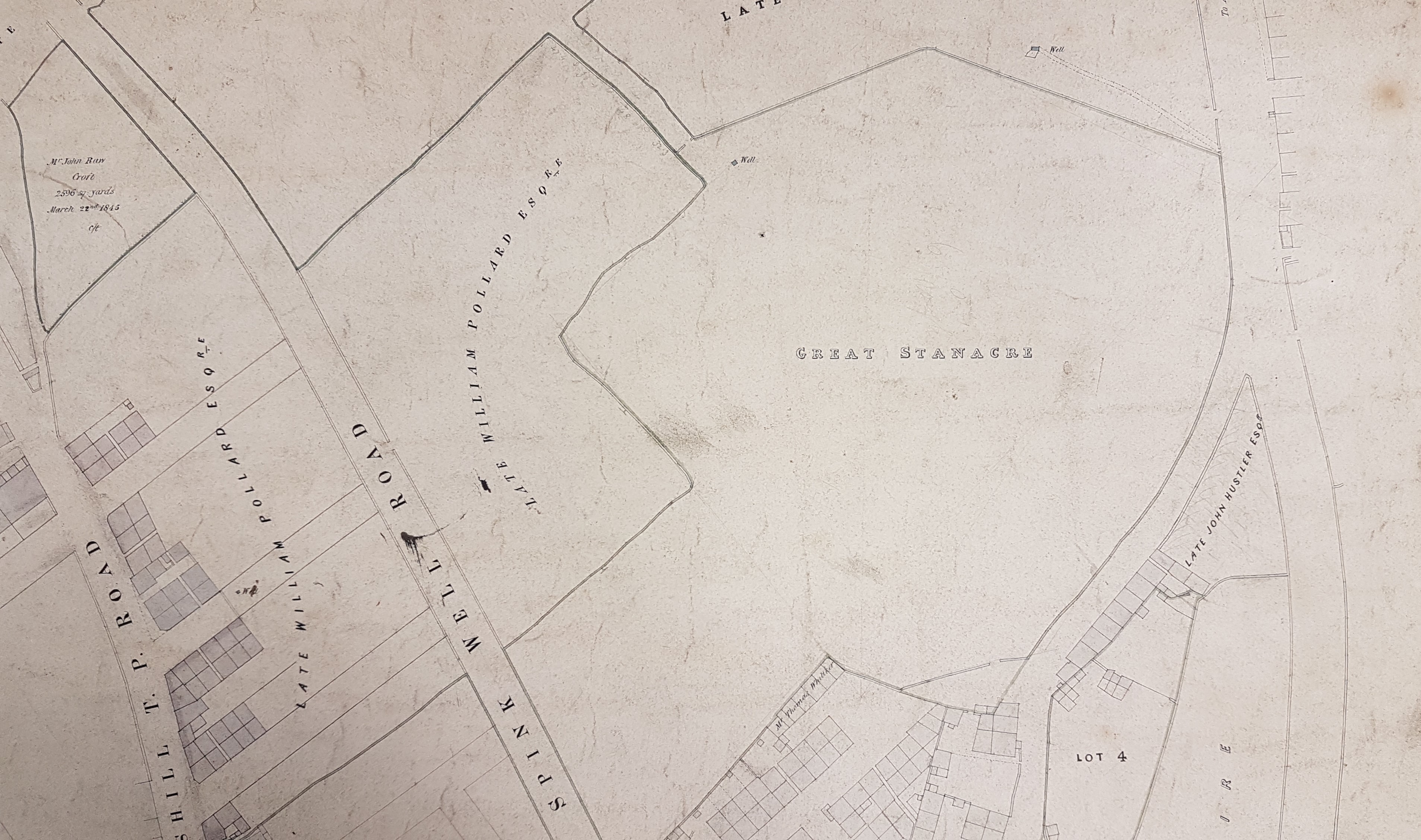
Lot 1 on our plan (Low Croft) is called Wilson’s Fold on the OS map. The other lots available for sale are not much changed on this later map, although to the west development has occurred on Low Stanacre. Great Stanacre is called ‘Wapping’ on the 1850 OS map, but is largely untouched by building. The situation was totally altered in the later 1890 OS map by which time a large brick works was present on the site.
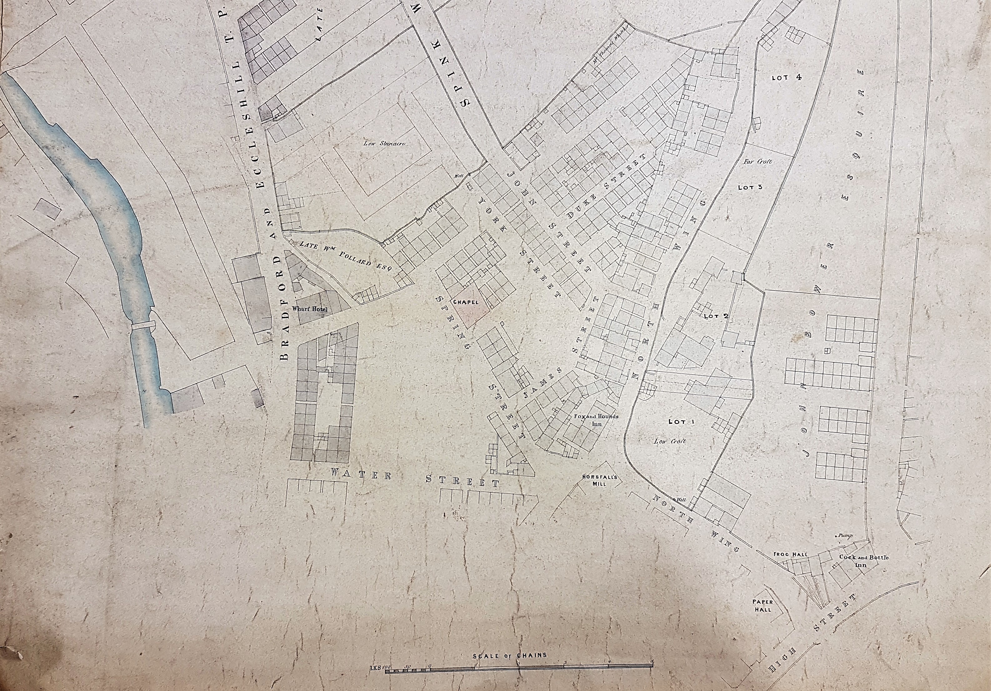
Horsfall’s Mill was of great significance in Bradford’s textile history. John Garnett Horsfall introduced steam power looms to the city. The consequent riot at his mill in North Wing (in 1826) led to several deaths when special constables fired on the protesters.
Is it possible to date the map by considering the names of the landowners? As I have mentioned elsewhere there were three related men, each named John Hustler, noted in Bradford history. One of them could have been termed ‘the late’ around 1790 (which is stylistically too early), or 1842 or 1861. Another clue to the date is a piece of property labelled as belonging to the late William Pollard. Assuming this man is William Pollard of Scar Hill he was certainly alive in the early 1840s when he drew up a will. There is a brass memorial in Bradford Cathedral which states that a William Pollard, who married Beatrix, actually died in the year 1840 aged 72. Scar Hall, at Scar Hill, was at the crossroads in Bradford Moor where the appropriately named Pollard Lane joined Killinghall Road. It is well shown in the 25 inch 1893 OS map, and must now be at the site of Bradford Moor Golf Club.
Finally, another tablet in the cathedral records that John Bower of Townend, Bradford (and Middlethorpe Hall, York) died in 1843, and his wife Anne in 1853. Bower is not described as ‘the late’ in our plan so, assuming all these identifications are made correctly, 1842-43 seems a reasonable date for it.

I walk past Paper Hall, down North Wing, along Wapping Road on a regular basis, so this map of how it looked before development is really interesting. A real shame about the state of Wapping School considering its significance to Bradford’s history in education and health. I didn’t know of the Horsfall riots – shall do some delving. Thanks for the posts, they keep me ferreting away and create ideas.
LikeLike