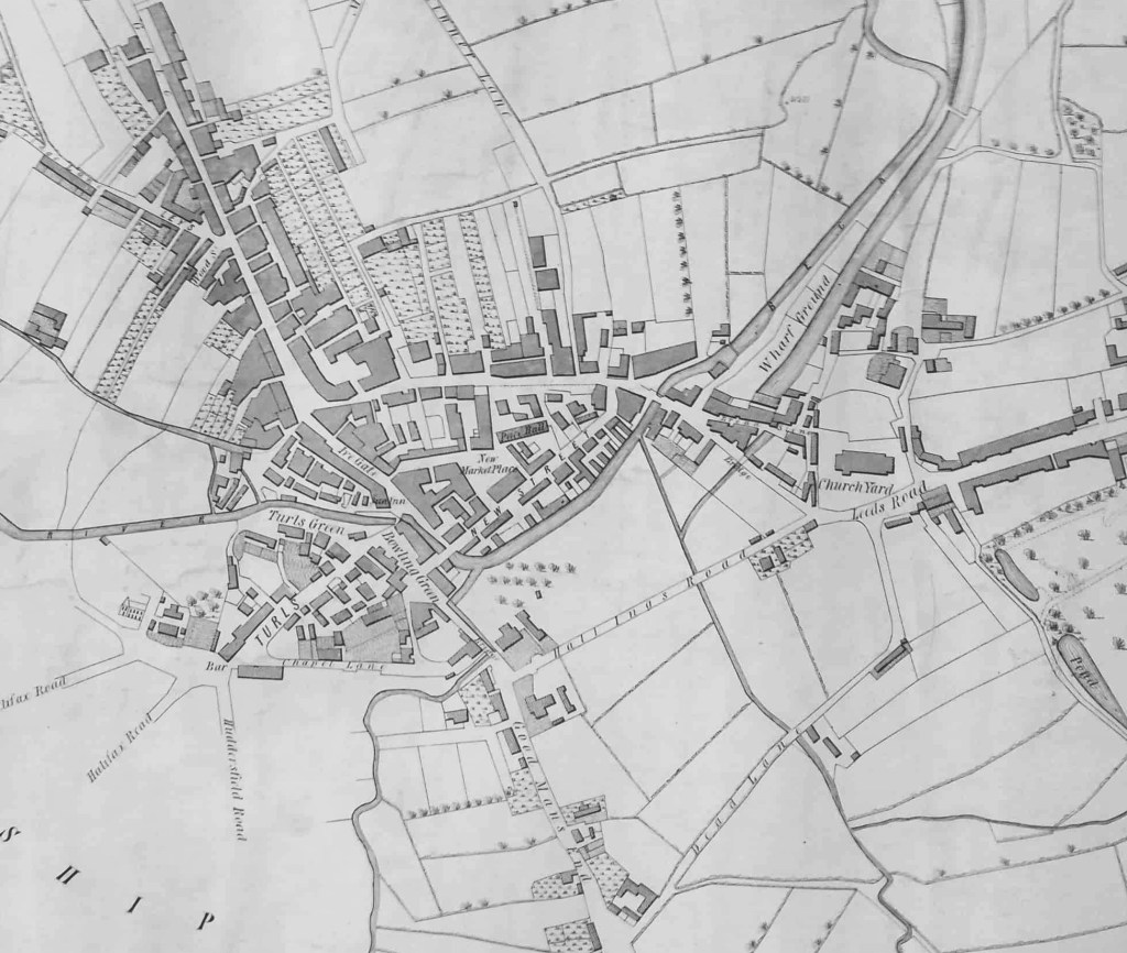
Bradford is fortunate to have an early town map of 1802 of which this is a detail. ‘Hall Ings Road’ is clearly marked and connects Bridge Street (Good Mans End) with the parish church and the road to Leeds (Barkerend Road). An ‘ing’ was a piece of marshy or swampy ground, which once must have been the state of the land surrounding Hall Ings being close to three watercourses, then of course above ground and visible. Who lived in the ‘Hall’ I cannot say.
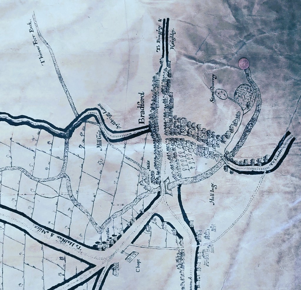
There is an earlier map derived perhaps from the office of attorney Samuel Hailstone (1768-1851). This map is 80 years older than the first and provides a great deal of information about the township of Horton. Bradford itself if really an addendum only. But Chapel Lane and Goodmansend can be readily identified, and we can be certain that ‘Hall Ings’ was a placename in the early 18th century. The land seems then to have been crossed by a path or bridalway rather than a made road.
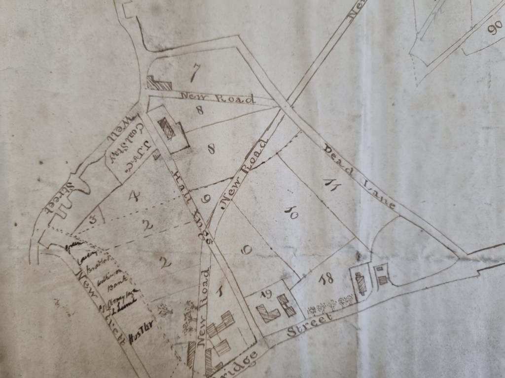
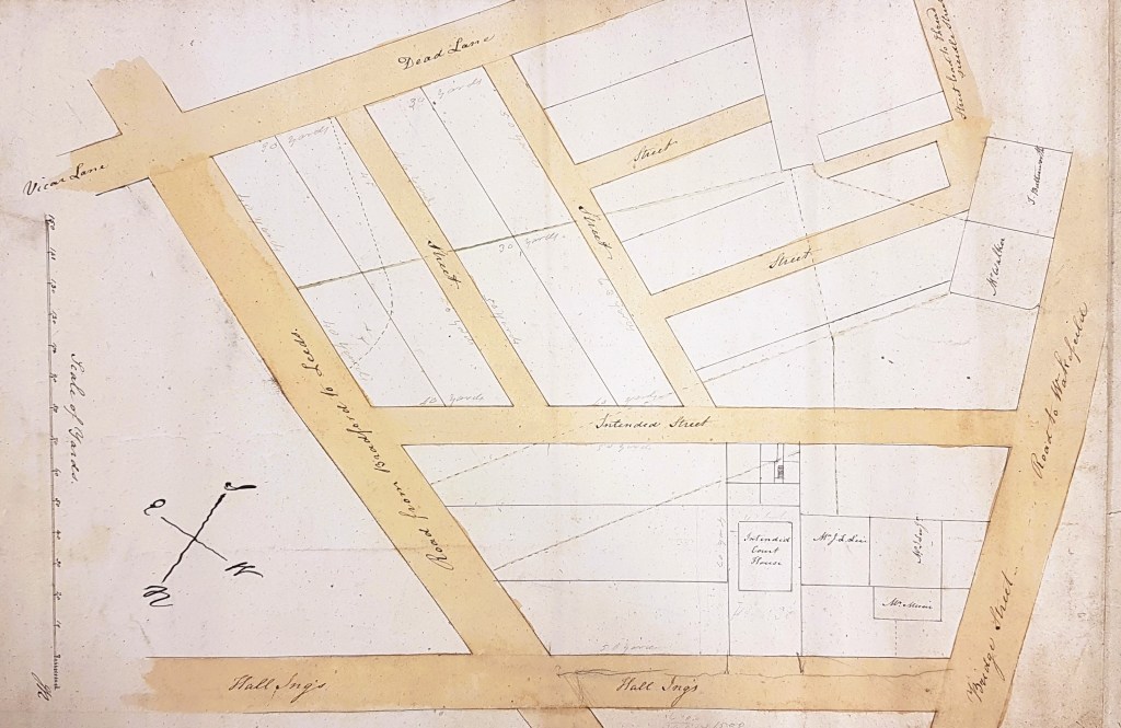
It is possibly to be more certain of Hall Ing’s progress in the 19th century because Rev. Godfrey Wright was a substantial landowner in this area, and the Local Studies Library has several of his estate maps. Fig 3 shows what is probably the oldest of these. An early date (perhaps c.1825) is suggested by Leeds Road still being a ‘new road’ and Vicar Lane being known by its former name of Dead Lane. My research suggests that Godfrey Wright owned all the numbered plots, which together constitute virtually the whole of the Hall Ings area.
This map must be of approximately the same age, but it is more detailed.
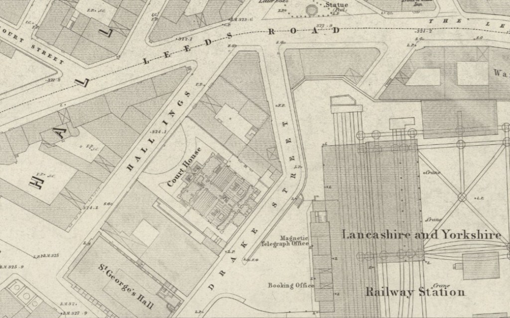
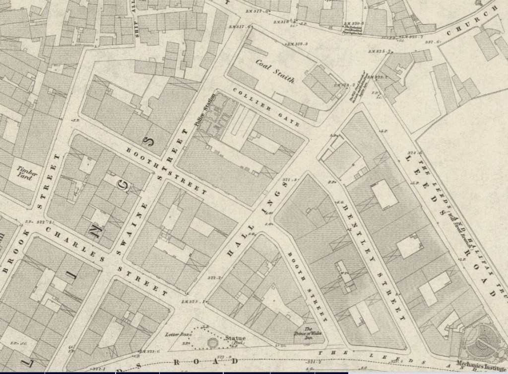
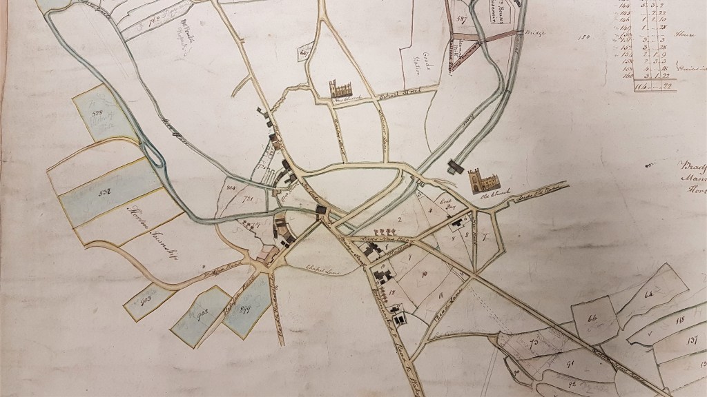
Two important buildings would shortly be erected which are helpful in dating later maps. The Old Court House was constructed in 1834. The formal entrance to the neoclassical Court House building was from Hall Ings. The Hall Ings frontage of this site is now occupied by the Bradford T&A building. In 1850 Godfrey Wright owned the land on which St George’s Hall was built and got £15,000 for selling it (Bradford Observer October 17 1850). The pre-existing buildings were demolished to allow the construction of the concert hall. In theory the new hall should not show on the above map detail since it was surveyed in 1848, but this must represent a somewhat later ‘railway revision’. In addition to these prestige constructions in a generation the whole area has been filled with industrial, retail and domestic units. Hall Ings is surrounded on both sides by a ‘gridiron’ pattern of streets: Swaine Street, Brook Street, Charles Street and Booth Street. These were created by the landowner Rev. Godfrey Wright in the 1830s who used family names to identify them.
This map must have documented those very changes taking place in the 1830s. After 1847 there would be a Swaine Street building which I believe functioned as a fire station, police headquarters and corporation accommodation before the construction of the Town Hall. All in all a highly significant area.
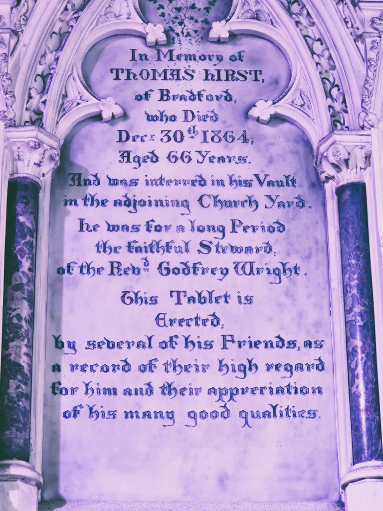
By the mid-1800s Godfrey Wright’s agent was Thomas Hirst of Hall Ings, Bradford. He died in 1864 and his memorial is in Clayton Parish Church.
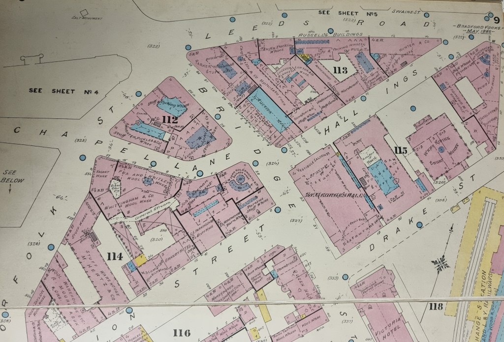
A detailed record of Hall Ings a further generation on is held in the Goad Insurance Plans of 1886, of which this is a specimen.
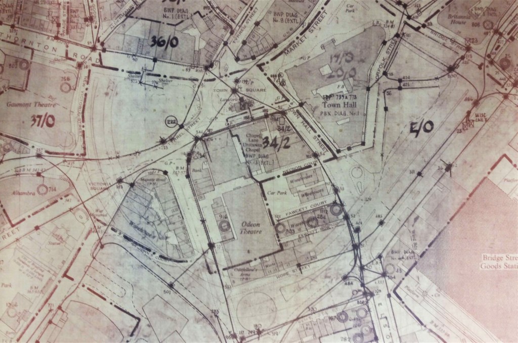
City centre roads were revised during the enormous developments of the 1960s. An extended stretch of Hall Ings, between Bridge Street and Prince’s Way, was constructed; this was the situation until very recently.
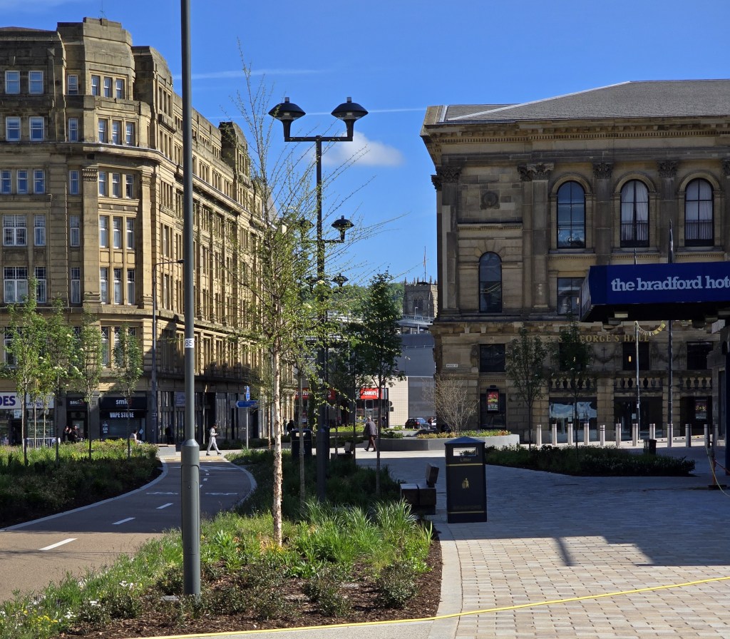
‘Lo, all our pomp of yesterday, is one with Nineveh and Tyre!’ So, here we are – approximately 300 years later than the oldest map of 1722. The extended stretch of Hall Ings has become a new urban park. The lower section of Hall Ings is once again closed to traffic and forms part pedestrianised precinct. The three watercourses are now underground, but will this be forever?
