If you read social media discussions on the subject of Bradford history, you will frequently read complaints concerning the way modern developers have destroyed Victorian Bradford. There is a good deal of truth in this belief, but love of Victorian architects and builders should not blind us to the fact that, between them, they in their turn destroyed 18th century Bradford. I have looked at the area shown in this plan before, but it is a perfect example of this destruction, as well as being an area well-served by illustrators and artists.
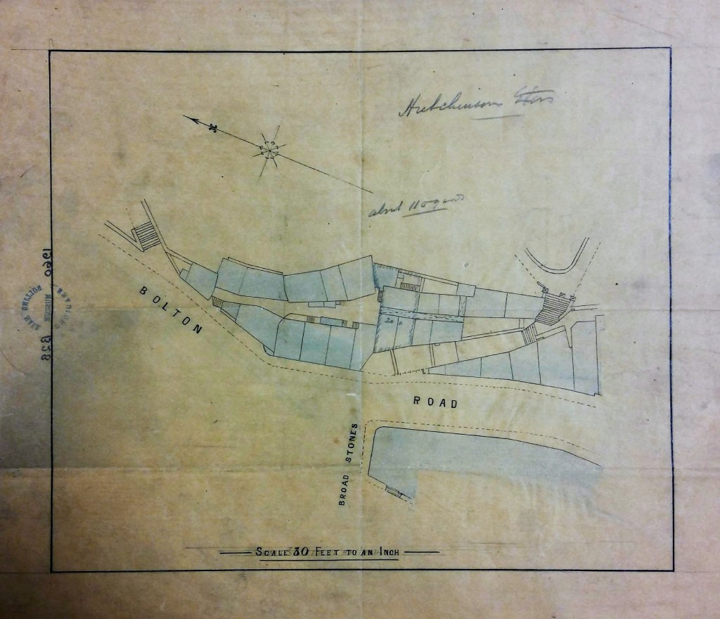
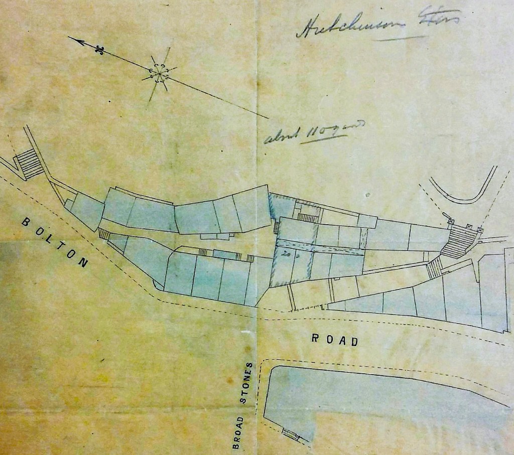
This plan clearly reached the Local Studies Library from Bolling Hall Museum, we believe in the 1960s. It has a catalogue number (1960 B28), but sadly we cannot locate a contemporary catalogue that might give further information. What can the plan itself tell us? It is drawn on tracing paper to a scale of 30 feet to 1 inch. Its size is 32*28 cm, and it is in remarkably good condition considering it must predate 1882 and be nearly 150 years old. In pencil it is annotated with the name Hutchinson. In the second figure I’ve concentrated on the central portion of the plan to make the arrangements clearer.
The plan is evidently drawn very carefully. It shows the junction between Bolton Road and Broad Stones (or Broadstones). Individual properties are clearly indicated, and tinted in blue, but not named. What are we looking at?
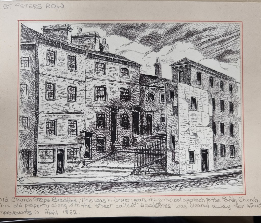
The Local Studies Library has two drawings by William Scruton which illustrate this area and name it as ‘Church Steps’. This first one clearly shows the right-hand side of the plan. The ending of a building in an acute angle is an unmistakable guide.
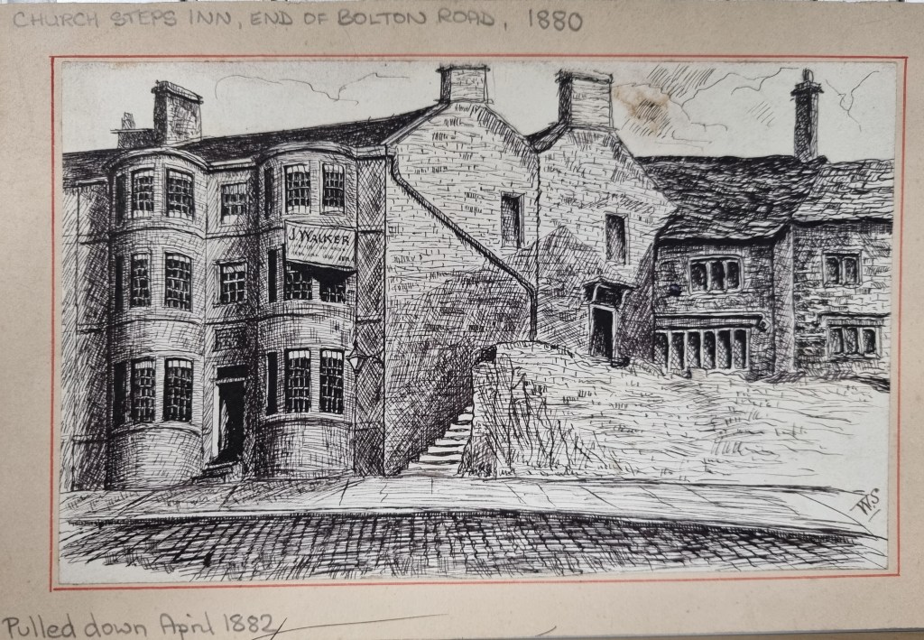
On the left of the sketch is the only name to appear: ‘J Walker’. You would think that Scruton’s second drawing would be the left-hand side of the original plan. It shows a narrower flight of steps and, apparently, a sharp right turn. But in fact this does not appear to be the case. Fortunately, the whole sketch is labelled the ‘Church Steps Inn’ and we have an additional map which identifies the position of this hostelry exactly.
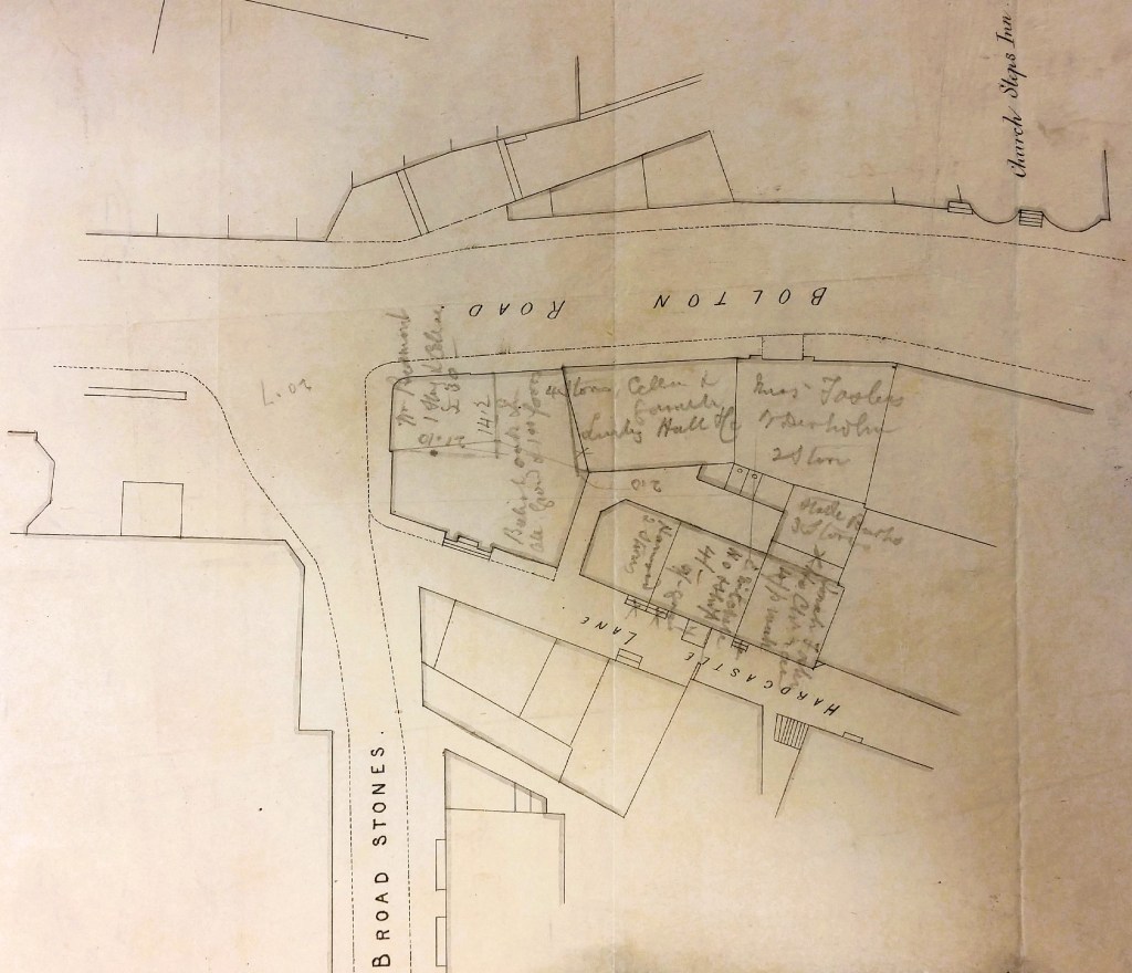
The Church Steps Inn with its double bow front (top right of the second plan) must be undrawn and off to the right of our original plan. William Scruton, in his Pen & Pencil Pictures of Old Bradford (1889) describes the Church Steps Inn as the oldest licenced house in Bradford, ‘wherein the fates of nations or the small talk of the town might be discussed’. At the time the second map was drawn the thoroughfare on which the Inn opened is confirmed to be Bolton Road.
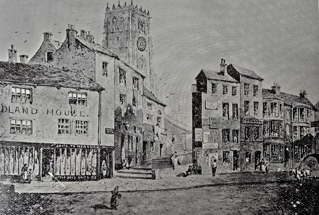
There is a second view of the broader series of steps which is taken from the pamphlet ‘Old Bradford Views from the Cudworth Collection’. The shop on the left of the steps is clearly a tailors with ‘suits made to measure’ and ‘little boys suits’. The whole building is seemingly labelled as (M)idland House, which must surely means that the sketch post-dates 1850 and the arrival of the Midland Railway Company.
Fortunately for me the Church Steps Inn was regarded by the 1851 census as the final property in Bolton Road, then occupied by a Charles Lightowler. Walking back along the road, in our imagination, we pass hairdressers, milliners, shoemakers and blacksmiths. Inevitably even in this short distance there is a second pub, the Ring of Bells (Moses Sugden) which was originally the home of canal promotor Abraham Balme and survived into modern times.
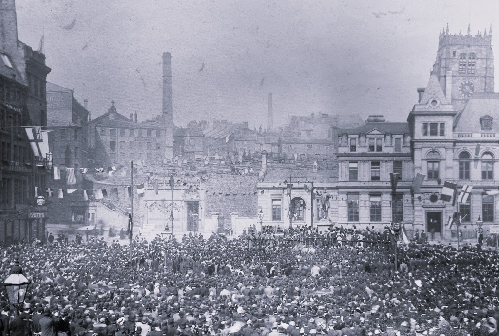
But, of course, this state was not to last. The church steps, the inn, and the adjacent old Grammar School, were clearly swept away by the creation of the General Post Office around 1882. This still exists but is unused for its original purpose and is now an Arts Centre. The final LSL photograph shows the area at the time of the erection of RA Forster’s statue in 1890. The GPO building is centre to right in the image.
