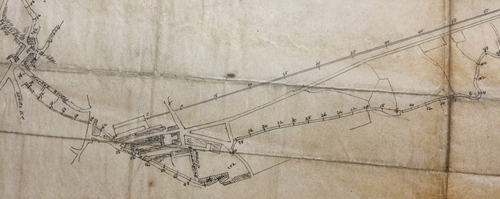
I thought I should have another look at this plan, which may be new to some users of this site. The sketch plan is not dated and its purpose is unexplained. Its importance lies in the fact that the Bradford Beck is almost entirely on the surface. The railway link from Shipley is drawn in, which means that it must have been surveyed, or at least updated, after 1846. It may then be roughly contemporary with the survey that resulted in the first 6” OS map around 1848-52. This map is helpful when interpreting our plan.
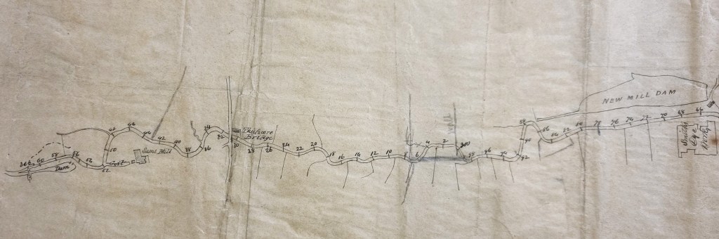
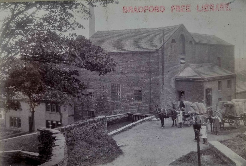
The extreme western end of the Beck shows a dam (reservoir) and a goit (leat) supplying Sam’s Mill from the Middle Brook. We are fortunate enough to have a photo of this mill in the Local Studies Library reserve collection which I used as an illustration for my last post. This is from at least a generation later than the plan of course.
Sam’s Mill is Grade II listed. The listing document describes it as a c.1820-30 rebuild of an earlier water mill. The mill retains its housed undershot wheel. The Friends of Bradford’s Becks are exploring the restoration of the river environment in this area. The Middle Brook continues to Thiefscore Bridge which gives passage to Cemetery Road. The previous name of the road was Thief Score Lane. The brook continues its meandering course, south of Thornton Road (which already existed but was not drawn here) and through the undrawn Brown Royd Farm to New Miller Dam. Cudworth records that the New Mill(er) Dam was created by John Smyth of Heath, near Wakefield, around 1777. His family were associated with the estate of Miryshay, off Barkerend Road.
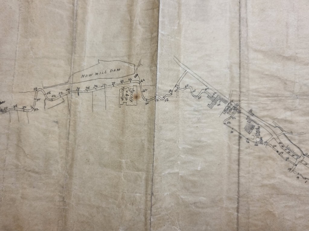
The next section shows the relationship between the dam and Smith’s Dye Works. Samuel Smith (stuff dyer) is in an 1850 directory and was placed at Field Dyehouse, Thornton Road. Stuff was a worsted cloth. A fire occurred at ‘Smith’s Dye Works’ in March 1848 (Bradford Observer). We know from other maps that two goits were taken off New Mill Dam to supply the Dye Works and the old Soke Mill (Pentrough & Tail Goit).
As the Beck flows further west things start to get more difficult. Thornton Road appears running south-east. This is from a point just below the junction with Brick Lane, but that is not shown. The Beck goes under Field Head Bridge and reaches Ashfield Worsted Mill, then Phoenix and Water Lane Worsted Mills. There is no mistaking the gas holders of the New Gas Works; it was constructed south of Thornton Road in this position around 1845.

There is no problem picking up the gas works on the left side of this plan detail. One third of the map is comprised of three linear features. From the top: the goit supplying Bradford’s Soke Mill, then Thornton Road, and finally the Beck. Working along the Beck you come to a P shaped building. I have found it impossible to identify this with certainty. The OS map shows a cluster of mills in this general position. The Beck then makes a turn and crosses under Thornton Road. Subsequently the presence of buildings is hugely simplified until we reach the rectangular Sun Hotel and Sun Bridge at the bottom of Ivegate.

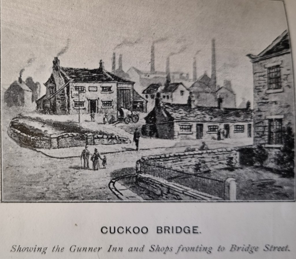
The famous ‘Sun Inn’ at the bottom of Ivegate was demolished in 1895 and was replaced by the Prudential Assurance Building, so we know where that was. At this stage there is a short section of the Beck already running in a culvert. The fact that the Beck emerges so soon suggests that our plan is earlier than the OS map. Here Leeds Road is drawn and named, but Bridge Street is drawn but not named. Nearby there was Cuckoo Bridge roughly where Britannia House is located now, formerly the site of the Gunner Inn. Cuckoo Bridge spanned Bowling Beck, which yards further on joined Bradford Beck.
On our plan the Beck re-emerges in an empty space running parallel to Market Street. On the OS map this is filled with a network of roadways including Swaine Street, Brook Street and Charles Street. The whole development was undertaken by Rev Godfrey Wright, but in the late 1830s. So, either the map maker is basing his plan on very old data, or we have disappeared below ground. The course of the Beck parallels Market Street, and then near where that street meets Well Street it goes under the, unnamed, Church Bridge. This arrangement is better shown in the next map detail, but note that north is now to the right.
There is a building between positions 64 and 62 which may represent the Woolpack Inn. The parish church is not drawn but our map is fairly detailed over the development that has occurred between the Midland Station and Canal Road, such as Mill Street and Commercial Street.

The Beck re-emerges at the base of a triangle formed by the divergence of Leeming Street and Foundry Street as they were called. It has just travelled under a second, but undrawn, gas works. I don’t imagine that did a great deal for water quality. The rest of the plan consists of the Bradford Beck flowing north for its rendezvous with the River Aire. I think the whole of its rather meandering course was later straightened.

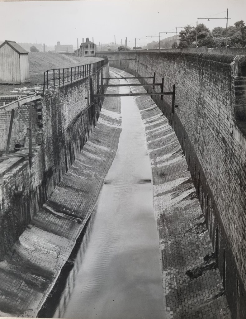
I’d like to finish with two photos from the 1960s in the LSL collection. The first shows the culverted Beck in the city centre. You would have to know old Bradford much better than I do to work out exactly where. The last shows the Beck on its northwards course near Canal Road.