
I have touched on this plan before, but it really deserves fuller treatment. Map 2.124 MAN c1860 PLA is from the mid-19th century. The map is undated, but it closely resembles the first 6” Ordnance Survey map of the area which was surveyed in the late 1840s. Such changes as there are suggest that our map is slightly later – 1854-1861 probably. One of the landowners mentioned is George Baron, of Clockhouse Estate. Miss Sarah Jowett who died in 1840 was the last member of the original Jowett family and she left the Clockhouse estate to this George Baron whose name regularly features on Bradford maps. Baron died in 1854.
We have to remember that at that time Bradford, Manningham and Horton were separate townships and we are on the Manningham-Horton boundary. The Bradford & Thornton Turnpike Road is modern Thornton Road. I understand that this portion of the turnpike ran from Bradford to Leaventhorpe Hall and was opened in 1826. The Trust that built the road ceased to exist in 1861, an event that our plan clearly pre-dates.
We are some way out of the modern city centre. The main road appears horizontal on the plan but, in reality, runs slightly deflected to the north-west. The Brick Lane Bar near the top left was a place for toll collection. It is not very near Brick Lane in Bradford but is located at the junction with Whetley Lane. Opposite today would be the Girlington branch of Morrisons and its huge carpark.
This plan also shows the land south of the Bradford & Thornton Turnpike Road (Thornton Road) divided up for sale and perhaps development. Brown Royd is presumably a former farm and it would appear that portions of its field system are being sold off. The rectangular plots do not, of course, follow the original field boundaries. I have a note that the Bradford Soke Mill (Queens Mill) and an associated estate at Brown Royd Farm, Thornton Road had been offered for sale on 27 November 1845. But I have no information about the vendor or purchaser.
Cudworth records that the New Mill(er) Dam was created by John Smyth of Heath, near Wakefield, around 1777. His family were associated with Miryshay off Barkerend Road. Note the Bradford Beck. There is a goit (leat) which has been constructed to take off water to supply the Manningham Soke Mill. A soke mill was the property of the Lord of the Manor. Farmers had to have their corn ground there, and the Lord would take a percentage as his perquisite. The OS map marks the mill as ‘not in use’. I cannot find an image of it at present so I have included a photograph the LSL has of ‘Sam’s Mill’ which was higher up the Beck.

Further downstream near the end of Thornton Road was the Bradford Soke Mill, already mentioned. Thus, the water flow in the Beck was sufficient to power three corn mills at one stage.
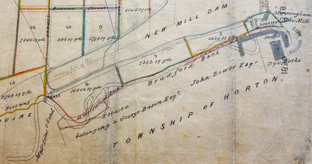
The most interesting waterway feature, in my view, is that the meandering Bradford Beck is already in the process of being straightened. In maps the Beck remains on the surface at the next OS in 1889, and is still unchanged in 1930. A ‘field trip’ would be sensible to assess the present situation.
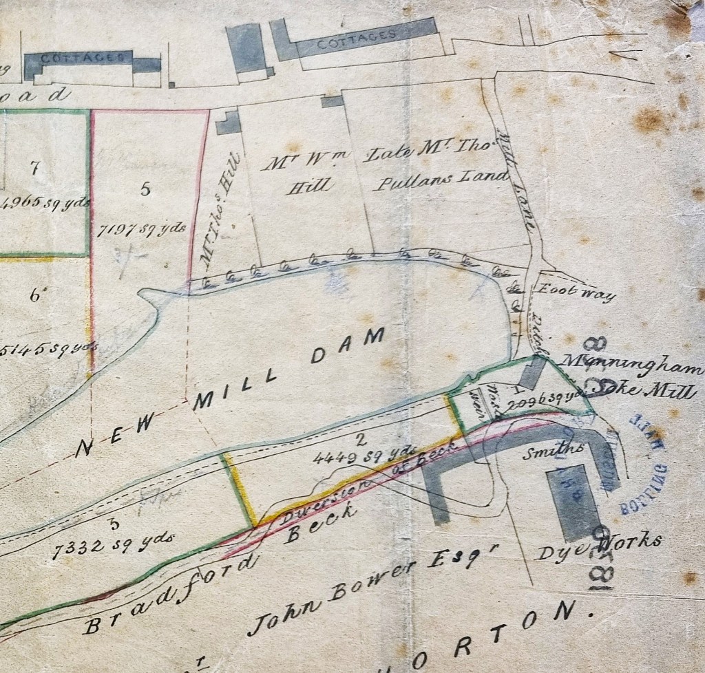
The buildings to the top right are two collections of cottages separated by the New Mill Dam Inn. Smith’s Dye Works and Manningham Soke Mill are clearly labelled. There are pencil annotations which are unhelpful.
Smith’s Dye Works is a prominent building at the bottom right. In the OS map a dye-works of a somewhat different footprint is called Field Dye Works but we are looking at the same enterprise namely: Samuel Smith, stuff (worsted) dyer, who in an 1850 directory was located at Field Dyehouse, Thornton Road. By 1889 the works had a reservoir (Brownroyd Reservoir) and some dyeing ponds: I imagine that they were created out of New Mill Dam. The rearranged reservoir and ponds continue into the 1930s although the surrounding buildings change use.
