
The Local Studies Library curates this photograph, which is annotated ‘Canal Road Gas Works’, although it is in fact the nearby Valley Road Electricity Generating Station. Its wooden-construction cooling towers were known as Davenport Towers. It had been built in 1896 and finally demolished in the mid-1970s: I never saw it.

The faulty labelling stimulated my interest in gas production and supply, although I never saw any of that either in Bradford. This second photograph was taken between Queens Road and Spinkwell Lock where the bridge carried Kings Road (previously Tordoff Road) across the now disused canal. The gas holder was once part of the Valley Road Gasworks.
I was so familiar with the modern natural gas supply that, despite an A level in chemistry, I had to check the process of manufacturing, and storing, the older alternative. This was named town or coal gas. It was produced by a process called the ‘destructive distillation’ of coal in a coke oven, often contained within a plant known as a ‘gasworks’. Often, but not always: in old maps of Bradford small ‘coke ovens’ are frequently marked with no apparent storage facilities. I assume that coke was then the desired product and the gas produced was simply allowed to burn off.
Heating coal in the absence of oxygen produced a solid (coke), a thick tarry liquid, and a gas. The coke was largely carbon and formed a useful fuel, especially in the iron smelting process. The tar was full of hydrocarbons and formed a raw material for many chemical processes as well, as I learned in my former life, a treatment for some skin disorders. The gas was roughly an equal parts mixture of hydrogen and carbon monoxide. The second compound made the mixture deadly if inhaled. With very rare exceptions town gas hasn’t been used in the UK for lighting or heating in 50 years. As a child in Eastbourne, East Sussex the gasworks lay conveniently on a bus route between my home and my grandparents’ house. Going past was always an exciting moment and very occasionally the coke ovens were opened to reveal their red-hot hearts. In this article I am, of course, interested in Bradford’s gas supply and its recording on maps.
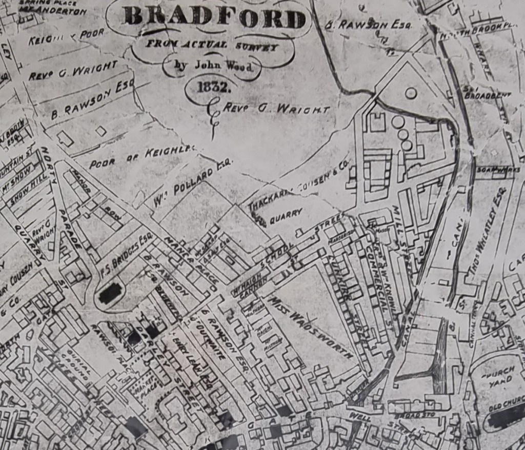
The original Bradford Gas Light Company was formed in 1820; its first works were built at Mill Street near Valley Road, supplying Bradford, Manningham, Horton and Bowling. The works can be seen towards the top right in this detail from the 1832 Bradford map.

In 1845 land at Thornton Road was acquired for a larger works. In this detail, from the 1848-50 town plan, it is recent enough still to be called the ‘New Gas Works’. There was a small surprise for me in this image since I hadn’t appreciated that there was another stone quarry near the town centre, off Water Lane.
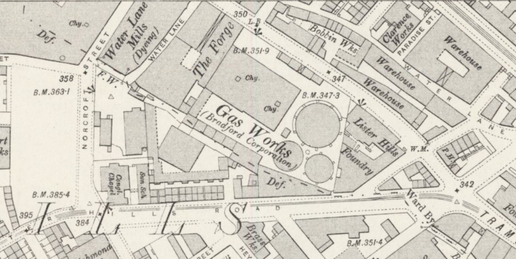
The gas holders don’t seem to have changed much at this location by the time of the 1890 OS map, although there has been substantial surrounding urban development. I wonder if all that explosive gas made for uncomfortable neighbourhood relations.
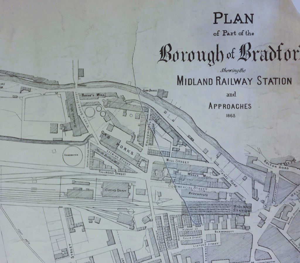
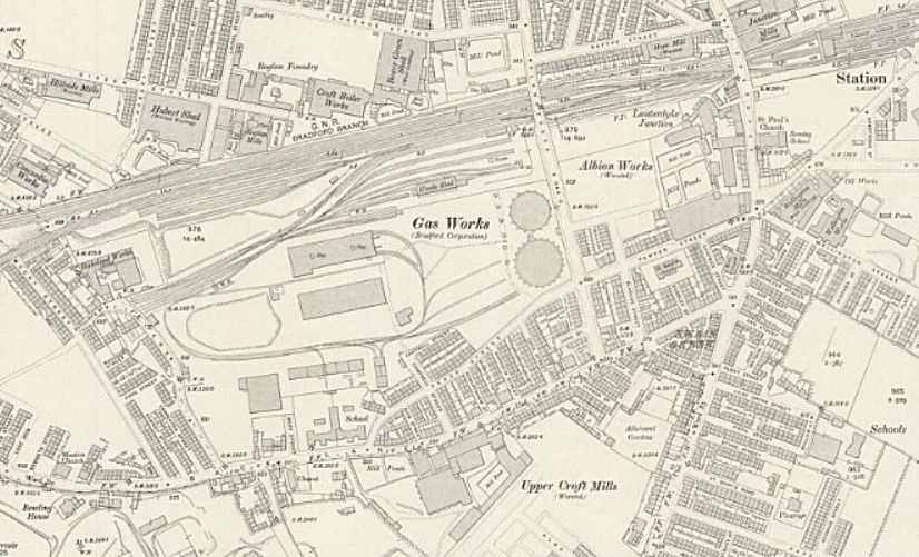
Evidently even these two plants did not prove sufficient and in 1852, an additional gasworks was constructed at Valley Road. I gather that these works were extended in 1869. The figure above shows the extent of the unextended works, and the map detail below shows the extended Valley Road works. The works was served by a network of railway lines which distributed coal, arriving on trucks from the Midland Railway, to the coke ovens.

In 1871, Bradford Corporation took over the Bradford Gas Light Company and purchased all three gas works for £210,000. Some years after the purchase additional works were constructed at Birkshall.
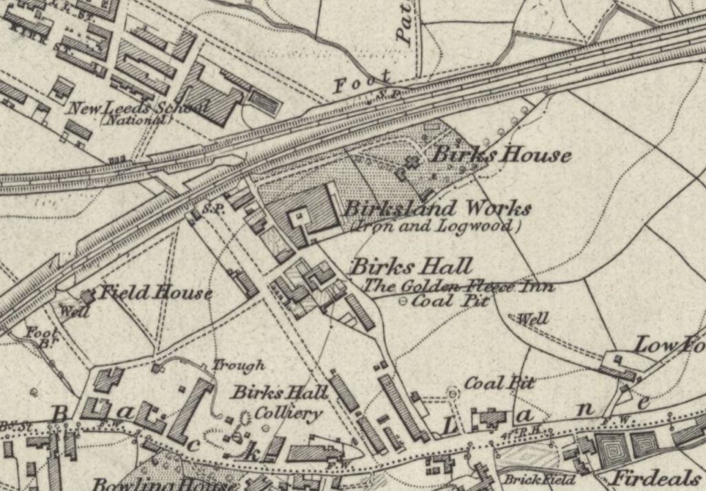
The above figure shows the area 25 years earlier in the first OS map. It is obvious that Birkshall was already an industrial site, quite near to the Bowling Iron Works. Some time later a brickmaker, Edward Gittins worked ganister in Bowling Back Lane until Bradford Corporation took the land for the Birkshall Gas Works.

In the collection of Bradford Industrial Museum there is a planning map anticipating the development of this works. I don’t think the nearby rail track belonged to the Great Western Railway whatever the map surveyor claimed: Great Northern it was.
The Corporation Birkshall gas works was developed between Leeds Road and Bowling Back Lane near Laisterdyke, and opened in 1883. This was the largest works of all, occupying 21 acres. It is present on OS maps between 1890 and 1930, and I believe it was the last gas works left within the city boundary. Towards the end of the 1930s gas production was abandoned at the Valley Road works which became exclusively a distribution centre. Production continued at Birkshall works, Laisterdyke, eventually the largest in Yorkshire. I have met people who remember it in the 1950s.
