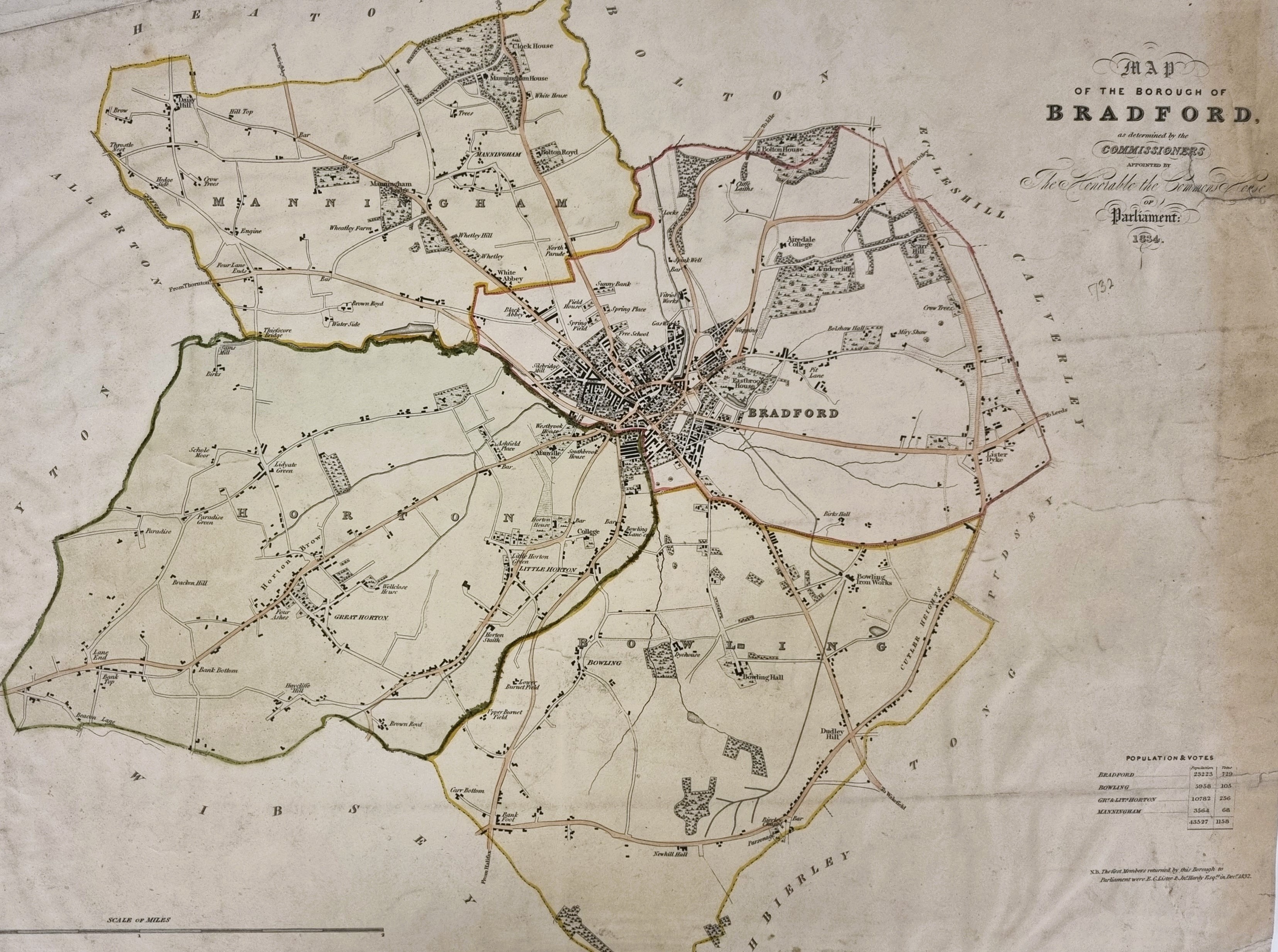
In 1834 commissioners for the House of Commons drew up a map of Bradford. The copy I have examined in the Local Studies Library has additional thick sepia marks showing the boundaries between Bradford itself with Horton and Manningham.

In this detail from the map you should be able to make out Bowling Lane (Manchester Road) in the centre, and Bridge Street (Wakefield Road) running off to the right at 4 o’clock. Roughly bisecting the area delineated by these two roads, though largely obscured by sepia, is the Bowling Beck which divides Bradford from Horton in this area. My interest is in the largely vacant land between the two turnpikes.

The next figure shows a plan from 1837. Noted local solicitor Samuel Hailstone is embarking on a large freehold land sale. It is clear that he owns this property and is not acting as an agent for another. In fact, his own agent is a Mr Peacocke.
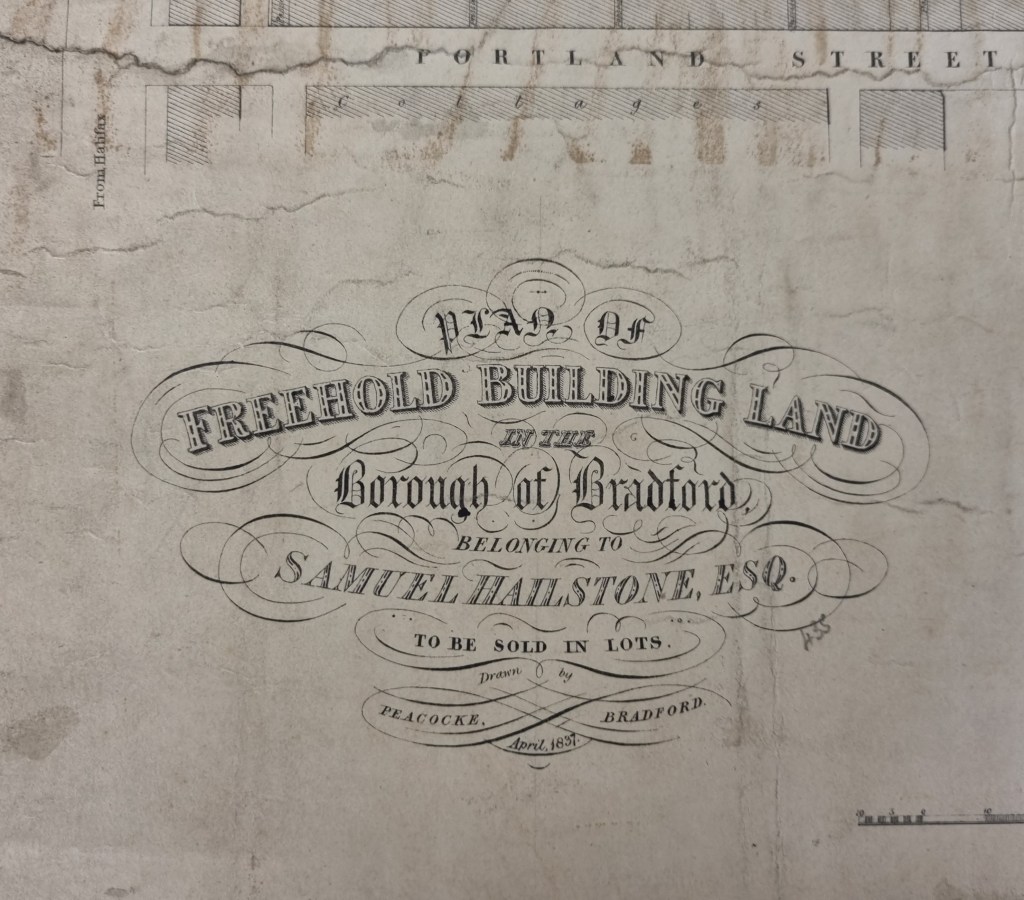
He envisages a number of roads, with purchasers assuming responsibility for the half the costs of the flagging and creating a sewer in the roadways which their new purchases will front. Lots marked green are for sale. Those marked pink are reserved, and yellow already sold. Despite the careful planning its obvious that nobody predicted the coming of railway lines from Halifax which would ultimately undo almost everything shown.

Samuel Hailstone does not own absolutely everything on the plan. At the top right this detail shows the long-established Friends Meeting House and burial ground. It is clear that the Quakers have already purchased additional land.

The available land immediately to the south, across the end of the newly created Croft Street was to be bought by the Wesleyan Association to create another chapel and burial ground.

At the top right of this map detail are a row of cottages belong to the Rand brothers (big textile men) and the opposite end of Croft Street, which presumably takes its name from Croft House. This building, and the curious roadway dog-leg it created survived as long as the 1846 town plan, a decade later. Croft Street still exists today but is very different. I won’t spoil the treat if you would prefer to explore for yourselves.

We are extremely lucky to have access to a second version of the sale plan. It is in poor condition, and the photograph is not very sharply focussed, but you can see the Friends Meeting House and the horizontal Croft Street again. I assume this copy was kept at Mr Peacock’s office to identify the ultimate purchasers of the sale lots.

Land immediately north of Croft Street seems to have been subject to a separate sale by Samuel Hailstone. The plan has evidently seen better days: you would have to turn the detail shown upside down to place Hope Street and King Street in the correct position. Most of this area is now under Jacobs Well car park or the modern extension to Hall Ings.
