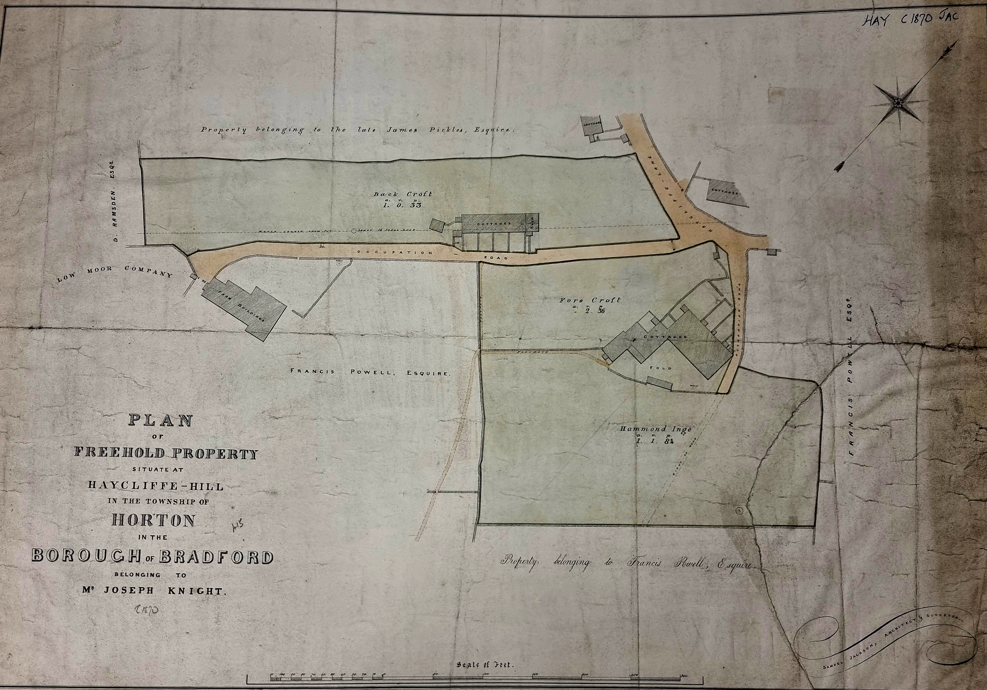
Today’s map at least gives us a date: 1870. Clearly the tinted areas are for sale and for once we have a vendor’s name, Mr Joseph Knight. We even have the name of the mapmaker, Samuel Jackson architect and surveyor.

The second figure is from the 1890 OS map. It is not of good quality, and must have been surveyed about 20 years later, but it does show the general picture.
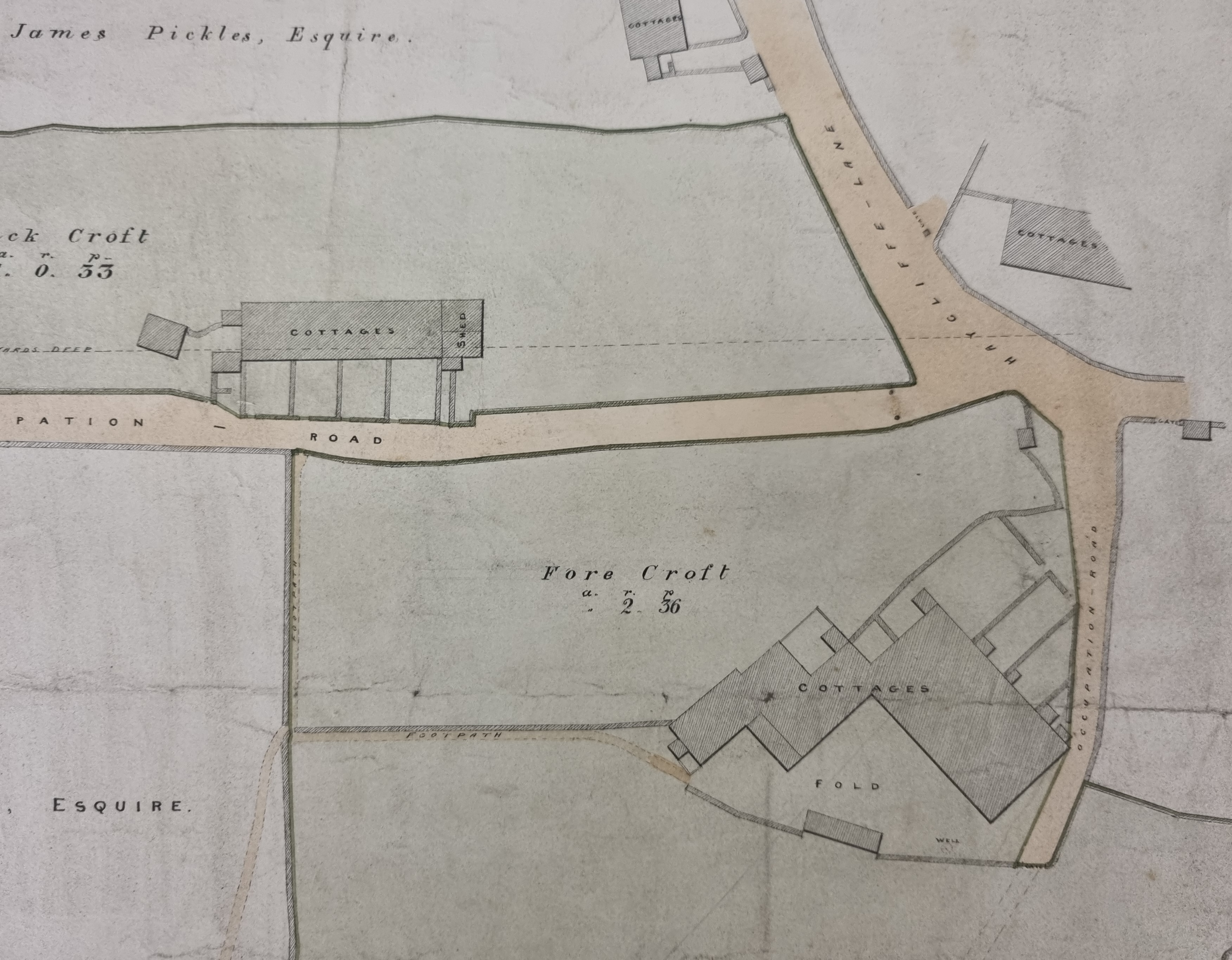
The last figure is the central portion of the initial map which shows the buildings involved, essentially a collection of cottages and small cottage gardens. The main road is Haycliffe Lane and there are two Occupation Roads. The term occupation road was usually employed to describe roads laid out for the benefit of the occupiers of adjacent businesses, and properties, but not public highways. Sometimes the name ‘Occupation Road’ survives as a modern road title.
There are also some field names recorded: Fore Croft, Back Croft and Hammond Ings. A croft was the land and garden associated with a dwelling and is definitely a medieval term. It would make more sense if, in earlier times, a single farm had been present at this site, rather than two groups of cottages. Ing or Ings means meadow or pasture (Old Norse eng). Ings is a common field name component in this area. For example, there are nine fields simply called Ing or Ings in Heaton for example, but there is often a modifier, for example Little Ing or, in this case, Hammond Ings. I assume Hammond was an earlier land over. Similarly in this area ‘cliffe’ seems to be a derivative of ‘clough’, meaning a wooded valley. The name does not imply that hay was cut there, the Old English hege means and enclosed piece of land, or the hedges that are performing the enclosure.
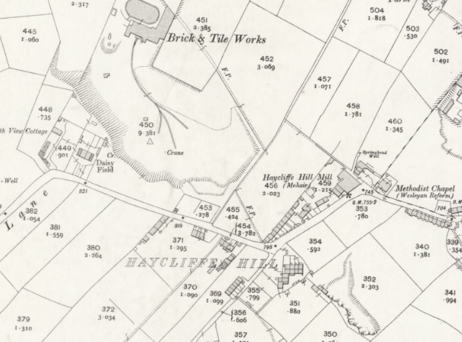
Interestingly there has been little development of the area by the early twentieth century (OS 1905). Although the quarry site of a brick works (Bradford Brick & Tile Works Co. Ltd.) has started to intrude on our area of interest.
A number of landowners are mentioned in addition to Joseph Knight although I cannot positively identify the man himself. The Low Moor Iron Company owned a good deal of property. Their interest was normally the ironstone and coking coal under it. Francis Sharp Powell (1827-1911) became an MP in 1857. In 1892, he was created a Baronet and consequently became ‘Sir Francis’. He must have been a large landowner, and his name frequently appears on our maps. The Late James Pickles and D Ramsden remain mysterious.
I do know a little about the mapmaker, however. Samuel Jackson (1830-1910) was a noted Bradford architect and surveyor of the late nineteenth century. Jackson designed Shipley Baptist Church, Baildon Moravian Church, and Blenheim Terrace, Manningham. He came third in the Bradford Town Hall competition.
