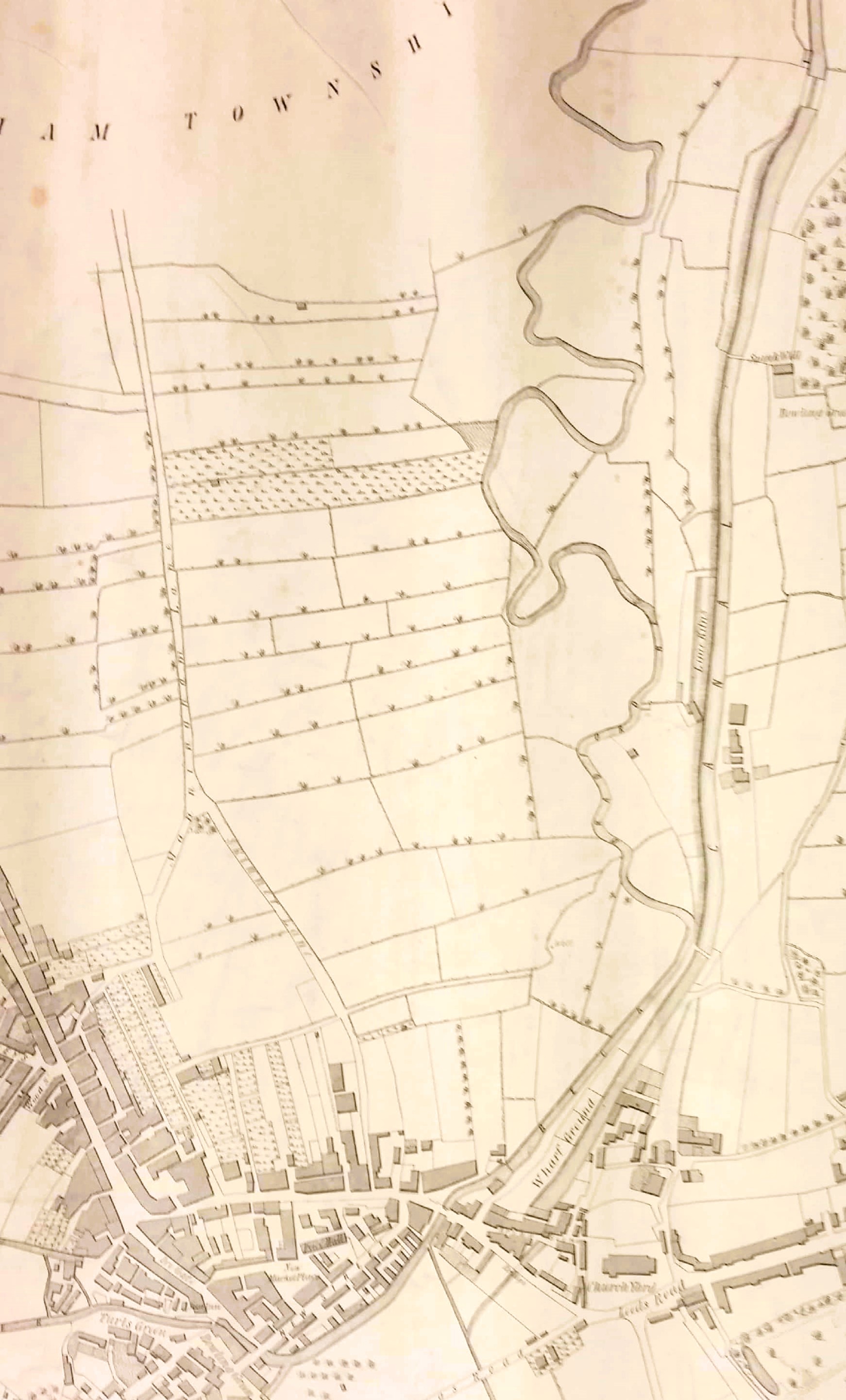
I find the Manningham Lane area of particular interest since it is possible to follow its development with maps relatively easily. The first map shows the situation in 1802. Manningham Lane is indeed a lane, and enclosed fields stretch down to the, as yet un-straightened, Bradford Beck.

The second map in its entirety is one of the most interesting that the Local Studies Library curates. It shows all the property of Rev. Godfrey Wright in Bradford and Manningham. This section is the current area of interest. I imagine it was originally drawn in the 1820s but was kept ‘up to date’. There have been regular land sales, Manningham Lane is now a turnpike, Valley Road is built, the Bradford Beck has been straightened, and the railway has arrived (1846). It would take some very careful work to know exactly where you are, and the writing is not very clear: is the very top of the map annotated with ‘Ash Well Lane’?
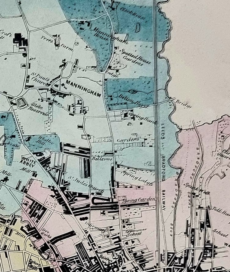
The land ownership situation is clearer in this detail from the 1850 Bradford map. Imagine walking out of the new Borough (as of 1847) along the right side of Manningham Lane. In order the points of interest are Bradford Grammar School, Spring Gardens, Spring Lodge, Spring Bank, Bolton Royd, the Spotted House (inn) and the Jowett estate at Clockhouse, to where the BGS ultimately moved. The repetition of ‘spring’ reflects the geology in this area. The combination of sloping ground to the east and impervious layers of rock would encourage the emergence of water from the aquifers onto the surface.
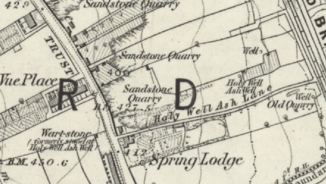
The best recorded example of such an emergence is Holy Well Ash. Cudworth and other Bradford historians mention one of Bradford’s healing wells as being off Manningham Lane. It evidently had various names including Helliwell and Holy Well. The ash tree was sacred in Nordic times. Holy Ash Well is present in the 1850 OS map of the area (Fig 5). The original well-water allegedly had curative properties directed at warts, but in ancient times the Holy Well must have been the location of many impossible dreams, and regular disappointments. Today things are quite different since the site is covered by Bradford City’s football pitch.
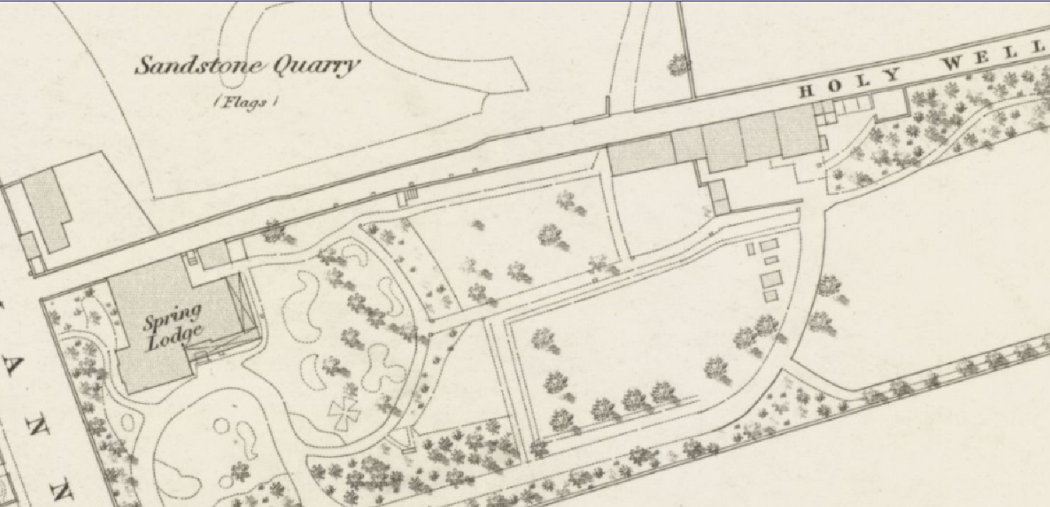
The main feature of the map detail is the surprising extent of the stone quarrying at this point, and also the villa called Spring Lodge. The villa is linked with the name Alfred Harris. Alfred Harris (1801-1880), together with his brothers Henry and Charles, was a Quaker banker in Bradford managing the Bradford Old Bank. He is resident at Spring Lodge (which you can see and which he had built) by the time of the 1841 census. Harris is most famous for heading the development of the Bradford Fever Hospital in Leeds Road.
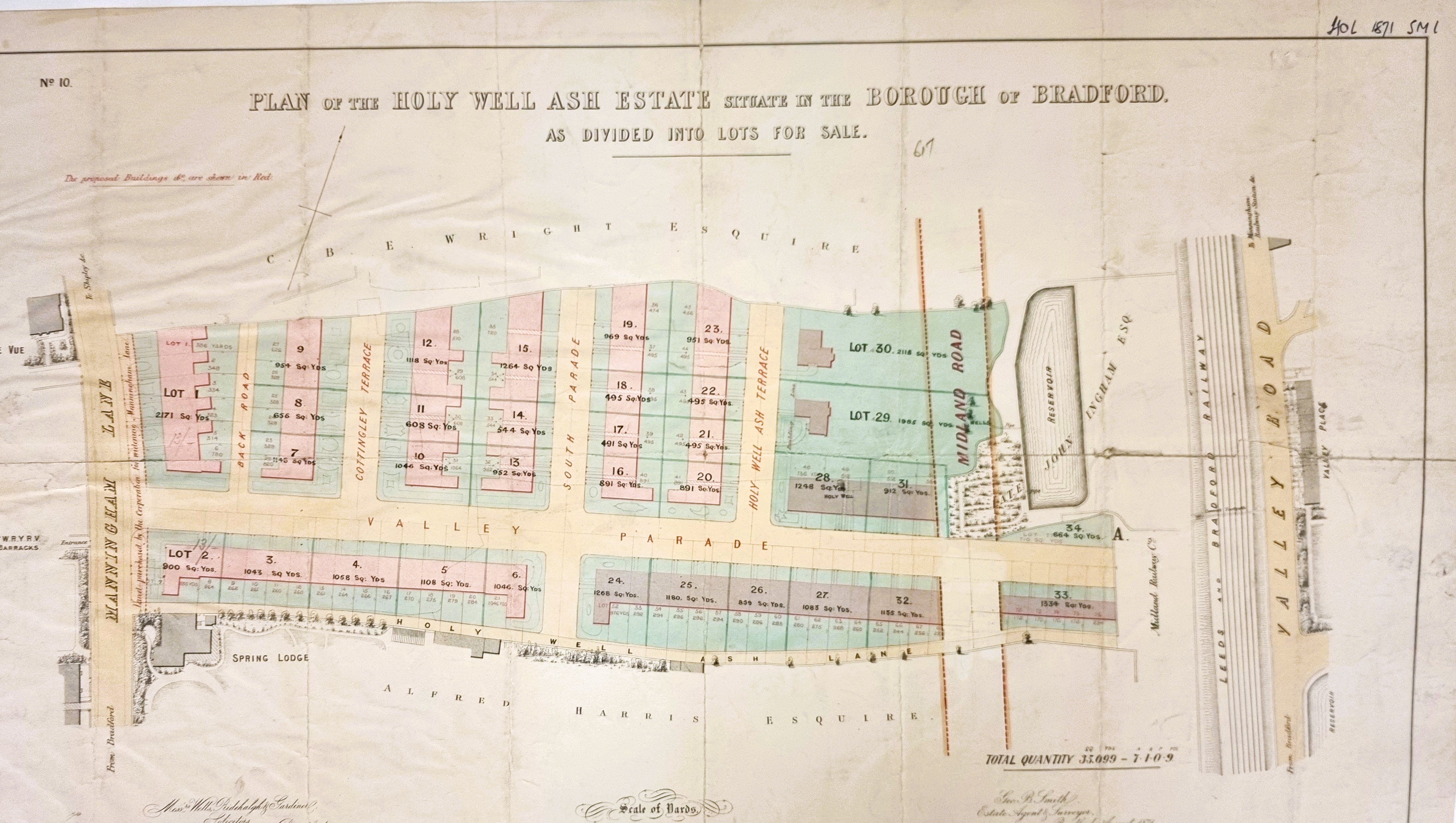
A sale plan in the LSL shows the same area in 1871. The plan reveals two significant landowners names. At the bottom is still the name Alfred Harris. Above the planned development is the estate of CBE Wright. Who is he? The date would suggest he is a grandson of Rev. Godfrey Wright who, as I mentioned, once owned a great deal of land in this area. I believe he was in fact Charles Booth Elmsall Wright (1848-1924) of Bolton Hall, who on-line investigation has revealed was a Victorian ‘sportsman’ and sometime high Sheriff of Yorkshire.

Other developments were taking place along Manningham Lane. Here, at the north of our area and by comparison with Fig 3, you can see that the last figure shows the pre-existing Spring Bank with four new villas being built in its garden.

To the south of our area Springfield Place was being developed as early as 1848. Finally, in a OS map detail from the 1930s, we arrive, after about a century, at the modern arrangements.

