I have always been interested by the story of Chapel Lane. Together with its famous Unitarian Chapel it is important to the history of ‘old’ Bradford. I have discussed Chapel Lane in the map blog before, but now my research in the Local Studies Library involves old photographs as well as maps. The addition of old images is particularly relevant because of this road’s total disappearance in the modern city. The city centre has changed almost beyond belief since Bradford became a borough in 1847, and readers will be aware of significant changes even in the last half century.
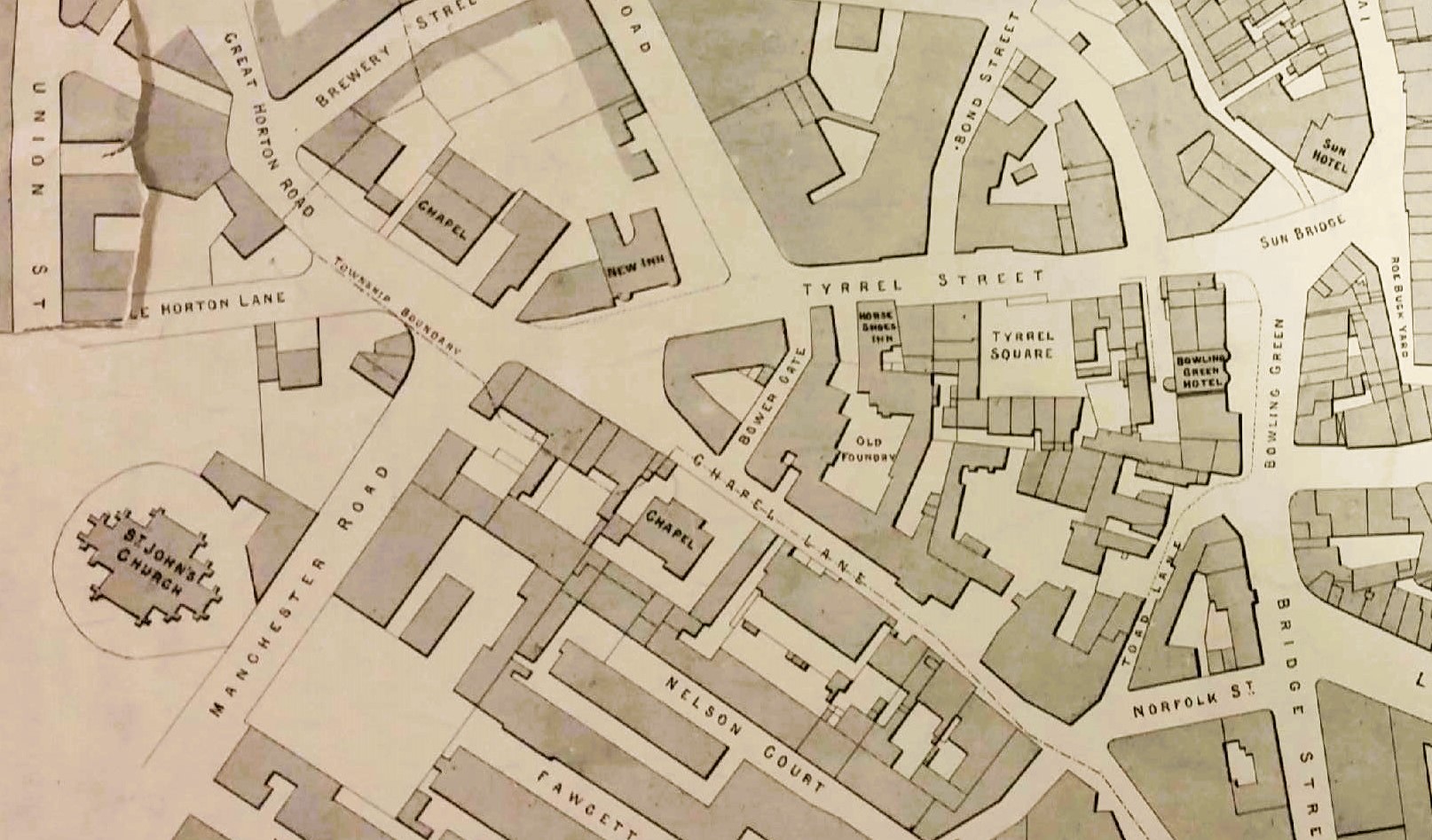
The first map detail makes the position of both Lane and Chapel very clear. The map is not dated but the presence of the new Wool Exchange, but the absence of the Town Hall, suggests c.1870.
The first Chapel was built in 1719 and was Presbyterian in doctrine. I know that for a period it regarded itself as Independent, but well before the end of the eighteenth century many of the congregation came to hold Unitarian beliefs. It is usually described as a Unitarian Chapel. The most famous member of the congregation was Rev Joseph Dawson of Low Moor Ironworks. Nearby was Horton Lane Independent Chapel close to Rands Mill. This was a popular and hugely influential Congregational Church. It was constructed in the 1780s and I have heard that those principally involved were that part of the Chapel Lane congregation who could not tolerate Unitarianism.
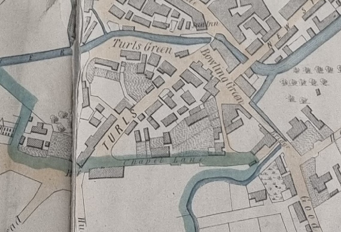
This second map is from 1802. Chapel Lane is a horizontal line near the base of the map; unfortunately, the name is made difficult to read by the blue colour indicating the Bradford – Horton boundary. I assume the Chapel is at least part of the hatched block opposite the Turls.
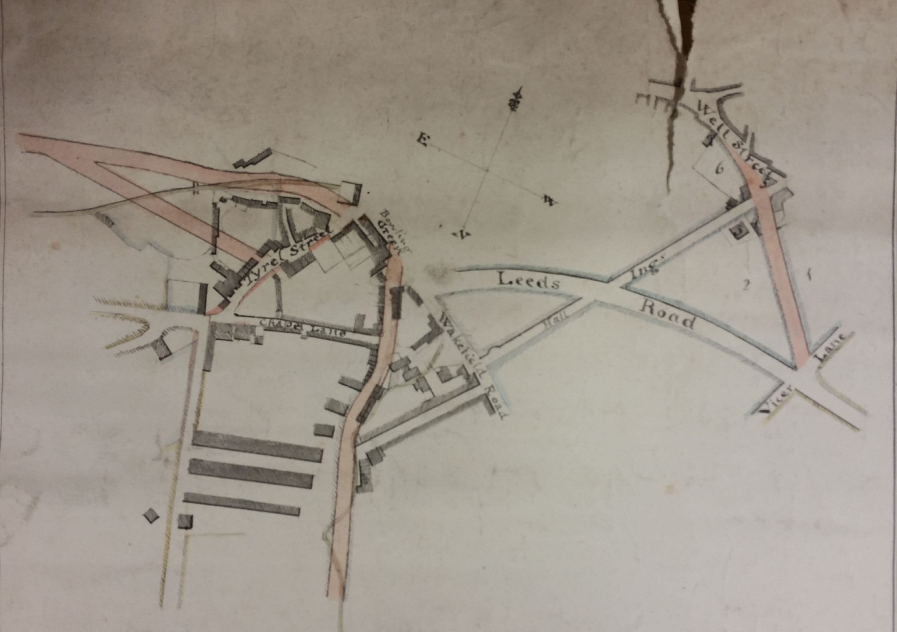
The next plan is a generation later; Leeds Road has been constructed (c.1825). You can see that there has been substantial development along Chapel Lane. Of what that development might have consisted I’ll mention later.
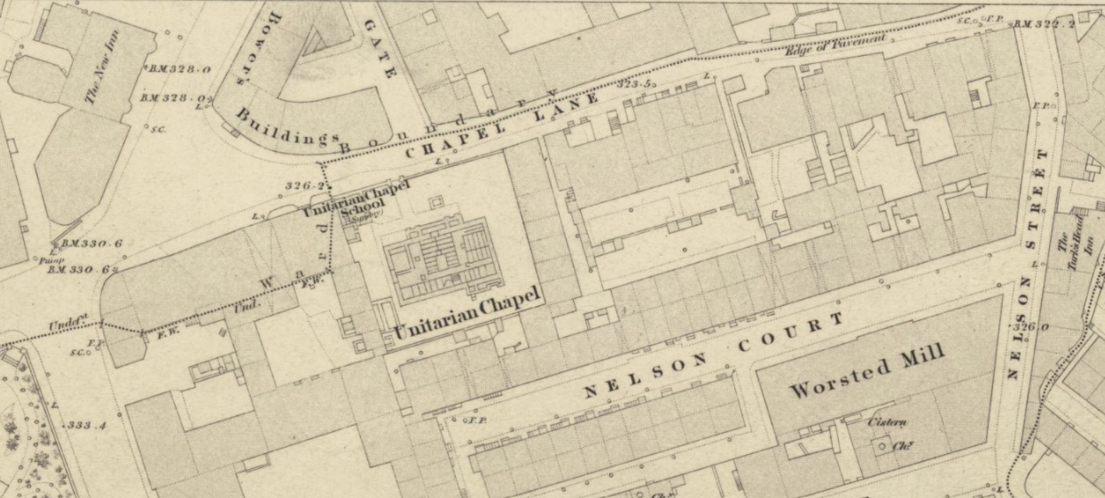
The above detail from the 1848 town plan shows further mid-century development, and the detailed structure of the Chapel, very well.
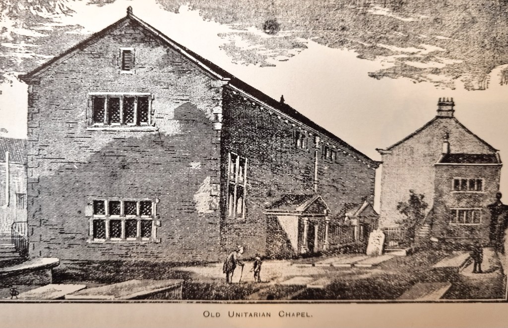
In 1867-68 the Chapel was completely rebuilt to the design of Bradford architects Andrews & Pepper. This reconstructed building is shown in the next image. Since it was ultimately to survive until the 1970s it will be recalled by many older readers who were born in Bradford, but sadly I missed it by a decade.

The above is a photographs from the Local Studies Library. Below is second labelled ‘Old Shops in Chapel Lane; Unitarian Chapel ’. I think that it is an original print, although it does show signs of hand-drawn ‘improvement’.
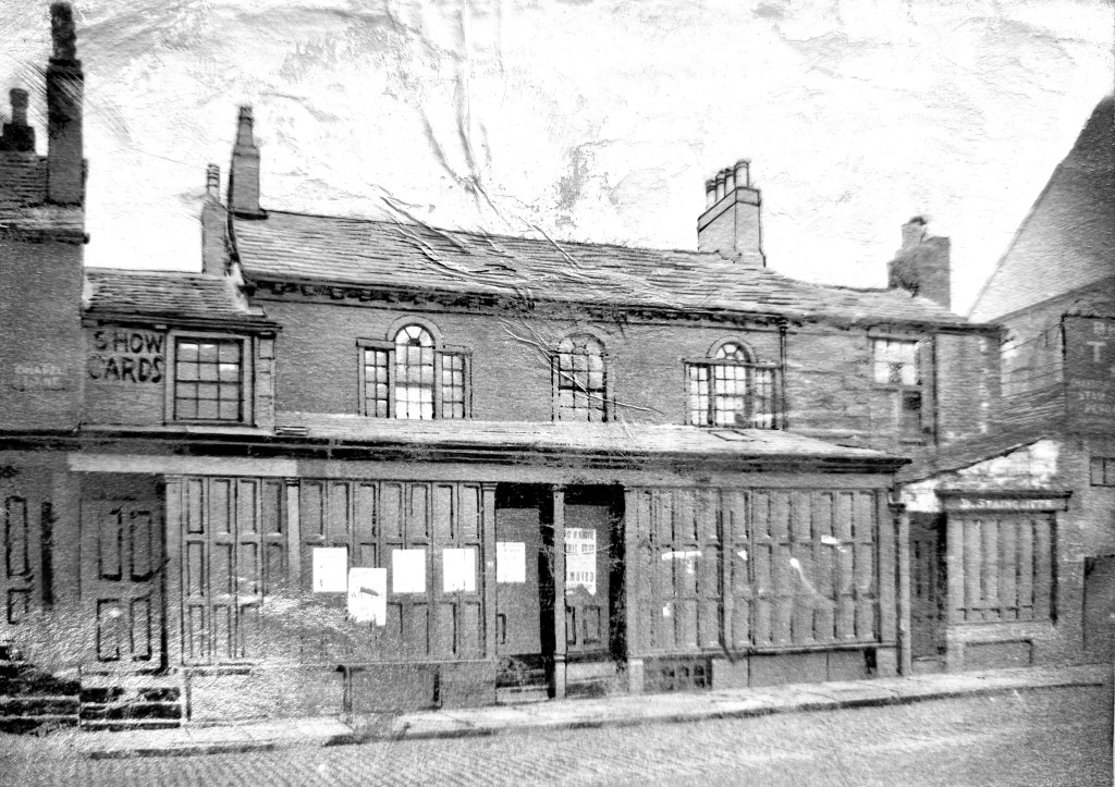
The Chapel Lane road-sign is just about legible and unimproved; the shop sign to the right reads (I think) ‘D. Staincliffe’. There was a wholesale late-Victorian Bradford tobacconist called David Staincliffe but in the 1891 and 1898 directories his shop was in Kirkgate. However, he did move about since in 1879-80 he was in Westgate and in 1883 in Westgrove Street.
Another photograph, which you have seen above, shows the shops to the right of the chapel. The date of that must be later than 1867-68 since it definitely shows the Andrews & Pepper rebuild. For the chapel’s immediate neighbour are we looking for a ‘GT Cheetam, Coach builder’, and right of that Douglas Mitchell, Stuff Warehouse. I can confirm the presence of the Stuff Warehouse from the 1886 Goad Insurance map. Old Bradford did not, of course, consist exclusively of stone emporia and marble halls.
At about this time Bradford Borough Council decided that a purpose-built Town Hall was required to support the rapidly growing urban area. The winning design was opened by the Mayor, Matthew Thompson, in 1873. The architects were the famous partnership of Lockwood & Mawson who had already designed the Wool Exchange (1867). The Unitarian Chapel and Chapel Lane itself were left alone during this development, but Bradford became a city in 1897 and the increase in Council business required an extension to the Town Hall, opened in 1909. This provided more committee rooms and a banqueting hall. The designer was Richard Norman Shaw. Only a stub of Chapel Lane remained after the completion of this extension.

The Chapel survived the Second World War, but it was to succumb to 1960s town planning. Many of you will have seen this image before, showing the closed Chapel surrounded by demolition debris.
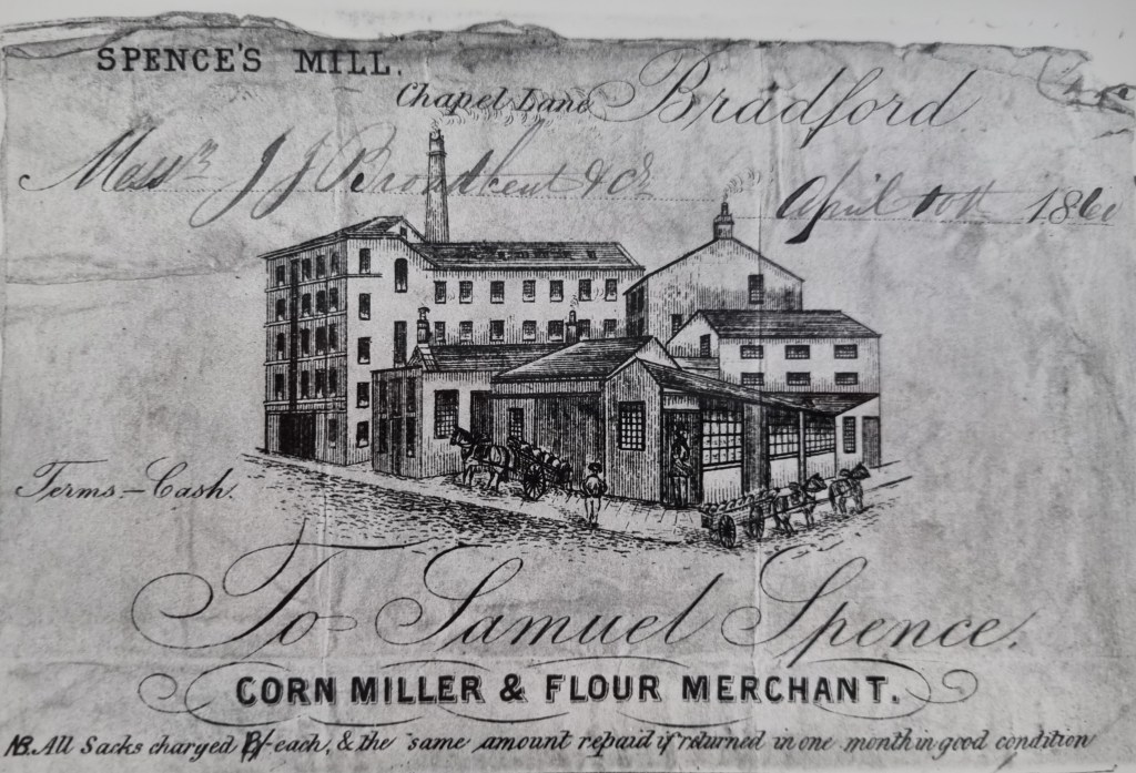
Chapel Lane was not, of course, simply a chapel. In 1847 the Poor Law Commissioners considered Chapel Lane a possible site for a ‘vagrants’ yard’, and in 1855 a ton and a half of ‘vile bones’ were removed from the premises of John Boyd – ‘rag dealer’. Other local people included Rev. JH Ryland who was the non-resident minister at the Chapel. There is also an architects’ partnership (Stott & Illingworth) and a painter (John Edwards). Otherwise the Chapel Lane residents are all tradesmen: plumbers, hair- dressers, bootmakers, saddlers, pawnbrokers and so forth. The LSL reserve collection also has the above photograph! I think that the date on the account is 1841. Could there really have then been a flour mill so near to the centre of Bradford? The 1850 Ibbotson Directory is somewhat ambiguous. One entry places Spence’s Mill in Chapel Lane with the owner having a house in Eccleshill. Another describes Samuel Spence as a hay, straw and flour dealer with premises in Nelson Street and a house in Chapel Lane. Publication of this problem on social media produced a good deal of interest and several excellent suggestions. The detail from the 1848 town map doesn’t make things much clearer, unless the ‘worsted mill’ had two functions. One reader suggested that the owner of the mill rented out space on a ‘room and power’ basis to Stanley Spence. Another identified a second worsted mill just off the map from Nelson Street where the Bradford Beck met Chapel Lane. In fact we do have a reserve collection map showing this mill (together with the course of the Bradford Beck), but sadly it doesn’t really add any additional information.
Addendum.
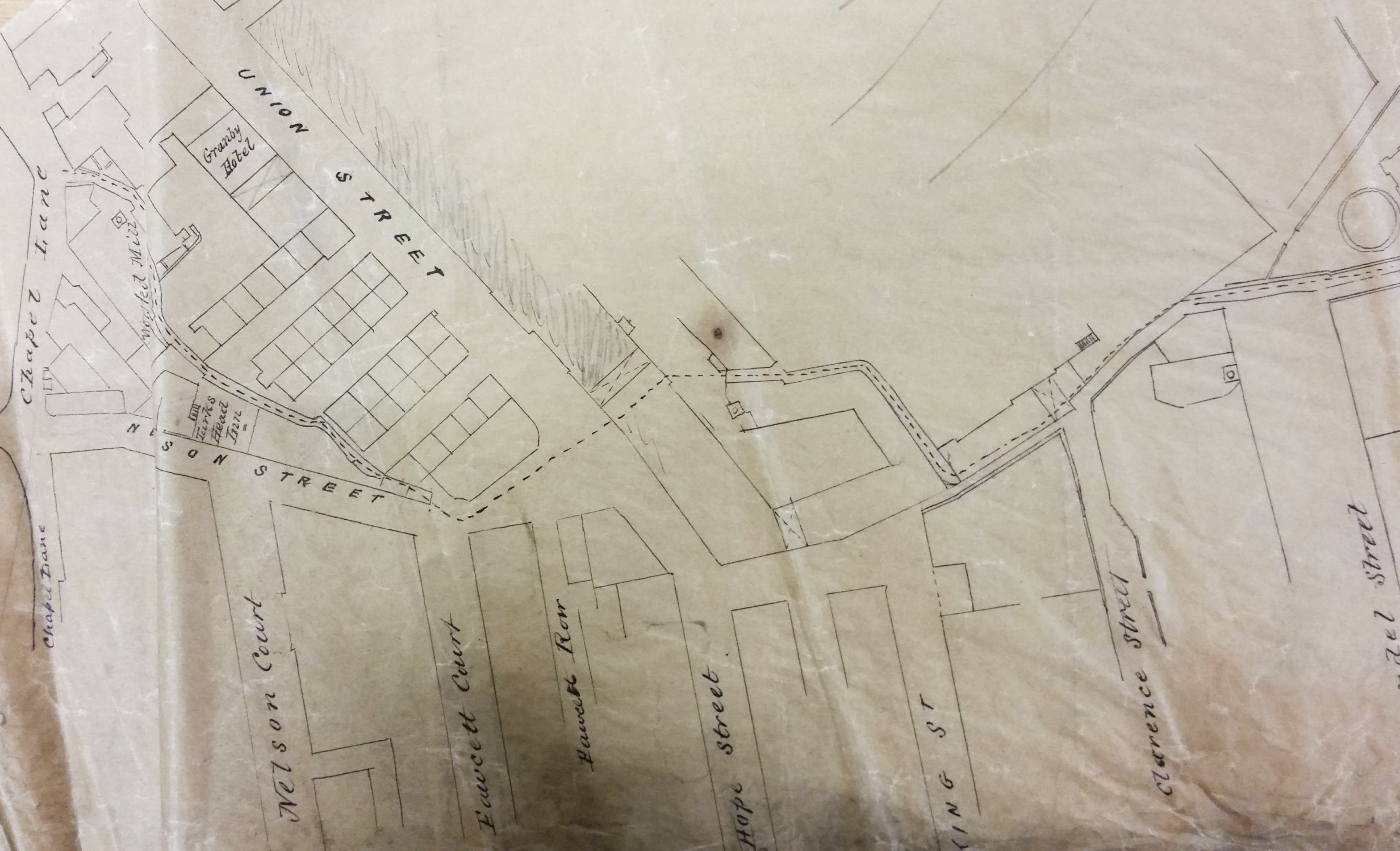
Since this blog was first posted in has aroused some interest, particularly over the location of the Spence flour mill. In particular local historian Kieran Wilkinson has been reviewing contemporary newspapers and has found numerous references to Spence being on Chapel Lane, effectively ruling out the worsted mill on Nelson Street. The suggestion that the mill didn’t have a single function is correct. Kieran found rooms being let out for wool combing. I have been undertaking a little family history research. A child called Samuel Spence was baptised at the Parish Church in 1846 to Mary and Samuel Spence, millowner. When poor Samuel died a few months later his address is recorded as Chapel Lane. Samuel and Mary live in Chapel Lane in 1841 and in the 1851 census Samuel is recorded as a corn miller and mill owner now of 29 Victoria Street, Manningham. His corn mill may not have been a large concern since in 1861, when the couple living in Edmund Street, he is recorded as employing only 6 men, but at least his wife was being assisted by a ‘maid of all work’.
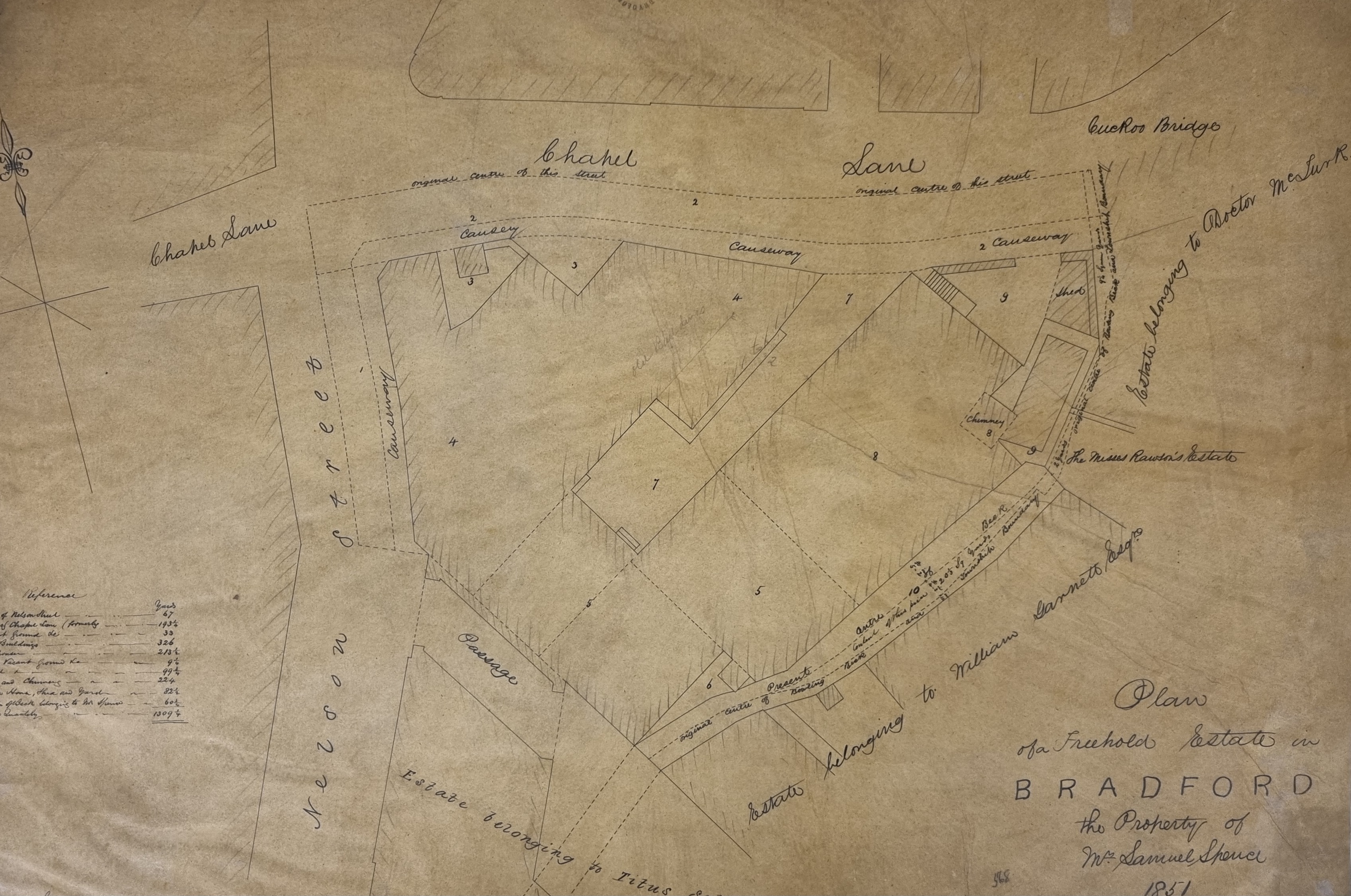
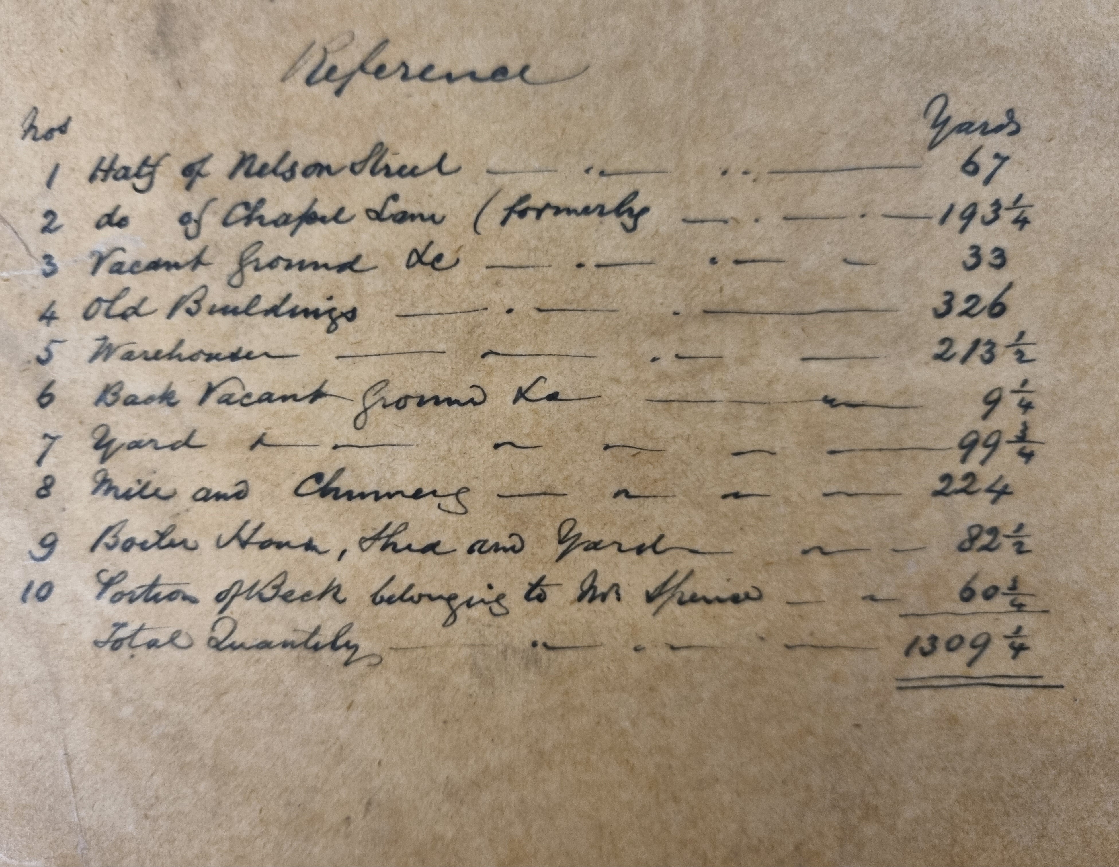
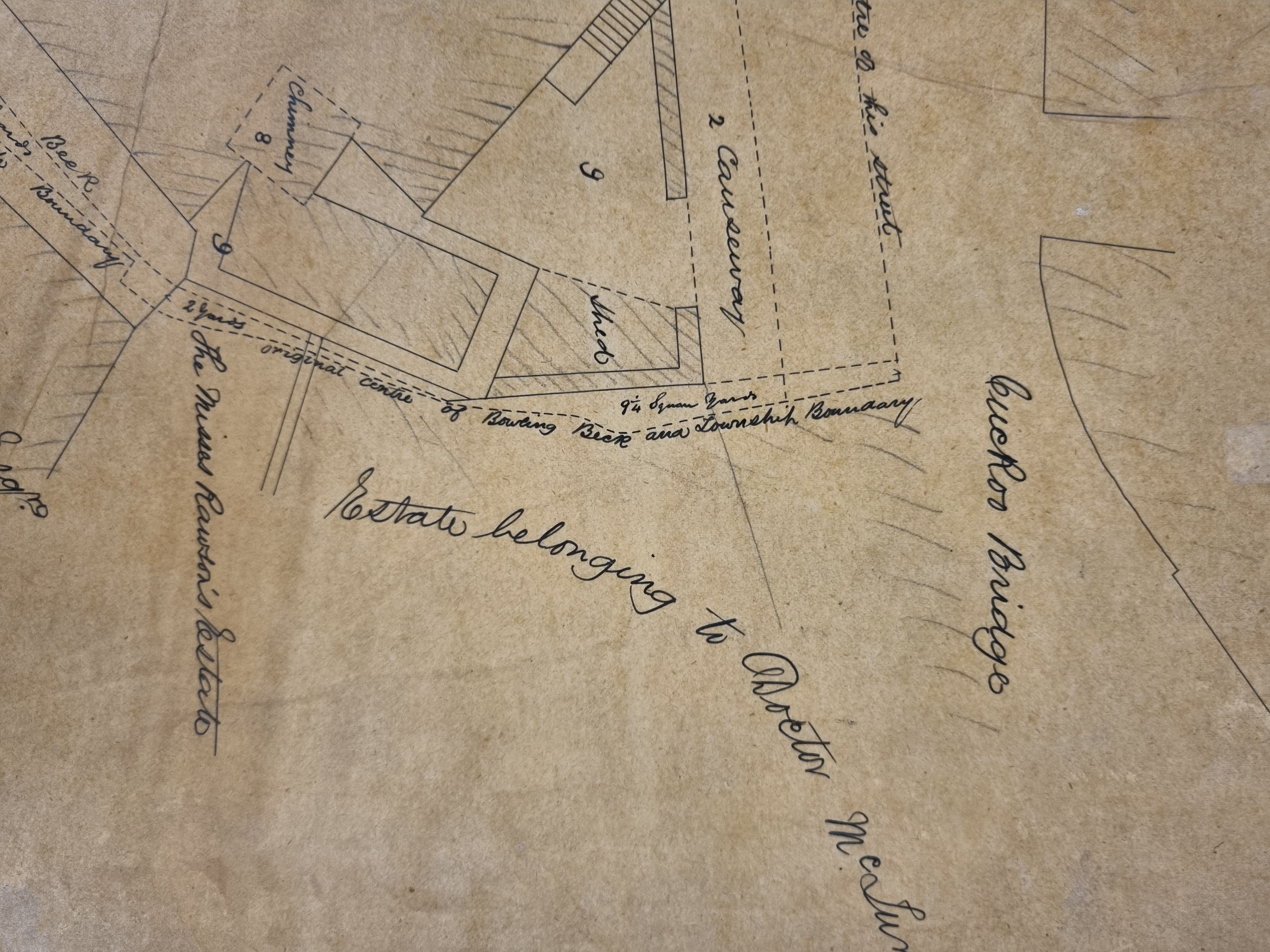
Most exciting is a further map I have found at the Local Studies Library. This is a detailed property map dated 1851 on behalf of Mr Samuel Spence. It would appear that he owned a substantial block of property between the Cuckoo Bridge and the junction of Chapel Lane with Nelson Street, To make it even easier the nature of individual blocks is listed – block 8 being a mill and chimney. The location of the Bowling Beck and the Bradford-Horton boundary is clearly indicated.