
Ironically very few of the maps I study at the Local Studies Library deal with Heaton, although that is where I live. The reason is firstly that Heaton was not incorporated into Bradford until then end of the nineteenth century, and so doesn’t feature on town plans. Secondly much land, and the Lordship of the Manor, was for centuries the possession of the Field and then the Rosse families and there was little selling of properties. Such maps and plans of Heaton as were created are safely retained by the Rosse Archive at Birr Castle, Eire. Eventually the whole estate (which by then included much of Shipley) was sold in 1911. The sale catalogue comes with a very full set of maps and the LSL has several copies of these.
As far as earlier maps and plans are concerned a rare exception to the general rule is HEA 1845 ING, which shows a stone quarry owned by the Earl of Rosse and operated by Abraham Hill. In trying to establish exactly where it was, I am fortunate that the Rosse Archive records were studied by my friend, the late Tony Woods. His research showed that Abraham Hill was certainly a known quarry operator, initially on his own and later with other family members. Directories also place Hill’s partnership in Shipley and Queensbury. Abraham Hill has also earned a position in Heaton: the best place of all by its most notable recent historian Stanley King. The date of 1845 for the map fits with Abraham Hill as a solitary operator. Later in the century he was certainly associated with stone quarries in village centre, but also in the land enclosed by the junction of modern Bingley Road and Haworth Road.
Could our map represent a quarry in Heaton village? The map is dated 1845 and this is important since we know from surveys in the Rosse Archive that he was certainly quarrying in Heaton Village as early as 1839-40 and his name is linked with Back Lane and Townend Quarries. A line joining Heaton Hall and the first Baptist Chapel would seem to mark the area once called Town End, although this name is no longer employed. Its quarry may have also been called Back Fold or this may have been a nearby, but recognisably distinct enterprise. Back Lane no longer exists (Rossefield Road approximately follows its line) but these quarries (19 and 20 on the Rosse Agent’s quarry list) were placed between Highgate (then Town Gate) and Back Lane. The Rosse Archive map that shows this location must be copyright, but I can substitute a detail from the Heaton Tithe Map which, at 1848, is roughly contemporary with our first plan.
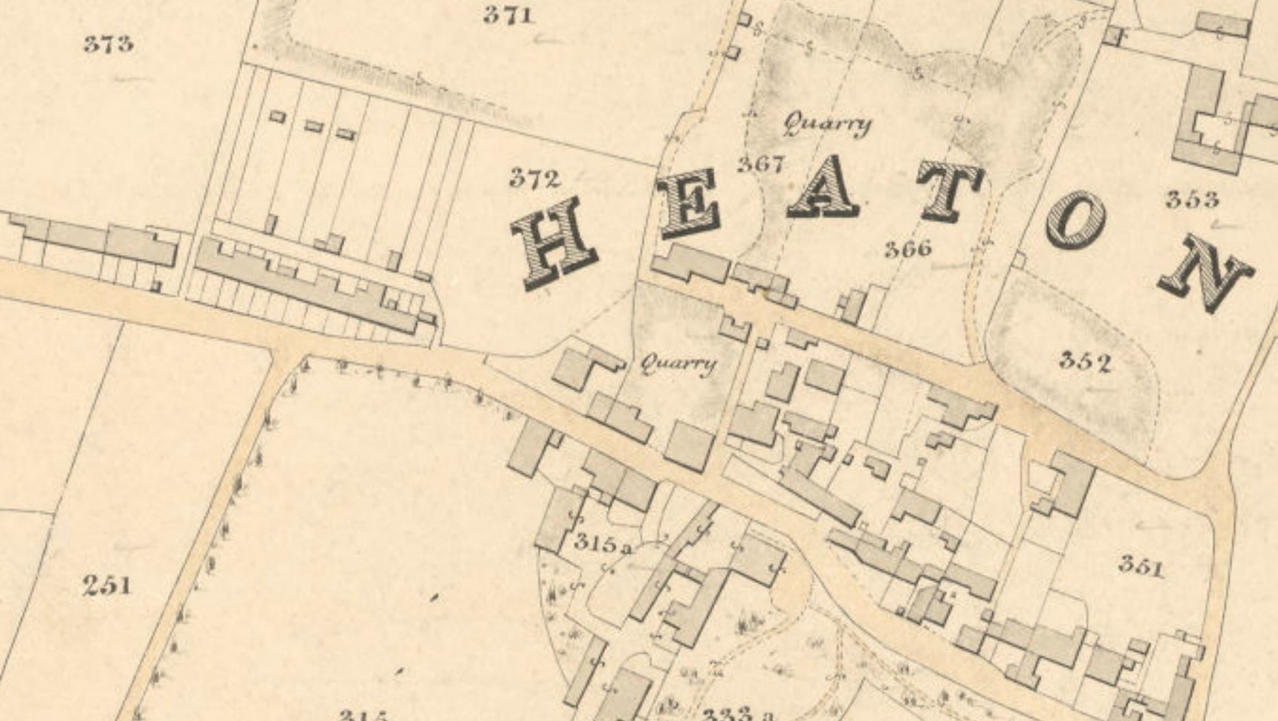
In this detail the lower large roadway is Town Gate (modern Highgate) and above it but roughly parallel is Back Lane, of which only a stump now survives. The area labelled ‘quarry’ in the centre of the plan (under the E of HEATON) would have held Back Lane and Townend Quarries. There is also extensive quarrying at 367 and 366, the sites of modern Quarry Street and St Barnabas School. Note that 371 is Heaton Hill (itself extensively quarried for Elland Flags sandstone). Plot 372 is Heaton Baptist Cemetery the perimeter of which, in one place, shows a quarry face. A final complication is that the Hill surname was also linked with Back Side Quarry which is left of the Village Hall side of modern Ashwell Road at a site now called Ashwell Farm. This is being developed at present and as far as I can see does have deposits of quarry waste.
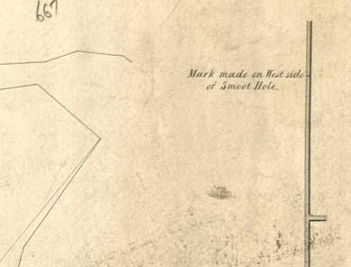
The only positional clue here in our original map is the straight wall and the mention of a ‘smoot hole’. This was a crawl-way constructed in a drystone wall to allow for the passage of sheep. This fact alone makes a village centre location unlikely I would say.
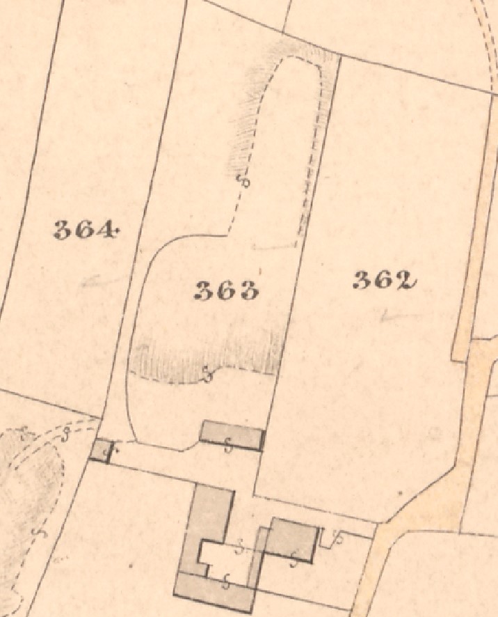
Further examination of the Tithe Map suggests two possibilities for the position of our initial mapped quarry, although neither are totally convincing. Figure 4 shows the site of what I believe is Back Side Quarry (363) which, as I mentioned, is on modern Ashwell Farm. The field boundary with 362 would certainly be a drystone wall and the two block buildings would be in approximately the right positions.

I have added a second Tithe Map detail showing another guess as to the quarry location. Haworth Road is at the bottom left. The Keighley and Bradford Road is modern Bingley Road.
Clearly neither of my suggestions match the original map topography exactly, but quarries, by their nature, tend to change shape with every passing year. Wherever it really was I hope that they looked after the resident of the dog kennel!
