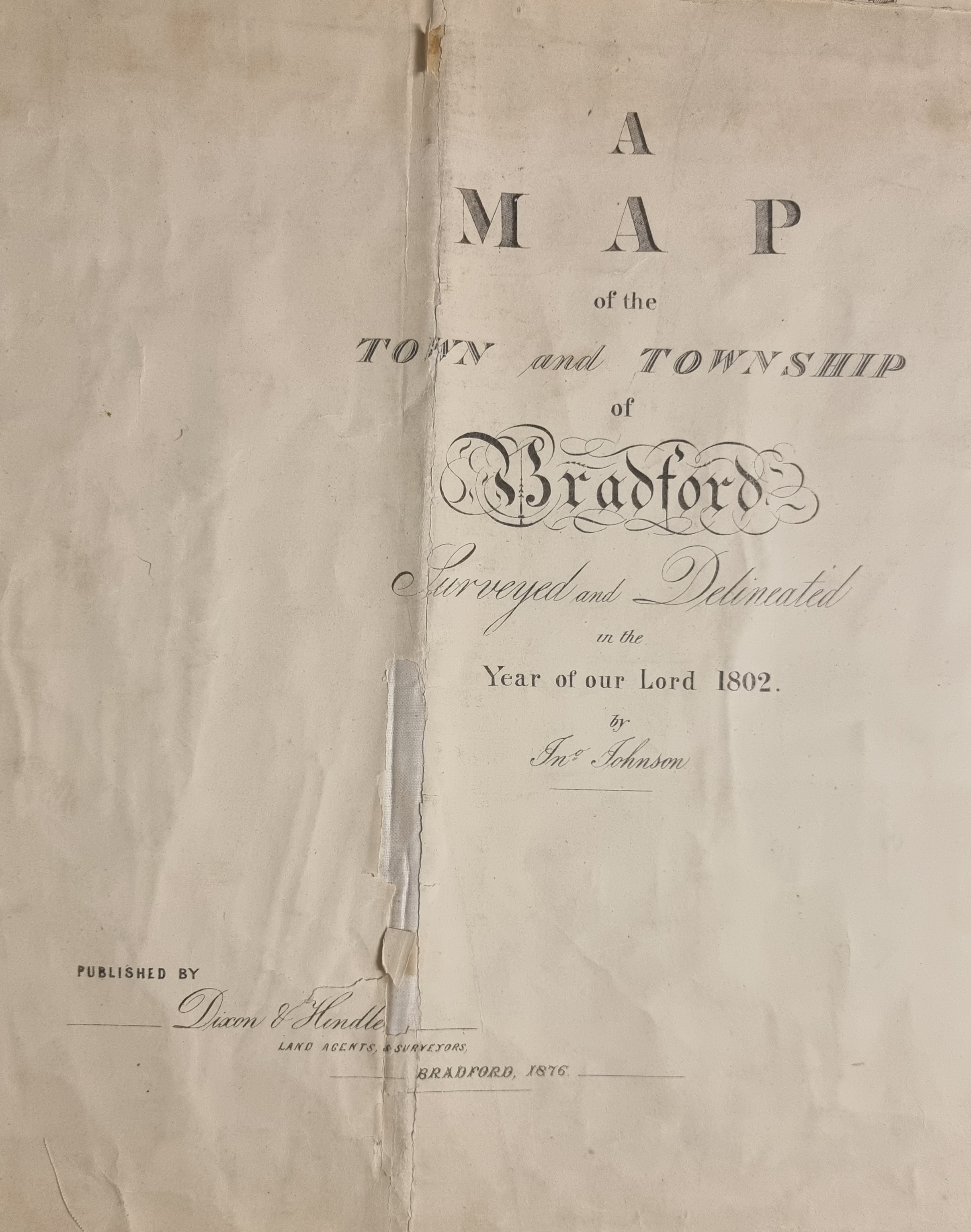
2.188 BRA 1802 JOH/2
Size: 120*95cm Material: Linen backed paper
Scale: 4 chains per inch Condition: Good
In 1975, for the nugatory price of £2, Bradford Libraries published a folder of reproductions of historical city maps. The folder was entitled ‘Bradford in the nineteenth century: shown in maps’. I was extremely fortunate to be gifted a copy by a fellow local historian. If you ever get the opportunity to acquire one, then take my advice and seize it! One of the items reproduced in this series was the 1802 Bradford map. This well-known plan was surveyed originally by John Johnson and republished by Dixon & Hindle in 1876. It is generally regarded as accurate but does not include Horton, Manningham or Eccleshill. The folder version only employs the central section of the original, but evidently used the same folded plan which is now in the Local Studies Library reserve collection, since the creases and areas of damage are reproduced accurately!
Clearly, we are fortunate to have a detailed plan from the very beginning of the nineteenth century, and copies are available in the public map drawers. The mapmaker’s policy on the naming of certain features is enigmatic and rather irritating. A ‘bowling green’ is labelled, surrounded by fields, in north Bradford, but no places of worship are indicated by name, which has caused me one major difficulty. Even at the parish church only the ‘church yard’ is named not St Peter’s itself. In the secular world only the Sun Inn and Eastbrook Hall are named, and the latter is simply identified as ‘hall’.
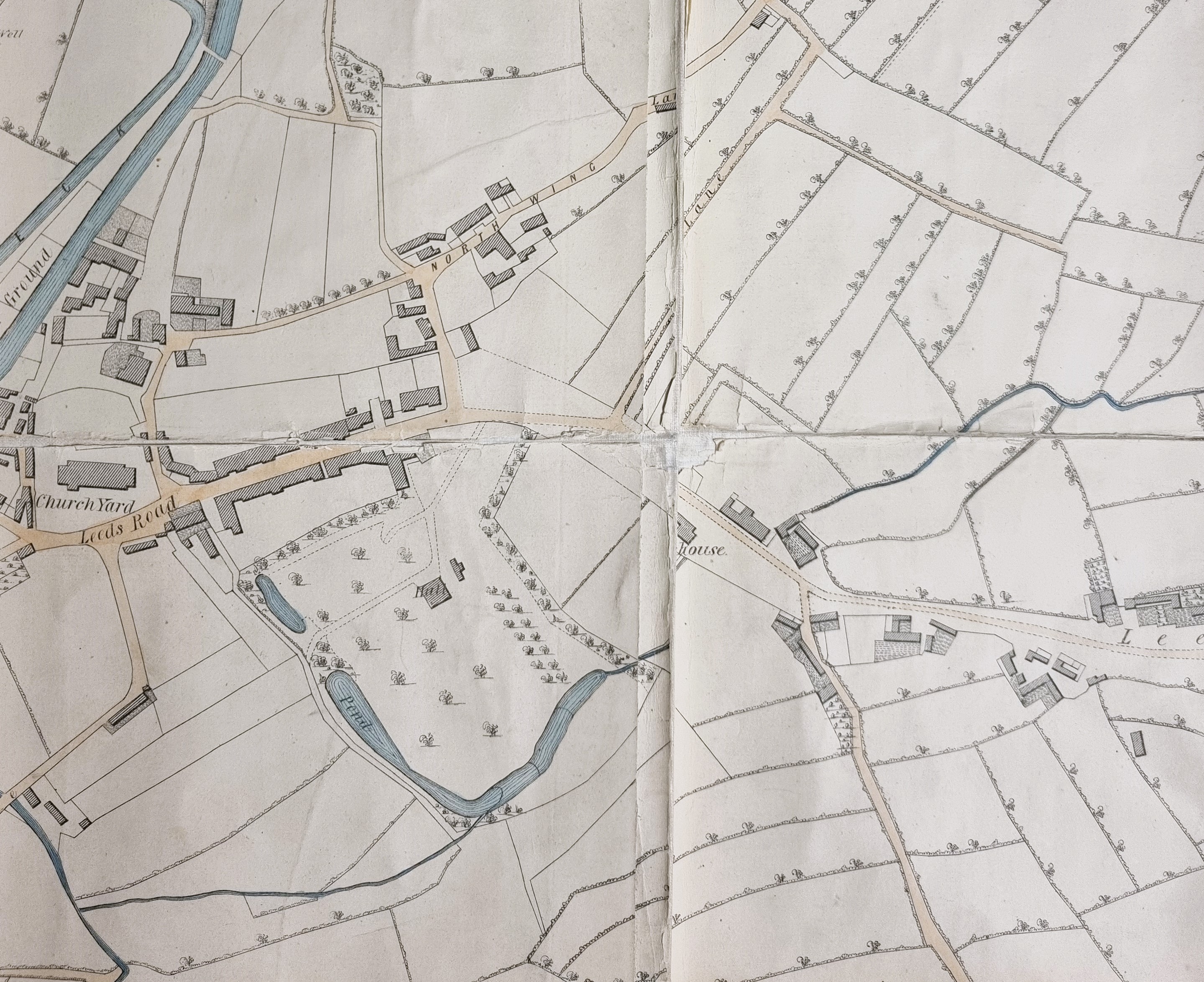
I’ll start this exploration east of the parish church. Start at the church yard and move east along Leeds Old Road (Barkerend Road). Modern Leeds Road is not yet constructed. You pass ‘hall’. In 1797 Edmund Peckover had purchased an estate close the centre of Bradford which had previously been glebe land. He began to construct a town house for himself called Eastbrook House. Further east, partially obscured by a crease, is ‘house’. This is the site of the old Barkerend Workhouse. In continuing to move east note how rural the Bradford area is, an appearance confirmed by the next detail.
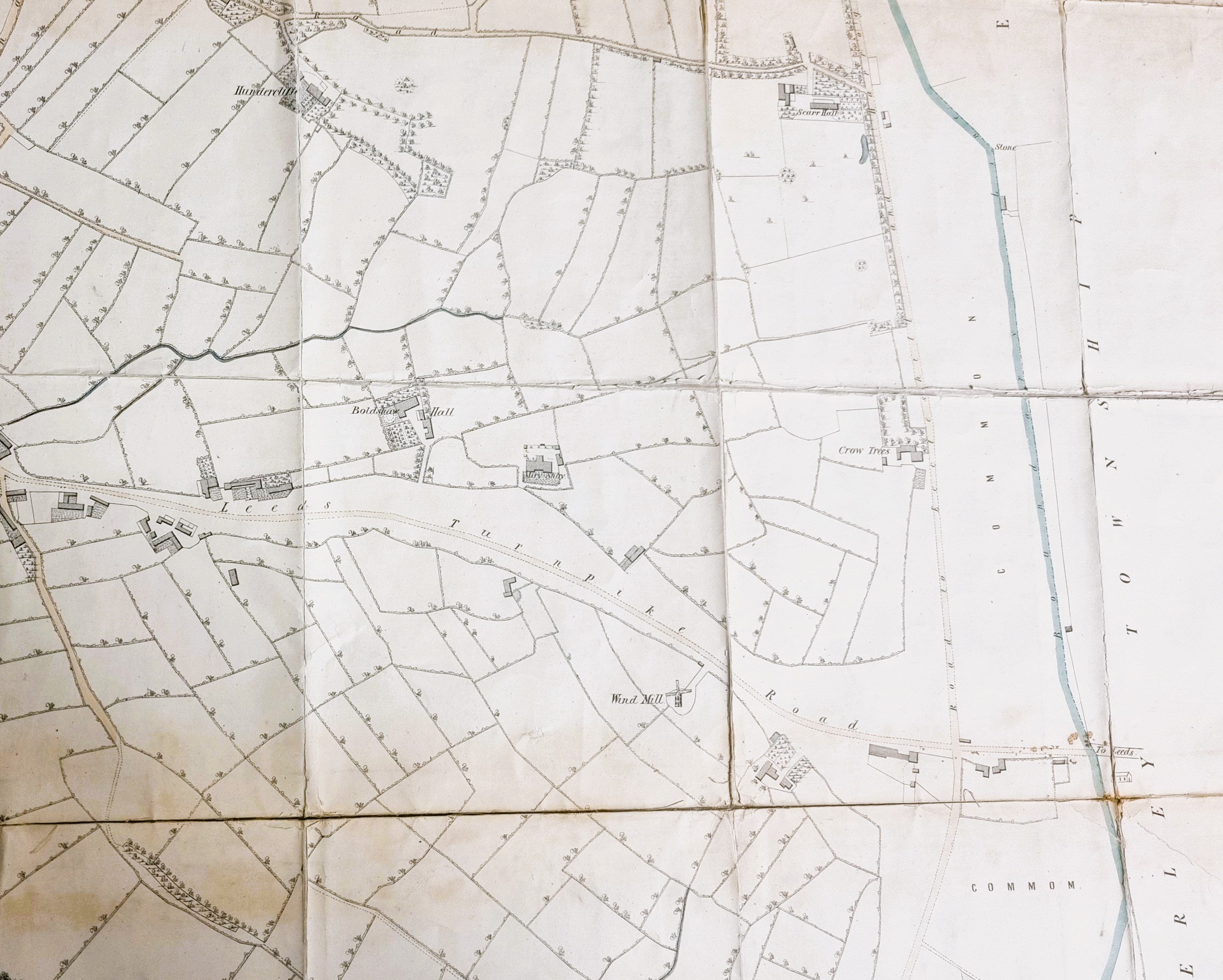
North of the turnpike are the old estates of Boldshaw Hall and Miry Shay. Miry Shay (or Miryshay) was a seventeenth century house. This has long been demolished but in the early nineteenth century was the property of JH (John Henry) Smyth or Smythe MP (1780-1822) whose family had owned it, and the Bradford Soke Mill, for generations. South, in the mid-section, is actually a windmill! This is the only windmill that appears on the map and was presumably the last in the Bradford area. In 1802 steam was already starting to replace all other forms of motive power. Finally, to the right you reach the Barkerend Road – Killinghall Road crossing.
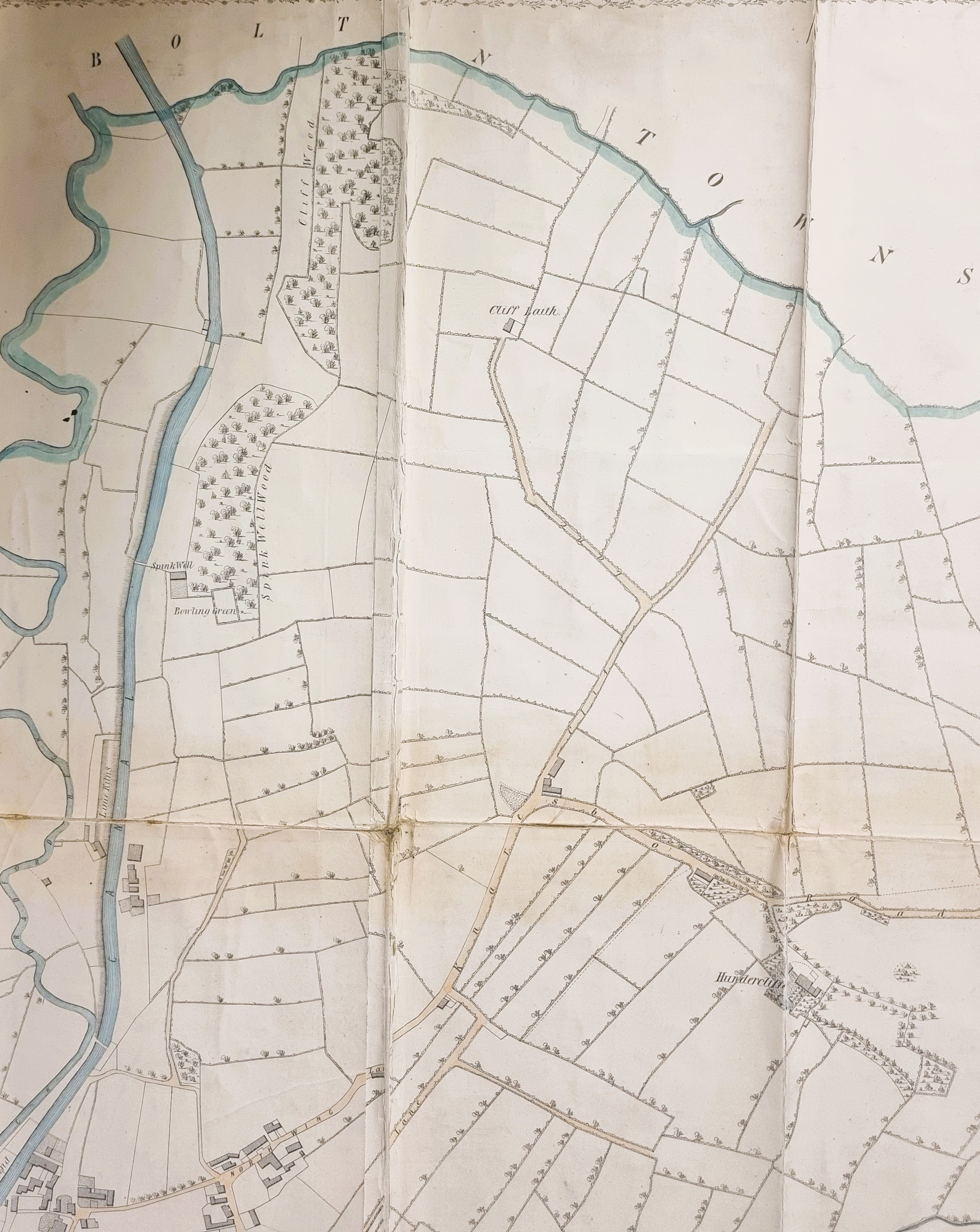
The next detail is the area to the north of the town. It’s not difficult to follow the canal and the, as yet unstraightened, Bradford Beck upwards. The lime kilns along the canal are identified: their raw material would be limestone brought by barge from the quarries at Skipton. Slightly further north is Spink Well (as yet unquarried for sandstone) and its bowling green. A spink is now more usually called a chaffinch. Of the roadways North Wing is apparent: it seems to lead into Knaresbo(rough) Road to reach ‘Hundercliffe’. I’d very much like to know if this spelling of Undercliffe is a genuinely alternative form, or simply a mistake.
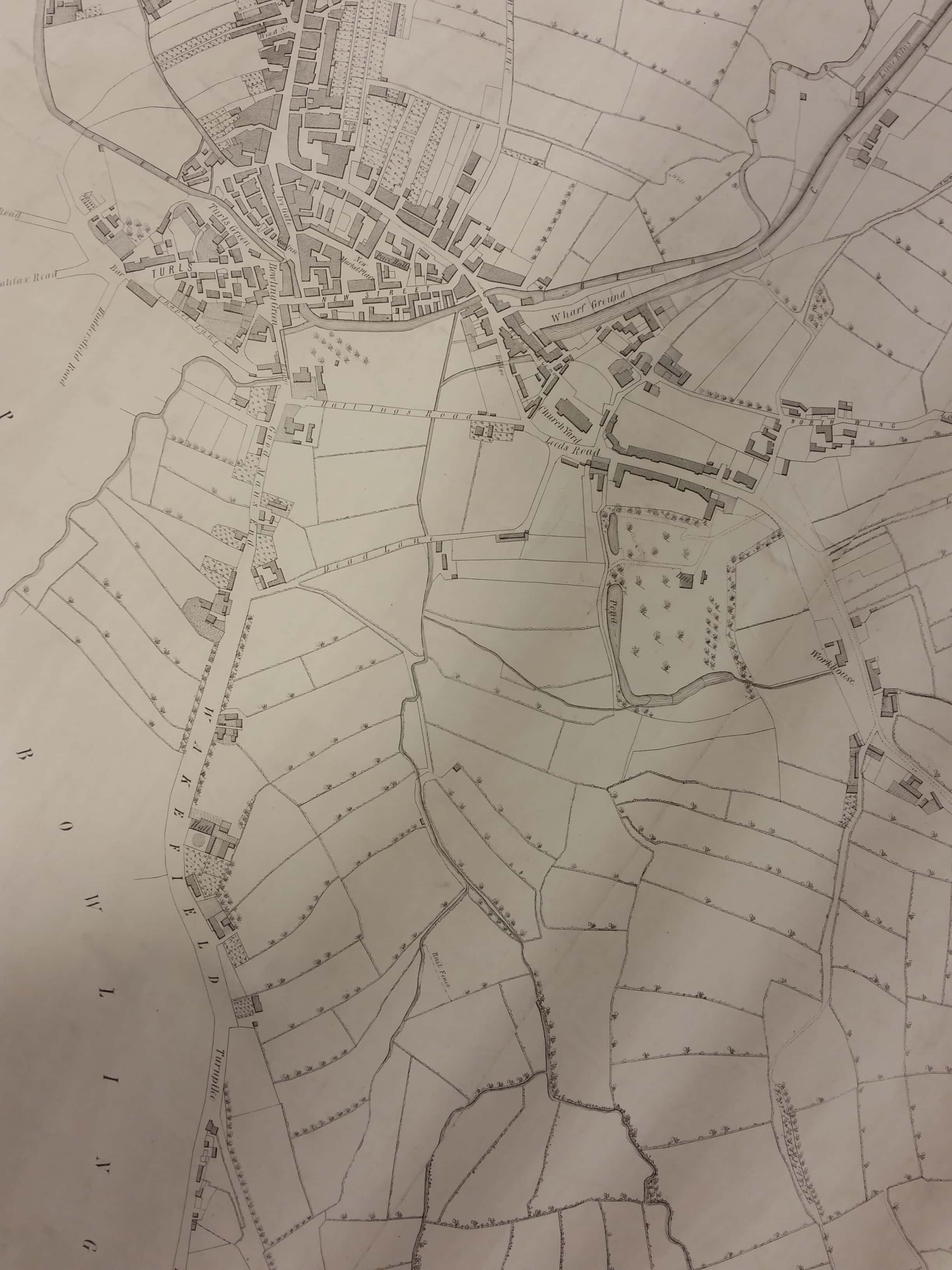
With this southern detail Bradford itself is more clearly displayed together with the end of the canal at ‘Wharf Ground’. Note how undeveloped the south of the town is. The end of Wakefield Road was long called Goodman’s End. Hall Ings is positively rustic and below it Dead Lane was soon to be renamed Vicar Lane. One of the cluster of buildings below the Goodman’s End – Dead Lane junction was the Friends (Quaker) Meeting House. The water way is the Bowling Beck heading north to join the Bradford Beck. Just above the junction of its two tributaries the map surveyor has seen fit to label a ‘rail fence’. What gave this fence its significance I cannot imagine.
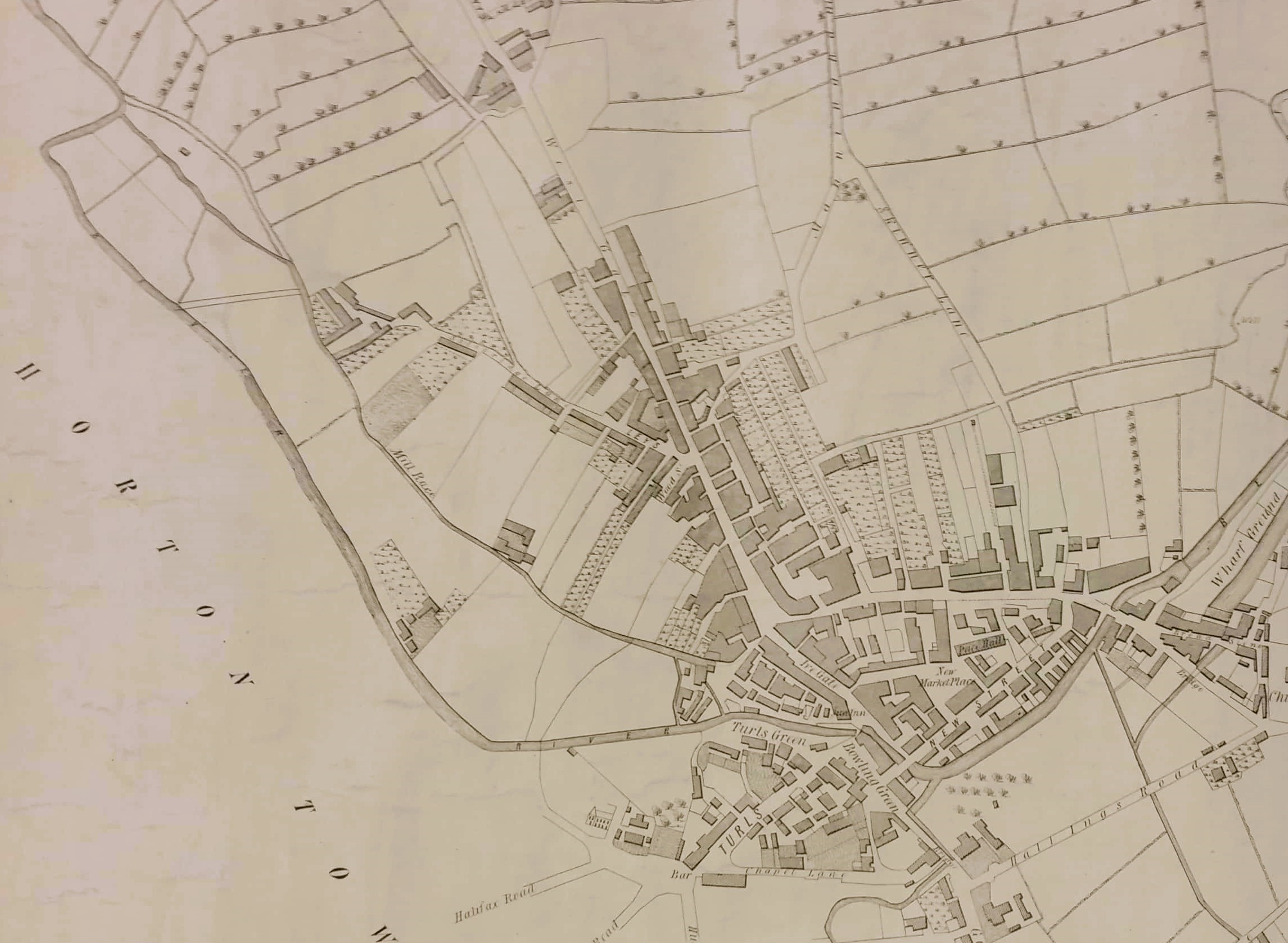
The final detail shows the Horton boundary. The Bradford Beck (now of course completely culverted) looks quite a substantial waterway and the mapmaker clearly felt it deserved to be called a river. The old Mill Goit, heading to the unnamed Soke Mill, is here uniquely called the Mill Race. The overspill and tail goit are clearly drawn but not named. In the town itself there is a New Market Place and a Piece Hall. West Gate leads north and several other streets in this area are named.
The final puzzle for me is another unnamed building. You can find the junction of the Turls (Tyrell Street) and Chapel Lane. The famous Unitarian Chapel that provided the street with its name seems to be omitted – unless it is subsumed into the block drawn at the end of the lane. Move left through the tollbar and there is a broad area at the end of three roads from Huddersfield and Halifax. Immediately above the left most Halifax Road is drawn a church-like building with a tower. It is the only building it the entire map drawn as an elevation rather than as a plan block, although it may be a later addition. Where is it and what is it? I would say just off Great Horton Road. St John’s Church and Horton Lane Independent Chapel were reasonably near this position, but not near enough. There was a Methodist New Connection Chapel slightly closer which is my best guess, but I’m far from certain and I don’t understand why this, or any building, was singled out for special treatment. Maps are often not as clear as they might be!
