2.97 ECC 1847 ING
Material: tracing paper 1847
Scale: unk Size:110*96cm
Condition: very poor
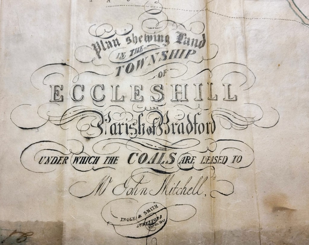
The ancient township of Eccleshill is well represented in the Local Studies Library reserve map collection, although many of its maps are in poor condition. This example is extremely fragile. It records ‘Coals leased to Mr John Mitchell’ and was drawn up by the well-known partnership of Ingle & Smith, surveyors. The condition of the map is so poor that it is not possible to record the whole map lying flat, so I have provided images of various features of interest which I have enhanced to make them more visible.
The Eccleshill historian Ken Kenzie told me that at this date John or Jonathan Mitchell was a coal merchant who lived at Eccleshill Bank. He ran Park Pits which were sold in 1860 when he was in his 70s. The West Yorkshire Archives (Bradford) has a huge collection of Jowett family documents (10D76/3/190). In box 6 of these is a lease dated 1842: ‘George Baron to John Mitchell, Eccleshill’. This document is a 28 year lease of Upper Bed and Lower Bed coals in the area of Greengates, Eccleshill. The price seems to be £60 per acre. Greengates and Apperley Bridge were traditionally considered to be part of Eccleshill. Other Eccleshill pits were: Idle & Eccleshill Coal Co. at Springwell Field, and Firth’s Averingcliffe Colliery.
It is hard to believe today but the whole of Eccleshill was once mined for coal, with mining features commonly being seen on nineteenth century maps of the district. The Hard and Soft Beds (sometimes called the Upper and Lower Beds) were widely exploited all over the north Bradford area. Above these in the geological sequence was the important strata of sandstone called the Elland Flags, which was extensively quarried. Modern geology maps suggest that the centre of Eccleshill was high enough to include the Better Bed coal and fire-clay seams, positioned above the Elland Flags. William Cudworth, in his account of Eccleshill, mentions the Better Bed, and also an associated fire-clay and brick making industry based at Manor Potteries in Eccleshill.
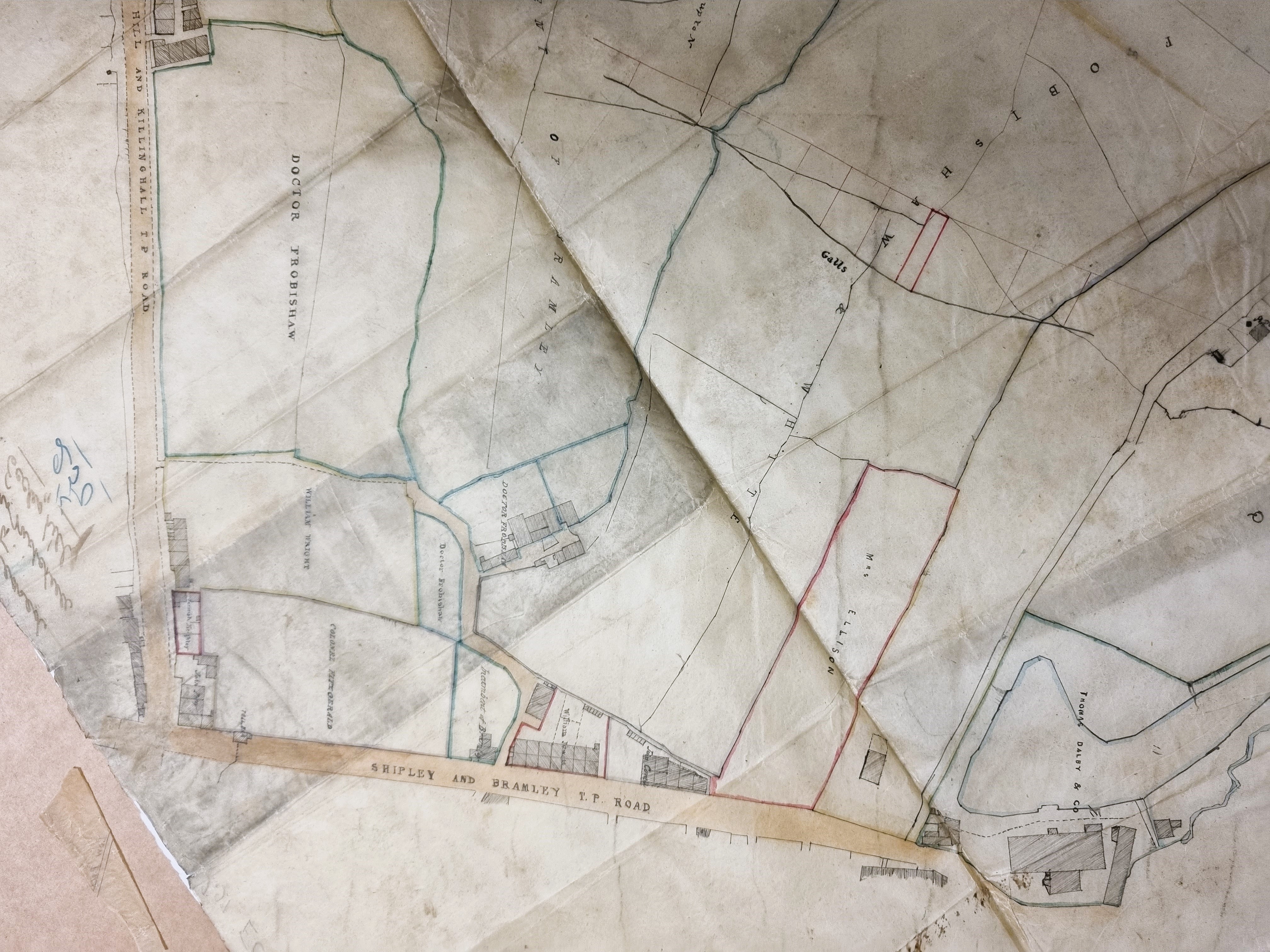
The second map detail shows the junction between the Shipley & Bramley Turnpike with the Dudley Hill & Killinghall Turnpike at Greengates. Colonel Fitzgerald and Dr Frobisher are landowners around the junction, and a dog-legged track leaves the main Bramley road and leads to the, unnamed, Haigh Hall, which survives to this day. The top of the map is south and is uphill from the turnpike. You will notice ‘galls’ which are geological faults, a matter of great significance to miners following a coal seam.
In the next detail we have moved higher up the Dudley Hill & Killinghall Turnpike in the direction of Eccleshill. About one third of the way up this road a trackway leads off to the right. This shows better in Figure 4.

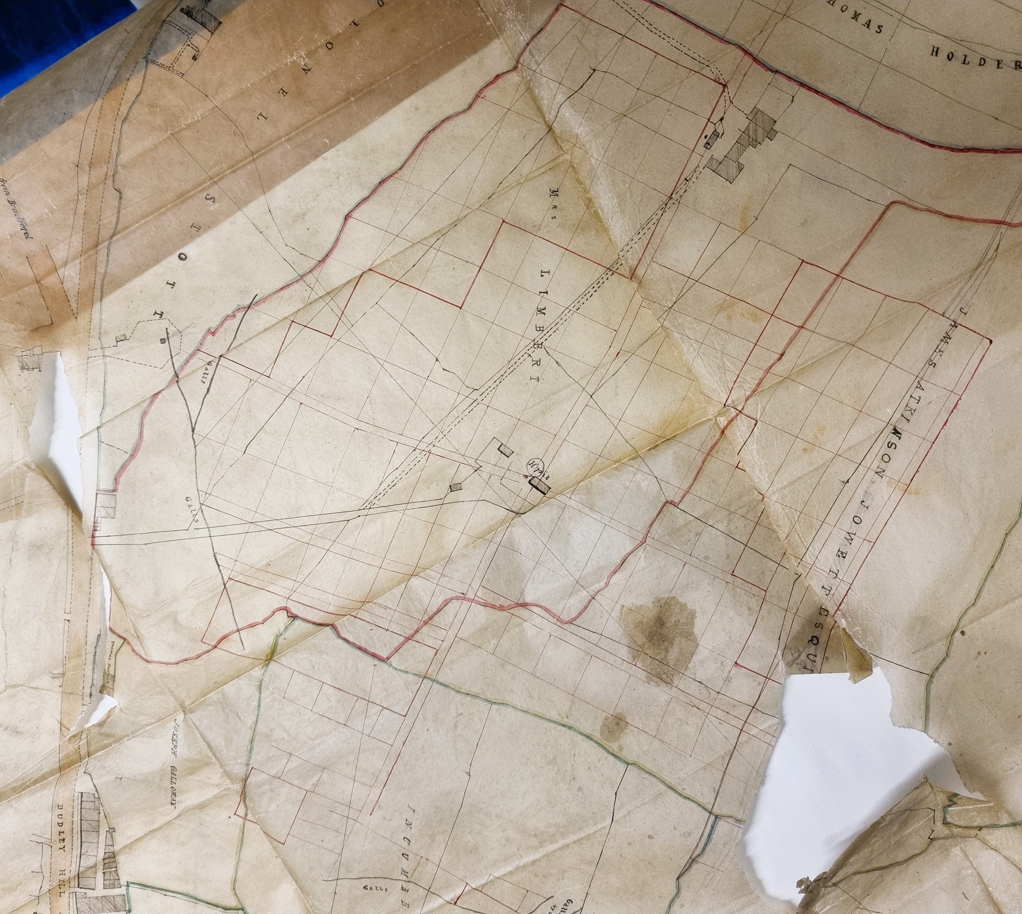
The trackway crosses further galls and ends at a colliery named as ‘H.pit’; could this be Haigh Pit? Around the colliery are a network of red lines which must surely represent a network of underground galleries. It’s difficult to say whether these actually existed or whether they are just formal, marking out the area of coal leased by Mr Mitchell. In those days the mining technique was ‘pillar and stall’, with the coal being won from the stalls with pillars being left unmined to support the roof.

In this next figure H.Pit is in the bottom left corner. It is difficult to be certain which lines represent surface features, and which underground, but I think that the trackway proceeds to cross the land of Mrs Limbert, Thomas Holders and Colonel Stott. On Mrs Limbert’s property there is an unnamed building which I assume is Low Averincliffe. Colonel Stott’s land there is a further cluster of buildings marked by a circle and black dot. I would imagine this is another colliery, possibly disused. Some of these features are on the contemporary 6” OS map near Cross Lane but not in exactly this form. At the top of the map is Eccleshill Bank which closely resembles the arrangement shown on the OS map.
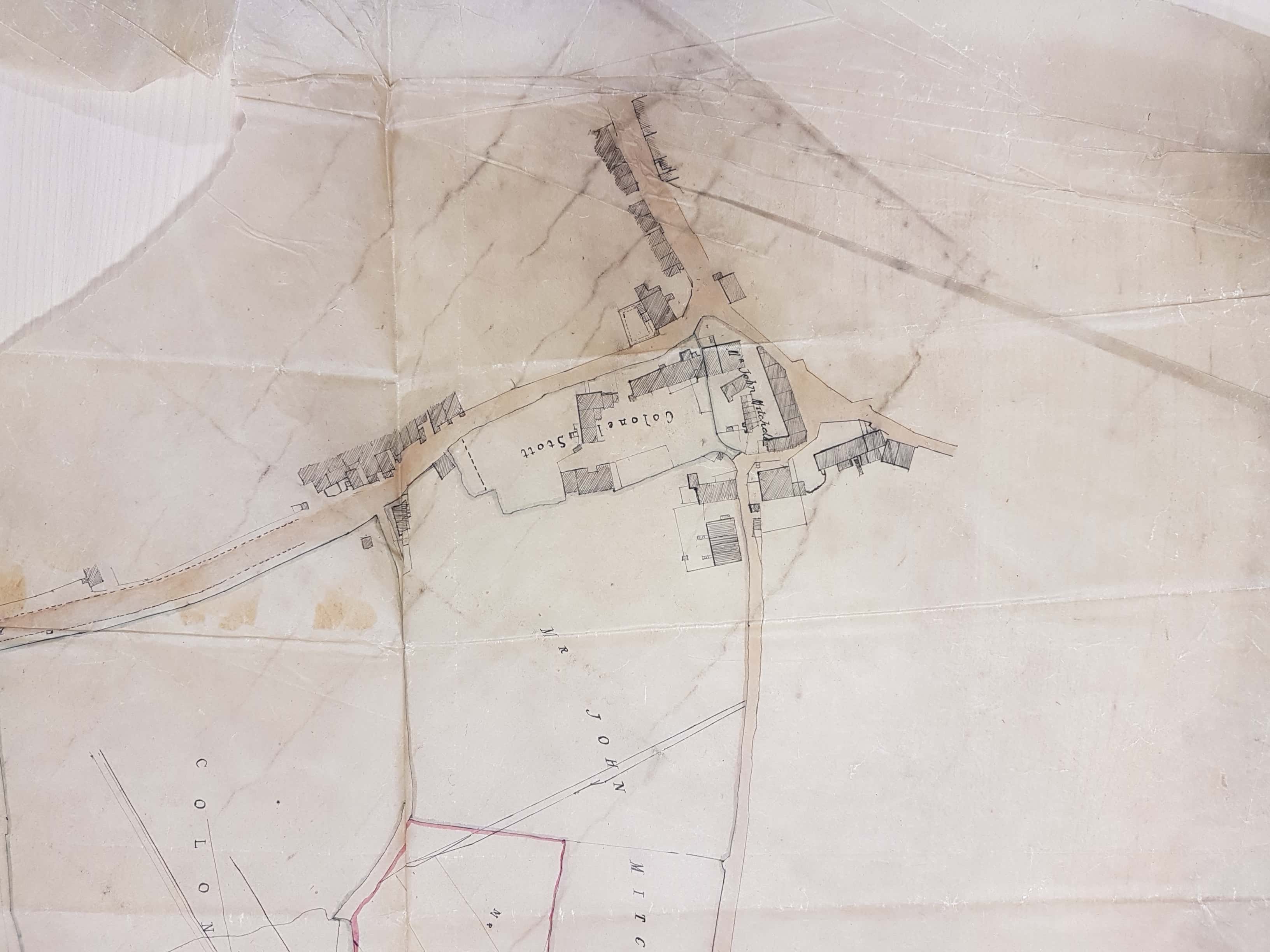
The final figure is takes us further along Eccleshill Bank to its end (Bank Top). The properties seem to be largely those of Colonel Stanhope and Mr Mitchell himself. From Ken Kenzie’s information I can assume that Mt Mitchell actually lived here. But it was Eccleshill Hall that was long the home of the Stanhope (later Stott-Stanhope) family. As far as I know Lt.-Col. George Stott-Stanhope was the last family member to actually live there. He was a large landowner whose name frequently appears in local maps. He died in 1874 and the hall was demolished in 1878. In another area of this map I can identify George Baron as a landowner; he was mentioned in my second paragraph. George Baron, of Drewton in the Wolds, was a possessor of the Clockhouse Estate with lands in Bolton, Frizinghall and Heaton. He inherited the estate from Sarah, last of the original Jowett family, and died in 1854. His successors adopted the surname Atkinson-Jowett.
