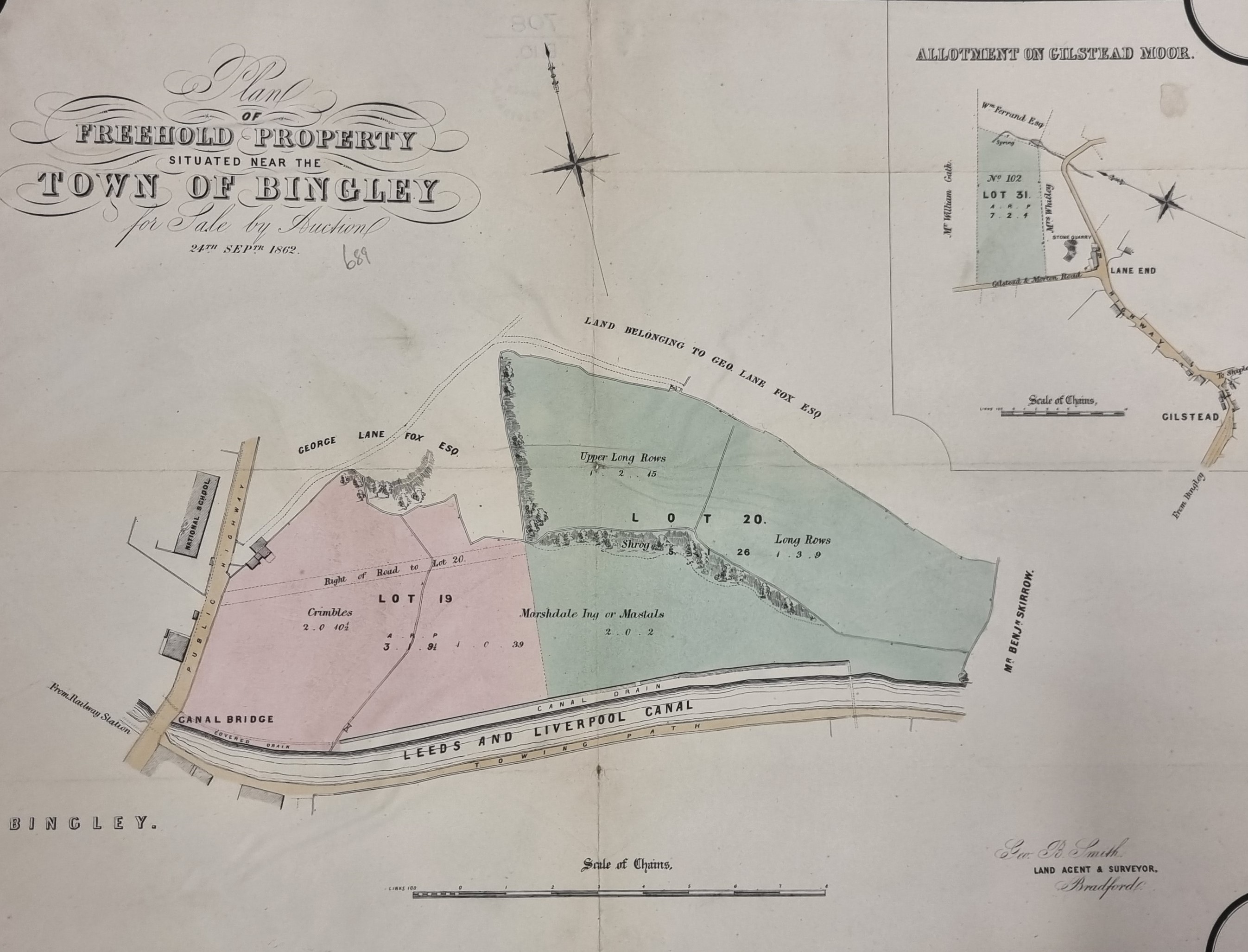
This plan (BIN 1862 SMI) has a definite date and purpose. On 24 September 1862 the land shown tinted, near the centre of Bingley and at Gilstead, was up for sale by auction. No vendor’s name is provided on the map but the land agent and surveyor was Geo. B Smith. George Lane Fox is a neighbouring landowner. We even know that north was at the top of the plan, which is by no means always the case with plans and maps of this age. In the limited time available I have not been able to find any notification of the sale in the press, but it is always possible that there was a private sale eventually. and the planned auction never took place.
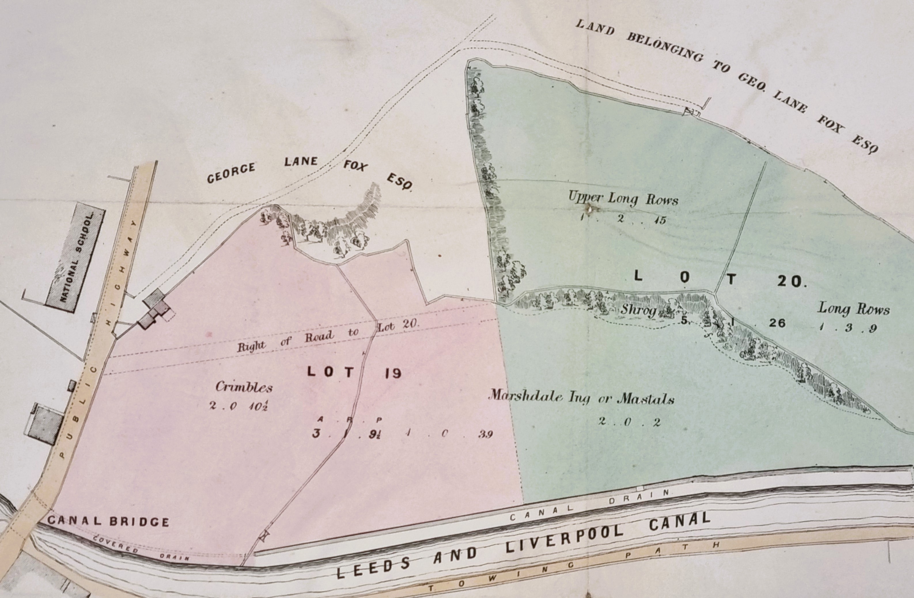
The canal and tow path are clearly seen, as is the canal bridge and public highway. The presence of the National School makes the location absolutely certain. Geo B Smith must surely be George Belk Smith the surveyor, son of the equally well-known surveyor and agent, Joseph Smith. George was Sir Titus Salt’s agent in the purchase of the land for Saltaire, and his offices were in Leeds Road, Bradford. There was a George Lane-Fox MP of Bramham Park near Leeds, but he died in 1848. His son is probably the man referred to here since he was also a George and lived to 1896. His grandson, yet another George, lived to be created the first Baron Bingley but was not born when this plan was surveyed.
What are the problems? Essentially the field names. Long Rows and Upper Long Rows are intelligible enough, but what do Crimbles, and Mastals mean? And what about Shrog? Also, what about the hatched areas: are they intended to represent trees? I hoped that the slightly earlier Ordnance Survey map (c.1850) might be helpful.
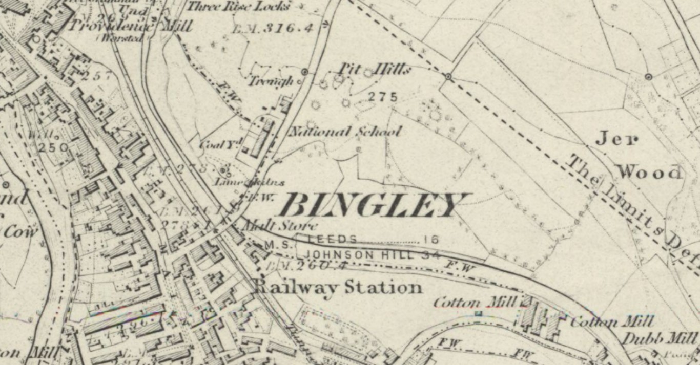
In the detail from the OS map you can orientate yourself by means of the National School. The area of the first map coincides with ‘BINGLEY’. The fields are not named, as is usually the case with OS maps, but the field boundaries match the sale plan. Just outside the sale area are ‘pit hills’. In most parts of Bradford you would imagine some connection with coal mining but in Bingley extensive glacial deposits of limestone boulders had been excavated for centuries. Note the adjacent limekilns. The burned or calcined quicklime could be slaked for mortar, or used to sweeten the soil. In fact, the Leeds-Liverpool Canal was bringing a closure to this industry since limestone could be now easily be transported by barge from the quarries at Skipton.
The valuable website of the English Place Name Society suggests that the field names are rare, but not unique in Yorkshire. Crymel may be one of the many words meaning a small plot of land, and Shrog, shruggs or Shrogg describes ‘scrubby woodland’. There is another example of Mastals too, but no etymology is suggested. It would seem to resemble Mastiles Lane near Malham. Today the area of the plan is totally developed and lies between the canal and Whitley Street. So, I don’t suppose Shrog crops up in conversation all that frequently!
