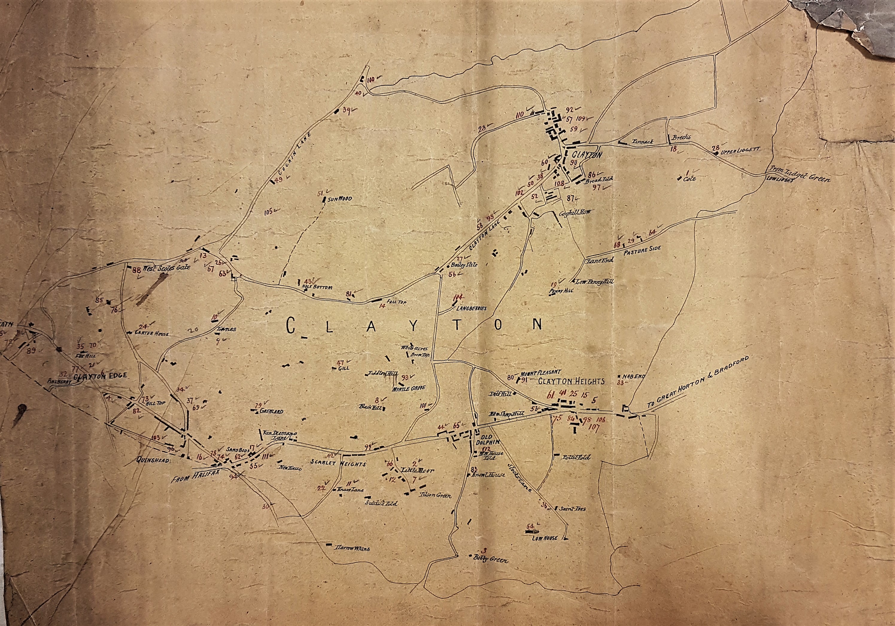
I have used this old paper map of Clayton before (X47, CLA c.1840 PLA), but now I am in a position to illustrate it with two late nineteenth century photographs, also taken from the Local Studies Library reserve collection: it is a different world. Clayton itself is a very old community whose name appears in the Domesday Book. It is assumed that ‘clay’ describes the nature of the soil, without necessarily implying it was the basis of a pottery industry. It was incorporated into Bradford at a fairly late date, in 1930. The index card associated with this plan simply describes it as ‘a MS sketch plan’, but there is no other information whatever. I assume my unknown predecessor is suggesting that it represents a hand-drawn sketch based on another map, and if so this interpretation seems very plausible. There appear to be some misspellings and the identifying label ‘Clayton Heights’ still has construction lines to aid the ink lettering, which was possibly added later to a completed plan. The plan shows a much wider area than simply Clayton Village itself, but I have added this detail concentrating on the village itself.
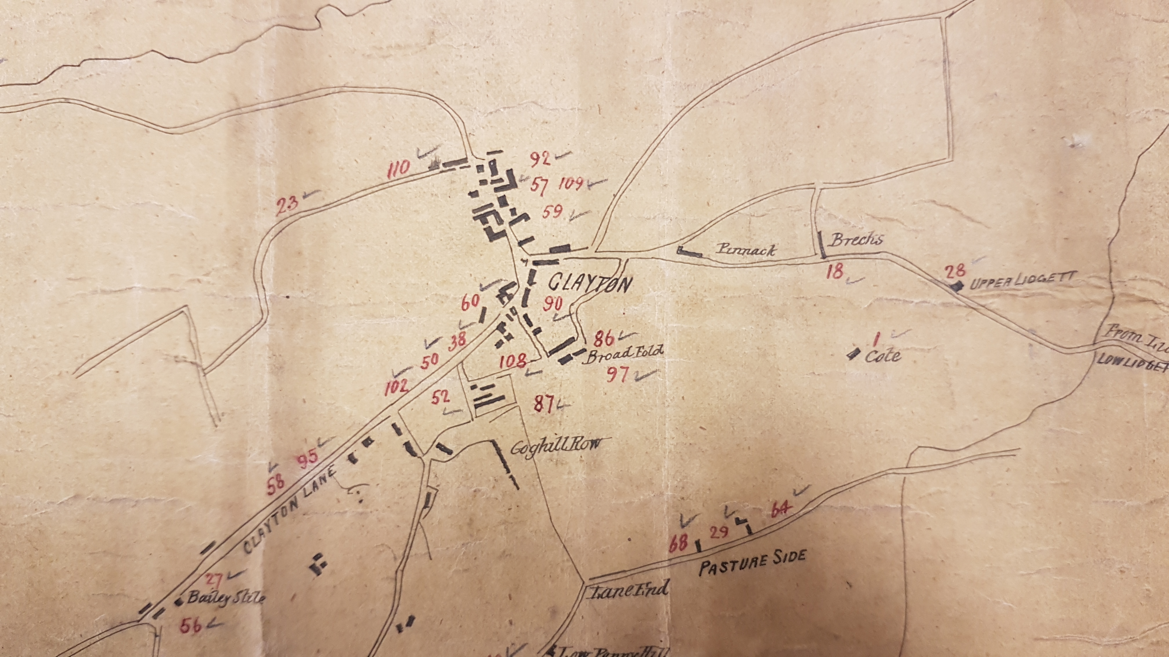
With no other information available, what can I say about the date and purpose of this plan? One clue is that Queensbury is described as ‘Quinshead’, this being an obvious misspelling of Queenshead, an earlier name applied to the township between Halifax and Bradford, one of the highest parishes in England. Another is the absence of the parish church of St John, Clayton, which would be situated (after 1851) approximately where the numeral 60 is positioned in Clayton village. So, we are probably looking at a plan drawn in the first half of the nineteenth century. What we have closely resembles the first Ordnance Survey map of the area, surveyed in the late 1840s. The OS map is of greater value to students of industry since it marks the position of quarries and coal pits, very few coal pits, which our plan does not. Other concerns, like the malt kiln immediately west of Coghill Row, are drawn on our plan but not named. The plan is a good guide to local topographical names however. Some seem a little strange: ‘Hole Bottom’, for example off Clayton Lane, which was later the site of Julius Whitehead’s famous brickworks. Another striking example is Van Diemen’s Land (or Lane) near Queenshead. The name of this colony and penal settlement was changed to Tasmania in 1856. Sadly, no dateable landowners’ names are included, and I cannot yet explaining the meanings of the numbers and ticks.
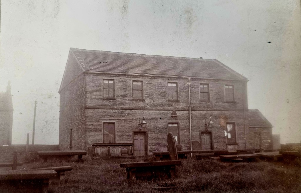
Historian William Cudworth is not very helpful. He describes Clayton Heights, and nearby Old Dolphin, as very ‘bleak and cold’ and places, but does not name, a worsted mill there. Turning to spiritual matters the next figure shows the Old Dolphin Wesleyan Chapel. Cudworth confirms that in the neighbourhood ‘the Halifax Bed’ coal was mined, but this is true over much of north Bradford of course. If there is coal mining occurring in the contemporary community it is strange that in the 1851 census I can find only a single coal ‘hurrier’, and very few pits are marked on the OS map.
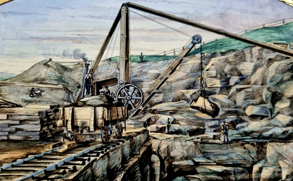
Cudworth also mentions stone and Clayton was famous for quarries. I don’t, yet, have a photo of one in the area but we do have this lovely watercolour of a Victorian quarry as an illustration. This produced stone for the Bradford – Queensbury – Keighley railway line.
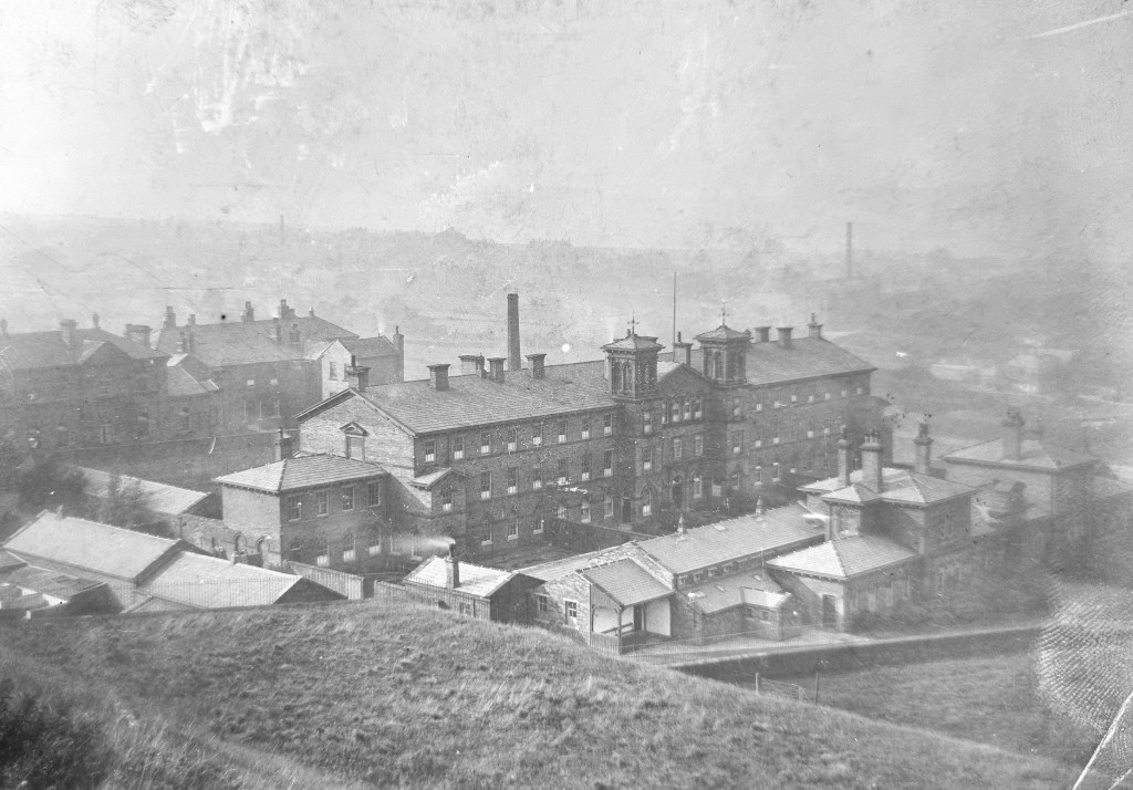
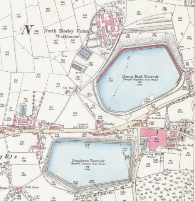
The final image dates from the last decade of the nineteenth century. Someone has written on the image ‘North Bierley Union, Clayton’, which I assume must be the Clayton Workhouse. In 1875 a North Bierley Union Workhouse was opened in Clayton at Nab End (which appears on the map) to house 250 paupers and providing for the sick and destitute. After closure I believe it became Thornton View hospital. The included 1890 25” OS detail shows its location in relation to Horton Bank Reservoir.