This week (November 2022) has seen the Bradford premier of a remarkable film. A Bunch of Amateurs is a documentary made by Kim Hopkins about a Bradford cine club. By all accounts the film records the manner in which the human qualities of the group triumph over declining membership, and external problems such as the Covid pandemic. I think we can all be proud that another Bradford institution is brought to public attention in such a positive manner.
It seems that the Bradford Movie Makers is one of the oldest of such clubs in the world. By an extraordinary coincidence the Local Studies Library map volunteer, who places these old maps of the city on-line, had the same week been presenting to the club another piece of local history: the financial involvement of Heaton and Shipley in the great Birr telescope of the 1840s. On my visit I was told that the club’s premises, off Little Horton Lane, was essentially a converted stable. This would certainly fit with the internal and external appearances of the structure I saw. I wondered if we might celebrate the Club’s achievement by tracing the area in which the clubhouse is located backwards in maps of the area. We can travel back 300 years – in maps.
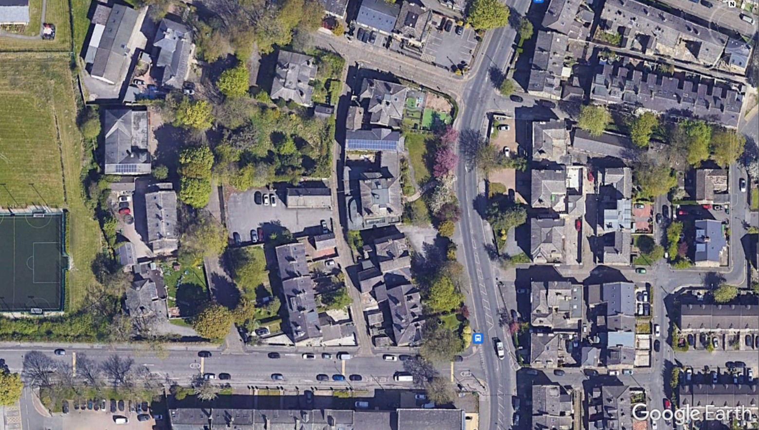
I have started with the present appearances contained in a capture from the valuable application ‘Google Earth’. In this capture the road running vertically is Little Horton Lane. Coming from the city centre, at the top of the image, the two right turns are Melbourne Street and Trinity Road. The now famous club house is the rectangular building in a yard off Back Russell Street, which has three parked cars beside it.
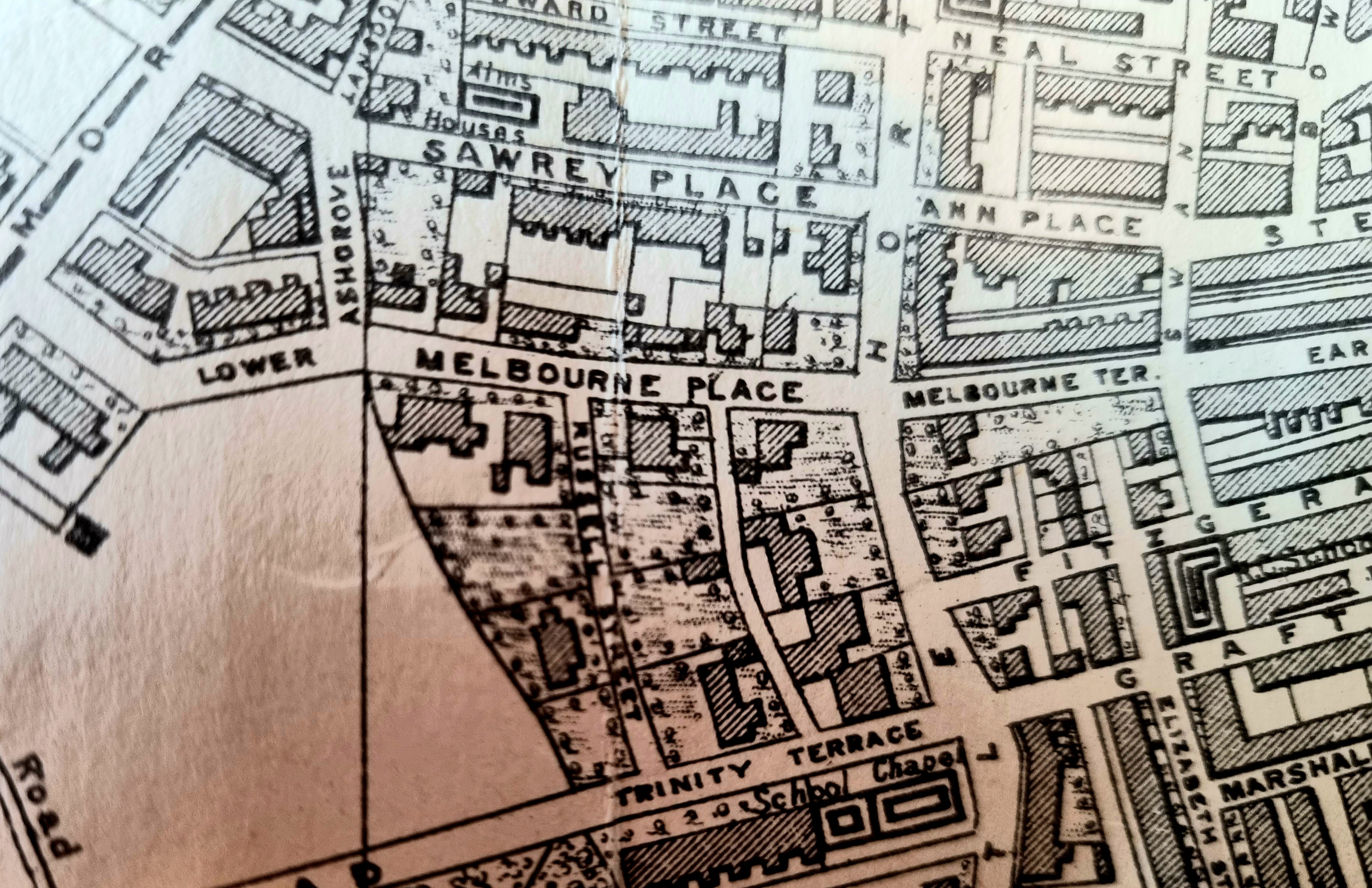
I was told that the film club has been in existence since 1932. The first map detail is from the William Byles map of the city centre, dated 1912. There were then some slight differences in the street names. In the early twentieth century, the adjacent thoroughfares were called Melbourne Place and Trinity Terrace, and they were linked by Russell Street. The clubhouse or stable is present at that date, but there is a puzzle. In 1912 the building was hard up against the property boundary. Today you could certainly fit a vehicle between the building and the boundary. Most probably some additional land has been purchased since 1912, but it is just possible that the original building was demolished and rebuilt on the plot in a position to allow for better access. There has also been a small degree of house development in the last 120 years, but you can judge that for yourselves.

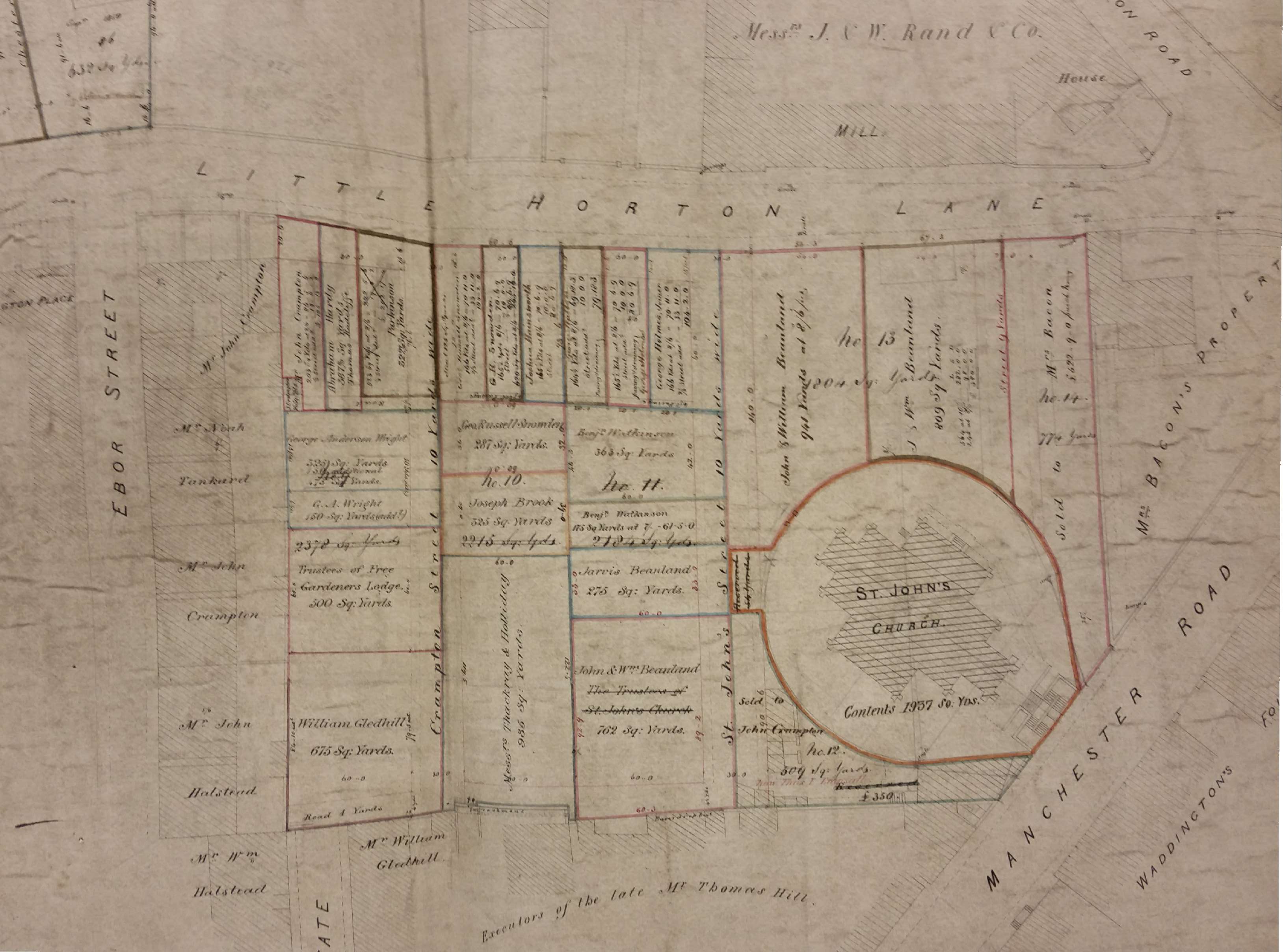
If we move backwards in time to the Bradford City map of 1871, now 150 years in the past, things are quite different. The stable is unbuilt and the plot that puzzled me in 1912 is undivided. A house opposite, with a frontage on Little Horton Lane, is marked ‘parsonage’. This indicates the residence of an Anglican clergyman. The chapel present on Trinity Terrace would not generate a ‘parsonage’. The nearest church would be St John’s, built in 1839. For various reasons it was not successful and at this time it only had another five years of existence, being demolished in 1876. The church shows well in this mid-century sale plan from the reserve collection.

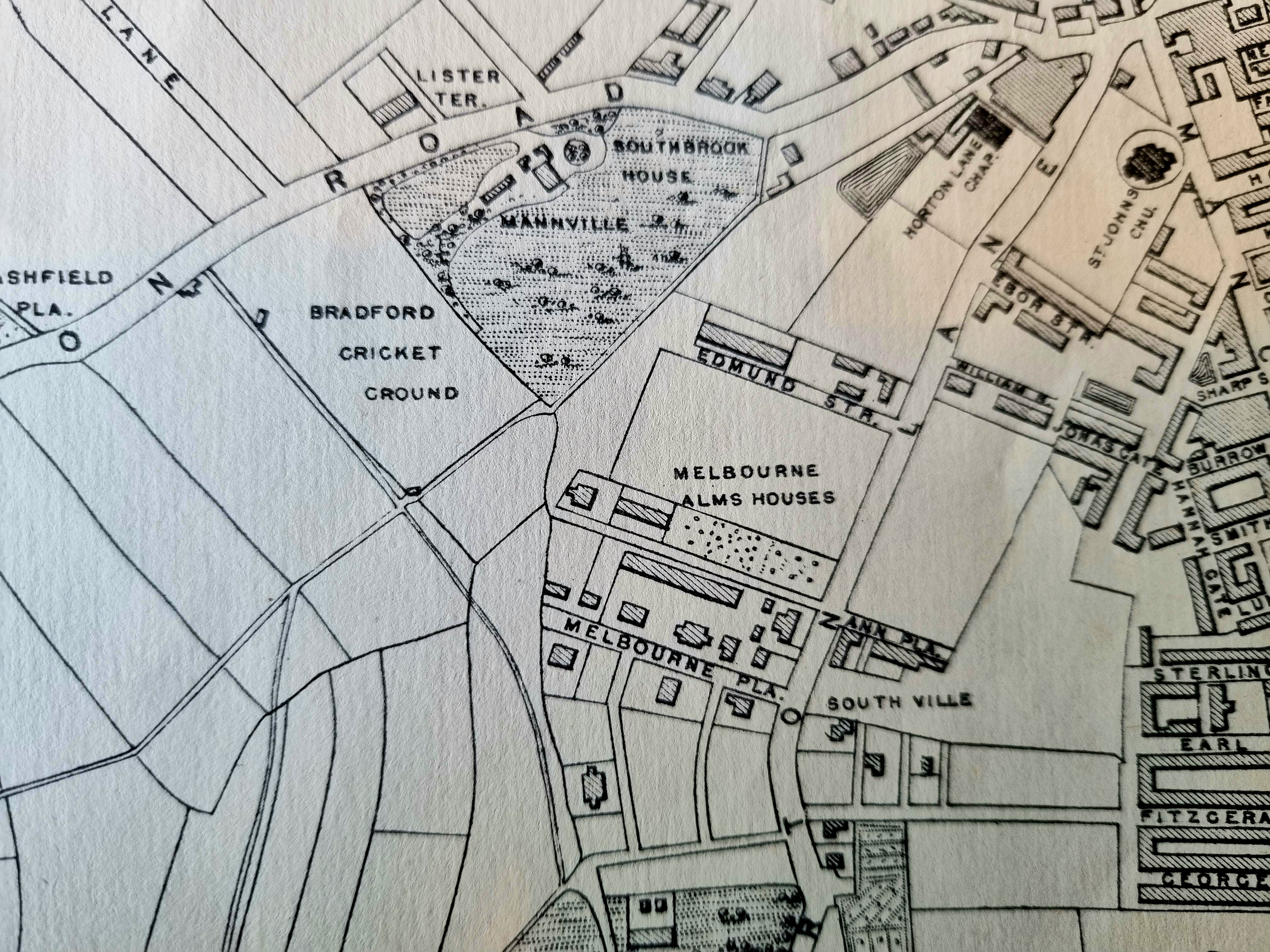
The next detail, from the John Hart Bradford block plan of 1861, confirms the earlier deduction. Buildings in the area of Melbourne Place are now quite sparse, but one is clearly marked St John’s Parsonage. The chapel is labelled, reasonably enough, Trinity Chapel and has an attached school. Trinity Chapel was a Baptist place of worship and its foundation stone had been laid in 1856, by the Lord Mayor William Murgatroyd, according to the Bradford Observer. Scruton described it as a ‘handsome and commodious’ structure.
Reaching further back it is clear that a decade has brought about a very substantial change, The Apkin plan of Bradford dates from the 1850s. The area is scarcely developed at all and there is neither parsonage, chapel nor school. North of Melbourne Place are the Melbourne Arms Houses. I gather that these survived at least until 1873 but further information has been difficult to come by. The area would, in any case, soon be covered by terraced housing. At the bottom centre of the map is the garden of Horton House extending down towards the city.
I haven’t photographed the 1834 map since there is so very little to see. Little Horton Lane (unnamed) extends from the town centre to Horton House with no building development on either side. Newspaper notices suggest that at this time the inhabitants of Horton House were John & Annie Wood. Later it had long been the location of Joseph Hinchcliffe’s ‘Academy for young gentlemen’. In the late 1840s it was considered as a possible site for a new Bradford workhouse. The academy, and the land surrounding, which probably included the future location of the film club, was in the possession of Col. Fitzgerald – Thomas George Fitzgerald, of Turlough, Ireland (1778-1850). After 1839 he was a Lt-colonel in the army. Fitzgerald had a strong Bradford connection for in 1809 at St Peter’s Parish Church, he had married Delia (1780-1817), daughter of Joshua Field, of Heaton Hall. In 1819 he took Elizabeth Crowther (daughter of a Dr James Crowther Leeds), as his second wife, which brought him property in Horton according to Cudworth. There was a Fitzgerald Street off Little Horton Lane.
The 1802 Bradford map doesn’t extend as far as Horton and is consequently no help. There is a remarkable 1720 map of Bradford and Horton. This marks a solitary building, Horton House, as ‘Mr Listers’ just before Little Horton is reached. Between that and Bradford itself is simply farmland. In that generation Horton House moved from the Listers to Dr Crowther, again by marriage. Now the story of the House might make a fascinating film!
