
3.027 MAN c1850 PLA BHM 817 B11
Material: paper Scale: unk
Size: 73*46 cm Condition: fair
As usual this plan is undated but helpfully it is annotated on the reverse ‘A148 Lady Royd Farm, Manningham’. It is doubtful if I would have located the mapped area without this assistance. As it is the positioning of the map still caused me difficulties since the names of thoroughfares are not included. I was familiar with Lady Royd Hall as part of the Bradford Girls Grammar School, but this was effectively at the Squire Lane – Duckworth Lane T-junction, close to Bradford Royal Infirmary. But, as the following detail of the 1852 Ordnance Survey map shows, the original hamlet of Lady Royds was quite some distance away, facing modern Allerton Road.
Cudworth states that this name is very old and was known as Lady Rhode in the 14th century. Could the lady concerned be Our Lady, that is the Virgin Mary? There was later religious connection since a Baptist Sunday School was present at Lady Royd in 1840s.

The OS detail suggests that Squire Lane was the name of a small hamlet halfway between the two sites already mentioned. What is remarkable to a modern eye is the presence of coal mining activity there. Four Lane Ends Colliery was still working in the mid-nineteenth century and I know from other evidence that it exploited either the Black or Better Bed coal seams. There are also adjacent ‘Old Pits’ which normally indicates eighteenth century activity.
Essentially then we have the land attached to Lady Royd Farm, Squire Lane. The fields are named, and the pattern is identical to the 1852 OS map. The regular rectangular shapes of the fields, or ‘closes’, strongly suggests that they are the product of the Enclosure Acts, but I haven’t pursued this question further.
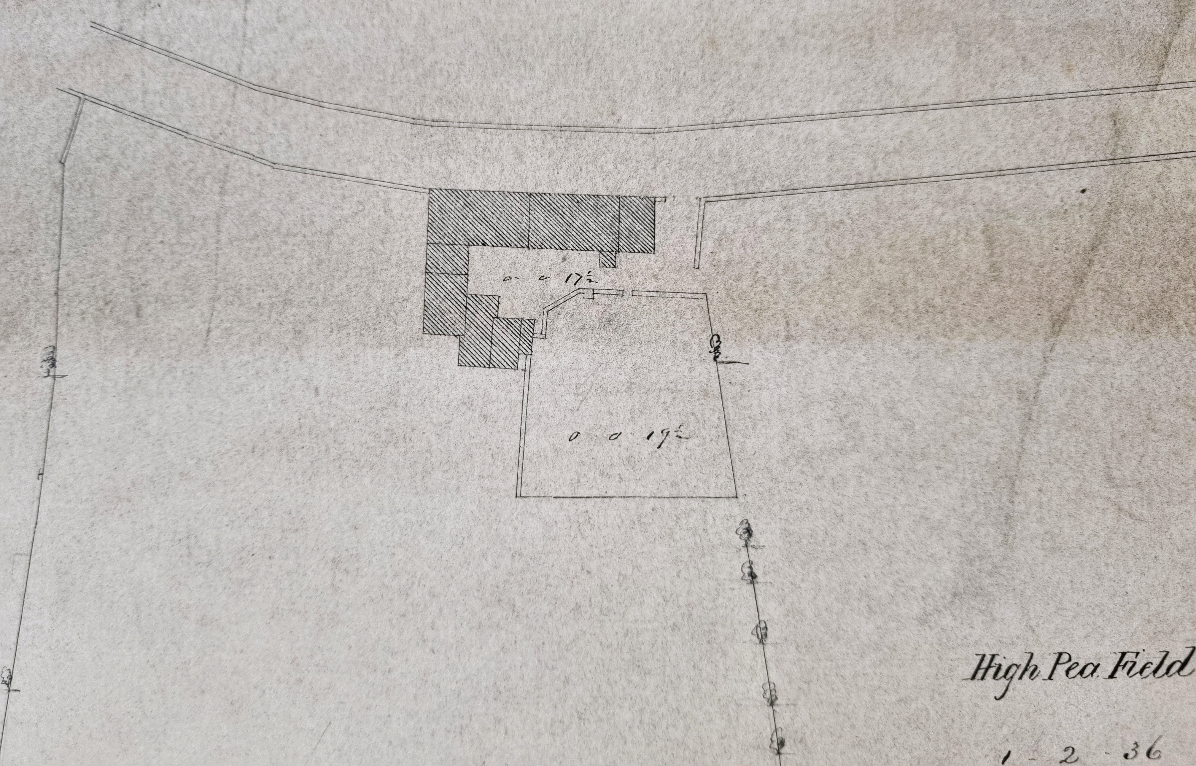
I assume that the farm building itself, sited on Duckworth Lane, is shown in the above detail. We are very fortunate since the sale of this property is announced in the Bradford Observer June 14, 1849. It was to be auctioned by Mr GT Lister at the Swan Inn, Bradford. The farm was in the occupation of Samuel Ackroyd and is described as:’ Lot 1 Dwelling House, Barn, Mistal, Outbuildings and Yard partly on Duckworth Lane’. There were other portions of land for sale: Lot 2 The High Pea Close, Lot 3 The Low Pea Close, and Lot 4 – a close of land bounded to the north by another close called the Ing (a common Bradford field name) and to the south by Hedge Side Lane, the Allerton-Bradford Rd, John Clayton’s devisees and the Baptist Sunday School.
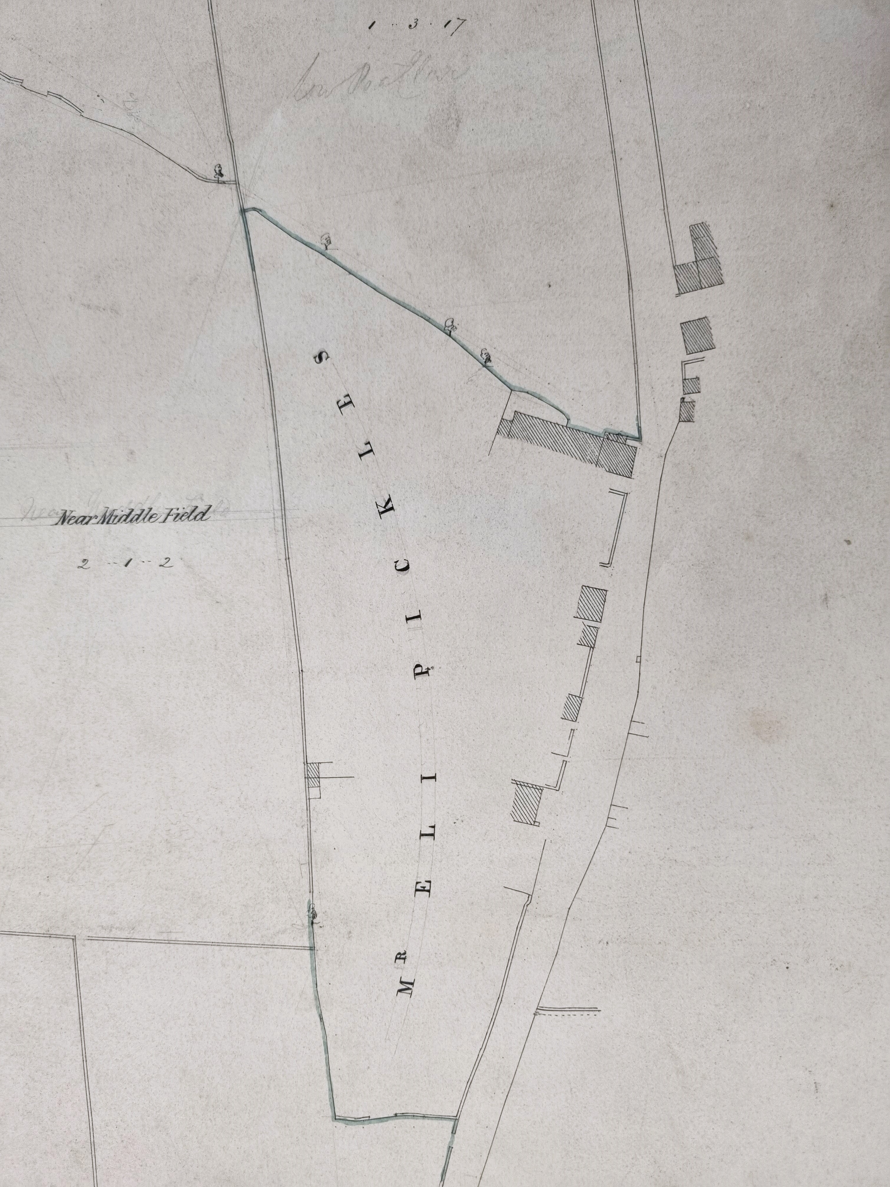
Other landowners are mentioned. To the east and south-east of Lot 4 were the property of Eli Pickles, and Squire Lane. Additional estate in Little Horton was also for sale and is described as ‘the property of the late Mr F Ackroyd’. Whether he once owned everything is not completely clear, but Samuel Ackroyd (note the same surname) was the pre-sale occupant of the farm and is recorded as such in the 1850 Bradford Directory. Eli Pickles is still resident in Squire Lane in the 1851 census. He was born c.1799 in Wibsey and was a stone quarry master who was employing six men.
The sale advertisement suggested that the land was suitable for villa development. But what happened next is rather different. At the time of the 1851 census Richard Brook, a stuff merchant, is living at Lady Royd Farm with his children and three servants. I understand that Lady Royd House was built there in 1865 by Bradford architects Milnes and France, for textile man Henry Williamson. Williamson Brothers were a firm of Keighley spinners; was this Henry’s concern? The house and the gate lodge are Grade II Listed. In the 1920s Bradford Girls’ Grammar School bought the building to use as a preparatory school and then constructed a new senior school. The building ceased its use as a school several years ago and was put up for sale in 2009.
