3.044 ALL c1850 PLA BHM 728 B11. AA2
Material: paper Scale: unk
Size: 54*43 cm Condition: fair
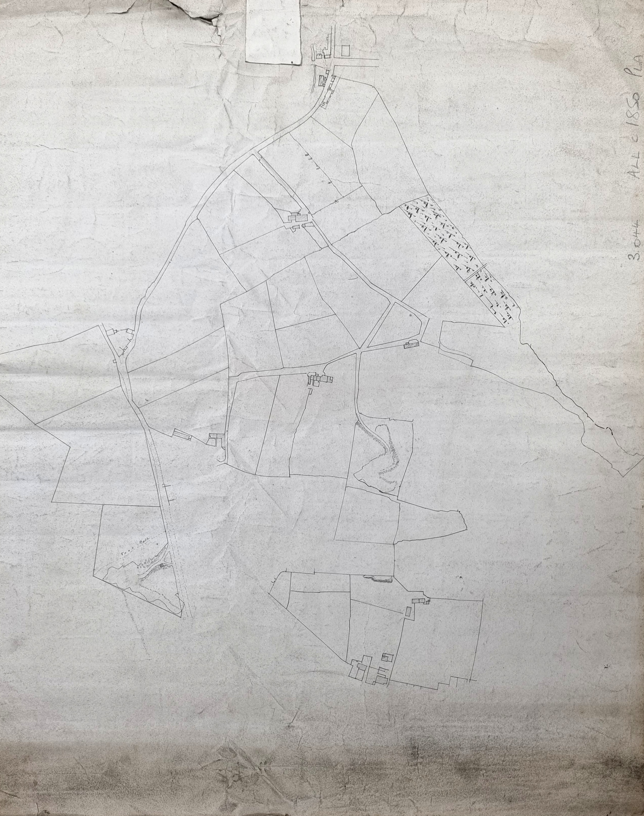
I’ve posted this map before, but I was not really satisfied with my exegesis on that occasion. As you can see this is an undated plan of field boundaries and buildings with no labelling of any kind except one ‘foot path’. The only information provided is an annotation on the reverse stating ‘Mr Rawsons Hell Cliffe Estate, Allerton’.
Allerton or Ollerton is a common place name in northern England and means ‘the place where the alders grow’. Since the neighbouring township of Heaton has a Paradise and an Eden might not Allerton have a Hell? But as far as I can see the area is called a more plausible Hill Cliff by the first Ordnance Survey map, as are some of the adjacent quarries, so the question of a misspelled map title must be presumed, although it does seem an odd mistake to make.
So, where are we? My best estimate is that it represents the area north of Guide Moor, west of old Allerton Village, and the fields shown are on both sides of modern Stony Lane (which I believe was formerly called Allerton Lane here). The complicated junction at the top of the plan is called Swain Royd Lane Bottom on the first OS map and is the modern village of Sandy Lane.
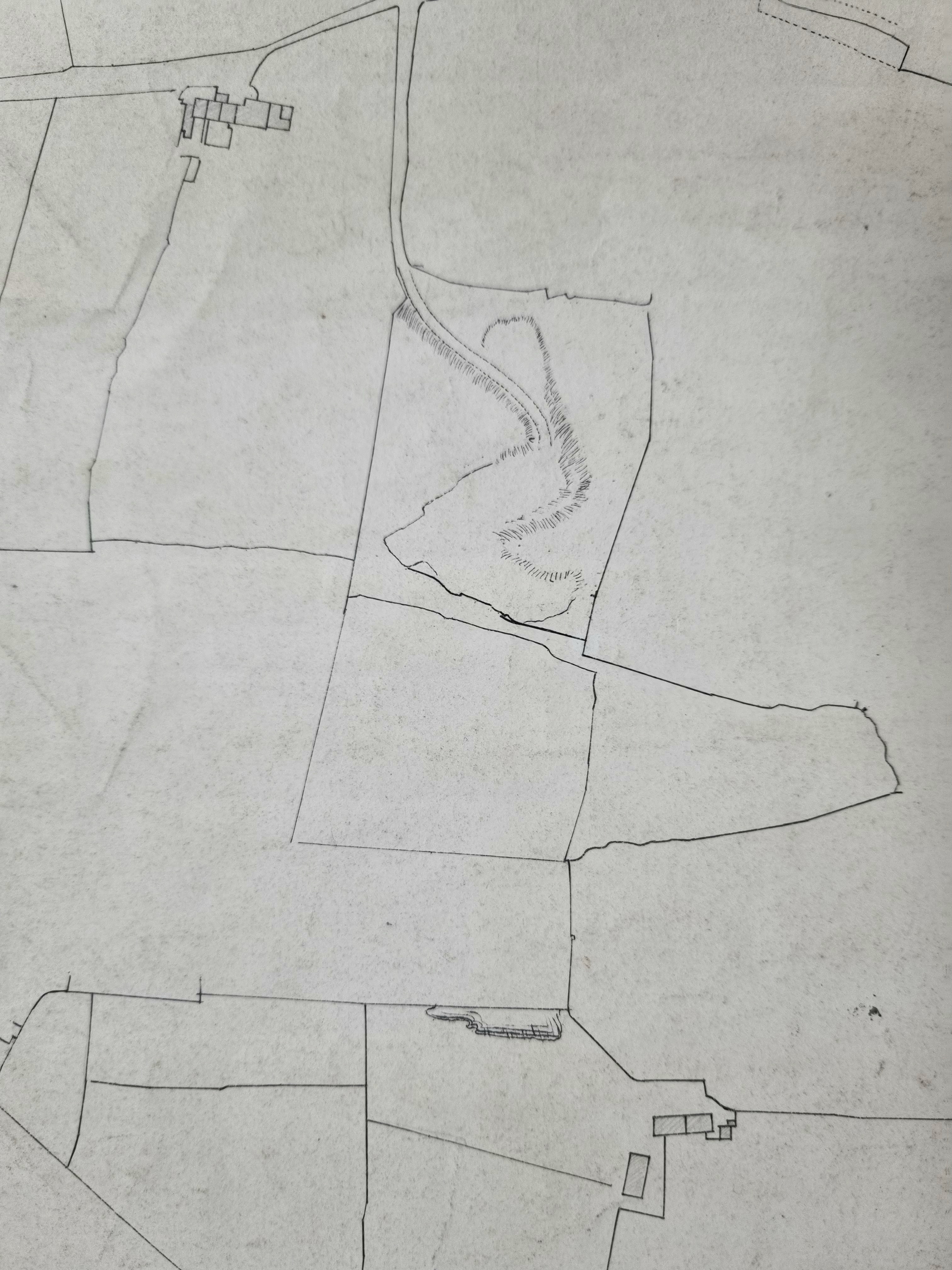
The short, straight, section is the Blue Bell Trust turnpike to Haworth. As we move south-west the field boundaries are a close match to those on the OS map. The hamlet is Moor Side, and the odd markings at the bottom right must represent the upper part of Chellow Dene. The Chellow Dene beck is not drawn until it crosses the turnpike. By the 1850s a large Bradford reservoir had been constructed in Chellow Dene which is present on the first OS map. In this area we are close to the boundary of Heaton and Shipley. Exactly where the border was of great importance in deciding which Lord of the Manor owned the rights to the underground minerals. Dr Cyril Jackson (Shipley) and John & Joshua Field (Heaton) had violent disagreements on this topic.
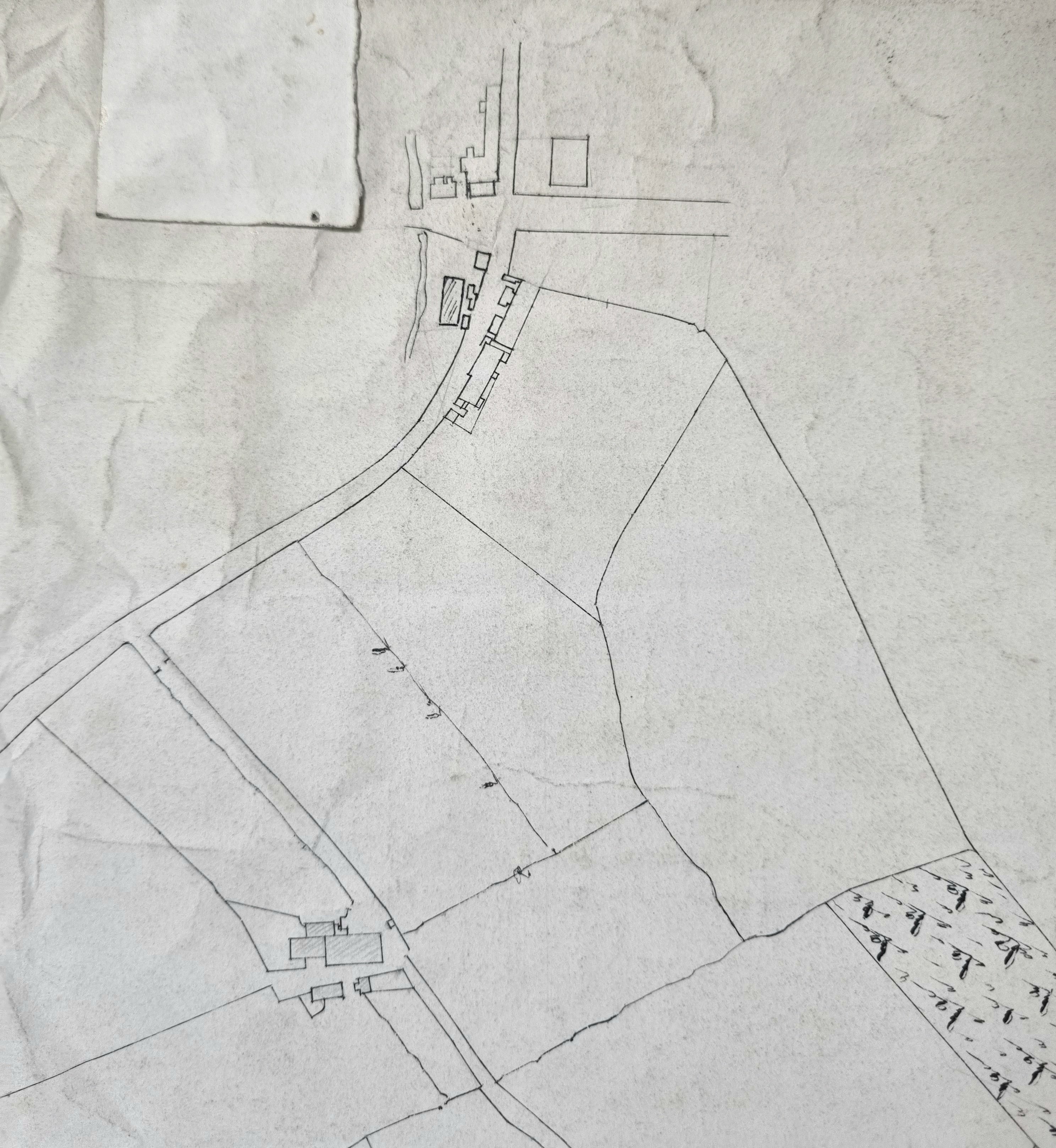
This map detail shows the Stony Lane, Prune Park Lane junction at the top, and the resulting road passes by a large quarry. There is an infallible rule among map enthusiasts that when things get interesting you reach a join in the OS sheets, and such is the case here. Changing sheets, the buildings to the right of the joined road are called ‘The Bogs’ and then the collection of sandstone quarries at Guide Moor are reached, immediately north of modern Allerton Road.
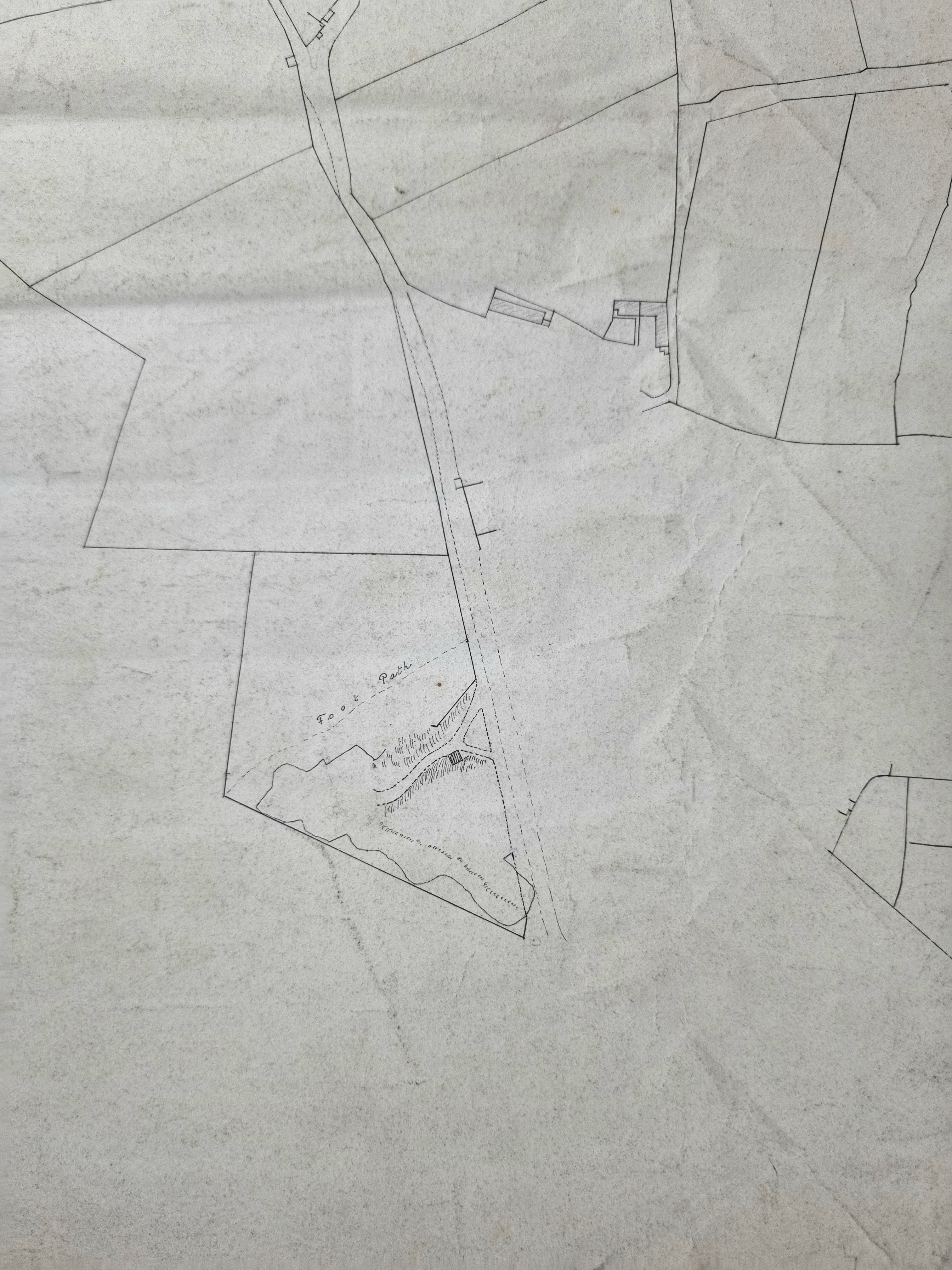
In this detail the buildings are Lower West Gate and the sandstone is being extracted from Hill Cliff Quarries which originally suggested the titular spelling mistake to me. Immediately south of this quarry, in the initial image, can be seen a portion of Allerton village itself.
Who was Mr Rawson? Unfortunately, this is a common surname in the Bradford district, but a Benjamin Rawson was Lord of the Manor of Bradford. In his writing on Allerton William Cudworth mentions several Rawsons in Allerton but not in sufficient detail to make an identification possible. Would any reader like to take on this problem?
