3.007 BRA c1845 PLA BHM 1171 B14
Material: linen backed paper Scale: unk
Size: 91*81 cm Condition: fair
Before examining this map further, I think it would be helpful if I showed a couple of planning maps of the city centre to give you the general view.
Maps of this type seem to have been produced by the Corporation when roads were widened or premises purchased. They are never dated but it wouldn’t be a huge task to reassemble them in order to study the developing town centre.
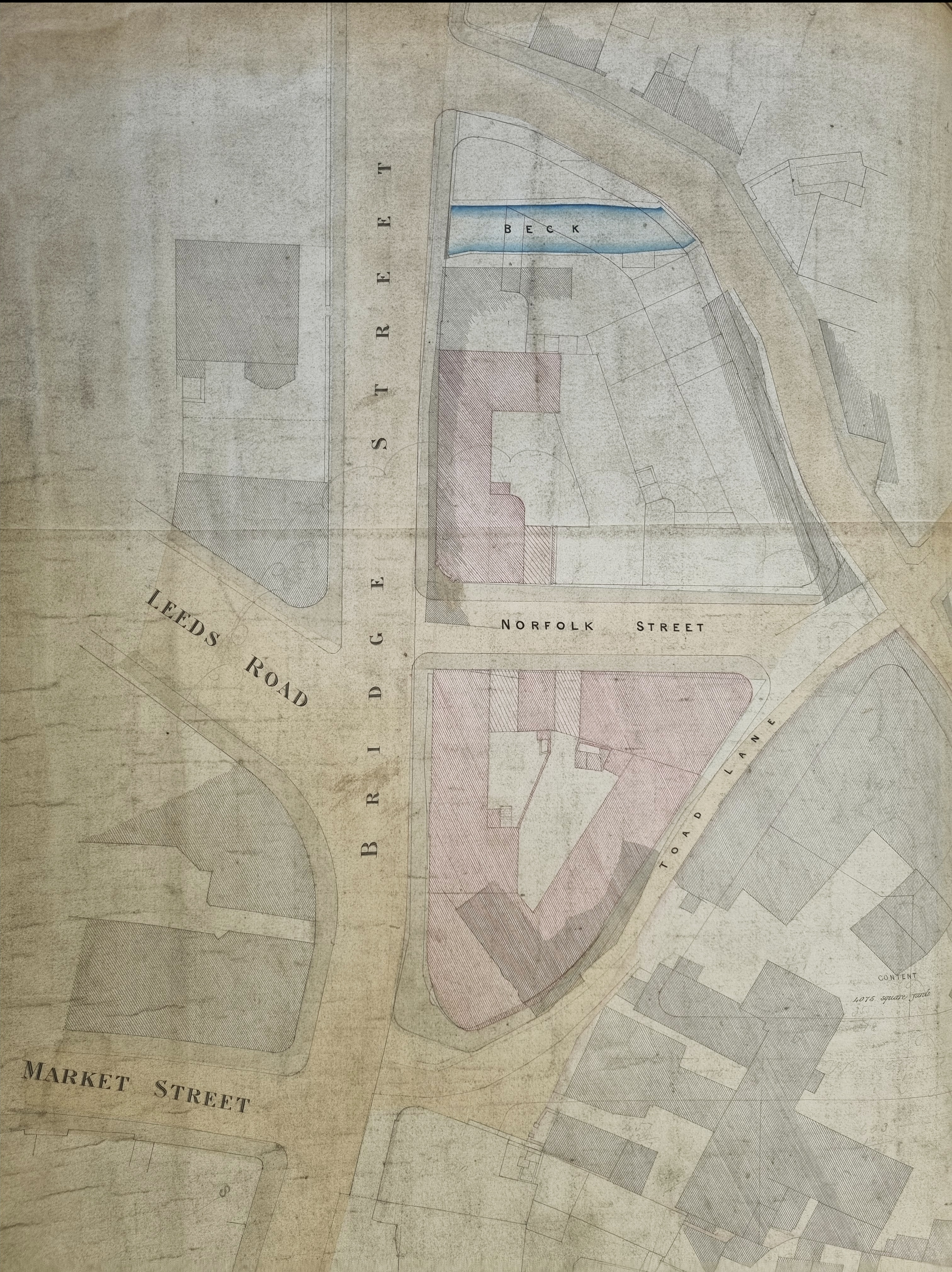
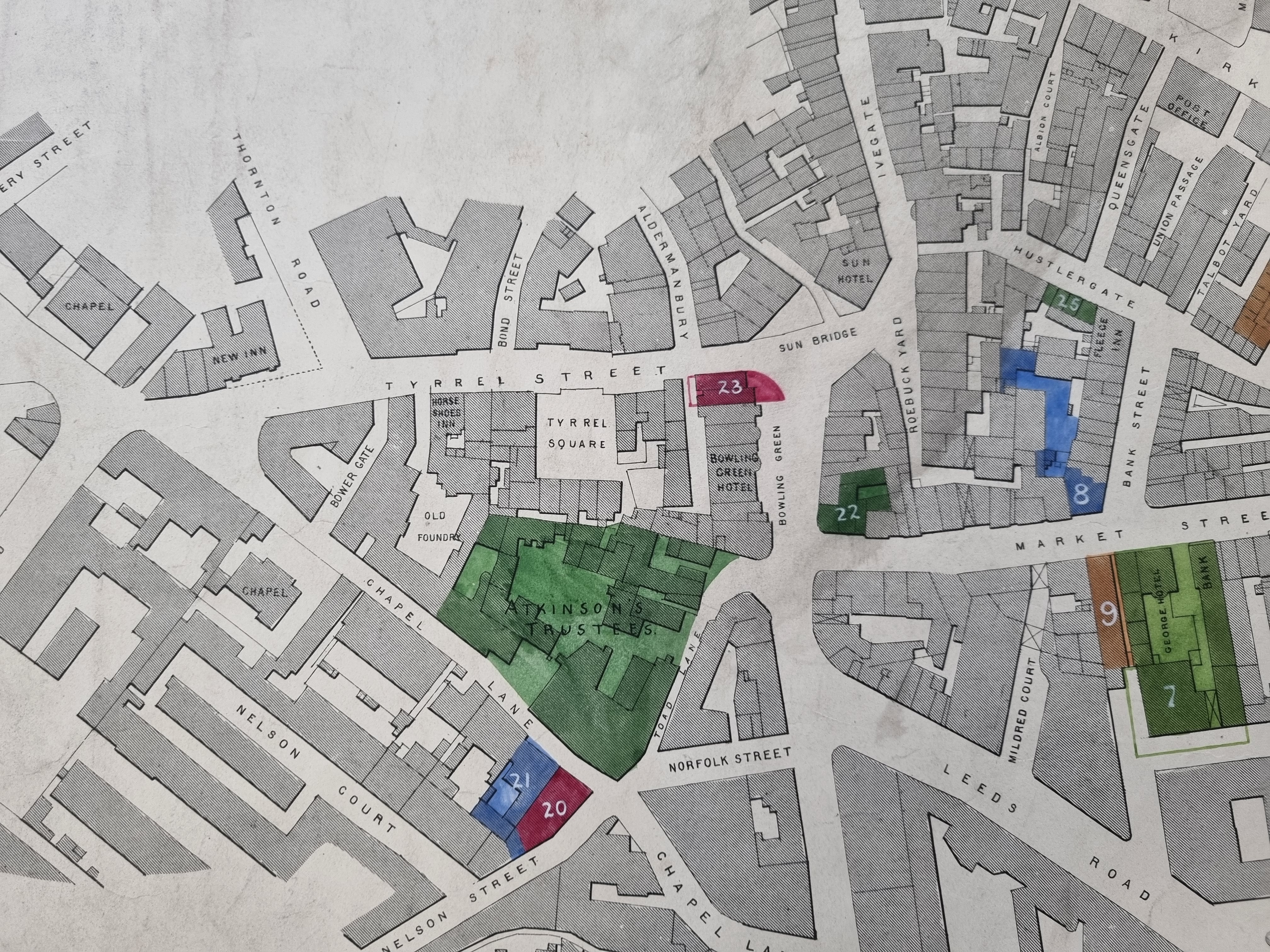
Neither plan shows the Town Hall which places them both earlier than 1873. The new Wool Exchange (now Waterstones) is missing from the first plan too which puts it earlier than 1864-67. If you look closely, some of the changes made to Bradford in the first plan feature as interrupted lines in the second. Anyway, you can see Toad Lane running between the end of Norfolk Street and the Bowling Green. I’m always surprised that there was an Old Foundry (Cliff’s Foundry) quite so near the centre of Bradford. There are a considerable number of inns, but this is understandable since many businessmen without permanent premises of their own would use them for commercial transactions.

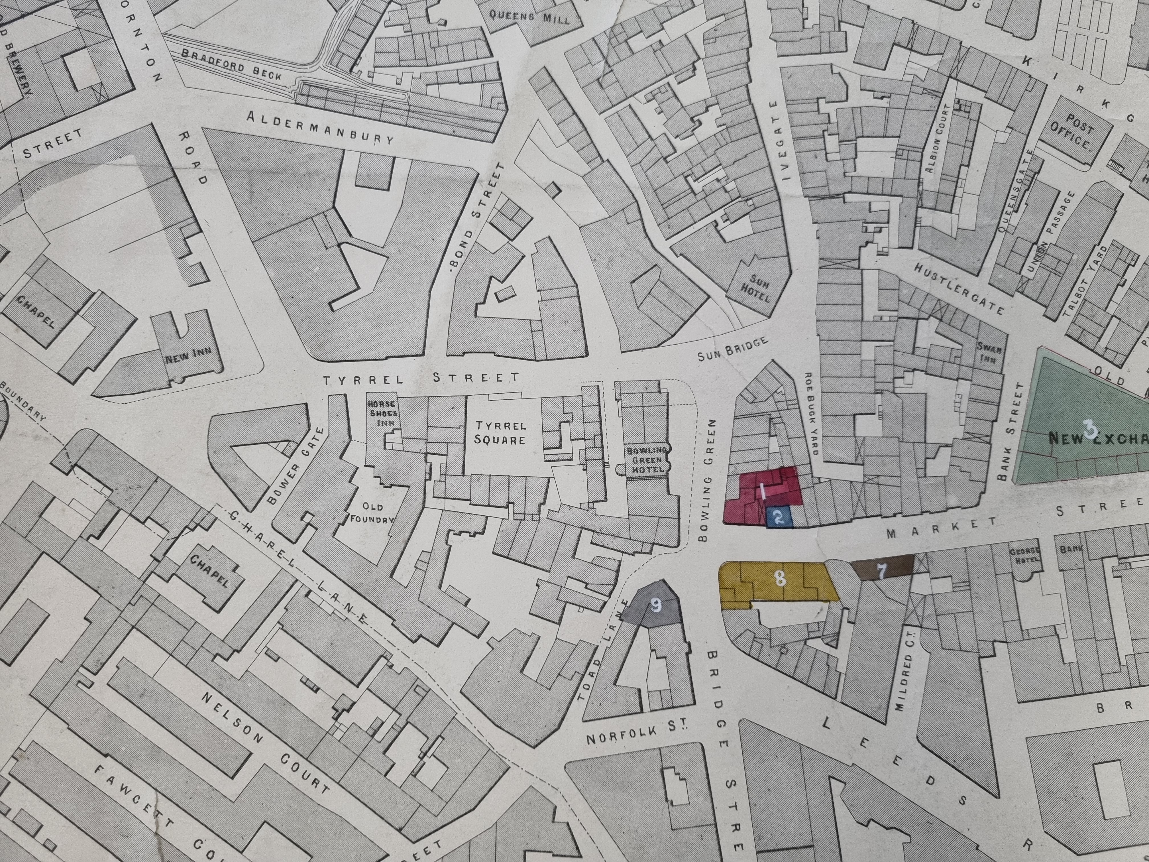
Now I am returning to details of the original map. As often occurs the plan does not have north at the top. I’ve decided to display the next two details conventionally even though this makes the street names more difficult to read.
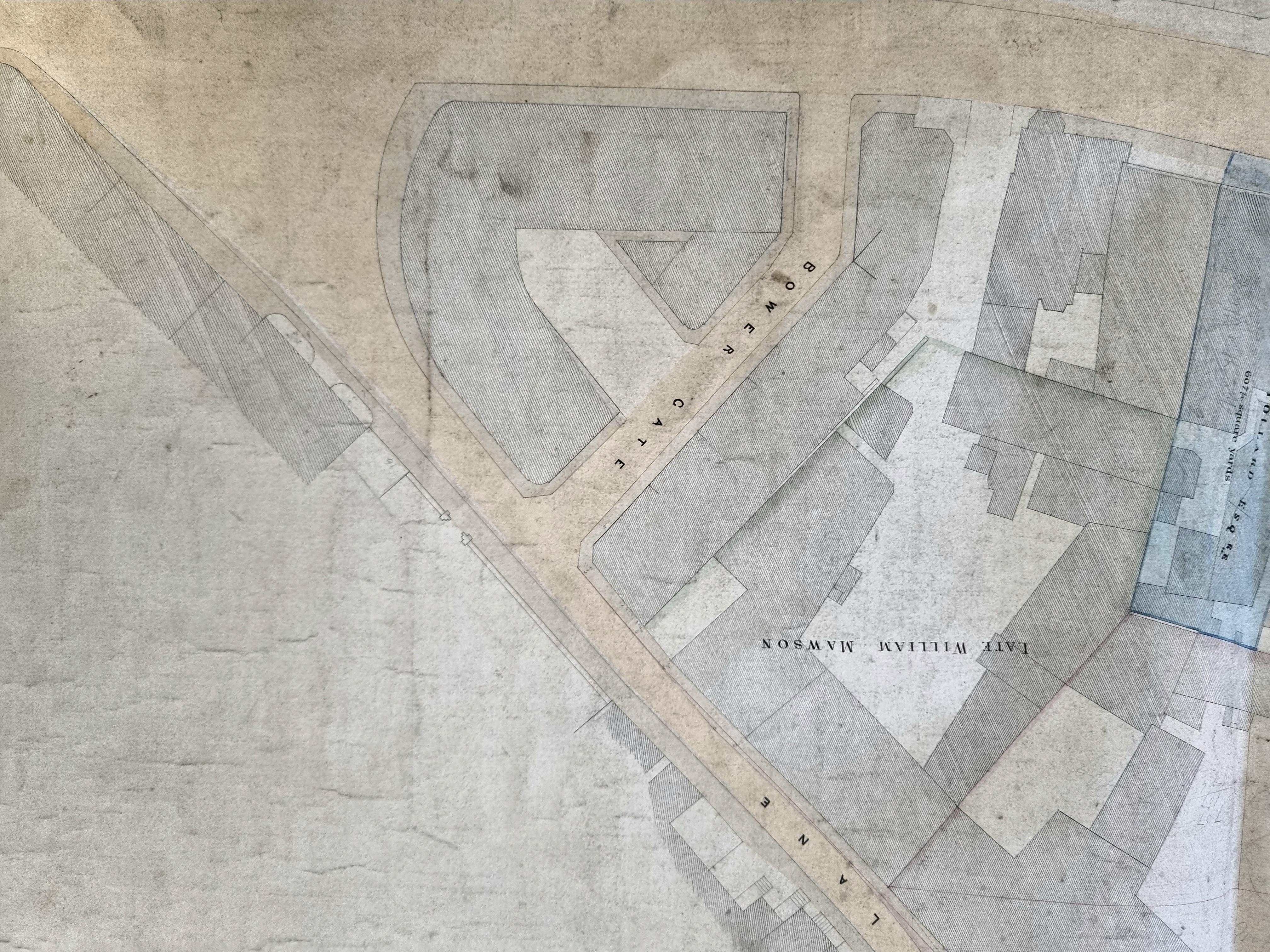
In case there is any difficulty I have left the last unaltered so that the names of thoroughfares and landowners are unmistakable.
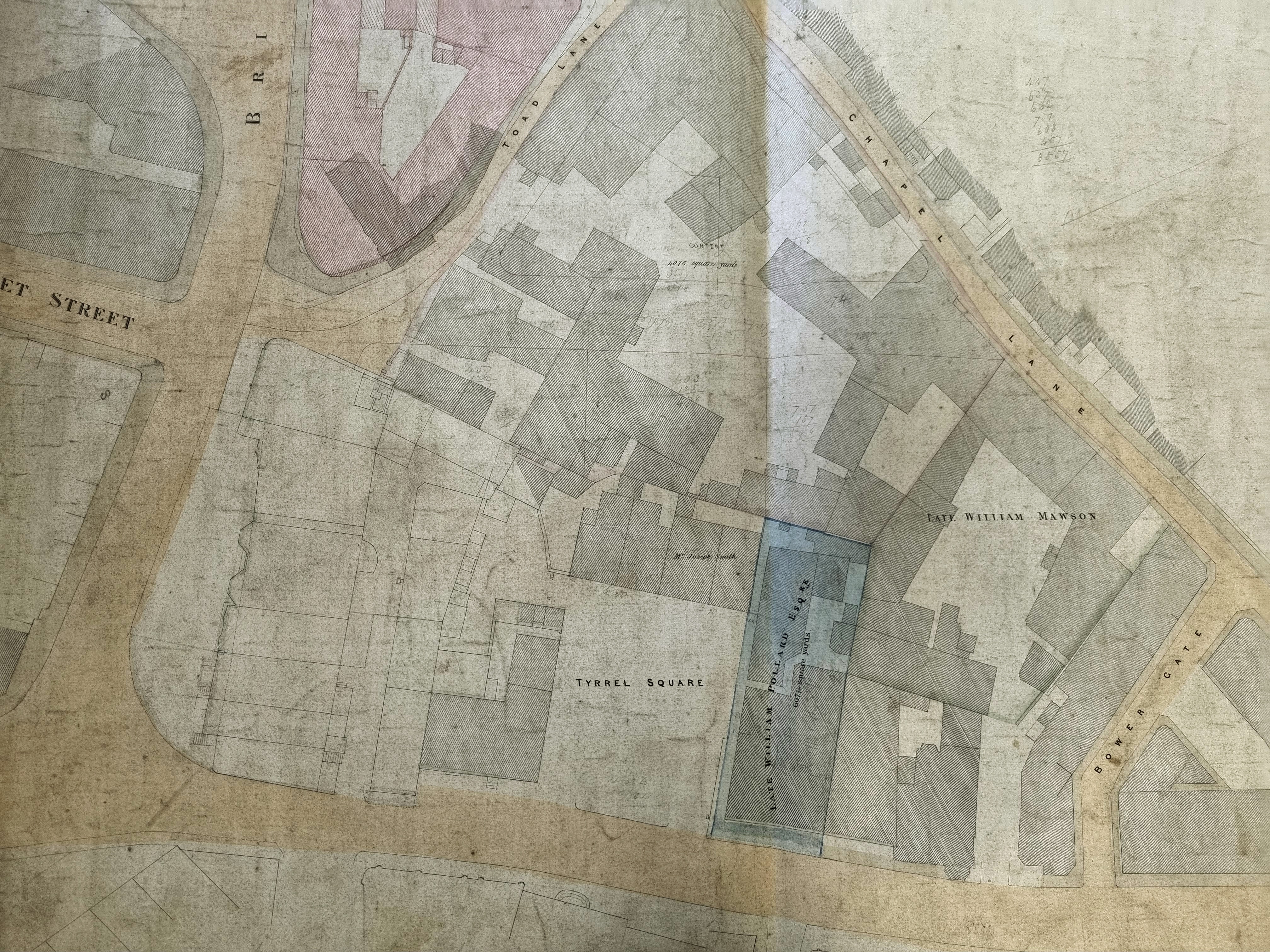
In this map the unnamed but well-known Bowling Green Inn has a shadowy presence on the left side of the image. I shall assume that the original plan is mid-nineteenth century in date. The road and building arrangements resemble the 1849 tithe map. The best clue can be seen in the last detail where a piece of property is labelled as belonging to the late William Pollard. If this is William Pollard of Scar Hill he was certainly alive in the 1840s when he drew up a will. There is a brass memorial in Bradford Cathedral which states that a William Pollard, who married Beatrix, actually died in the year 1840 aged 72. Scar Hall, at Scar Hill, was at the crossroads in Bradford Moor where the appropriately named Pollard Lane joined Killinghall Road. It must now be at the site of Bradford Moor Golf Club.
Who lived in Toad Lane? Consulting the Lunds’ Bradford Directory (1856) reveals an interesting picture. There are shoe-makers, boot makers, hatters and cabinet makers, but also two or three solicitors and Metcalfe & Son who were architects. Inevitably there was also a beer seller. Nearby Norfolk Street was a far superior address. Here you would find William Schaub and Lowenthal & Co, both stuff merchants.
Why Toad Lane? I have heard that it is a contraction of ‘th’owd’ lane, and I don’t have a better suggestion. Local photographer and historian Kieran Wilkinson tells me that Toad Lane was ‘stopped up’ in 1869 to assist with the subsequent Town Hall development. The Bradford Daily Telegraph of 10 September 1873 recalled that Toad Lane was a ‘narrow passage… immediately behind Garth’s warehouse’. According to the Bradford Observer of 17 March 1869, the width of Toad Lane was only three and a half yards.
