4.009 BRA 1863 PLA BHM 1066 B13
Date: c.1860s Scale: unk
Size: 100*65 cm Condition: Paper, poor
In the Local Studies Library, reserve collection, there are many maps and plans in the area of Goitside and around the Soke Mill. In fact, it is probably better represented than any other part of the city. There must have been frequent land sales and road developments in the area. The first step to at least a partial understanding of this plan is to locate Miller Gate.

It is fairly easy to see on the 1871 Bradford map between Queens Mills and Ivegate.

With that location clue it can also be just about be seen on the 1861 Bradford map above.
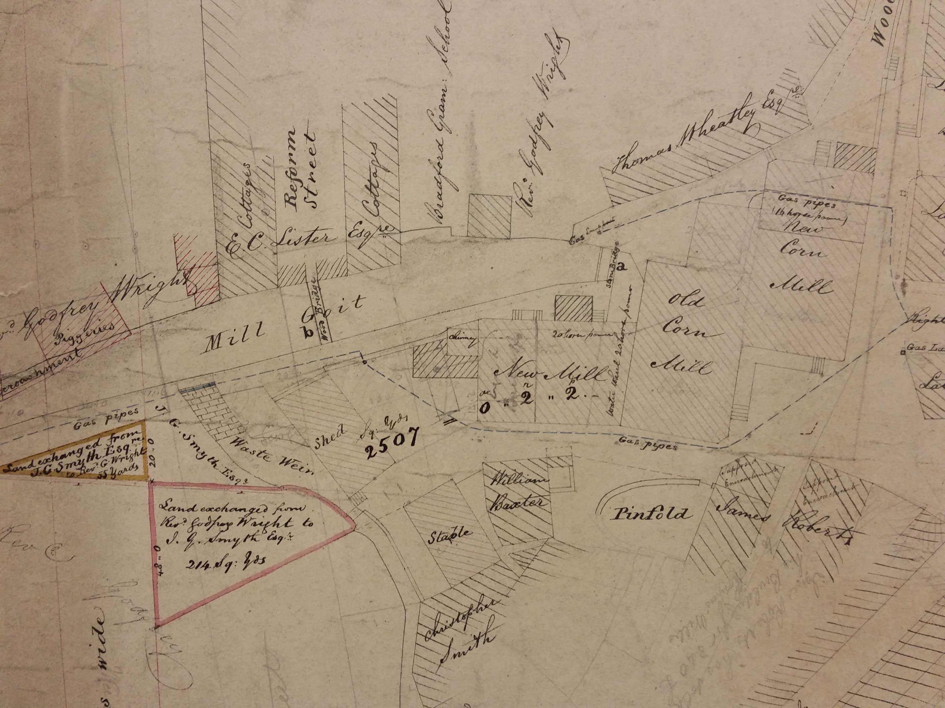
To provide a bigger picture, (south east of our plan) which enables you to see how much the geography had changed, here is what I believe is the earliest map we have of this location. I have speculated that this was drawn in the 1840s. Miller Gate looks as if it was called Wood Lane at this time and you can just see the Black Bull block starting to appear.
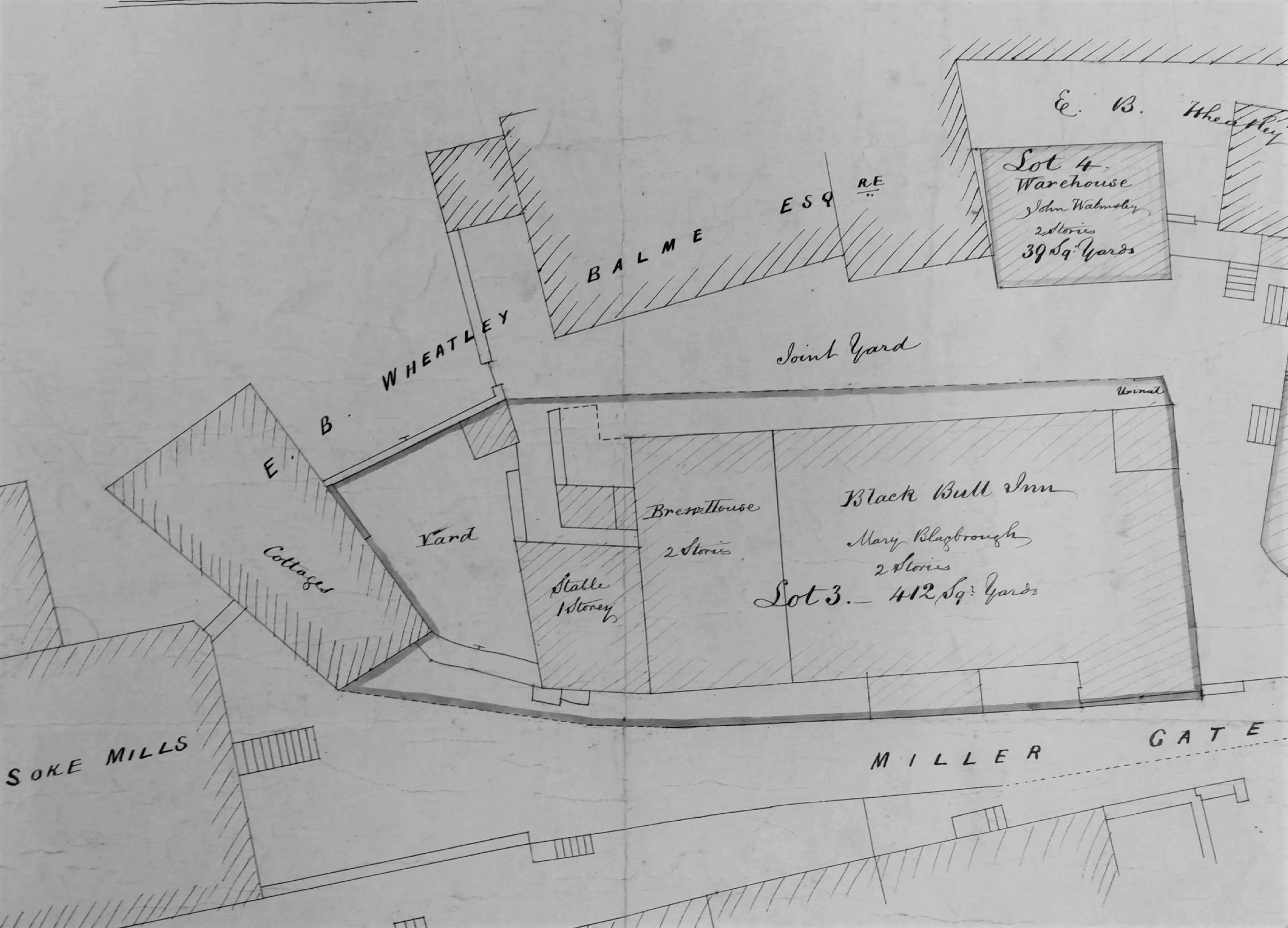
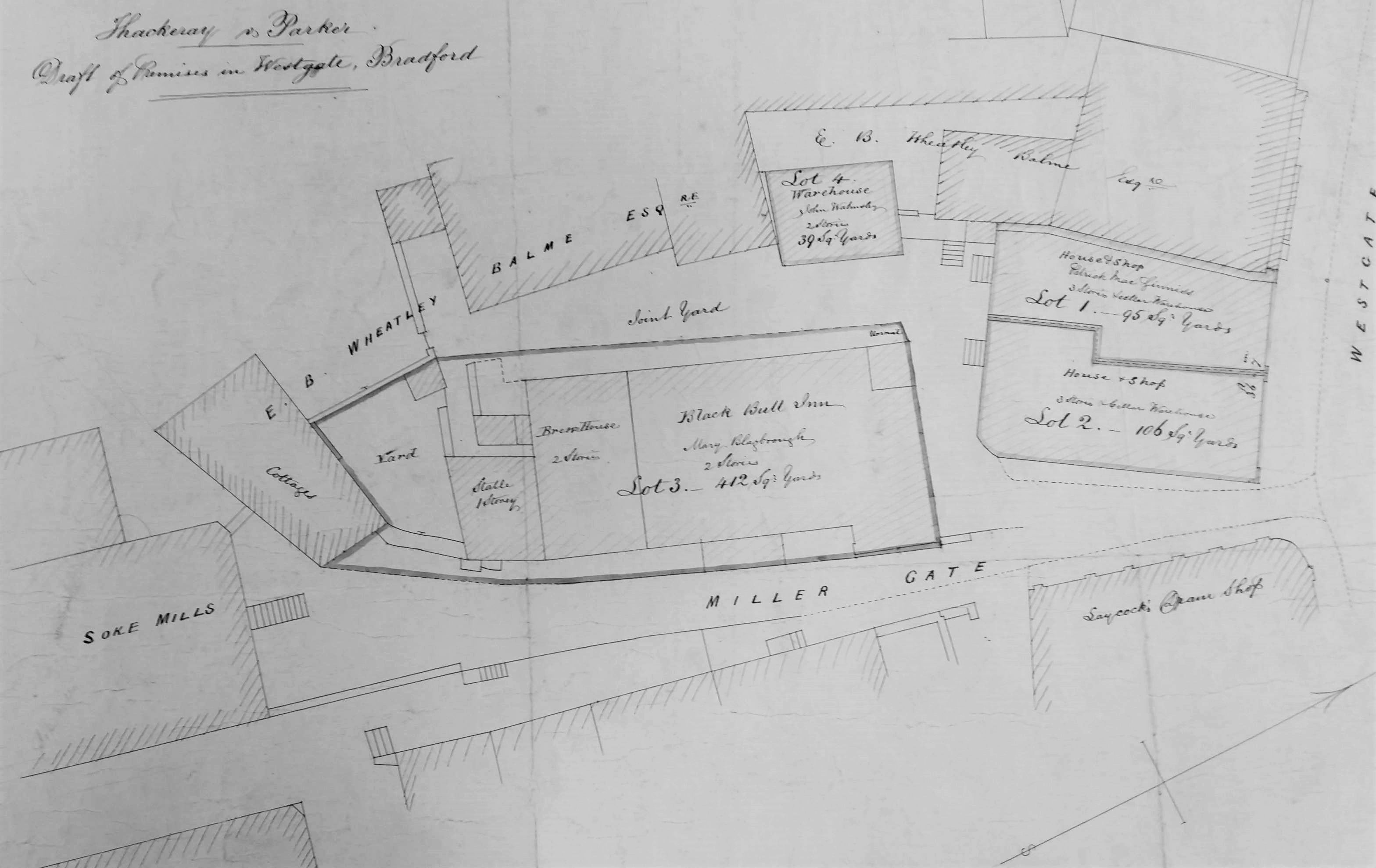
Right: we’re back to an enlarged version of the original plan. No map I have found goes so far as to name the Black Bull, and I don’t think it could ever have been one of the famous historic inns of Bradford. The original plan should be rotated by 90 degrees anticlockwise to bring it to the same orientation as the 1871 and 1861 map details.
This is a detail of the first plan which is undated. It is entitled Thackery v Parker, although I know nothing more about this case. What we have is a 4-lot auction plan showing the Black Bull Inn, Millergate and the surrounding premises. Clearly the inn is the focus of the map. As well as a bar area there is a brewhouse, stable, and urinal. A highly civilised operation then but perhaps not one for refined ladies. The frontage is on Miller Gate of course and there is a yard behind.
The occupier is one Mary Blagbrough. Mary Blagbrough is an unusual name but the only one I can find in the 1851 and 1861 Bradford censuses is a miner’s wife from Horton. Whoever she was Mary Blagbrough may not have needed to move after the sale. A lady of this name, of Westgate, subscribed to the Bradford Infirmary in 1866 (Bradford Observer 11 1 1866).
The major landowner in the area is one EB Wheatley Balme. Edward Wheatley Balme (1819-96) of Cote Hall, Mirfield. was the son of the Thomas Wheatley, seen in the oldest map. Through his mother he was related to Abraham Balme of Bradford. He was educated at Rugby, Cambridge, and Lincoln’s Inn. He inherited his family property in the 1850s. He was described as one of the richest men in the West Riding but, like my favourite Bradford landowner Rev. Godfrey Wright, it is a mystery how he became quite so rich. He wasn’t a Bradford manufacturer certainly, but rather a gentleman, justice of the peace, and scholar.
The original plan appears to pre-date the creation of Godwin Street in 1871. It possibly represents the purchase of land by Bradford corporation for street redevelopment, but I don’t know how the map entered the collection of Bradford Libraries.

INSTEAD OF ME RECEIVING MY MOTHER INHERITANCE IRENE BALME NOW OWNS MY MOTHERS PROPERTY 79 COXLEY VIEW NETHERTON.
LikeLike