4.037 ALL 1844 LIS BHM 427 B8
Material: paper Scale: 5 chains = 1 inch
Size: 63*51 cm Condition poor with handling repairs
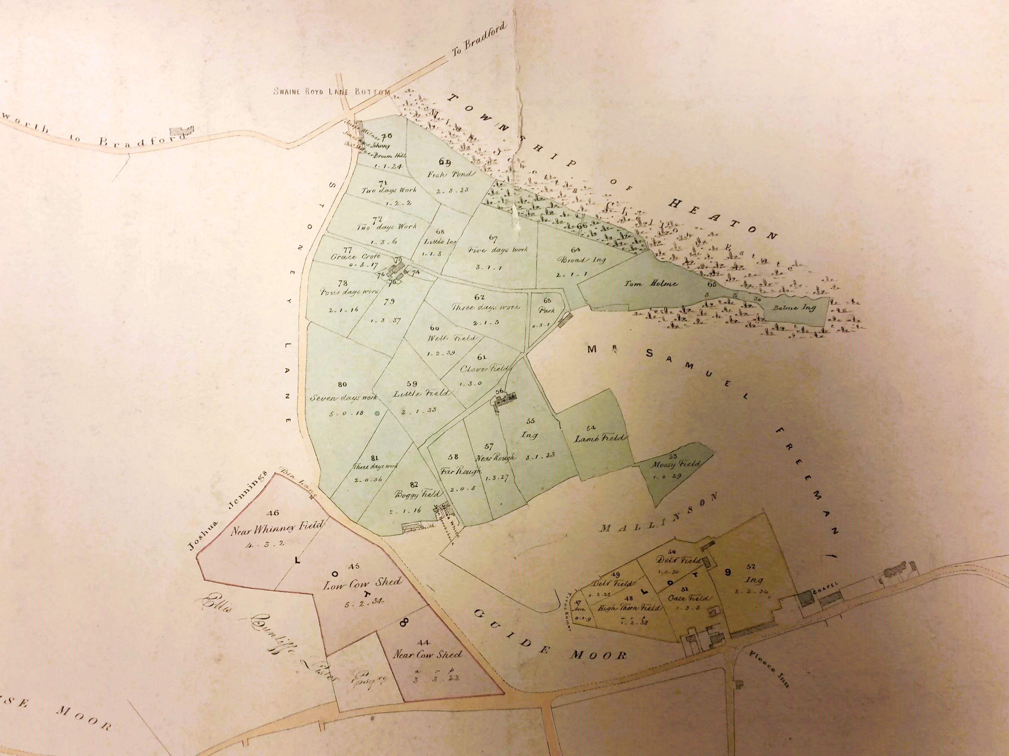
It will help you orientate yourself here if you remember that Swaine Royd Lane Bottom is today called Sandy Lane, Heaton. The road at the top of the map is today the extension of Haworth Road, Heaton on its way to Wilsden and Haworth.
This plan is officially entitled ‘plan of several farms situate in Allerton in the Parish of Bradford’ but it is annotated ‘Mr Rawson’s farms in Allerton’. If the Mr Rawson meant Benjamin Rawson, Lord of the Manor of Bradford, then he died in 1844, but the surname is common locally, and I don’t think that the former ownership of the land is particularly important. The land is evidently divided up into lots for sale or auction purposes. Most, but not all, has been developed in the twentieth century.
The best confirmation of the date is provided by the name of a landowner, Ellis Cunliffe Lister. He was the father of textile magnate Samuel Cunliffe Lister and died in 1853. The other landowners indicated are ‘Samuel Freeman’ and ‘Mallinson’. The fonts of the two names are different so I assume that two individuals are intended, not one. There was a well-known Bradford architect called Mallinson, who was a James. Neither name is otherwise familiar. More valuable in many ways are the names attached to the various cottages which might one day be of interest to family historians.
The plan is a product of Lister & Ingle, surveyors of Bradford. I think it is reasonable to assume that the surveying is a few years earlier than the first Ordnance Survey map of the area, which was published in 1852. The plan is valuable because it records the field names. Some simply record the number of days required to work the ground; others like Boggy Field and Ing indicate the condition that the ground is likely to be in. My personal favourite is 70 – Johnny Broom Hill but Delph Field is a good indication of a former quarry site.

The second portion of land is west of the first. The road at the top of this detail is Allerton Road. Long Lane, at the left of the detail still exists today. Note Pikeley Colliery, which is an ‘old coal pit’ by the time of the 1890 25” OS map. The whole area was mined for coal in the late eighteenth and early nineteenth centuries, so its presence is unsurprising. Allerton & Wilsden Colliery is the most familiar name.

Google Earth is a most valuable free resource for archaeologists and local historians. This capture from the application suggests that Pikeley Colliery is forgotten perhaps, but not entirely gone.
