3.041 BAR c1860 PLA BHM 775 B11
Material: paper Scale: 30 ft per inch
Size: 65* 57cm Condition: fair
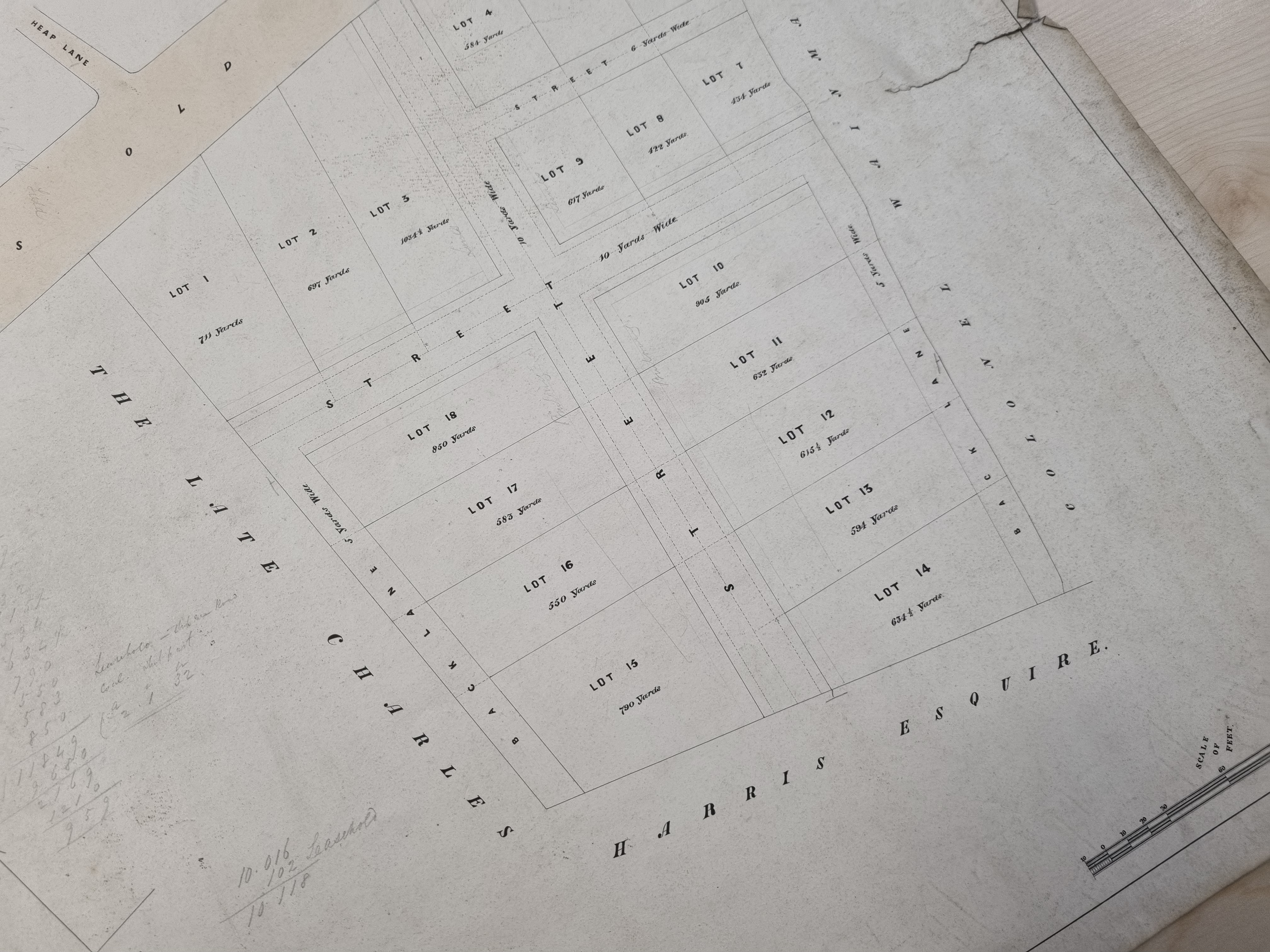
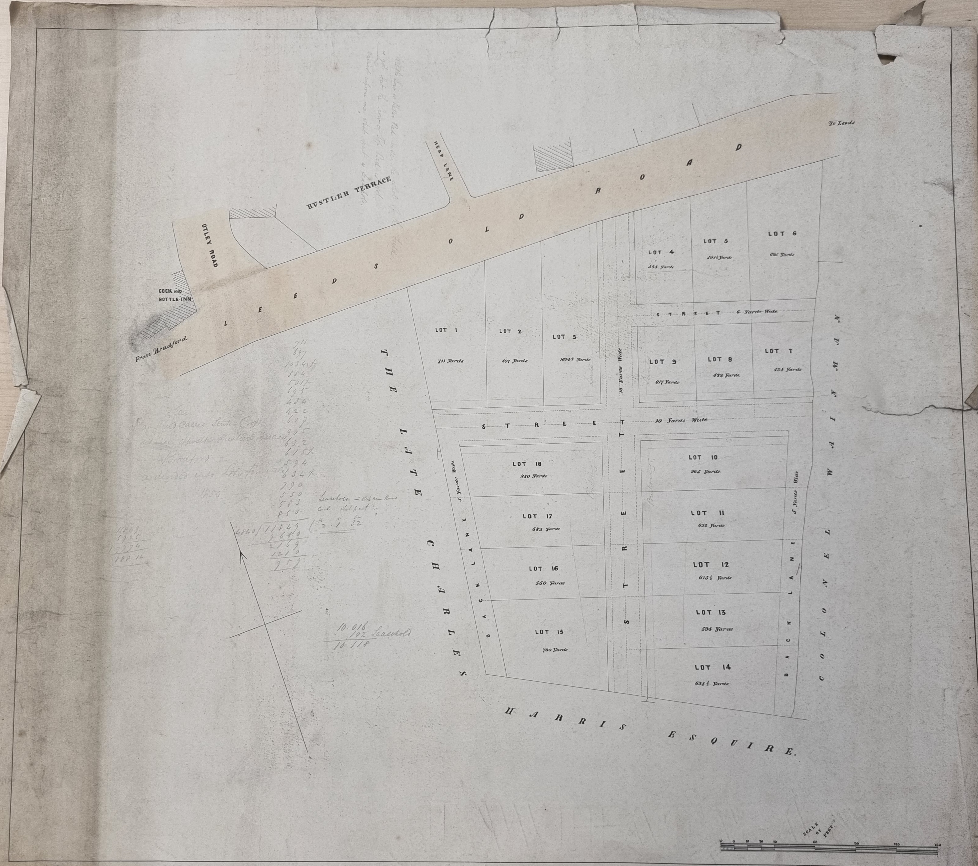
Helpfully this plan is annotated on the back ‘53. Plan of Hustlers Field, Leeds Old Road’. The location can be identified exactly since Otley Rd, Heap Lane and the Cock & Bottle Inn are drawn. We are dealing with the sale, or auction, of building plots on land that was once the site of the Bradford Union Workhouse grounds, south of what is now called Barkerend Road.
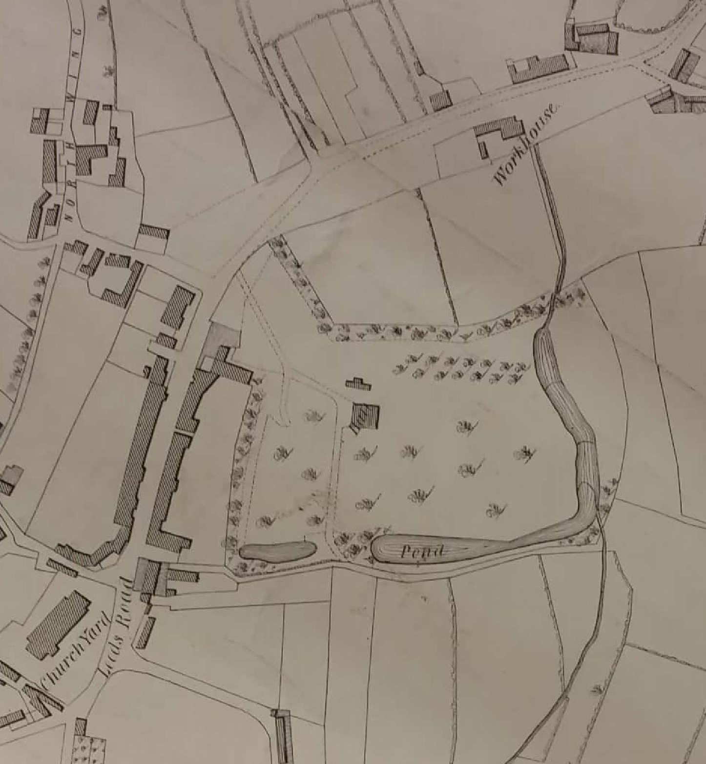
The area, together with Workhouse shows well in the 1802 Bradford town plan.
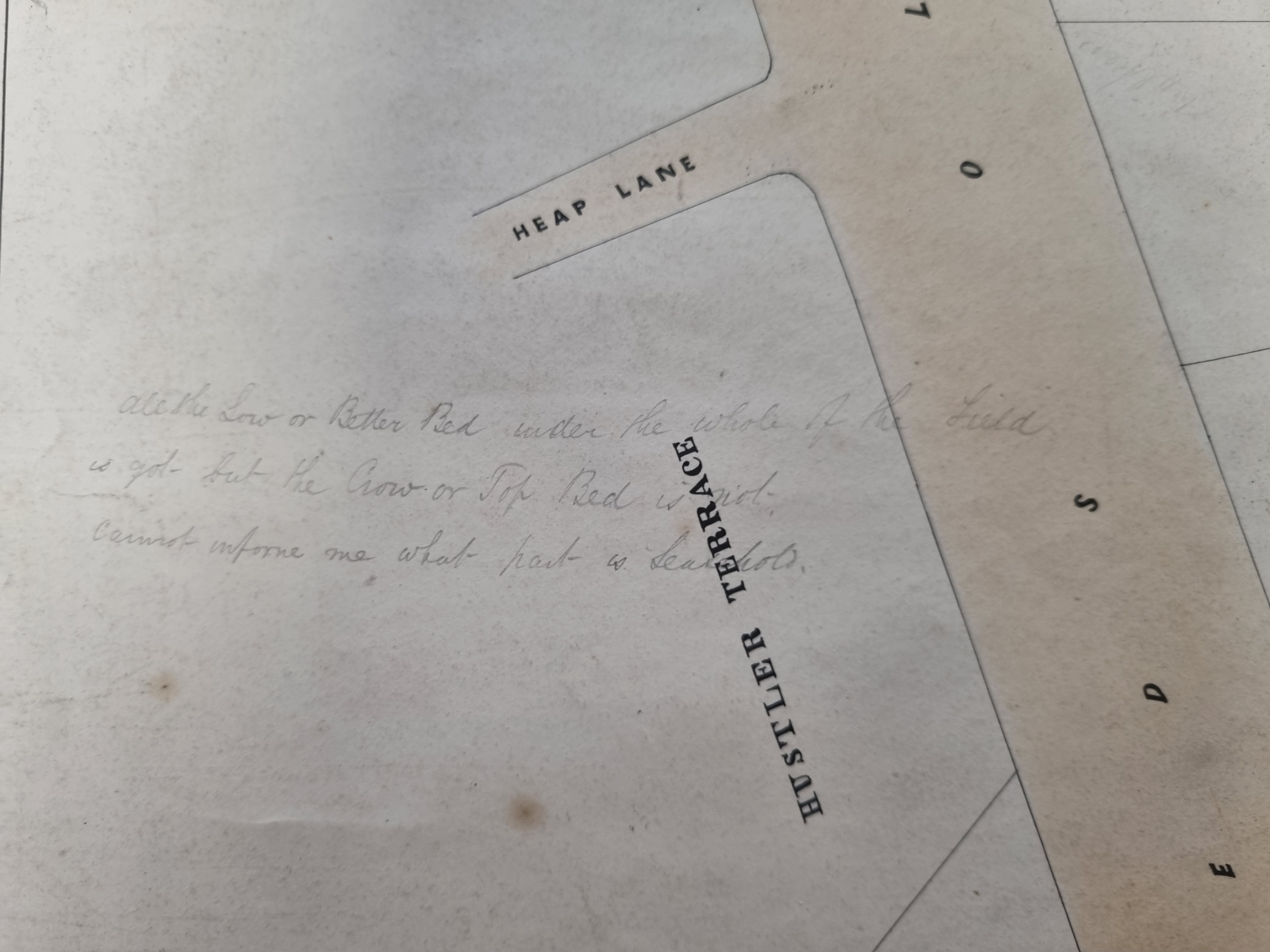
There are many pencil annotations. One reads ‘all the Low or Better Bed under the whole of the field is got but the Crow or Top Bed is not. Cannot inform me what part is leasehold’. This clearly refers to coal mining in the area. The Better Bed (highly prized as coking coal) retains its name: I assume the ‘Crow Coal’ or ‘Top Bed’ is the modern Black Bed coal seam famous for its iron stone content, exploited at Bowling and Low Moor. There is a seam called the Crow Coal in south Bradford too, but the term seems to be applied to the coal nearest the surface in many regions.
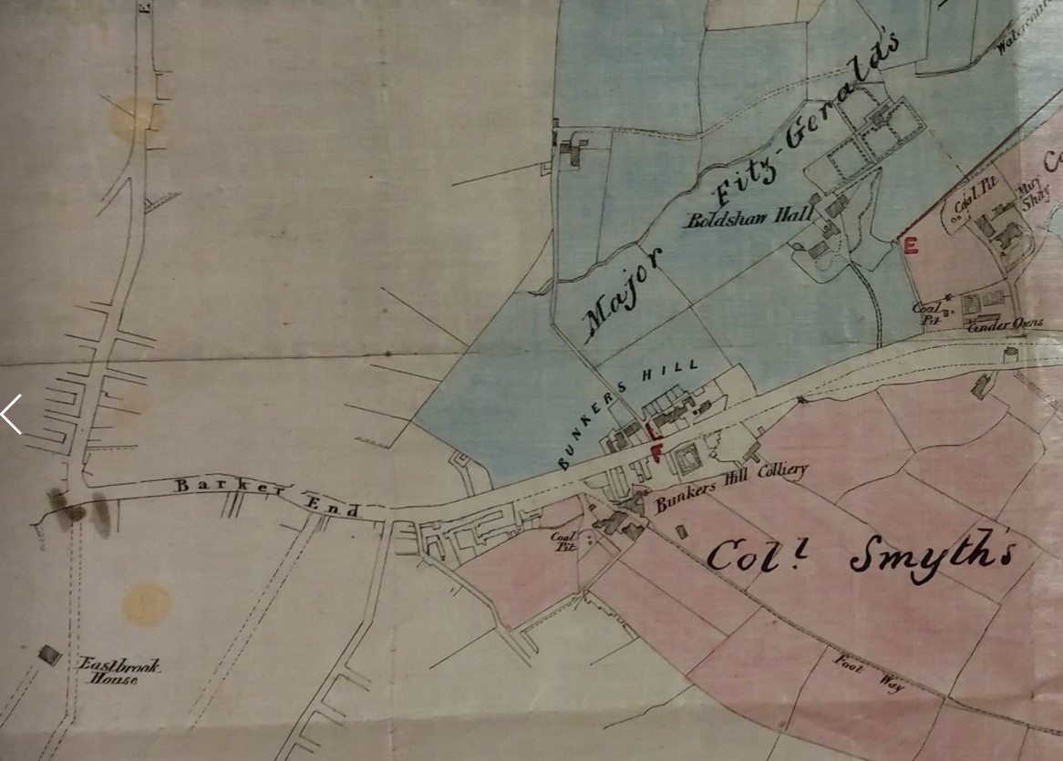
The ground was presumably mined by the Bunkers Hill Colliery immediately to the east. I haven’t gone into detail about the ownership of this institution. Some of its shafts are described as ‘Wainman’s Pit’.
So, who was Hustler? The very famous John Hustler, whose dates were 1715-1790, was the Leeds & Liverpool Canal promotor and company treasurer. The second John Hustler (1768-1842) was his son, who was a prominent Bradford Quaker, a woolstapler, and a partner until his death in John Hustler and Co. Coal Merchants and Proprietors, at Orrell and Liverpool. Finally, there was John Hustler of Bolton House (1797-1861) who I think was the nephew of the second man, and was a wool merchant in partnership with Benjamin Seebohm. While we are on the subject of names, was Heap Lane named after Henry Heap (1789-1839), once Vicar of Bradford?
Reasonable dating evidence is the name the late Charles Harris, mentioned as a landowner. Edmund Peckover was a Bradford banker who developed Eastbrook Hall and estate. His partner was the said Charles Harris. After Peckover’s death Harris seems to have attempted to lease the hall but eventually he decided to live there himself, although upon his retirement (1840) he moved to Fulford Grange, York where he died in 1847. The original Eastbrook Methodist Hall was built in 1825 on land purchased from Harris although this was replaced in 1903 by the more familiar Edwardian building. In 1832 a Quaker School was built nearby in Chapel Street on land given by Harris. Despite the sales and gifts of land it can be seen from the first OS map, surveyed around the time of Charles Harris’s death, that the estate was left largely intact. His brothers Henry and Alfred were also bankers but the important detail here is that Charles wouldn’t have been ‘the late’ until after 1847.
It is useful for me to review these plans in order to be able to undo the mistakes I made several years ago on the last occasion that I looked at them. On this occasion I can be quite sure that the original date I gave this map is a decade too late. There is a second pencil annotation which reads: ‘plan of a field called Tenter Croft situate opposite Hustlers Terrace and divided into lots for sale – 1850. A tenter croft was a field used for drying wet cloth on ‘tenter hooks’ in a frame, in order to prevent shrinkage. It would be a common designation for land in a textile area. I cannot find a press advertisement for the sale under either name.
