2.117 BOW c1850 CAR
Material: tracing paper Scale: 2 chains per inch
Size: 90 * 60cm Condition: poor
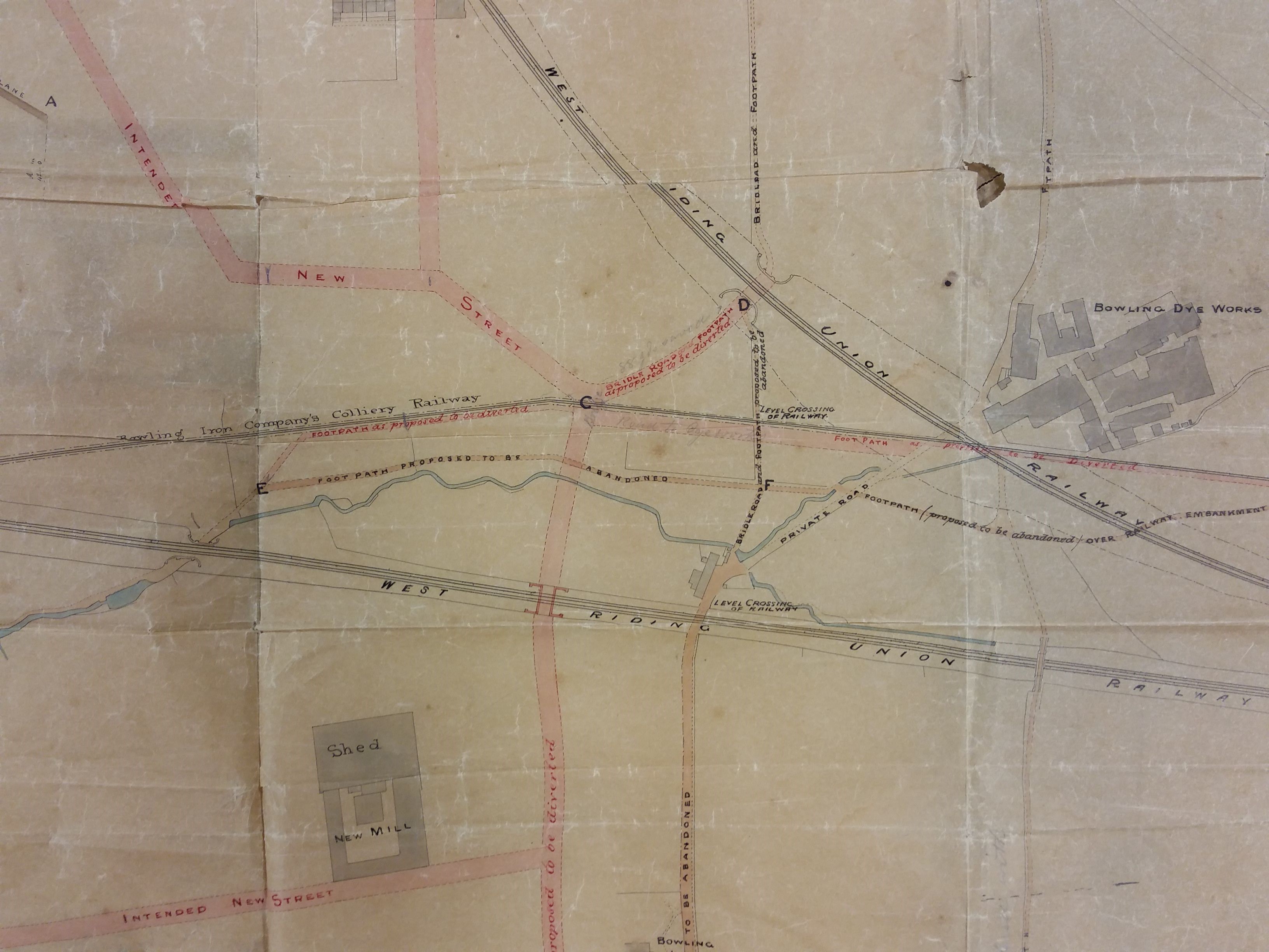
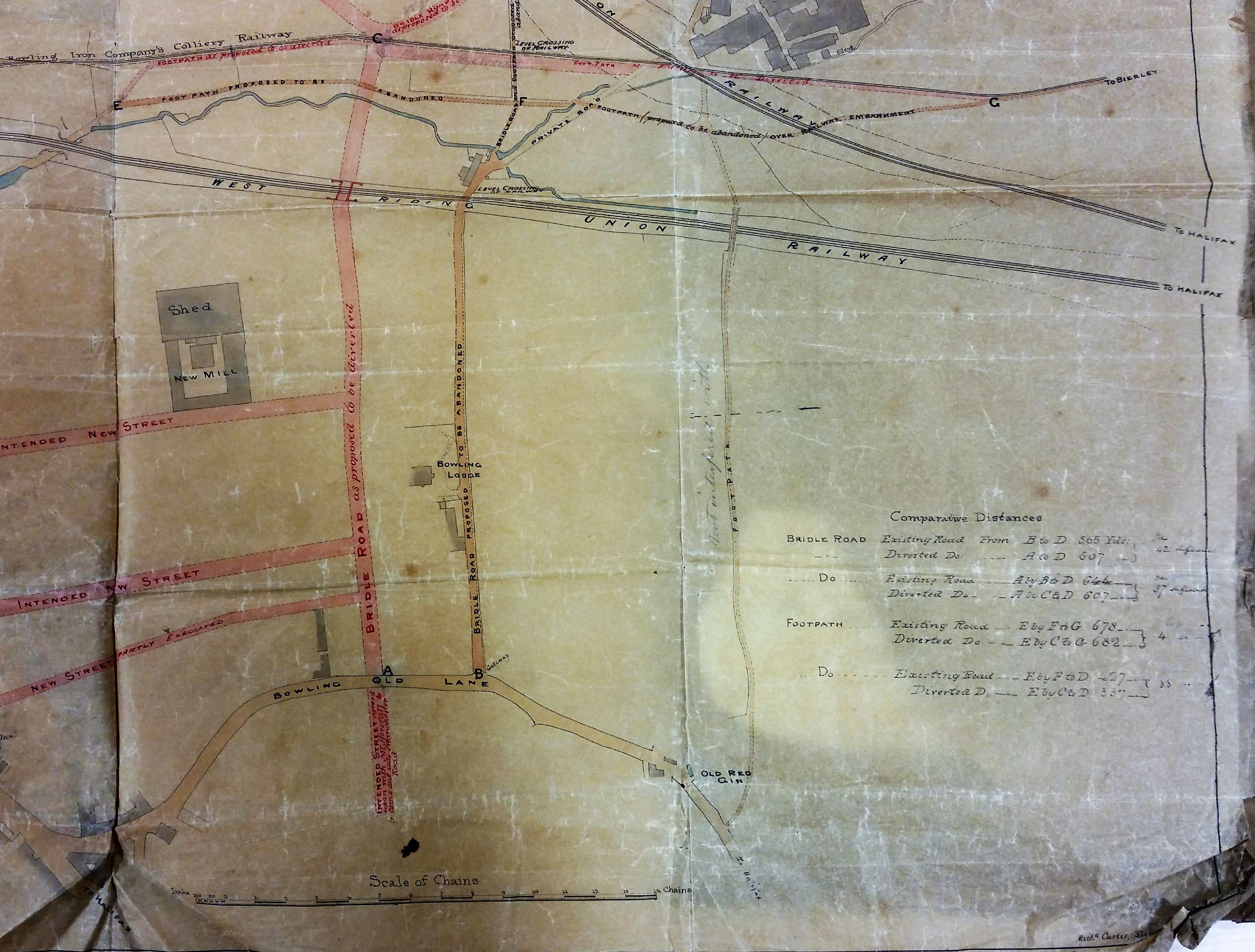
This damaged and fragile map from the Bradford Local Studies Library reserve collection shows proposed street development east of Manchester Road & Bowling Old Road. The ‘tracks’ of the title are two railway lines and a colliery tramway. The map is labelled as ‘Sections of Bridle Roads’ and the surveyor was Richard Carter & Sons, Halifax. A wholesale closure, abandonment and diversion of footpaths and bridle ways seems to be envisioned. Perhaps the creation of the railway tracks required these changes.
If you imagine the map turned 90º clockwise it would offer the same orientation as the first OS map of the area surveyed in the late 1840s. You can easily identify the two railway tracks and the Bowling Dye works.
I must admit that I don’t find the early history of Bradford’s rail links an easy topic since the companies involved seem to change their names, and move the location of their stations, quite frequently. The name of the company involved in this map is West Riding Union Railway. As I understand it this title was only employed for a brief period around 1845-47. There is the usual problem of not knowing whether a map feature existed, or was simply being planned, so I have suggested a date for the map of around 1850. The two railway lines met at Bowling junction, although this is not reached here. The lower line became the Lancashire and Yorkshire Railway line which connected Halifax to Bradford, and its terminus at Drake Street (later Exchange) Station which opened in 1850. The upper line went from Bowling junction to Leeds, via Laisterdyke, and was opened a few years later in 1854. It was operated by the same company and, I presume, allowed trains to travel from Leeds to Halifax direct, by-passing Bradford completely. The track no longer exists but the line is still visible on aerial photographs.
This map shows the Bowling Iron Company colliery tramway (called ‘railway’ here) very clearly. This took coal from the Iron Works to the Bowling Depot on Queens Street where I assume it was available to local merchants. This was not the only coal staithe the company developed in Bradford.
This plan centres on an intended new street which became Spring Mill Street and a new mill shed which became part of Ripley’s Dye Works. I should explain to any readers outside Bradford that yarn was spun in a mill, and cloth was then woven in a weaving shed. Sir Henry Ripley (1813-1882) was the owner of huge cloth dyeing concern and rates among the most famous of Bradford business magnates. The dye works had been established by his grandfather in the early nineteenth century. Some years after this map was drawn, in the 1860s, Sir Henry began the construction of model housing for workers, which became known as Ripleyville. What are obviously missing in this map are the large reservoir and dye pits which are such a prominent feature in the OS map. When were these created? The Bradford Observer reports a large sale of land in this area, including that piece accommodating the Dye Works, in 1850. The vendor isn’t stated but might well be the Bowling Iron Company. Probably Sir Henry Ripley, purchased land at this time to allow for the expansion of his business and the assurance of adequate soft water supplies, which included a reservoir.
Victorian historian William Cudworth records a 100 acre purchase by the Ripley company and also states that a contractor called Samuel Pearson constructed reservoirs for Bowling Dye Works and Bowling Iron Works at a date ‘early in the fifties’. Samuel Pearson was a Cleckheaton brick-maker who founded a contracting dynasty. By 1860-63 Messrs. S. Pearson & Son were established at the Broomfield Works, Mill Lane (near St Dunstan’s) for the manufacture of building bricks, sanitary tubes and terracotta goods. The works closed shortly before the 1887 map was published, but within a generation Pearson’s had became an international contractor and was particularly associated with Mexico during the dictatorship of Porfirio Diaz. Canals, railways and oil were among the company’s many interests. After being created a baronet Samuel Pearson’s grandson, Weetman Pearson, became the first Viscount Cowdray in 1917.
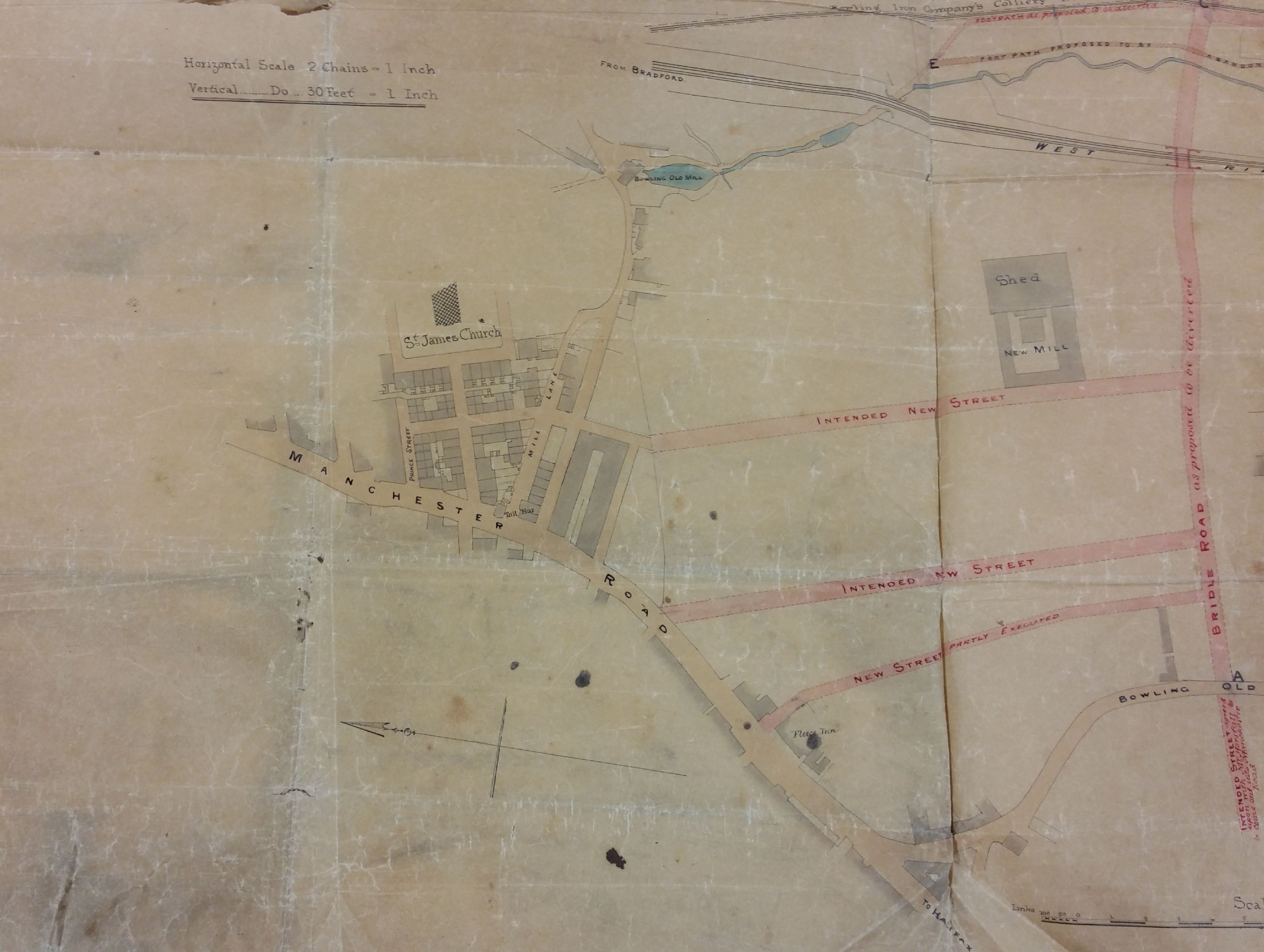
What else? The Red Ginn was a public house, and a nearby colliery had the same name. A ‘ginn’, presumably a corruption of ‘engine’, was used to haul coal out of a pit. St James Church was, I believe, constructed in 1838. Bowling Old Mill was a corn mill at the time of the first OS. The Low (or Law) Beck joined the Bowling Beck above the mill. Both these watercourses appear rather suddenly on the map, so presumably their upper reaches were culverted. After their junction the result , called Bowling Mill Beck I believe, then went under Cuckoo Bridge to join the Bradford Beck itself.
Marked on this map are marked a variety of planned new streets. Were these streets ever constructed? Presumably not. After 1863-64 Ripleyville, consisting of 200 houses with schools, was constructed by Sir Henry Ripley but the alignment of these streets on the 1887 borough map looks quite different.
