
This essay is an introduction to the junction of Great Horton Road, Little Horton Lane and Manchester Road. Things were once very different from the situation today. I shall start with a detail from the 1802 Bradford map which is part of the Local Studies Library’s permanent collection. Two ‘Halifax Roads’ and a ‘Huddersfield Road’ enter a substantial open space. The Turls and Chapel Lane leave to the right. The lack of detail in the lower left of the map probably results from Bradford and Horton being separate townships. Rather surprisingly historian William Scruton reports that there was once a colony of ‘good houses of the better sort’ where the three roads met. If so, their days were numbered.
The next detail is from a favourite map of mine found in the LSL reserve collection. It shows the property of Rev. Godfrey Wright. He owned the fields (closes) tinted in green, and the darker buildings. The map must post-date 1815, with 1825 being a plausible date. Little has changed from the first map and the streets retain their names from a generation earlier. Horton township is at least marked but the total lack of detail may not necessarily mean that that no buildings were present, especially if they were not owned by Godfrey Wright.

This is a later map of Godfrey Wright’s property. He owns the Bowling Green and the New Inn and has provided the land for a new Independent Chapel (the Methodist Ebenezer Chapel) in 1836. This was rebuilt in 1861. Above this Rands Mill has probably been constructed but is not named. I know that John & William Rand founded their company as early 1803 and, thanks to William Cudworth, I can provide an image of the mill.

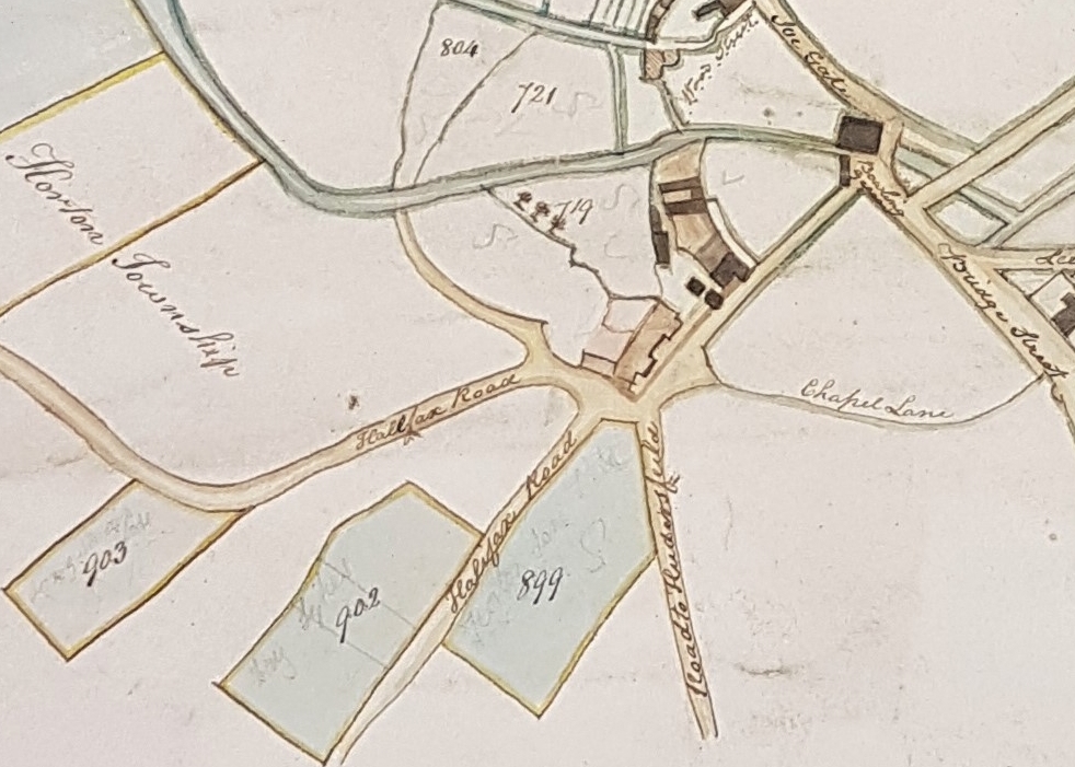
On the map note that the new turnpike (Thornton Road) has been constructed. The Turls has become Tyrrel Street. The three roads that interest us consist of two ‘Horton Lanes’ and a ‘Bowling Lane’. Benjamin Thompson’s brewery occupies a large site that was previously empty. The brewery was present by 1830 but I don’t know its year of construction. There is nothing between Horton Lane and Bowling Lane except a small property belonging to Mrs Bacon, but thanks to William Scruton we do know a little about the owner. Writing in the late nineteenth century he said that her house would be remembered by many, but even if that were not the case, the good deeds of the occupant would be recalled ‘for she spent her life in acts of kindness’. What a memorial! Finally see that some property belongs to the ‘late Captain Giles’. To the best of my knowledge this was Edmund Giles who died in Australia around 1858. This dates the map to c.1860 I would imagine.

By the later nineteenth century there is a dramatic change. The streets have acquired their modern names of Manchester Road, Little Horton Lane and Great Horton Road. The Ebenezer Chapel and Rands Mill are still present. Now the Dewhirst Buildings occupy the right-hand side of Manchester Road. Mrs Bacon has vanished from the space between Manchester Road and Little Horton Lane, which is now totally full of new constructions, including a New Theatre.
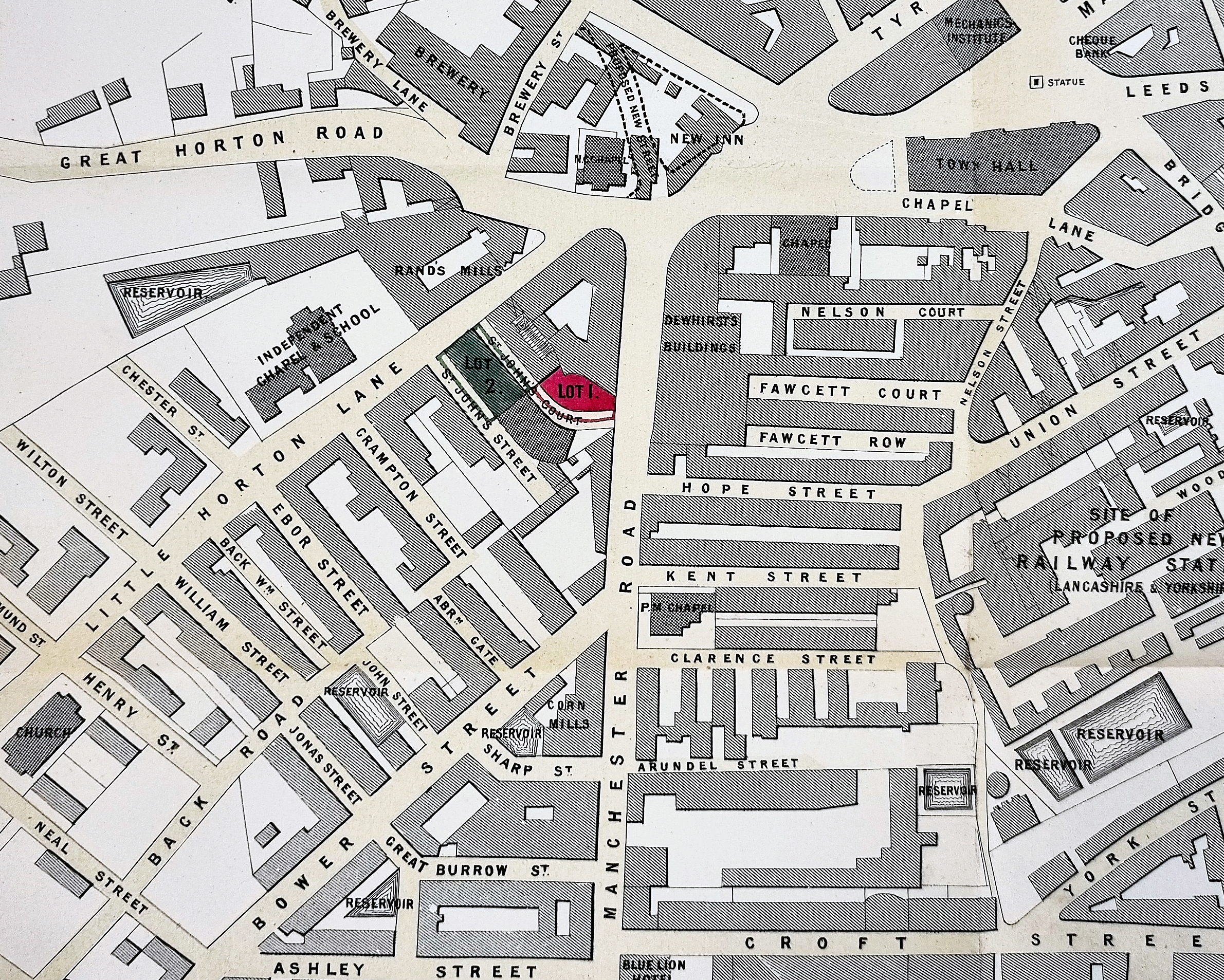
This map originating from the Borough Council shows the bigger picture towards the end of the nineteenth century. The Town Hall has been constructed (1870) and it looks as if the New Inn is about to fall victim to a road scheme. Morley Street is not yet present but the Brewery, the Independent Chapel, Rands Mill, and Dewhirsts Buildings are fixed points.
I tend to finish my surveys by the beginning of the twentieth century. There is a 25” OS map from 1905. By this time Morley Street has been constructed and the Central Swimming Baths are built over the Rands Mill reservoir. The mill itself is no more but the ‘Old Brewery’ remains. There is still a chapel on Little Horton Lane, but it is described as Congregational rather than Methodist. The new theatre is still present between St John’s Street and St John’s Court. Dewhirst Buildings are replaced by the Central Worsted Mill and two warehouses. This brings us to Hope Street, long vanished under a modern road scheme.
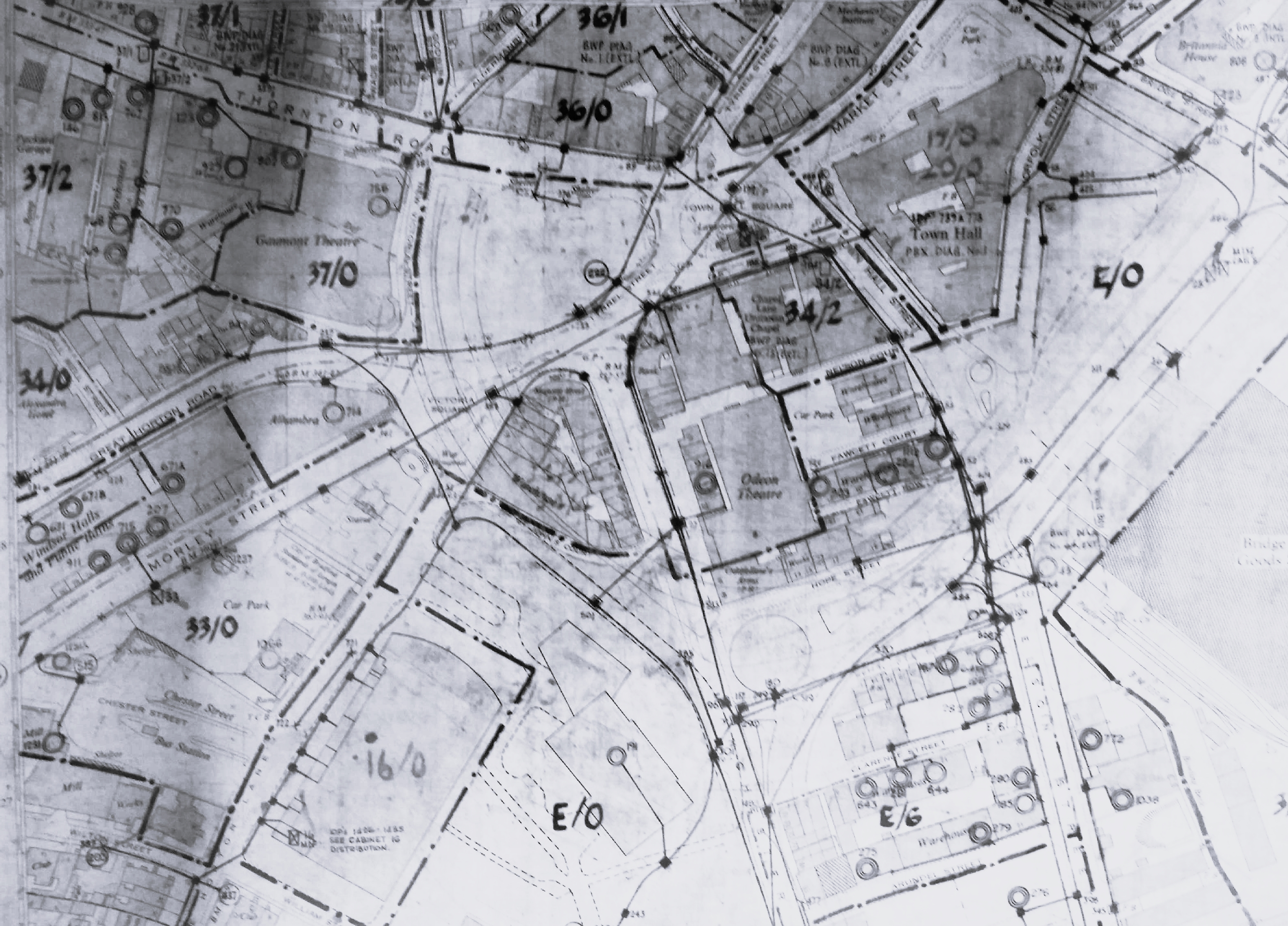
In many respects the last map is the most difficult to display and to understand. It dates from the 1960s and displays the total reorganisation of the city’s road network. You may be able to find Hope Street behind the Odeon Theatre, which is not of course the modern Odeon Cinema then called the Gaumont!
