
3.004 BRA c1825 PLA BHM 2033 B29.
Paper backed with linen Scale: unk
Size: 50 * 40 cm Condition: fair
This plan was originally used, several years ago, as my Local Studies Library ‘map of the week’. I find that I keep coming back to it, trying to better understand its date and purpose. It is a hand-drawn plan in sepia, with annotations in a different ink. It shows the east end of Bradford, with Wakefield Road and a collection of ‘new roads’. The first figure shows the whole plan, but details will be easier to study.
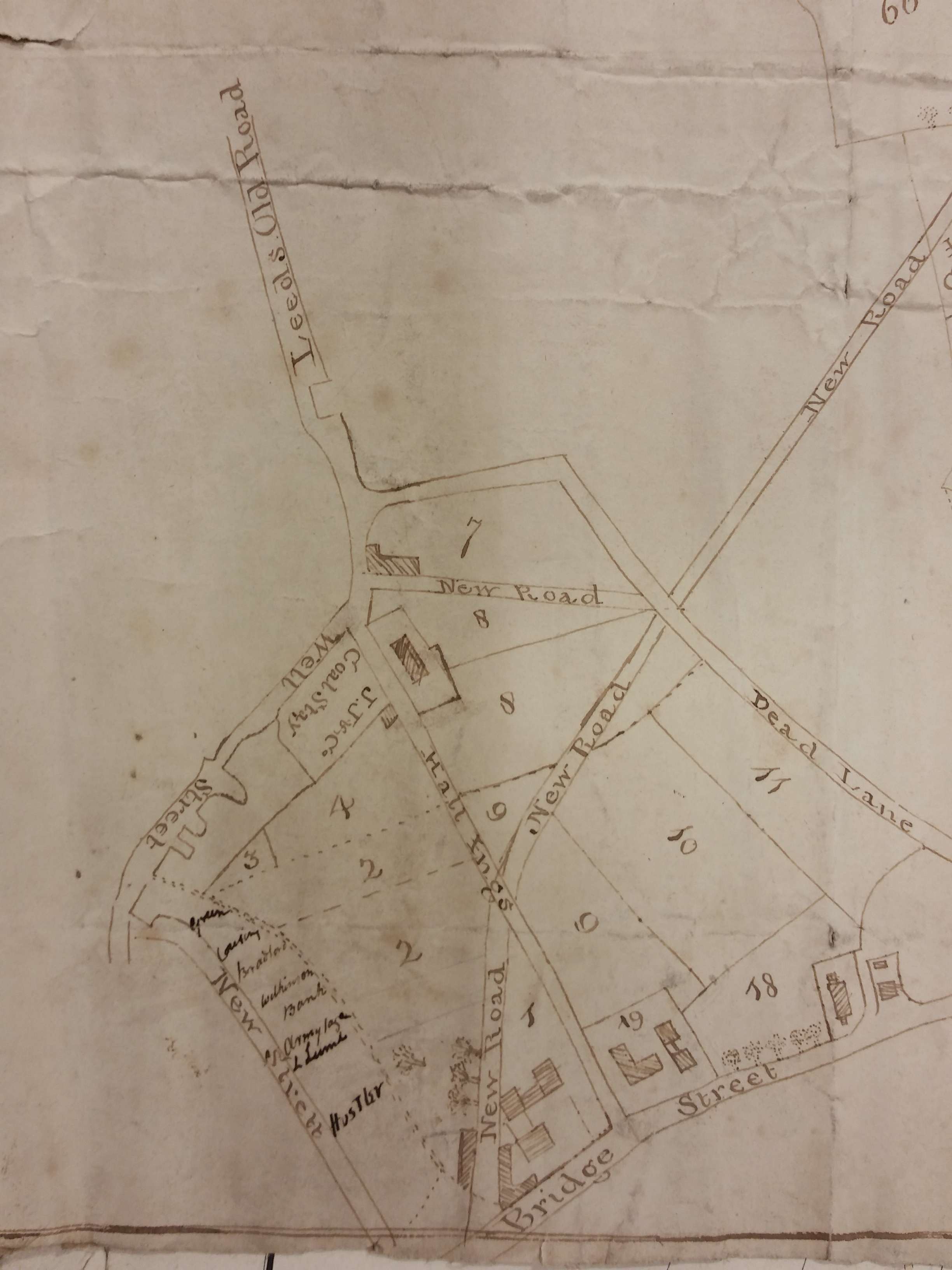
The first of these details shows the town end of the plan. One of the ‘new roads’ is the modern Leeds Road, and Vicar Lane is here known by its old designation of ‘Dead Lane’. The plan clearly pre-dates the tithe map of 1849 and the first OS map of the area. On the basis that Leeds Road was in existence, I originally dated it to later than c.1825, around which year the new turnpike to Leeds was constructed by the Leeds & Halifax Turnpike Trust. I am more doubtful now.
It is not difficult to locate Hall Ings running from Well Street to Bridge Street. It is crossed by New Road making an ‘X’ shape. The New Road then continues to cross Dead Lane. I now hypothesise that the two unconvincingly drawn junctions indicate the original plan did not include the New Road, even if it was subsequently added by the same hand using the same ink. The New Road is very definitely not on the 1802 Bradford plan. But I am conscious that it is present (as Leeds New Road) on a previous map used in this series which I have dated to c.1815 on the basis that Christ Church is described as the ‘New Church’.
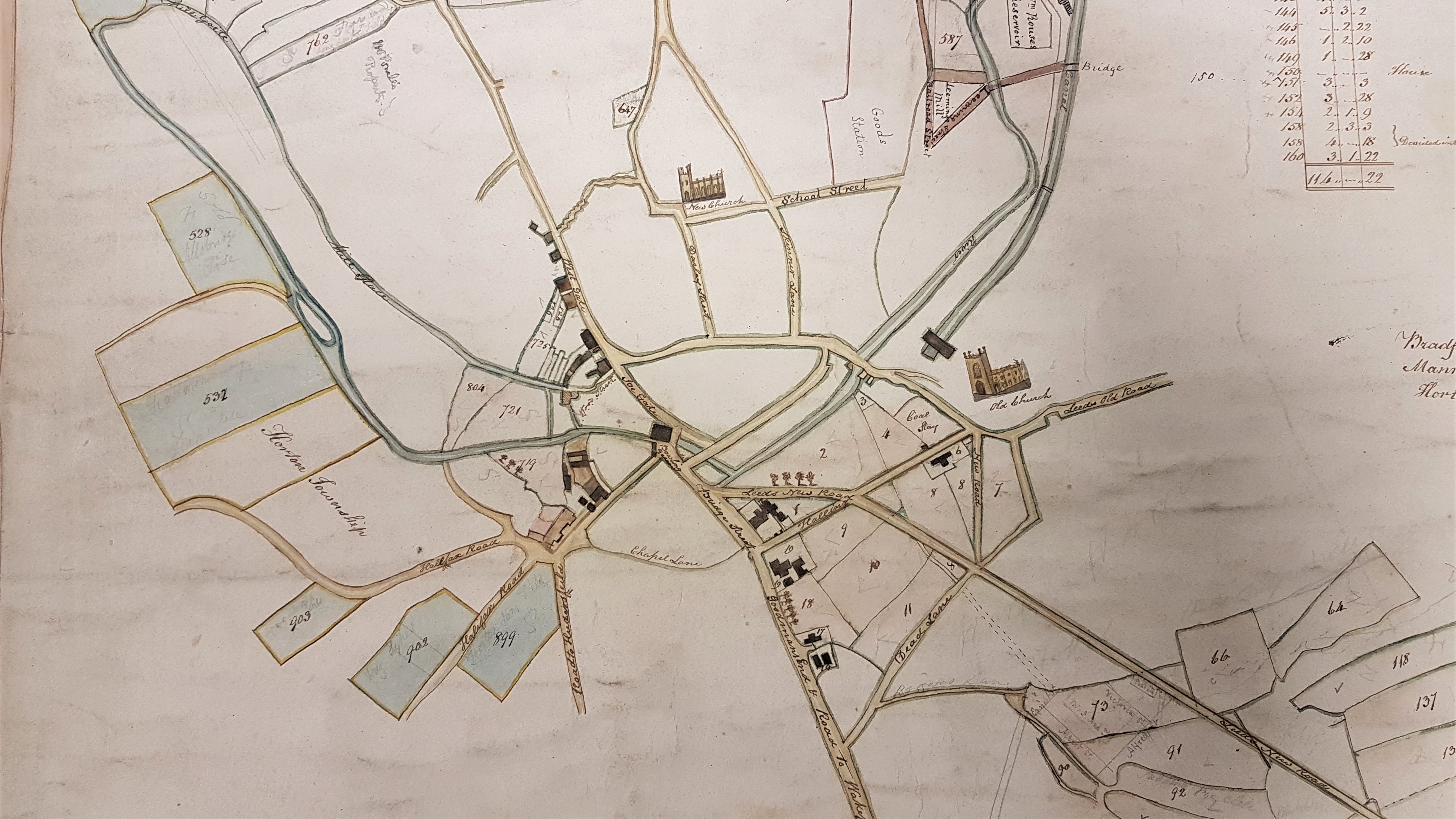
Clearly the crucial information would be the exact year that the new turnpike to Leeds was constructed. Putting that issue on one side the two maps I have include are so alike that I suspect the information on the first plan was used in the production of the second. This is vital since the second map is labelled as showing the property of ‘Rev. Godfrey Wright in Bradford’. The way in which the property was bequeathed to him suggests that 1815 was the earliest date by which he could definitely be considered its owner. I conclude that the first map is also either intended to show Godfrey Wright’s property or, just possibly, the property of one of those from whom he inherited.
Returning to the first detail, two coal staithes are drawn. ‘JS & Co’ must be Jno. Sturgess one of the Bowling partners who supplied the Eastbrook coal staithe. A coal staithe is a place adjacent to a highway from which merchants can collect a supply for subsequent delivery to their customers. The ‘new railroad’ which is drawn is in fact a mineral carrying tramway bringing coal in trucks to the Eastbrook staithe from the iron works, by rope haulage. Bowling Iron Company owned and operated many collieries and ironstone mines. The tramway was closed in 1846 and the area is marked as an ‘old staithe’ in the first OS map of the area. There is second coal staithe (or stay) at the junction of Well Street and Hall Ings. It is marked ‘J J & Co’ which must I think represent John Jarratt of the Low Moor Iron Company.
It is clear that Wakefield Road, Bridge Street, and Hall Ings are in their present positions. ‘Dead Lane’ has subsequently been renamed Vicar Lane, and Leeds Old Road is now Barkerend Road. As far as I can tell the numbered areas represent fields. Trees are growing west of the first section of Leeds Road and a rather larger wood is mapped there in the 1802 Bradford plan. At the opposite end of Wells Street is another ‘new street’ which had been in existence for some years and has evolved into Market Street. Behind this is a rather sketchily drawn Bradford Beck. A subsequent user of the map was evidently interested in the owners of property between Market Street and the Beck and has added some names. You probably won’t be able to read these names, and in fact they are not easily legible even on the original map. As far as I can make out, reading from top to bottom, the names are: Green, Cowling or Crossley, Bradford, Wilkinson, Bank, Armytage, L Lumb, and Hustler. There are directories listing Bradford business in 1822 and 1834. Plausible identification of most of these names in Market Street can be made from these directories although it is impossible to be quite certain.
Thomas Green, grocer and tea dealer 1834
David Crossley, attorney 1834
Bradford – uncertain
James Wilkinson, cabinet maker 1822
Thomas Jowett Wilkinson, cabinet maker 1834
Bradford Commercial Bank Co. 1834
Samuel Armitage, plumber & glazier 1834
John Lumb, straw hat maker 1822
Ann Lumb, pawn broker 1822
Thomas Lumb, pawn broker 1834
The name Hustler is more difficult. The famous Quaker wool-stapler and canal promoter, John Hustler, had died 1790. I believe he left two daughters. The fact that Market Street boasted two wool-stapler partnerships carrying his surname cannot, surely, be a coincidence. The two partnerships were Hustler & Blackburn and Hustler & Seebohm and I have confirmed the existence of both in other sources.
I can identify some other features. The house surrounded by the field (or close) marked 8 once belonged to Mary Swaine who died in 1759. The buildings in area 19 are also present on the 1802 map, but must have been knocked down in 1850 when St George’s Hall was erected.

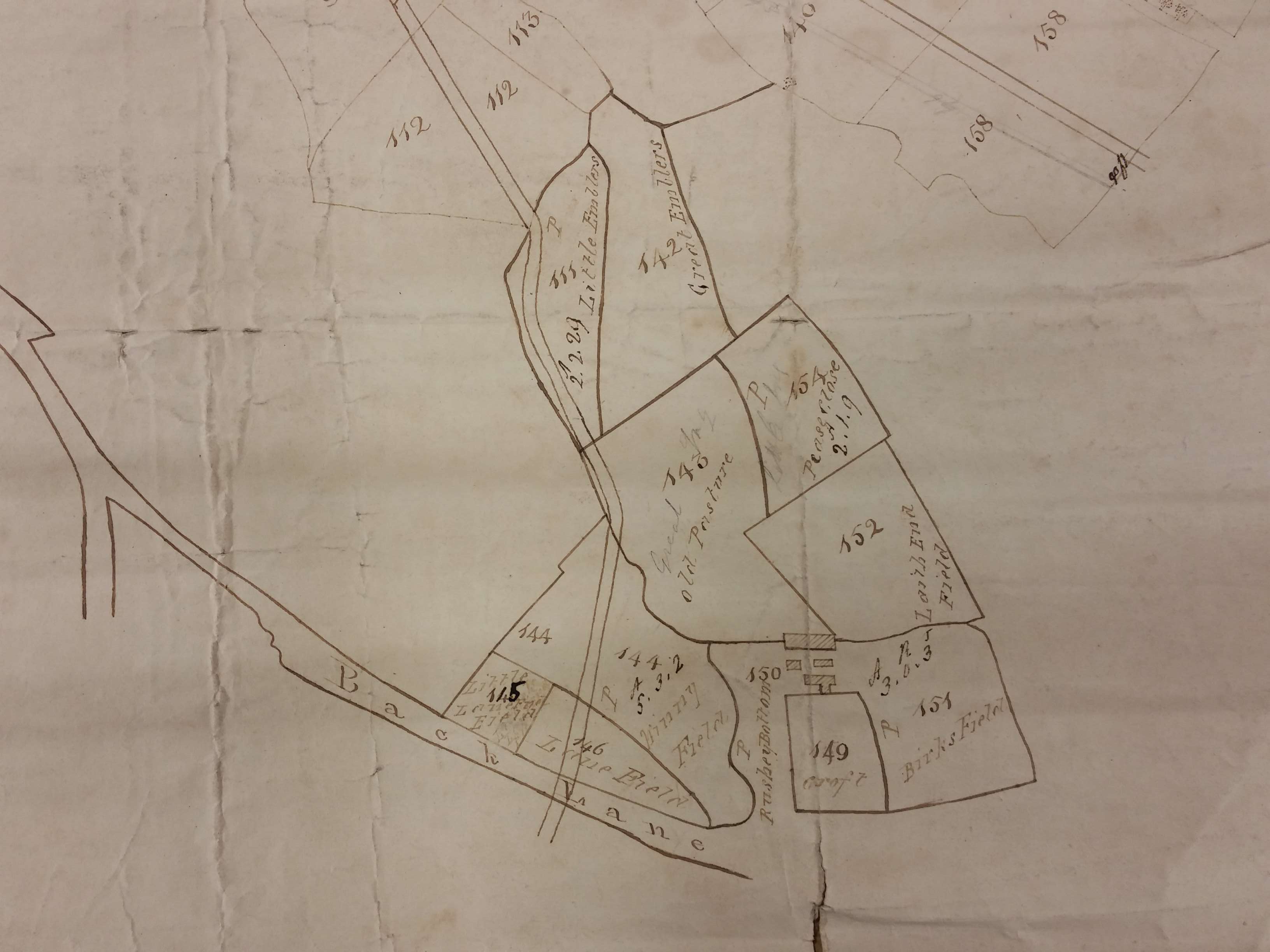
The last two details show the very considerable quantity of land that Godfrey Wright possessed south of Bradford. Back Lane, leading off Wakefield Road, is today called Bowling Back Lane. Naturally there is no indication of the railway track which within a generation bisected the space between Bowling Back Lane and Leeds Road. The buildings drawn may represent Birks Hall. Godfrey Wright certainly owned all this land, which was known as the Field House Estate, and he had coal and ironstone mining interests here.

Thank you for this information. My family Sugden are listed in the directories as living in this area in the early 1800’s. Would love to learn of any other information there may be of this area of Bradford.
LikeLike