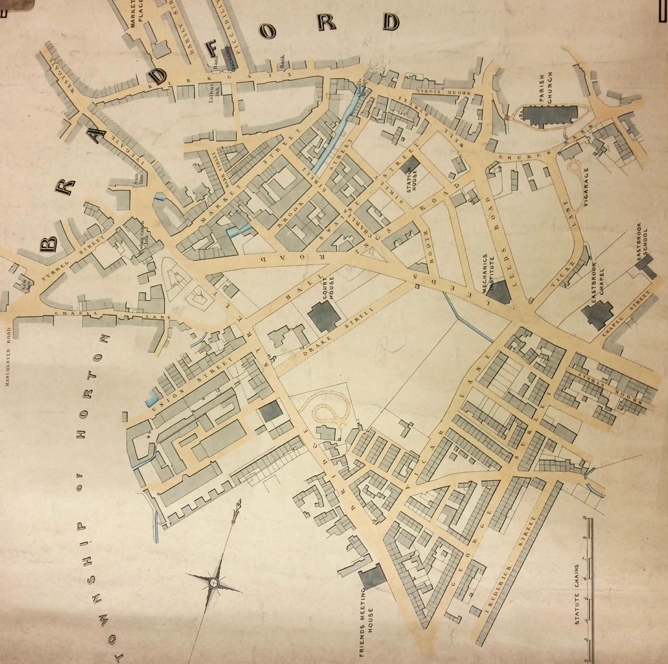
I have to confess that I had never heard of this building until I reviewed the first map from the Bradford Local Studies Library reserve collection. The Court House is placed virtually in its centre between Hall Ings and Drake Street. To its south-west there are a cluster of buildings that clearly must have been demolished when St George’s Hall, currently occupying the site, was constructed. In fact these two buildings help to date the map. William Scruton in Pen & Pencil Pictures of Old Bradford gives 1834 as being the year that the Court House was opened. St George’s Hall was erected in 1850. We can tighten things up a little since the Mechanics Institute, also shown, would not have been present before 1837. But the Swaine Street Station House (a fire and police HQ) was, I believed, opened around 1847. Essentially then the first map shows Bradford just after it became a borough in 1847.
I know that ownership of the Court House was vested in the West Yorkshire Magistrates, but I knew nothing of its antecedents. So I am very grateful to local historian Barbara Reardon who gave me a reference to an article written by Mike Priestley in 2006. The author was describing the T&A building press hall, built in the 1980s, but he mentioned that after 1834 the same site was home to a court house and prison. The building was ultimately acquired by Bradford Council and demolished in 1957 because of dry rot.
Of especial interest to me was Mike Priestley’s account of the land previously belonging to the Rev. Godfrey Wright, whose name haunts both this series of maps and my imagination. Wright inherited the property from Charles Swaine Booth Sharp of Horton Hall, who in turn inherited it from his father Rev. Charles Booth. The author is very definite that the land came to the first reverend gentleman from his marriage in 1731 with Sarah Field, daughter of William Field of Bradford.
With this hint in was straightforward to find the site on Rev. Godfrey Wright’s property map of which this is a detail.
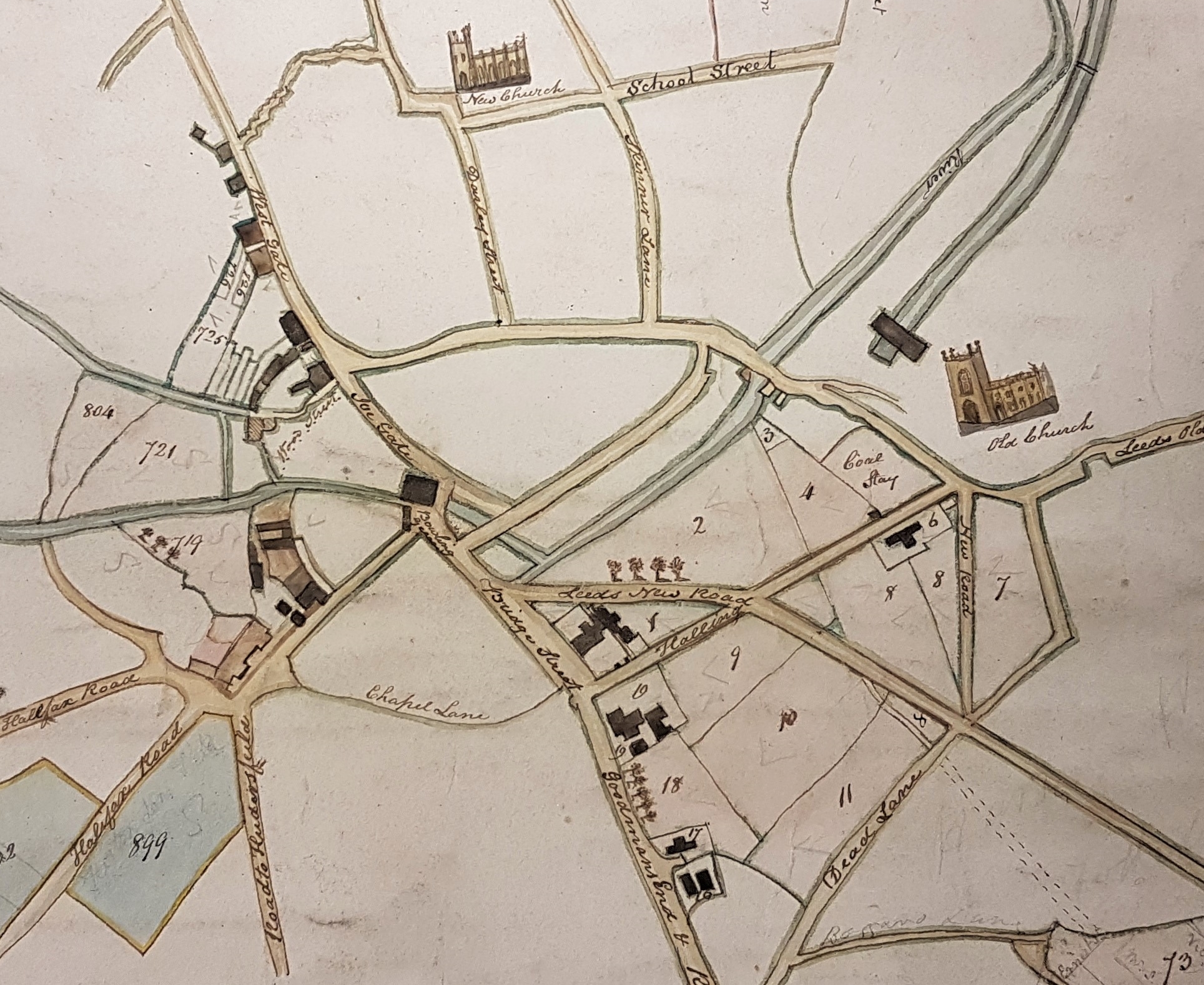
This second map was probably drawn in or about 1815 when Wright came wholly into his inheritance. This is confirmed by the image of the long-vanished Christ Church (actually built in 1815) being referred to as the ‘New’ Church. You can see that the Thornton Road turnpike has not yet been constructed. The land on which the Court House was to be built is vacant and marked with the number 9.
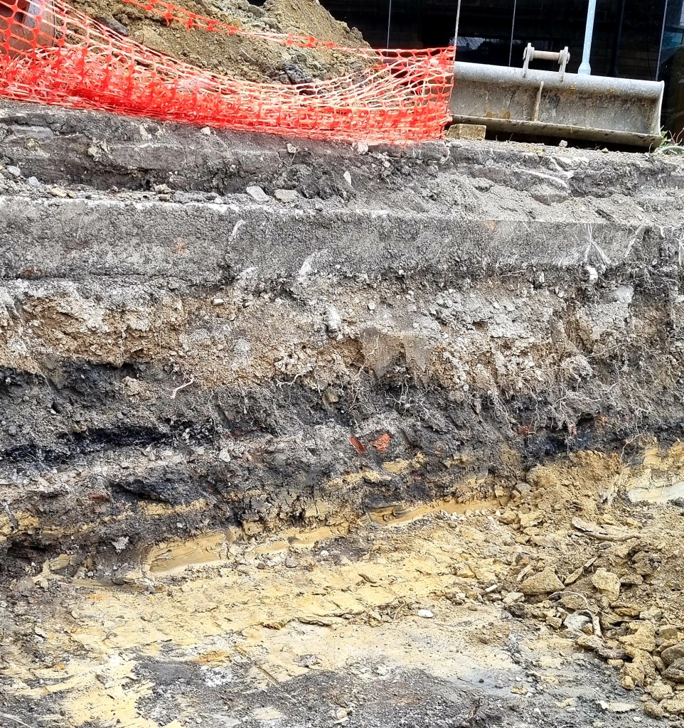
I don’t normally put much archaeology in these articles but here I shall make an exception. Recently a mechanical digger had cut a very convenient section in from of the T&A building of which this is a photograph. Under the orange net there seem to be two modern surfaces of concrete or stone. At the bottom is the yellow ochre colour of glacial drift deposit. Between the two, a distance of not much more than half a metre, are two distinct soil horizons with minimal brick and coal debris. It would not appear that any substantial construction predated the T&A building on this site.
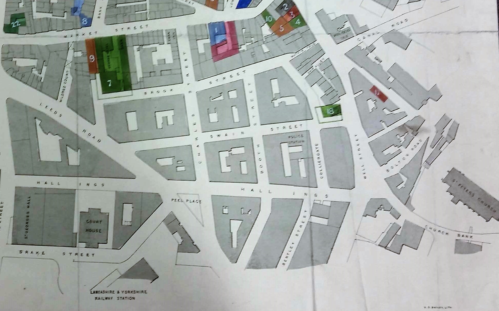
Both the first and this final map detail show that the space in front of the Court House was left empty. I imagine it was occupied by a lawn and formal entrance. In the last map detail notice that St George’s Hall is now constructed. Next to it was a wool warehouse for Milligan, Forbes & Co., which was later the T&A’s original home. If you would like to read Mike Priestley’s article it is available at:
Pressing need that created a landmark | Bradford Telegraph and Argus (thetelegraphandargus.co.uk)
