2.143 BRA c.1861 PLA BHM 1956 B28
Material: tracing paper Scale: unk
Size: 22*18cm Condition: fair
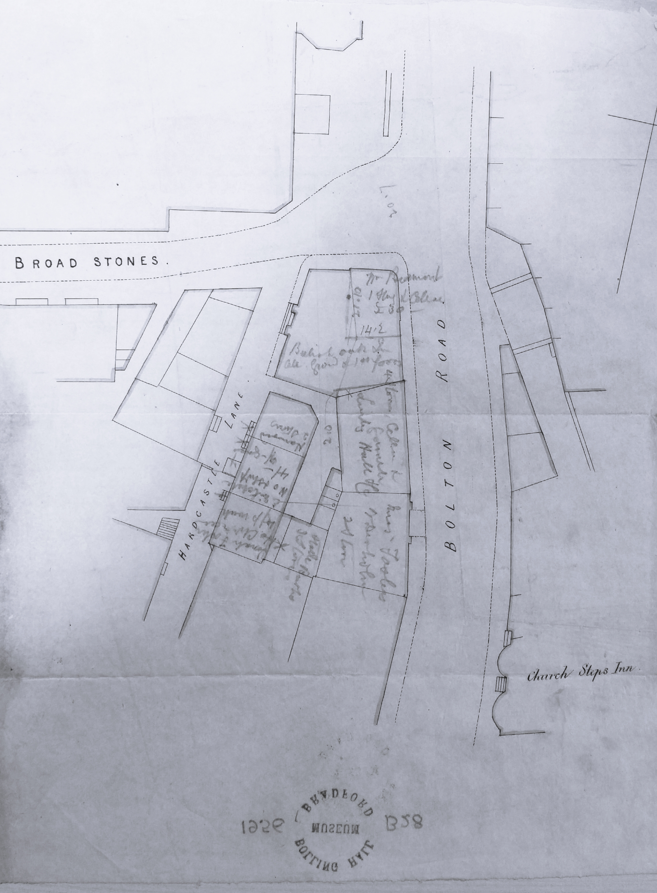
My search for Broad Stones began with this little plan from the Local Studies Library reserve collection. It is undated but pencil annotations seem to be providing details concerning adjacent properties, including occupiers, areas and valuations. At the junction of Broad Stones, Hardcastle Lane and Bolton Road is the situation of an business which (in pencil) seems to be the British Oak Inn, but I’ve totally failed to find this in trade directories. Of the other occupiers: Jonah Foster, E Mitchell, Burke, & Harwood (2 stories) the only one I’m reasonably sure of is Greenwood Harwood, a whitesmith at 12 Hardcastle Lane in the 1861 Bradford Directory. On this rather tentative basis I dated the plan as c.1861.
Ironically I knew what Broad Stones, and the clearly marked Church Steps Inn, looked like, since illustrations of both are included in ‘Old Bradford Views from the Cudworth Collection’ (1897).


William Scruton, in his Pen & Pencil Pictures of Old Bradford (1889) describes the Church Steps Inn as the oldest licenced house in Bradford, wherein ‘the fates of nations or the small talk of the town’ might be discussed. He also provides a slightly variant illustration of Broad Stones. Taken together maps and pictures provide perfect aids to how we can construct the former appearance of Bradford in our imagination. The wider picture, and the exact position of Broad Stones, are indicated in two further maps from the reserve collection.
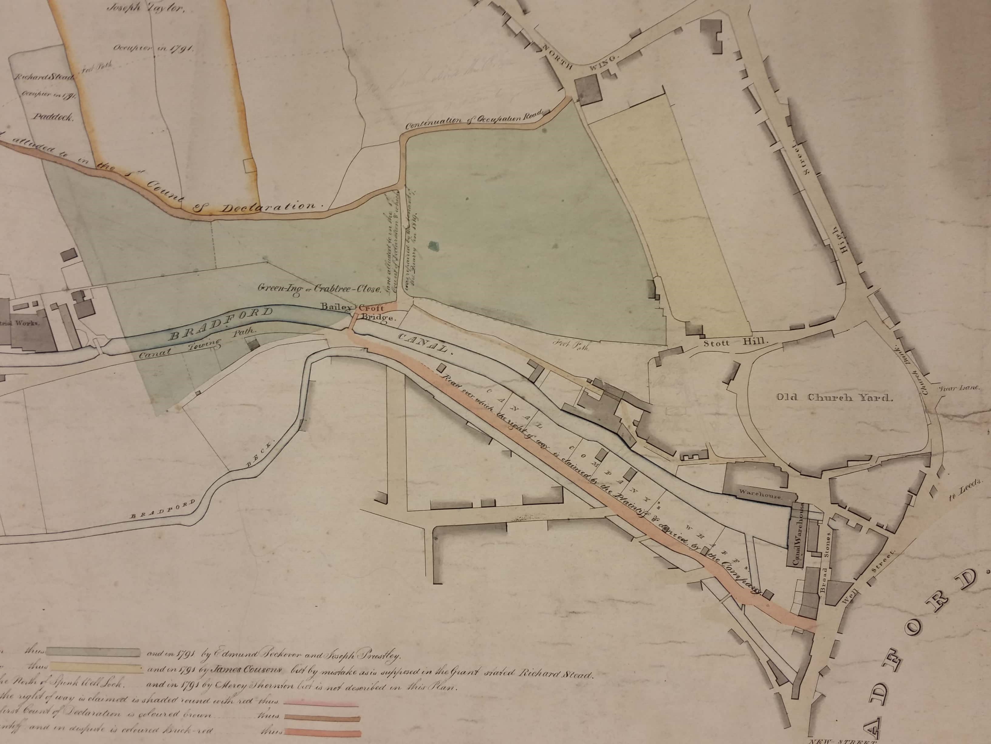
The first, from 1820, clearly shows (in the bottom right corner) the area of interest. The earlier plan and illustration did not indicate how close Broad Stones was to the canal terminal and its warehouses. At this time it evidently opened into a space in front of the church steps and Bolton Road doesn’t exist.
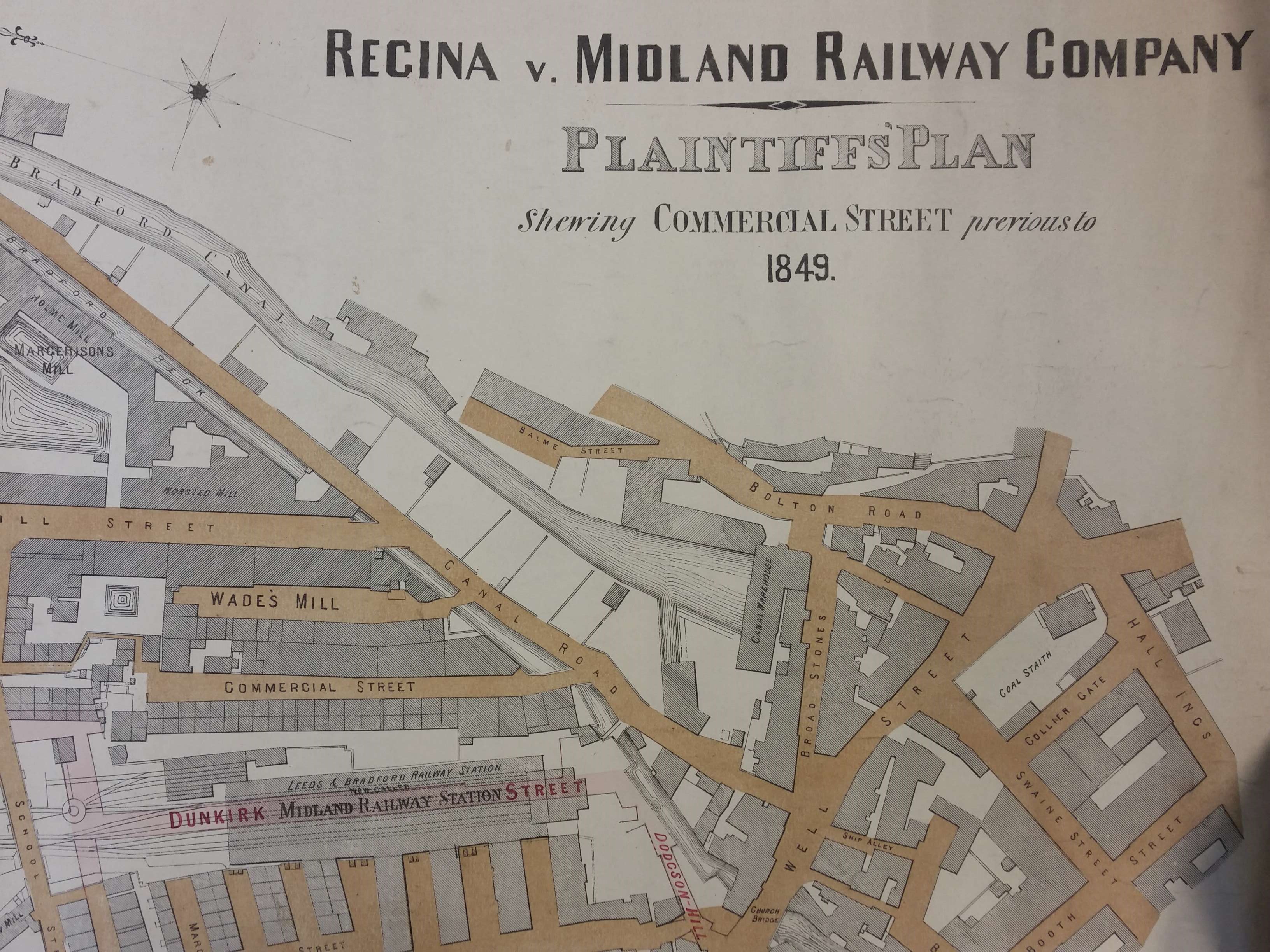
A generation later, in 1849, Broad Stones is still evident, but the open space has vanished as Bolton Road has now been constructed. In this map notice the Well Street coal staithe (owned by the Low Moor Iron Co.) which has featured in this series on several previous occasions. Note also, the arrival of the railway and that Church Bridge does actually cross a flowing surface portion of the Bradford Beck.
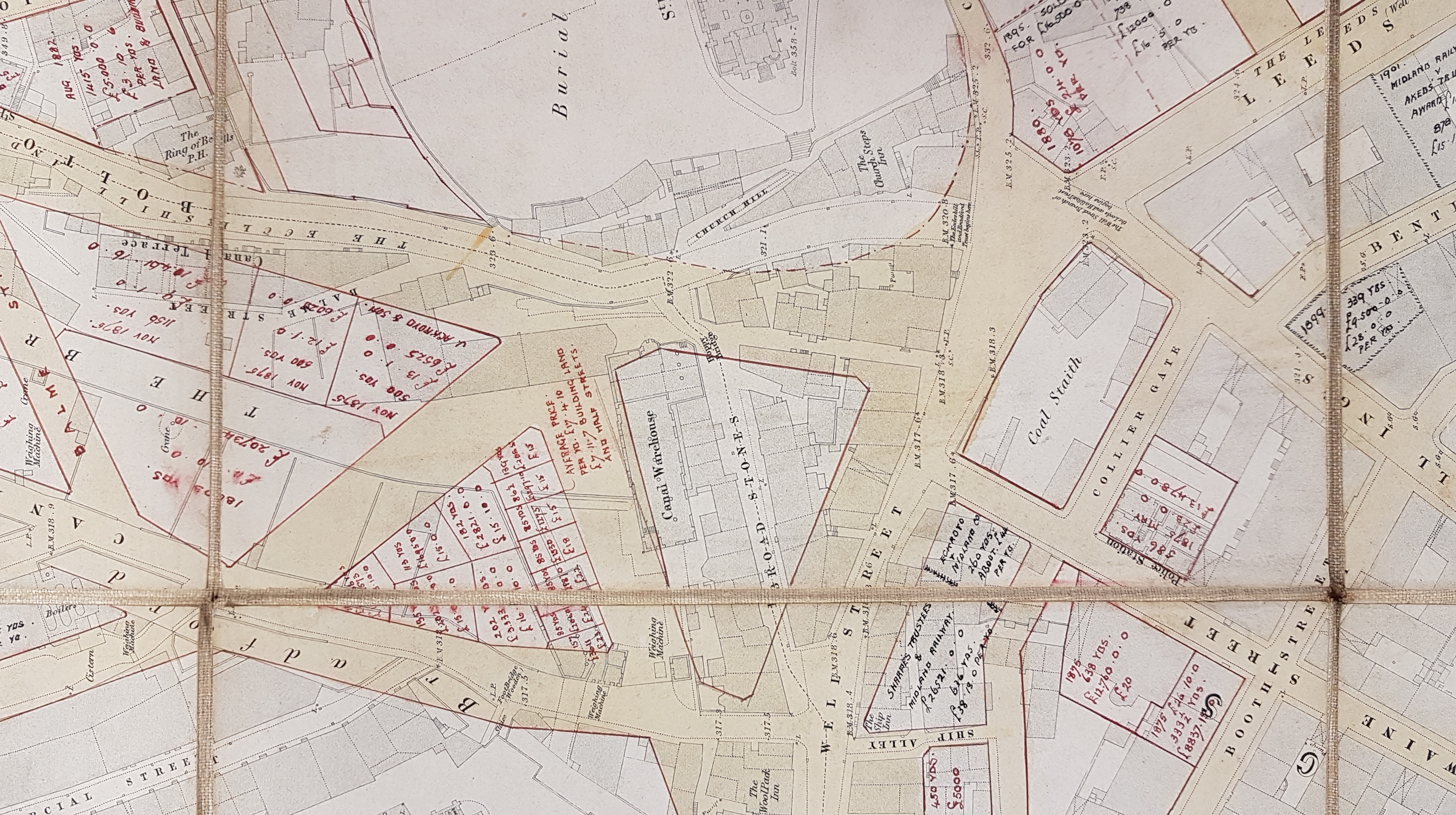
So, what happened? The third map is not dated but is effectively a more detailed and annotated version of the 1876 Milnes & France map of the Borough. In the centre find the name ‘Broad Stones’ now lost in a triangle about to be created by Lower Kirkgate, Well Street and Bolton Road. The canal warehouse will follow it into oblivion. By 1887 this triangle has evolved into Forster Square with the famous statue. The church steps, the inn, and the adjacent old Grammar School, were clearly swept away by the creation of the General Post Office around 1882. The General Post Office building still exists but is unused for its original purpose.
This all explains what happened to Broad Stones. What happened in turn to Forster Square must wait for another day.
