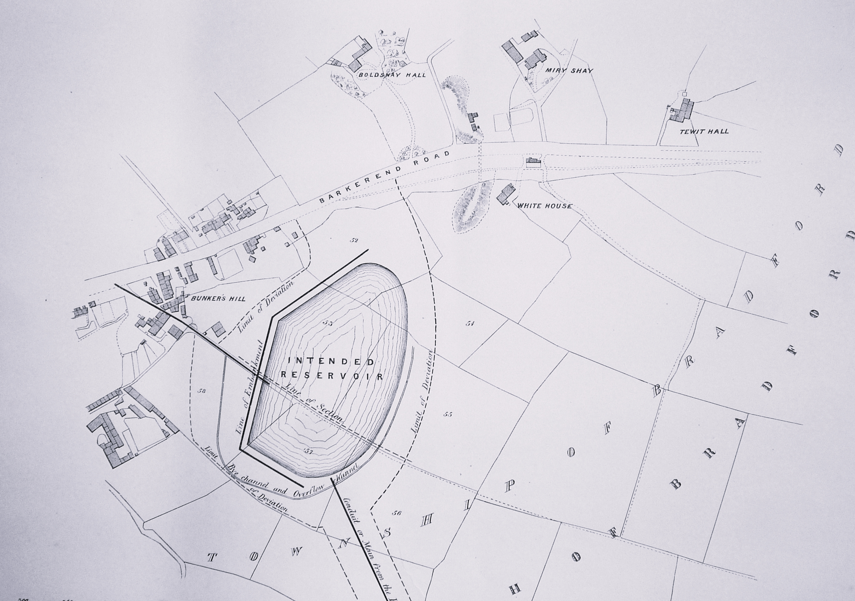
A recent map placed on-line dealt with the water supply of the former Baildon reservoir. This map shows the area south of Barkerend Road but, unlike at Baildon, this reservoir remained an intention and was never constructed. The map however does show the area in considerable detail. I haven’t found it easy to locate information about the places drawn here. There is not much doubt that Barkerend is still awaiting the attentions of an anticipated modern scholar to thoroughly investigate its history.
Boldshay Hall was built c.1740 and at this early period was associated with the name of Samuel Hemingway and his son Henry Hemingway, who were both Bradford lawyers. Their names regularly appear on legal documents of the period. The associated estate itself is presumably older still. Remarkably the hall still exists on Byron Street, surrounded by Victorian housing, and is Grade II listed. The gardens, fields, and coal mines which once enclosed it have long ago vanished completely.
South-east of Boldshay once stood Miry Shay (or Miryshay) an older seventeenth century house. This has long been demolished, but in the early nineteenth century was the property of JH (John Henry) Smyth or Smythe MP (1780-1822) whose family had owned it, and the Bradford Soke Mill, for generations. In the mid-nineteenth James Cousen, a partner in Rawson, Clayton & Cousen, coal merchants, lived there.
By the time of the 1852 Ordnance Survey map there was a large colliery just south of Miry Shay called Bunkers Hill. The name Bunkers Hill seems in fact to be applied to a series of collieries along Barkerend Road. I believe that, in this period at least, Rawson, Clayton & Cousen operated Bunkers Hill. The 1834 Bradford Directory places Rawson, Clayton & Cosen (sic) at ‘Calbery colliery’, but this name is quite unfamiliar. Local historian Ken Kenzie notes that Rawson Clayton & Cousen are shown as Coal owners at Calverley and Bunkers Hill in the 1853 Whites Directory, and suggests that the mysterious Calbery is just a typo for Calverley!
In the middle of the map, on either side of Barkerend Road, elevations are drawn: these could well be heaps of spoil from earlier incarnations of these collieries? In fact, the 1887 PO Directory map of Bradford actually places an unnamed colliery adjacent to the northern heap: this may be the function of the unnamed buildings on our own map.
The name Tewit Hall survives in Tewit Hall Road, near Bradford Moor Park. I can’t find any references to it except that the 1849 Bradford map places in on ‘Windmill Hill’. The same map indicates that there were a cluster of additional small coal pits to the north of Barkerend Road in this general area. I have the same problem with White House. Both buildings survive in the 1887 Bradford map and probably into the twentieth century, but will have to await the attentions of my anticipated scholar.
