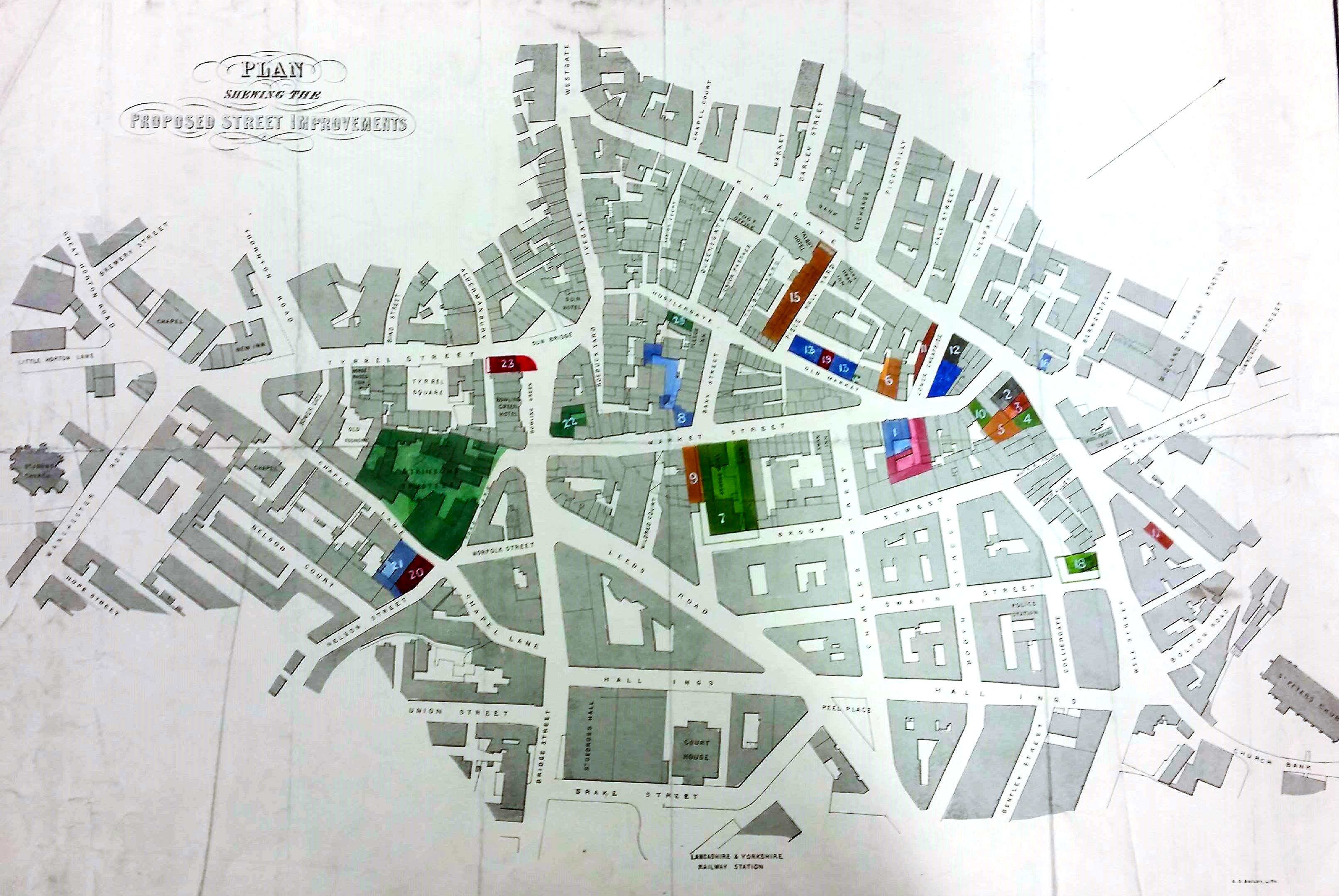
4.045 BRA c1860 PLA BHM 461 B8
Material: paper Scale: unknown
Size: 70*52 cm Condition: fair
The Local Studies Library reserve collection contains a number of maps of the above type. I assume that they were issued prior to street improvements, or any other development requiring the compulsory purchase of land. Under such circumstances the existing landowners were compensated, although it is clear from some of the maps that the landowners might dispute the amount of the compensation payments and resort to the law.
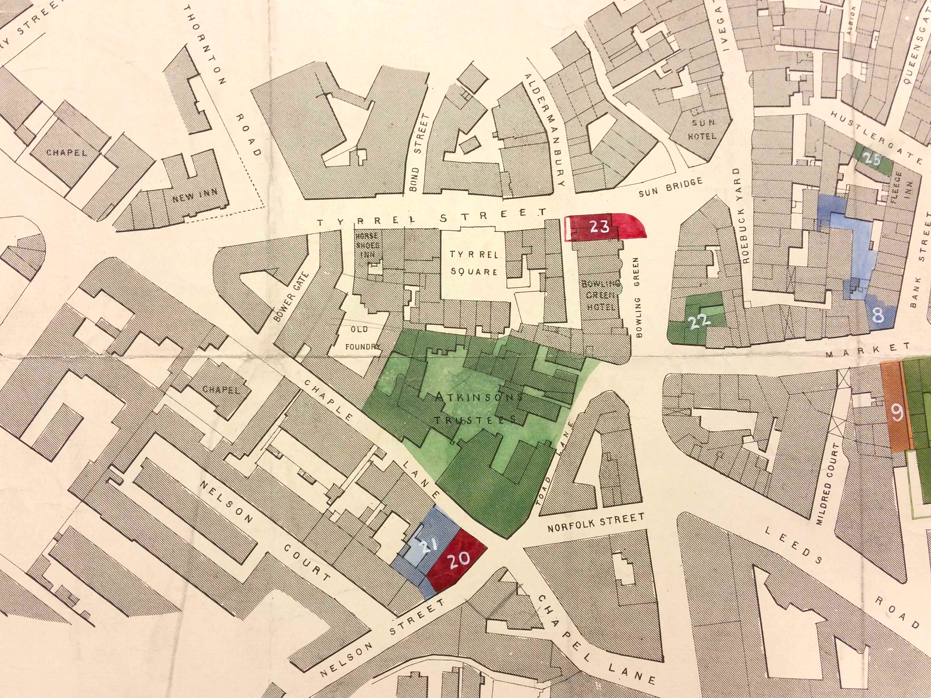
The specific reasons behind the production of this particular map is not the issue here, although it probably wouldn’t be too difficult to trace the Atkinson’s Trustees who are included. The map is undated but St George’s Hall has been built so the plan is later than 1853 but there is no Town Hall yet, so it clearly pre-dates 1873. It closely resembles the 1861 Bradford map so a portrait of the borough around 1860 seems a reasonable conclusion. You might care to wander, in your imagination at least, around the central section of the plan (shown as a detail) with its long forgotten inns, chapels and courts.

The second detail of the original map shows the newly constructed St George’s Hall on Bridge Street, close to the Courthouse and the Yorkshire & Lancashire railway terminus (Drake Street Station). Have you ever wondered why the hall is where it is? The answer to this question involves the Rev. Godfrey Wright, an important absentee land-owner of a great deal of central Bradford in the early nineteenth century, and an individual with whom I have become slightly obsessed!
Bradford had become a borough, with an elected borough council, in 1847. The Bradford Observer of 15 August 1850 recorded that many influential Bradford people favoured the construction of a public Hall. The mayor and a dozen enterprising citizens had met to consider this project. A previous meeting had empowered this group to select a suitable site, and in fact three had been short-listed. The first to be considered was a large piece of ground between Bridge Street and the Court House belonging to Godfrey Wright and already covered with buildings. An alternative site, also belonging to Godfrey Wright, lay between Bentley Street and Well Street. A third plot lay between North Parade and Manor Row, near the long demolished Christ Church.
Evidently the first site was eventually chosen. The press account records that a possible drawback to the first site was that Godfrey Wright wanted to sell his entire land holding here, not just the portion of the land required to construct the hall. The well-known local solicitor Mr Samuel Hailstone was chosen as solicitor for a company of shareholders, and the meeting recommended the second site be purchased. The name, St George’s Hall, was discussed but not decided upon. I have yet to understand why, in the end, the advice concerning the site for the hall was rejected, and the purchase of the Bridge Street location undertaken.
You might be interested in the sum of money the shareholders needed to raise. The cost of the second site was given as £3 per square yard, which produced a total of £6,130. This doesn’t sound too bad until you realise that, in modern purchasing power, this was about £500,000. The shareholders would still need to pay for the demolition of existing buildings and the construction of a distinguished concert hall. They would really have had to sell a lot of tickets to recoup their investment.
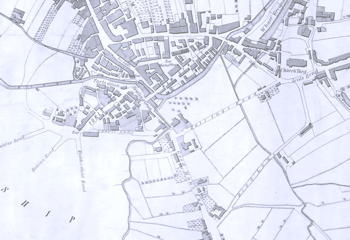
It is plausible that several members of the mayor’s group remembered the area as it had been 50 years earlier. In this detail of the 1802 Bradford map you can see a sparse cluster of buildings on either side of Hall Ings, and the various watercourses which were then still on the surface. It is quite clear how Bridge Street got its name.
