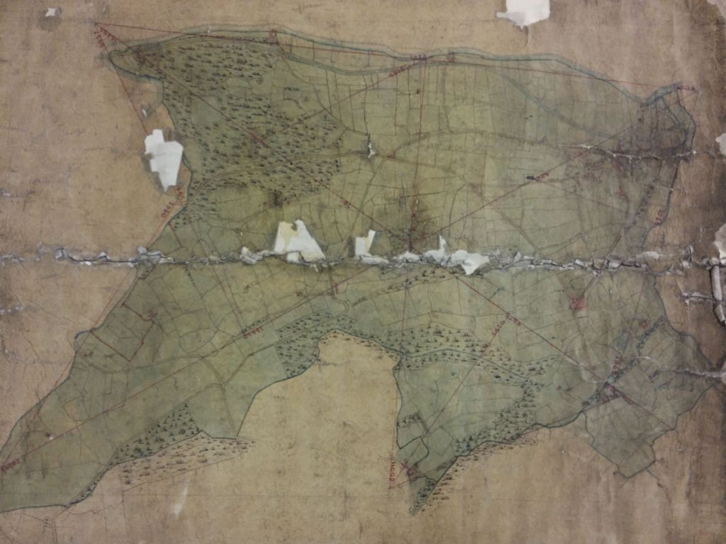
2.03 SHI c.1833 PLA BHM 626 B9
Linen Scale: n/a
Size: 30*35cm Condition: poor
It is deeply frustrating that so many maps and plans in the Bradford Local Studies Library reserve collection have no indication of date or function. I imagine that those which were originally part of the collection at Bolling Hall Museum (and for which I have provided a BHM index number) once had all necessary details entered in a written catalogue. Although no such catalogue is now available its discovery is always a possibility. Meanwhile what can we do without such a source of information?
Clearly this is a plan of the land south-west of Shipley centre from the River Aire up to the boundary with the neighbouring township of Heaton. As you can see from some of the details provided there are red surveying lines with distances inked in. Shipley is coloured green and Heaton is left uncoloured. The Shipley historian, the late Tony Woods, told me that the map represented Shipley before the addition of Windhill: the area covered being the same as the Shipley tithe map. I’m sure that this is correct.
This map shows thoroughfares, woods, fields, and buildings as blocks. There is no indication of land use, quarrying or mining. The presence of buildings is naturally helpful for dating. For example, Red Beck Mill is marked so the plan is later than 1815. In the same way the presence of St Paul’s Church dates the plan to after 1826.
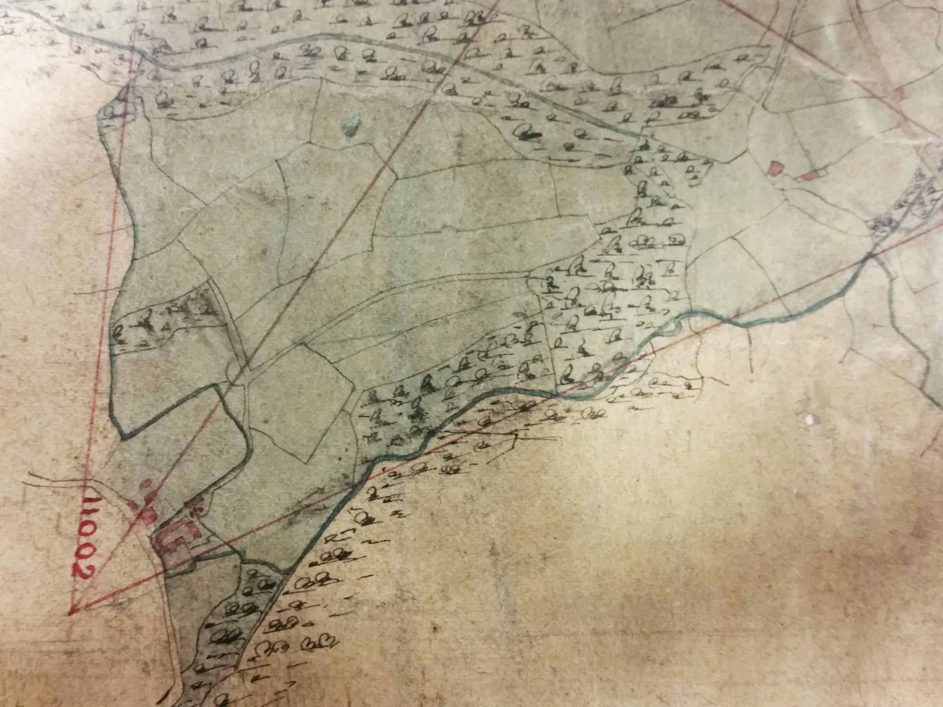
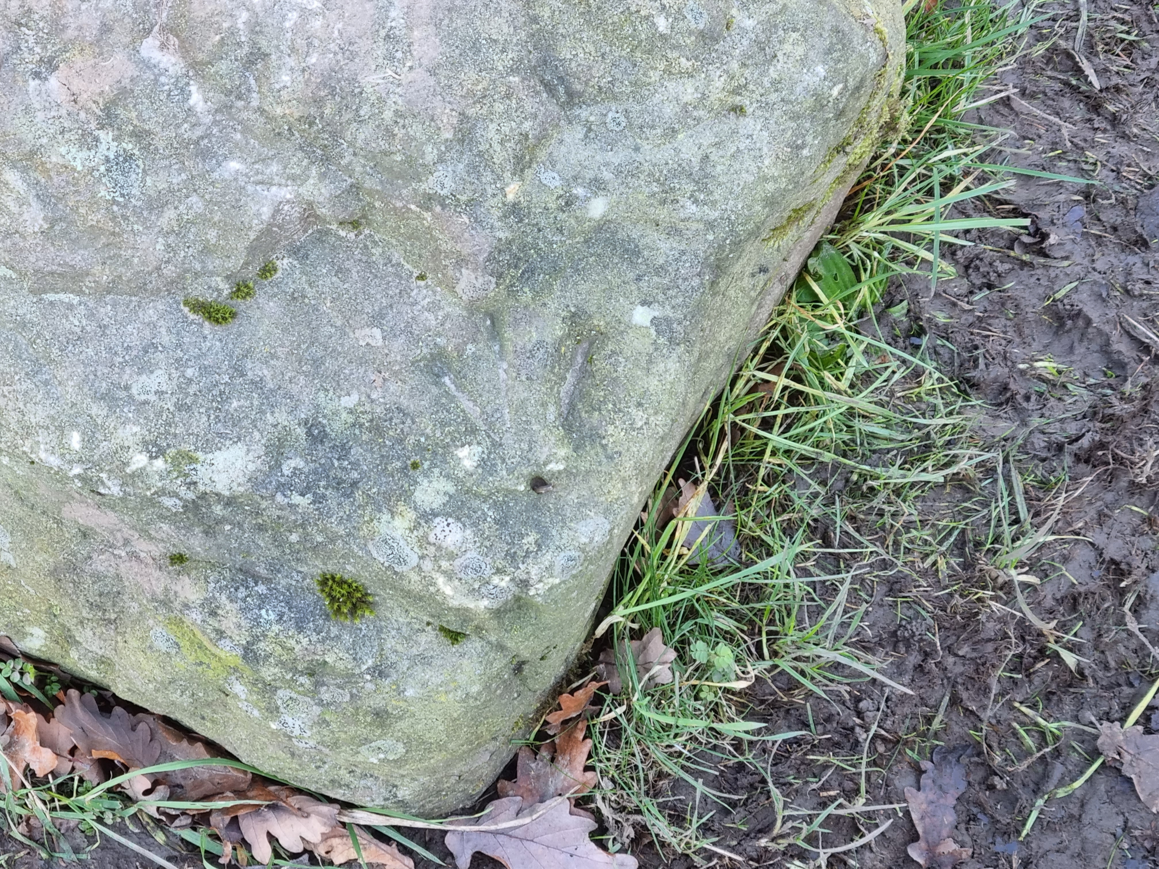
One obvious possibility is that the map represents the preliminary surveying done in the preparation of the first Ordnance Survey map for this area undertaken in the 1840s. There is a piece or archaeological evidence that may support this. In the detail showing the hamlet of Heaton Royds (Six Days Only) there are three surveying lines that meet on the lower left portion of the map, which is just over the border in the township of Heaton. If you follow the middle one of these three lines it soon crosses Shay Lane and clips a block which represents Heaton Royds Farm. It then crosses a field (which is tinted green although in fact it is part of Heaton) and then meets Heaton Royds Lane, which makes a ‘Y’ shape at this position. At this point today there is a large boulder lying in the path on which you can just make out the arrowhead shape of an OS benchmark. The boulder has clearly been moved from its original position, but not very far I would guess.
At the bottom of this detail the sinuous line is the Red Beck that flows through Heaton Woods. The beck in this area generally forms the boundary between Heaton (then part of the Rosse estate) and Shipley (owned then and now by the Dixon family). Rather bafflingly at one point the beck meanders but the border keeps straight. That is not the only puzzle in this plan. The overall pattern resembles the first Ordnance Survey (OS) map but neither the railway nor Shipley Grange is present. On the map it is not difficult to find another ‘Y’ shaped ‘branch’ where the main roads to Saltaire and Shipley divide, and where the public house named The Branch was situated until recently. Below and to the right is a circular feature connected to two trackways. On the definitive first OS map this appears to be a carriage ‘turning circle’ for Shipley Grange. The contracts for Shipley Grange were issued in 1840. But on the surveying plan there is no house. Could the constructors have completed the ground works before the building started?
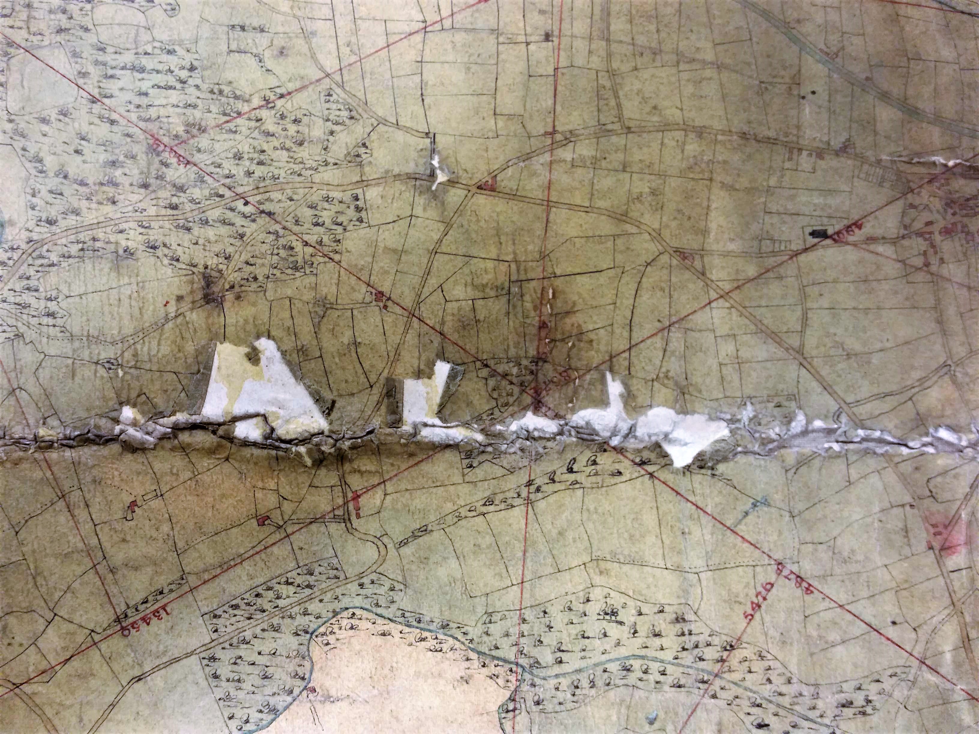
Finally, there is a star-like feature where all the surveying lines cross. Where would this be today? It would appear to be in Moorhead between the Paradise Wood and Round Wood that are marked on the first OS. Somewhere along the line of modern Grosvenor Road I would guess.
