
2.87 RAI c.1853 PLA BHM 1835 B28
Material: Paper Scale: 2 miles to 1 inch
Size: 45*35 cm Condition: Fair
This is the second map I want to put on-line from the Bradford Local Studies Library reserve collection that hardly involves the city at all. This example shows a proposed Halifax & Hull Direct Railway. Essentially this would have been a direct rail link from Methley Junction to Halifax. The idea was perhaps to give Halifax speedy access to a sea-port, while bypassing Leeds and Bradford. Though I am far from certain what imports or exports would have justified this expense.
In fact I haven’t found it at all easy to source information about this project and I am very grateful for the information contained in the on-line resource, Malcolm Bull’s Calderdale Companion. Here it is stated that in October 1845, the Halifax & Hull Direct Railway Company announced proposals for a railway line passing Hull, Goole, Grimsby, Methley, Halifax via Hipperholme, Lightcliffe, and Cleckheaton, with branches to Wakefield. There are no other Google ‘hits’ for this name, and searching the archive of Victorian newspapers for the company name likewise produced no results. Maps like this must have been issued with company prospectuses when funds and investors were being solicited. The map resembles, stylistically, one of those issued by George Hudson but I know of no other link to ‘the railway king’.
Can I, virtually destitute of knowledge concerning early railway lines, say anything useful about this map? Firstly, the line does not seem to have ever been constructed. Around Bradford the line from the city to Leeds from Market Street (Forster Square) Station via Shipley was opened in 1846 and is certainly drawn on the map. The line of the Leeds & Yorkshire Railway Co. from Halifax via Low Moor into Drake Street Station was opened in 1850. The fact that it is also drawn suggests the map cannot be as old as 1845, even if the initial proposal was. In reality the next line to the city was constructed by the Great Northern Railway from Leeds to Bradford (Adolphus Street) in 1854, but this is missing. The Laisterdyke – Bowling Junction loop was constructed in the same year and is also not present on this map. There is a Wakefield & Bradford line drawn, but this seems a mite hypothetical. In reality there was a Bradford, Wakefield & Leeds Railway Co., which within a few years built a line to Dudley Hill, Driglington and Morley, but this is not the route shown.
What else can one say about this map? Bradford was clearly not considered of importance to the map makers, but the mineral resources of the area evidently were. I’ll give up at this stage and await an injection of knowledge from one of the many early railway enthusiasts.
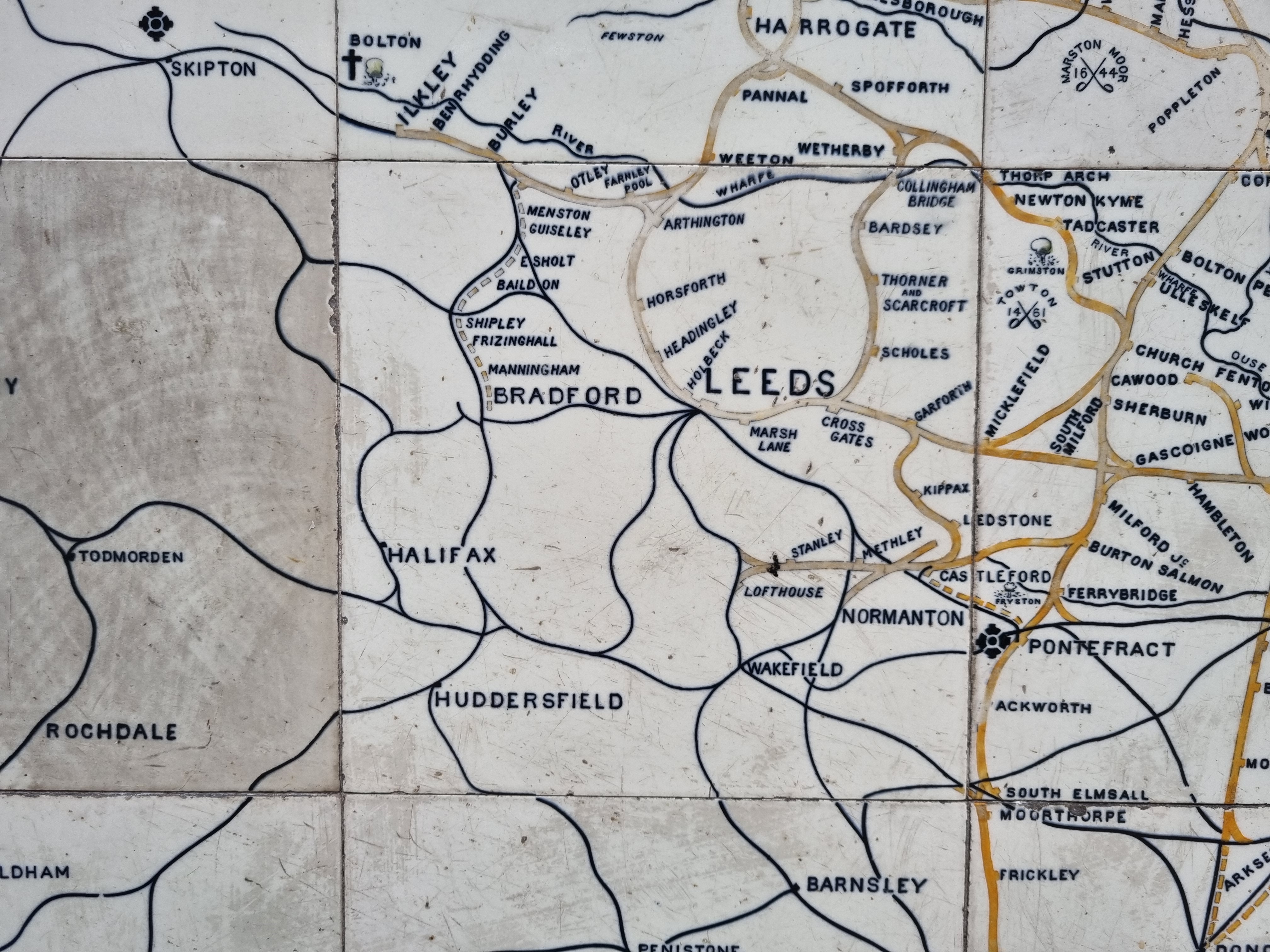
Truthfully, I do find early maps of rail tracks difficult. I’ll finish with this rather lovely one on glazed tiles at York Station. In shows many long-vanished lines and stations, like Manningham for example. But there is no hint that you could never travel direct from Huddersfield to Shipley. It looks as if the two main Bradford stations are linked by a connecting line whereas, to the city’s great loss, they never have been. Was this simply a mistake by the tile designer, or did the design date from a time when the construction of such a link was planned? Was the hope father to the thought?
