2.148 BRO c.1875 PLA
Material: tracing paper Condition: poor
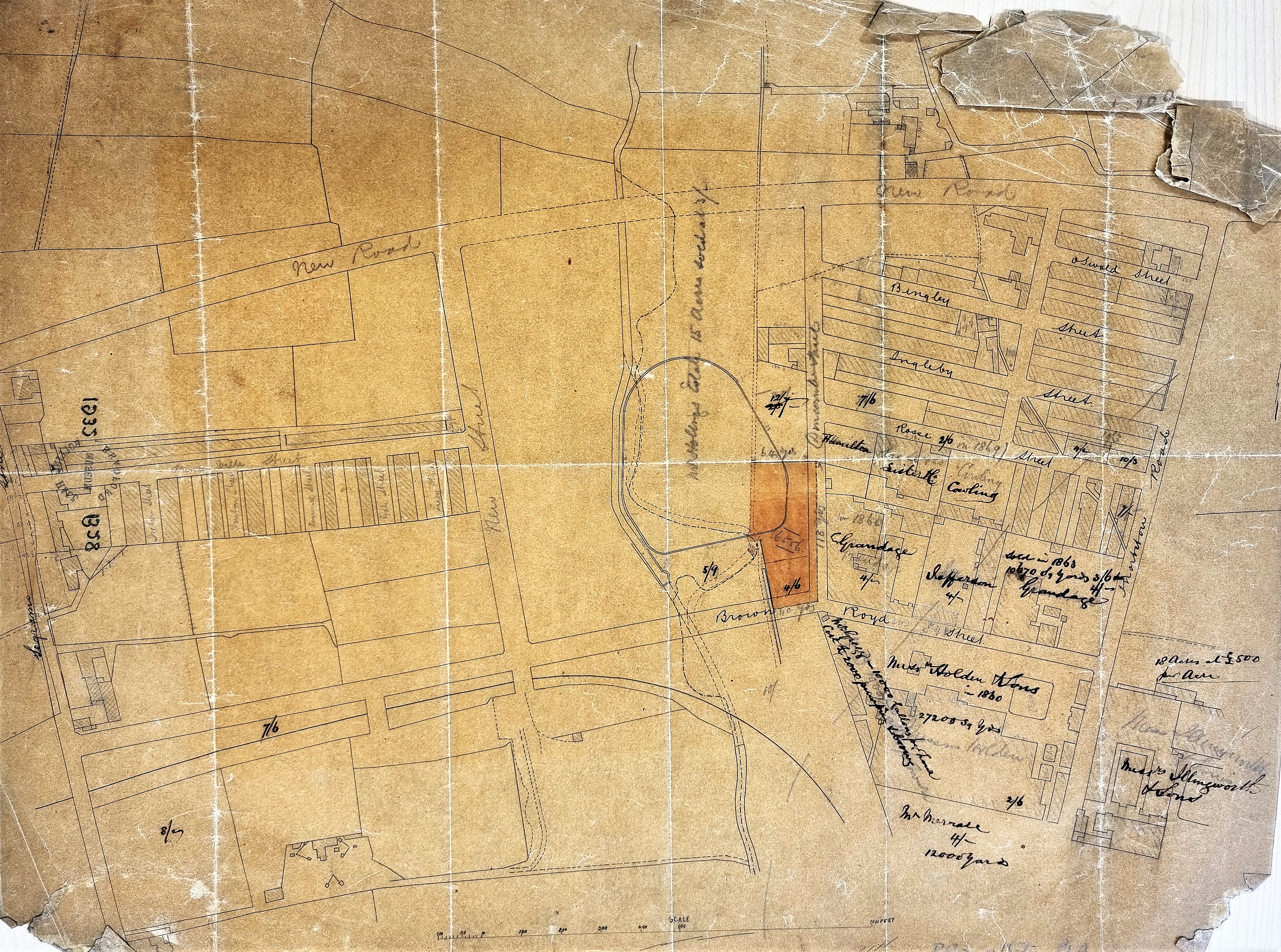
This map continues the story told in my previous addition to this series: ‘A freehold property in Horton, c.1860’. The present map catches a large area of Bradford in the process of being transformed from farmland into housing and industrial sites.
I cannot be completely sure we have an entire map since its condition is so poor. As usual the map is not dated and its original purpose is unclear. I imagine a block plan of the area was originally copied on to tracing paper which accounts for the fine ink lines. Over this copy comments both in pencil and ink were added later. Some of these comments are probably contemporary, but others quite definitely record historical information. The base map includes the track of the City Road Railway branch line, which led to the City Road goods station. This must indicate a date of around 1875 or even later. But if you look at the hand-written comments added you will see the names of some of the commercial landowners are together with dates from the 1860s.
The creation of new streets south of Thornton Road & mainly east of Brown Royd Street has evidently occurred. Some of these roadways are named but some are simply described as ‘new streets’. Among the owners or occupiers recorded are: Isaac Holden & Sons, Illingworths, and William Grandage & Co. All were of course textile related companies. William Grandage may be the least familiar name. He was a master dyer whose firm of piece dyers & finishers became part of the 20 or so companies that were to form the Bradford Dyers Association in 1898. I’m not even sure that the sale dates written on the map refer to these current occupiers. For example, over the space occupied by Grandage is the comment ‘sold in 1860 (or 1868)’, but in my notes I have recorded that ‘in 1873 a Mr Grandage, dyer, bought the Brown Royd dyeworks’.
Perhaps it is best not to be too concerned with such details but simply to use the map to examine the way in which there was development of the area in the period 1860-1880.
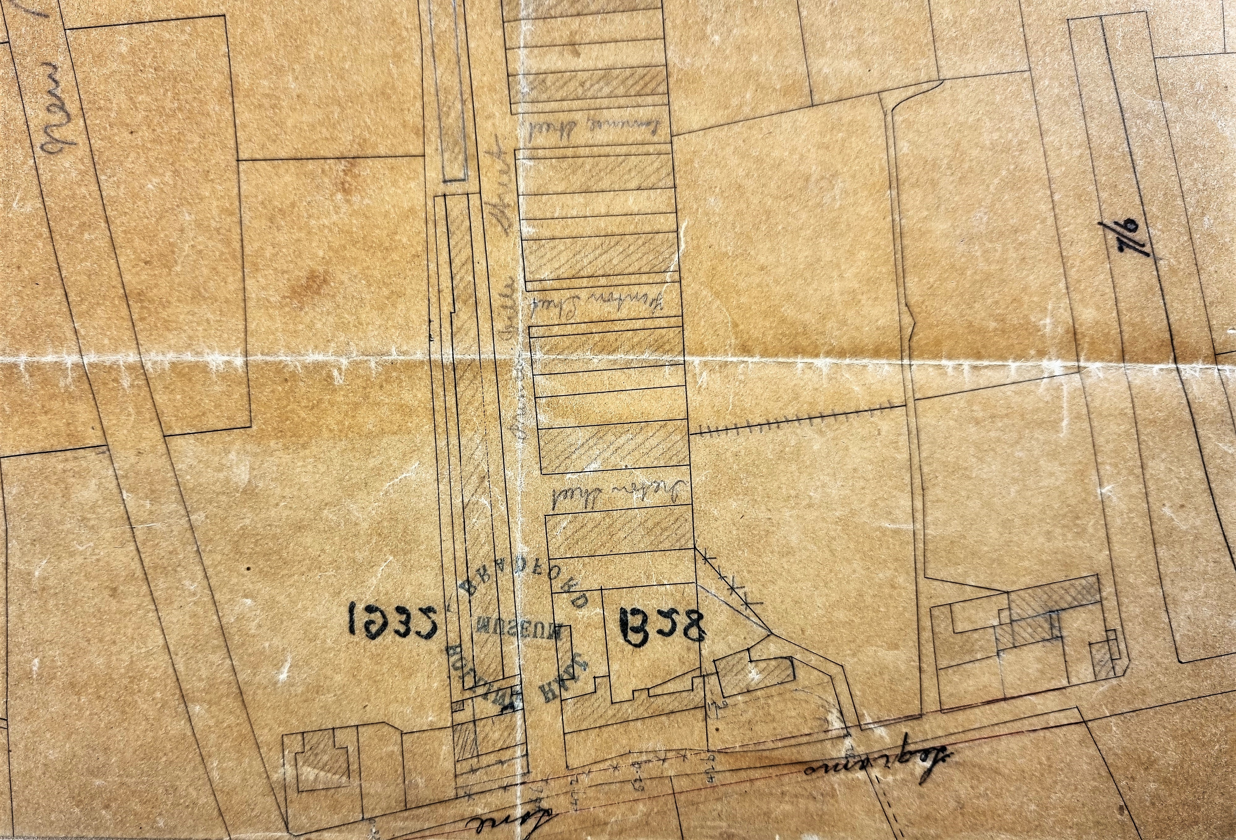
In the first detail Legrams Lane is running along the bottom. The farm buildings whose detailed plan comprised: ‘A freehold property in Horton, c.1860’ are in the bottom righthand corner. Running upwards to its right is Brown Royd Street, and beyond that the railway cutting and track. To the left of the farm buildings there is a track that ends blindly. This was the situation through much of the nineteenth century, but by the time of the Bradford 1912 map the track had evolved into Willowfield Street. Left of this is Princeville Street and if, in our imagination we walk up this road opening off it, to the right, are short terraces – Ireton Street, Fenton Street, Lawrence Street and others. Later these would all be lengthened when Willowfield Street was created. Returning to Brown Royd Street we can take an imaginary walk up this roadway using the second detail.
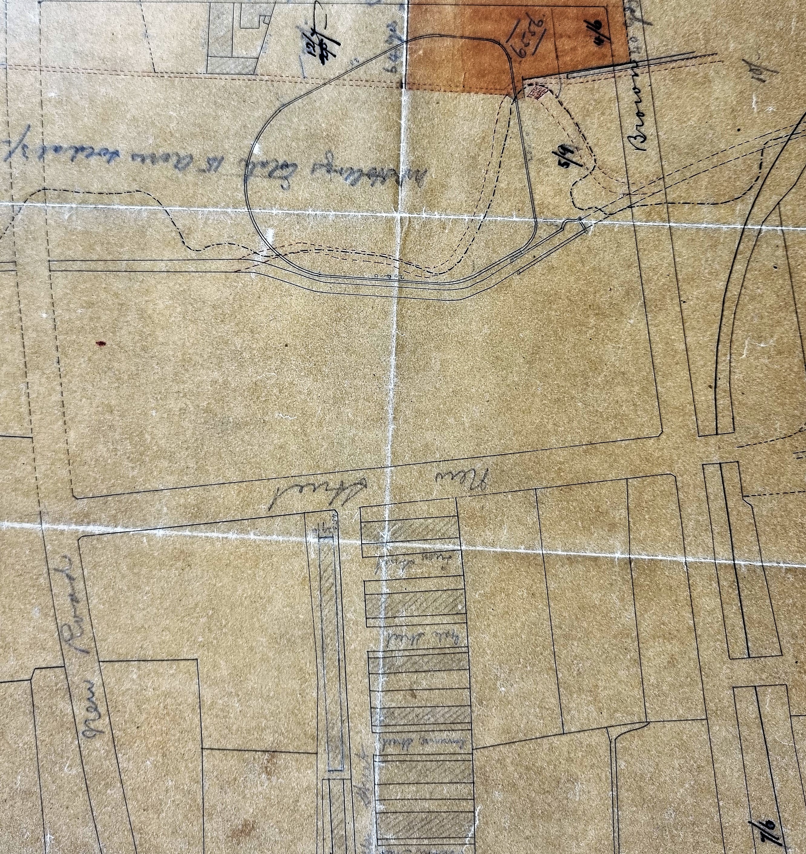
Again, at the extreme right is the railway track which bears away further to the right. The short terraces terminate in a ‘new road’ which will eventually be named, with no great display of imagination, Princeville Road. North of this is a blank space on which Alston Mills (Holden & Sons) would shortly be built, and beyond that a tributary of the Bradford Beck, and a sketch of the Brown Royd Reservoir (Bradford Corporation waterworks).
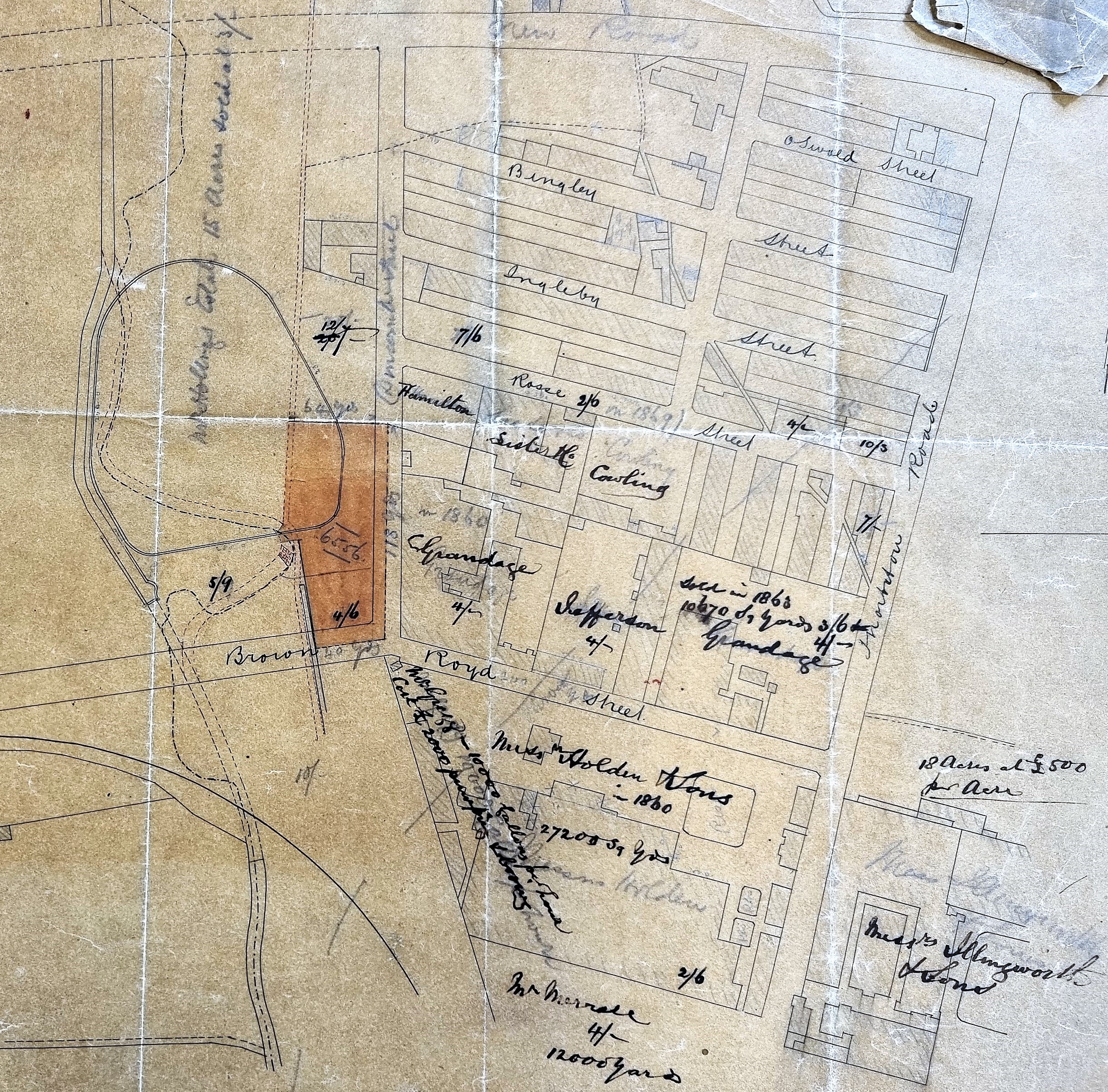
The final detail has been rotated 90° to the right to make the annotations easier to read. Brown Royd Street is now running roughly horizontally about two thirds of the way down the plan, ending in Thornton Road. Below the junction are Alston wool-combing Works (Holden & sons) and across Thornton Road at the same level the Whetley Worsted Mills of Daniel Illingworth & sons. Above Brown Royd Street, where the name Grandage appears, is the place where two of his dye works (Brown Royd and Low Royd) would be built. There are then a series of terraces: Rosse Street, Ingleby Street, and Bingley Street. Running across these diagonally is a narrow pair of lines. It is also present on the 1890 25” OS map and the 1912 Bradford map but I’m not yet sure what it represents. A footpath perhaps, but if so it does produce an odd appearance.
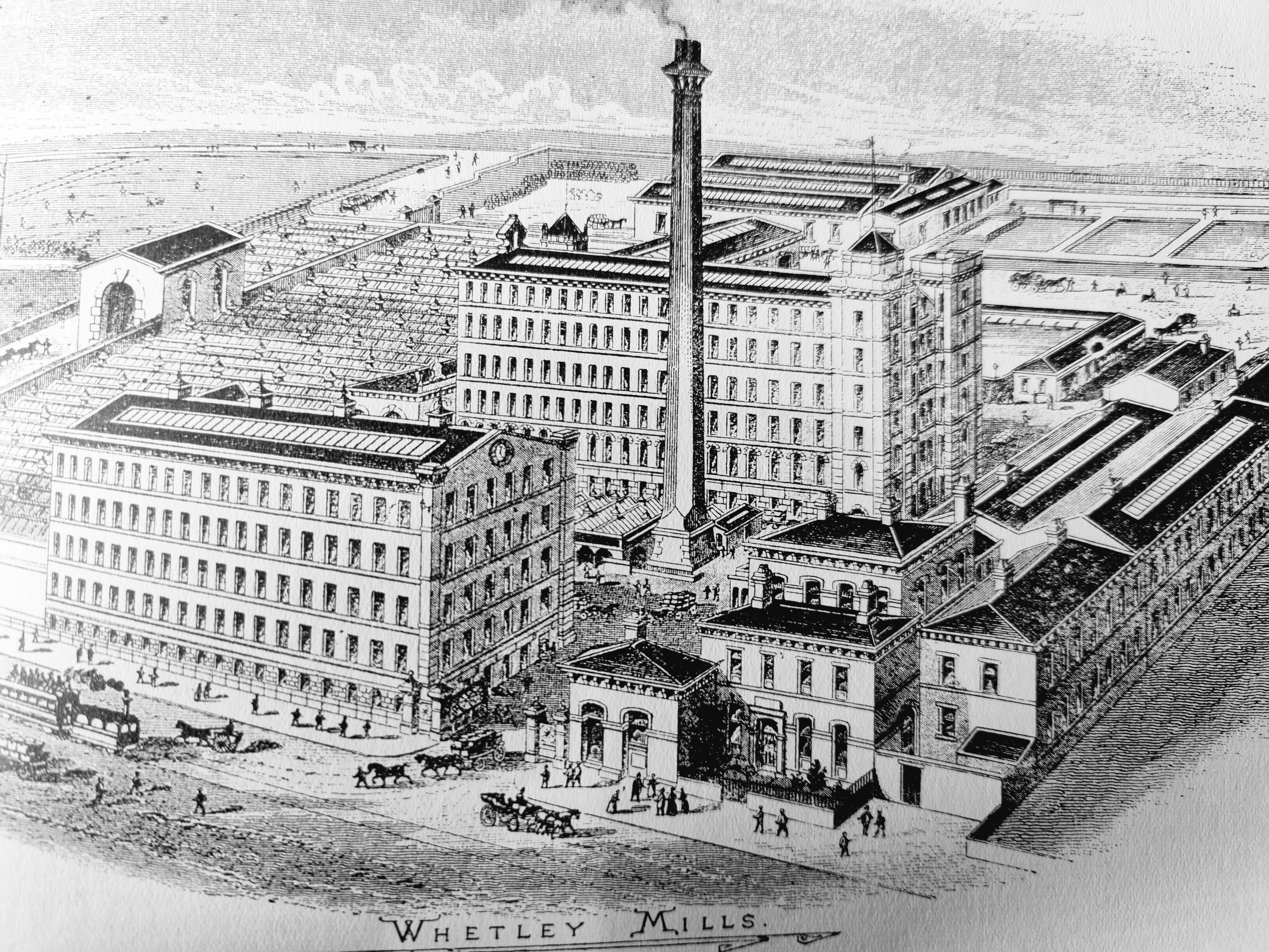
It is easy to find this area today on Google Earth but ‘the old order changeth’ and there has been wholesale demolition and further redevelopment. Rather than provide an image of wholesale destruction I shall finish with a dignified building: Whetley Mills in its prime. Note the steam tram!