X76 H HOR c.1860 PLA
Size: 19” * 24” Material: paper
Scale: 30’ to 1” Condition: good
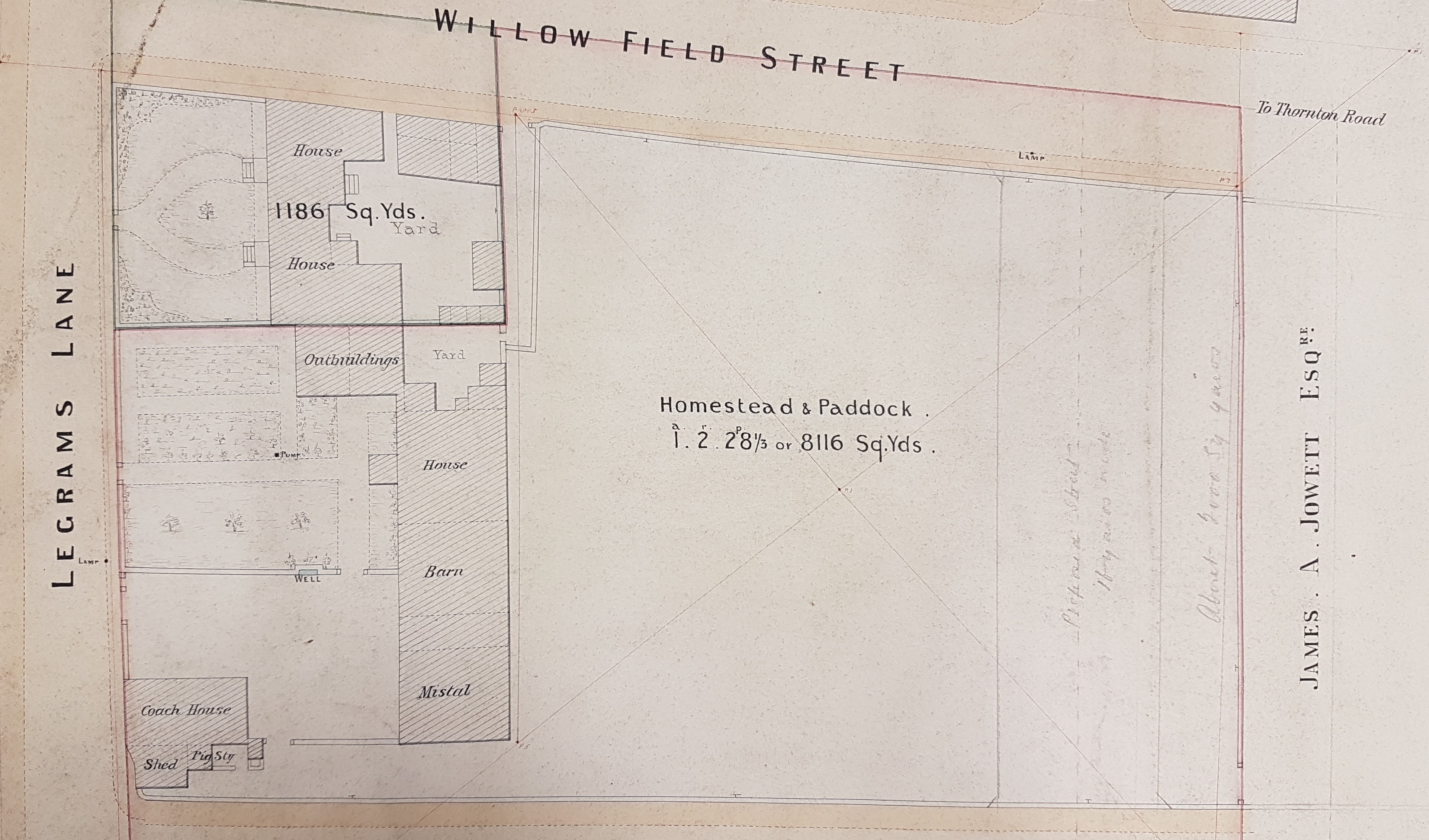
This item is an undated plan entitled ‘plan of a freehold property in Horton in the Borough of Bradford’. Identifying the exact location of this site is easier that usual since the roads retain their names to the present day, except that Royd Street is now called Brownroyd Street. If you walk up Shearbridge Road, past the university, and turn left at the top you are in Legrams Lane. You soon pass Legrams Mill and next you cross the long disused railway track of the City Road Railway branch line, which led to the City Road goods station. The last time I looked there was a huge fig tree growing on the embankment at that site, and I would dearly love to know how it got there since they are far from common in Bradford. Note the ‘Great Northern Railway’ as a landowner on our plan.
Immediately beyond the track bed, on the left, is (Brown) Royd Street. The plan essentially shows a quadrangular pattern formed, today, by Legrams Lane, Brownroyd, Street, Ireton Street and Willowfield Street. The same area shows very clearly in the Bradford maps of 1912 and 1887. The buildings looks rather similar too, although they are simply cross-hatched plans in the city maps. The board school on Willowfield Road is also in the same position on all three maps.
The index card that accompanies this plan gives it a date of c.1860, although there is no evidence of why so definite a date has been adopted. Perhaps my unknown predecessor had evidence unavailable to me. Nothing now remains describing the original cataloguing of the reserve maps when they were housed at Bowling Hall Museum. I have reviewed slightly earlier Bradford maps from the late 1840s and 1850s. In these Shearbridge Road is called ‘Cross Lane’ and there is of course no railway. There are buildings in approximately the same position as on this plan, together with a number of stone quarries along Legrams Lane.
This present plan shows a substantial home with a coach house, but which must surely have a connection with farming as it is associated with further accommodation, a pig sty, a barn, and a mistal (cattle shed). This buildings themselves must surely predate the 1850s if they do represent a farm, but the date given for the present plan may well be correct. I cannot find Willowfield Street in any trade directory of this period. The road does feature in the 1879 PO Directory, but with only three inhabitants: this rather suggests a recent development.
There is also a clue to the date of the plan from one of the nearby landowners. Connecting the ends of Royd Street and Willow Field Street, where shortly Ireton Street will exist, is the name James A Jowett Esq. This was James Atkinson-Jowett (1817-1886) of the Clockhouse Estate, Manningham. The Clockhouse name survives as one of the Bradford Boys’ Grammar School buildings. James Atkinson-Jowett was the son of Nathan Atkinson-Jowett. Both men changed their surname from plain Atkinson in the 1860s in order to claim the large Jowett property inheritance. So, a date for the plan in the period 1860-90 seems certain.