X71 ALL c.1840 LIS
Size: 17” * 25” Material: paper
Scale: 6 chains to 1”. Condition: good
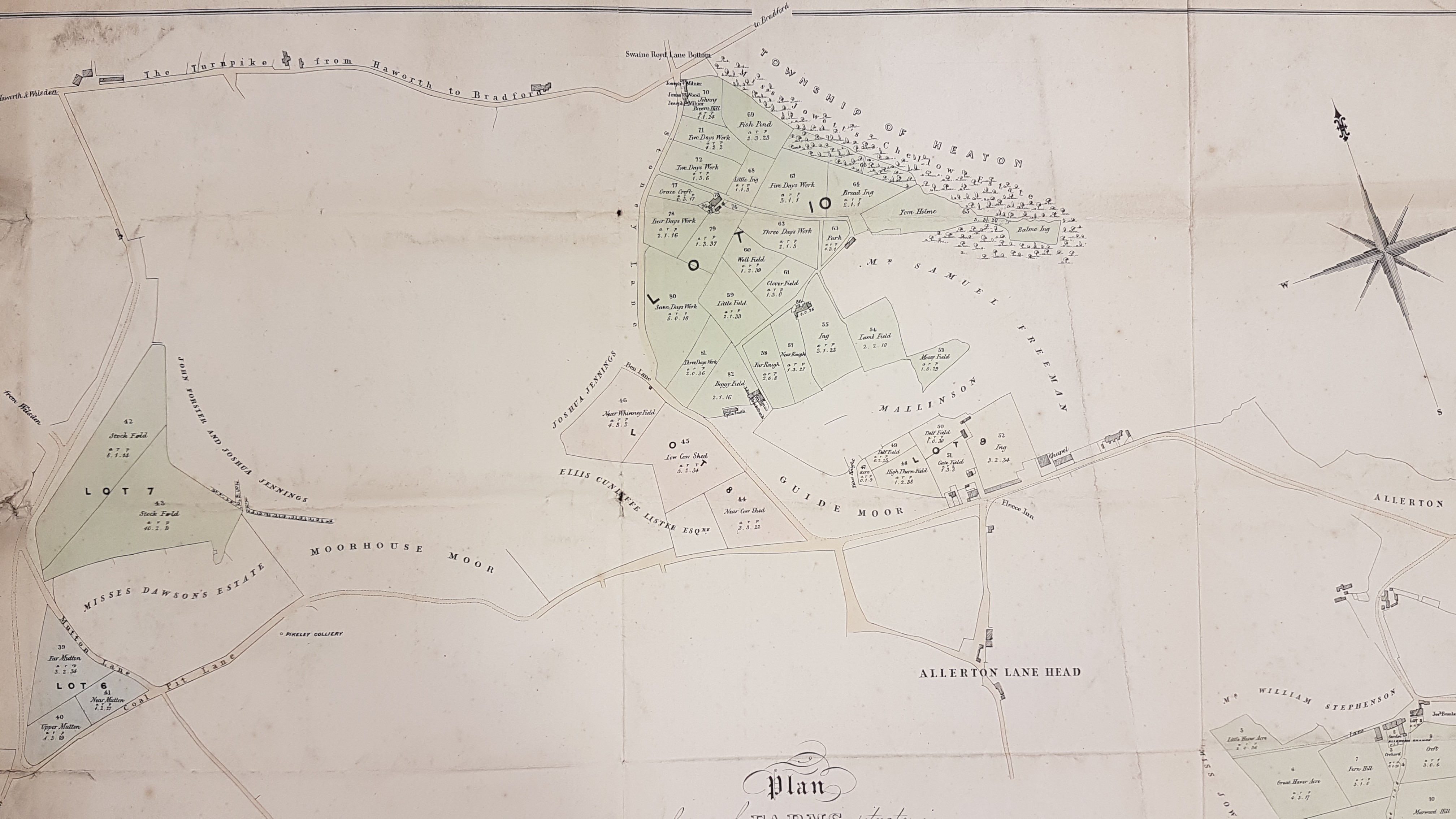
We have many Lister & Ingle surveyed maps in the reserve collection. I don’t know the exact dates of their partnership, but they flourished in the 1830s and 1840s. This example of their work is evidently a sale plan, but unfortunately undated. Stylistically it is of mid-nineteenth century. The overall appearance is not much different to the first Ordnance Survey map of the area, which would have been surveyed in 1847-48.
The estate portrayed is clearly quite widely distributed. Some of the land borders Thornton, some is close to the township of Heaton. The neighbouring landowners include: William Fairbank, Miss Jowett, the Misses Dawson, and Ellis Cunliffe Lister.
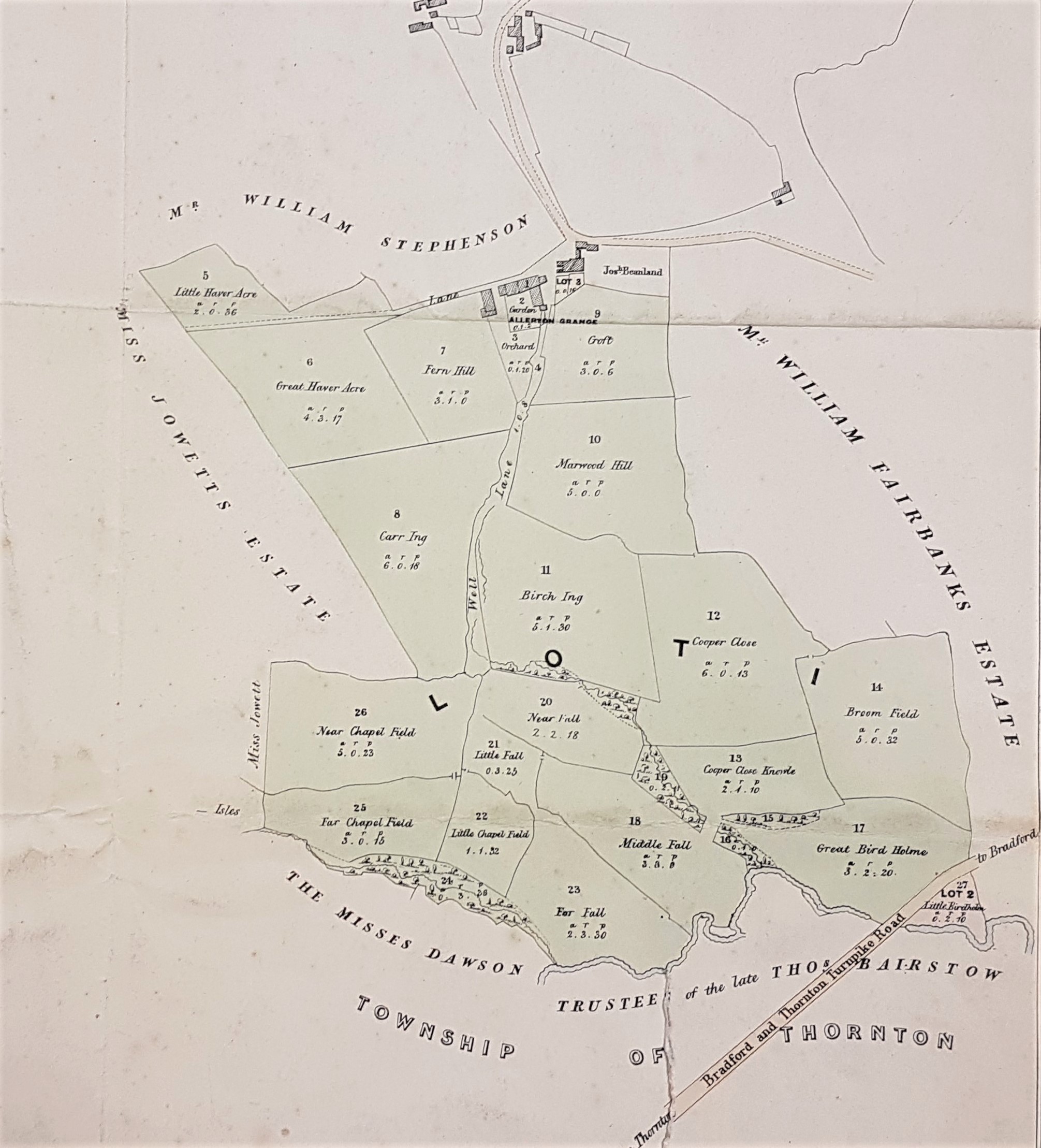
The first section of the estate is quite a long way along Thornton Road (Bradford & Thornton turnpike): note the position of Allerton Grange. William Fairbank, whose land is east of our plan was, together with his relatives, a coal master. He exploited coal under the city end of Thornton Road, but also here and along Squire Lane. His name still appears in directories from the 1850s. The land included on our plan would, in reality, have been the location of Crosley Grange Colliery and Allerton Grange Colliery. So, in real life the area would not have been as rural as may first appear. Today much of the area is covered by the Lower Grange Estate. Miss Sarah Jowett who died in 1840 was the owner of the Clockhouse Estate at Frizinghall. She was the last member of the original Jowett family and left the estate to George Baron whose name regularly features on Bradford maps. The year of Sarah’s death is good dating evidence for our plan. I assume that one of the Misses Dawson is Miss Eliza Dawson of Royds Hall (1814-1879), daughter of one of the Low Moor Iron Company partners. I know from other local maps in the Local Studies Library that she certainly owned land in this area.
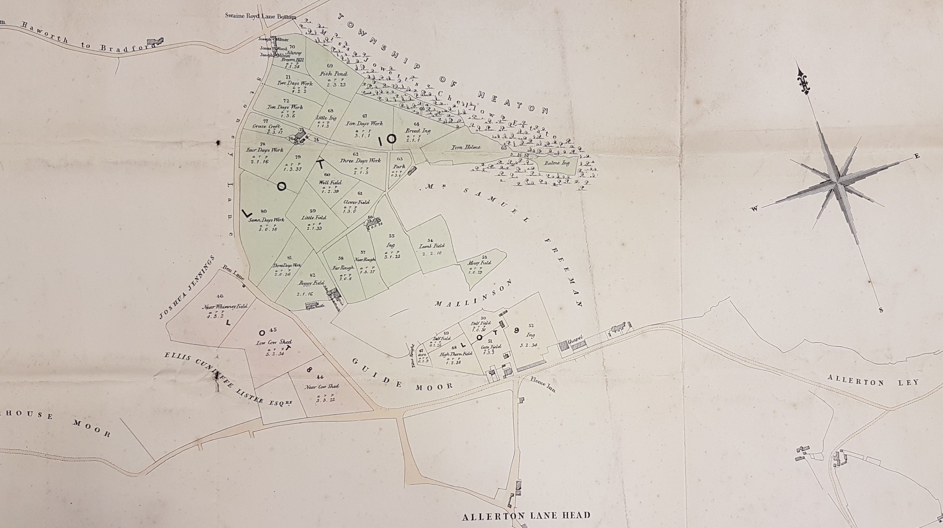
We have to move quite a long way north to find the second farm available for sale. The community which on this plan (and on the first OS map) is called Swaine Royd Lane Bottom is today known as Sandy Lane. The modern road south still follows the course of Stoney Lane on this plan, but the area is completely developed on the eastern side where the sale estate is located. The west side of modern Stony Lane is largely unchanged I would imagine. ‘Miss Jowett’s Chellow Estate’ which you can see just under the words ‘Township of Heaton’ became the Chellow Dene reservoirs. The upper reservoir was constructed for Bradford in 1844, after Sarah Jowett’s death.
Ellis Cunliffe Lister who also owns land in this area was the mill-building father of textile magnate Samuel Cunliffe Lister. Ellis lived at Manningham Hall (now the location of Lister Park) and died in 1853.
