X53 BUR c.1848 GRE
Size: 28 * 55” Material: Paper
Date: unk Scale: unk
Condition: Good
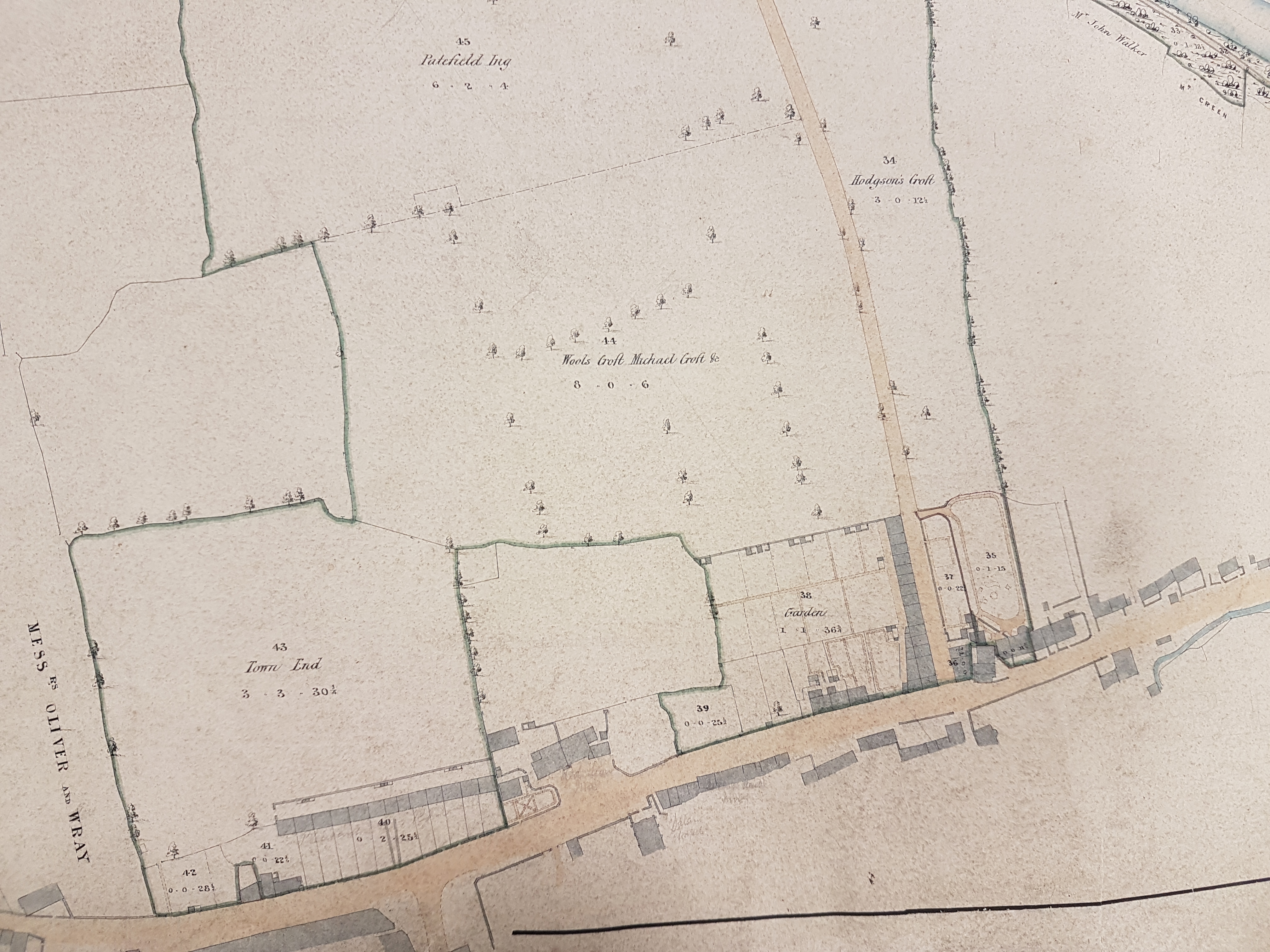
Recently I posted a plan of ‘an estate situate in the parish of Ilkley…and Burley’. This evidently belonged to a Mrs Marianne Layton and was being sold off after her death, around the year 1845. The Greenholme estate, surveyed in this plan, was almost immediately east of Mrs Layton’s property. The index card that accompanies the plan is annotated with a reference to BUR 1848 LIS. Although I can’t find this at present the presence of this reference suggests that my unknown predecessor in the 1960s found parallels with another plan of Burley, probably drawn up by Lister & Ingle, in the mid-nineteenth century.
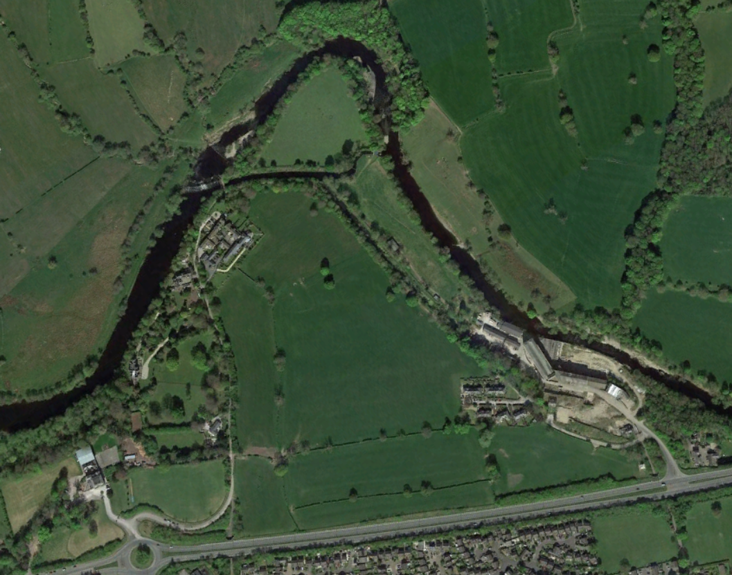
It is a simple matter to locate the position indicated on this plan since the topography is so similar to the first Ordnance Survey map of the area which was published in 1851 (but surveyed 1847-48), or indeed a modern Google Earth capture.
Our plan is very large and the photographs that I put on-line consequently show more detail than the OS map itself. For example the OS maps do not provide estate field names which ours does. Very helpfully the Burley Community Library has done all the research necessary on this site which they have very helpfully put on-line. Do please take the time to familiarise yourself with their detailed work. See:
Greenholme, Burley in Wharfedale (weebly.com)
In synopsis a water powered cotton mill (Green Holme Old Mill) was built by four partners around 1790, together with a timber weir in the River Wharfe, embankments and a goit (leat). Other suitable mill sites on the Wharfe had already been occupied. The weir (by now rebuilt in stone) and the original goit are clearly visible on our plan. You will also be able to see a newer, longer, goit supplying water to the New Mills – constructed around 1811 and seemingly once England’s largest water-powered mill. The New Mills are also present on the first OS map, which identifies that they were also initially devoted to cotton spinning. The overall arrangements had not changed much by the time of the 1895 edition of the OS map except that the New Mills were now producing worsted. The Burley Community Library states that this change occurred in the early 1850s, directed by Wm Fisons & Co., but since the functions of the mills are not given in our plan this information is not definitively helpful in its dating. It is tempting to speculate that the plan was drawn up at the time Fisons acquired the estate.
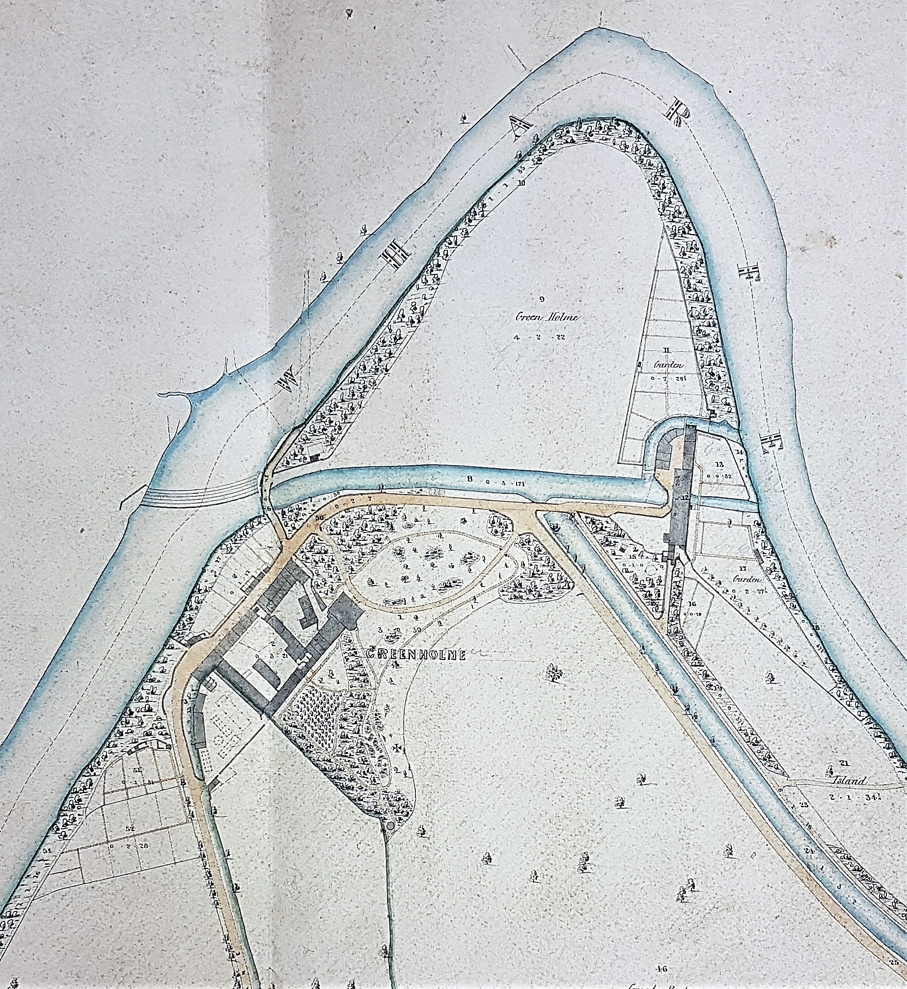
Greenholme itself (now demolished), which here in plan looks rather like a Roman villa, is described as a grand Palladian mansion. It was constructed in 1819-20 for Jonas Whitaker, one of the original mill partners. Later it was lived in by William Fison.
I believe that the New Mills have recently been converted into apartments.