X49 BRA c.1850 DIX
Size: 18” * 28”
Material: paper Date: unk
Scale: 31/3 yards = 1” Condition: good
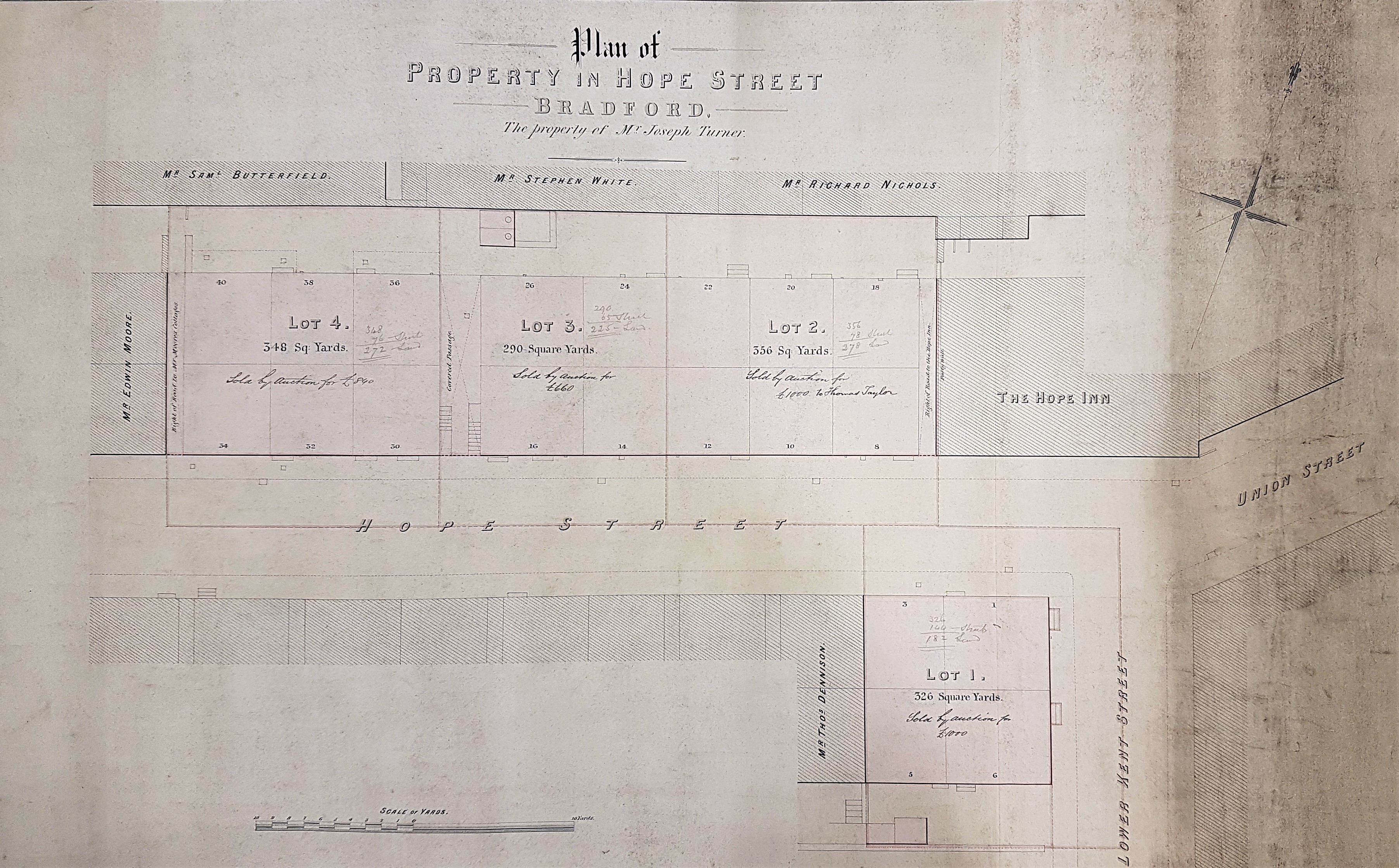
The full title of this plan is ‘Dixon & Hart: Plan of property in Hope Street (the property of Joseph Turner)’. It looks like a short terrace of back to back houses were being envisaged, immediately west of the Hope Inn. I admit that on the face of it the plan doesn’t seem to be very exciting, although the number of property owners’ names might facilitate some identifications in contemporary census reports. But, as will be seen, the plan has hidden depths.
The first step is evidently to establish the location of Hope Street. The 1853 street directory of Bradford indicates that Hope Street is off Manchester Road. The first Ordnance Survey map of approximately the same date puts it near to the centre of the city, with Manchester Road itself running north-south just off the left of our plan and Union Street to the right. The OS map also confirms that the terrace was actually built, and was not just a developer’s pipe dream.
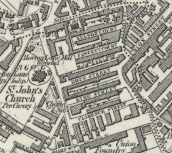
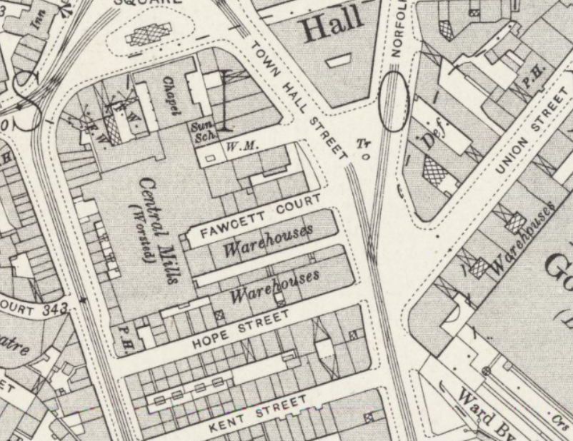
But it was only a transient development perhaps: by the time of the 1890 OS map the housing, and the Hope Inn, were replaced by warehouses, with the Central Worsted Mill placed immediately to the north. Did we lose anything of value with the demolition of the terrace? Perhaps in the case of the Hope Street back to backs the answer is not much. It would appear that 16 houses were planned and the central covered way, a few steps lower than street level, gave access to only two privies for them. Rather a niggardly provision for that number of households.
Who lived in Hope Street in the mid-nineteenth century? It features in both the 1850 Ibbotson’s and the 1856 Lund’s Directories. Neither identify a Hope Inn by that name, but in 1856 there is a John Pickard at 2 Hope Street who is a beer retailer. His house number would seem to fit with the inn location. In 1850 Joseph Pollard, a boot and shoe maker, lived at number 6 and James Forrest, butcher, at number 12. No all the trades of occupants are recorded but there is also a leather cutter, and Graham Thomas, a brazier and tinplate worker, who lived at 29. Joseph Beetham, the clerk of nearby St John’s Church also lived in Hope Street, at number 70. It is obvious that none of these house numbers feature in our plan and, in the limited time available I can’t find any of the occupants identified in the directories making returns in the 1851 census. Perhaps having moved to Hope Street you hoped to get out as soon as possible.
But where would Hope Street be located now? Readers might care to follow my reasoning process. Hope Street must have run across Jacobs Well (now a car park since the demolition of the office building). A parallel road to Hope Street placed just off the bottom of our map is Kent Street. Remarkably this road has survived the vicissitudes of the 19th and 20th centuries until the present day, with the Jacobs Well Pub (1830) being its last surviving building. This is all well displayed by the attached Google Earth capture. This is an invaluable application for map enthusiasts.
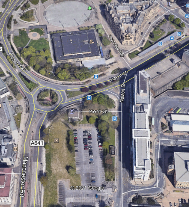
This, rather awkwardly, puts Hope Street (immediately north of Kent Street) in the middle of a modern main road (Hall Ings) somewhere near the Jacobs Well roundabout, which I cross every time I visit the Local Studies Library. Since you cross below street level I can imagine the descent of those steps to get to the Hope Street privies.
The customary Bradford way is to demolish historic buildings, with the best of intentions, and then replace them at least twice until no particle of the original could possibly remain to the present day: ‘Lo, all our pomp of yesterday, is one with Nineveh and Tyre!’
Addendum
It is not unusual for readers to request more information about the maps included in this series. On this occasion Bradford-born archaeologist, Dr Jane Wheeler, encouraged me to look a little further for information in the large collection of photographed reserve collection maps I have accumulated. The first detail is from a map of Bradford dated 1825. Manchester Road was known as Bowling Lane at that time.
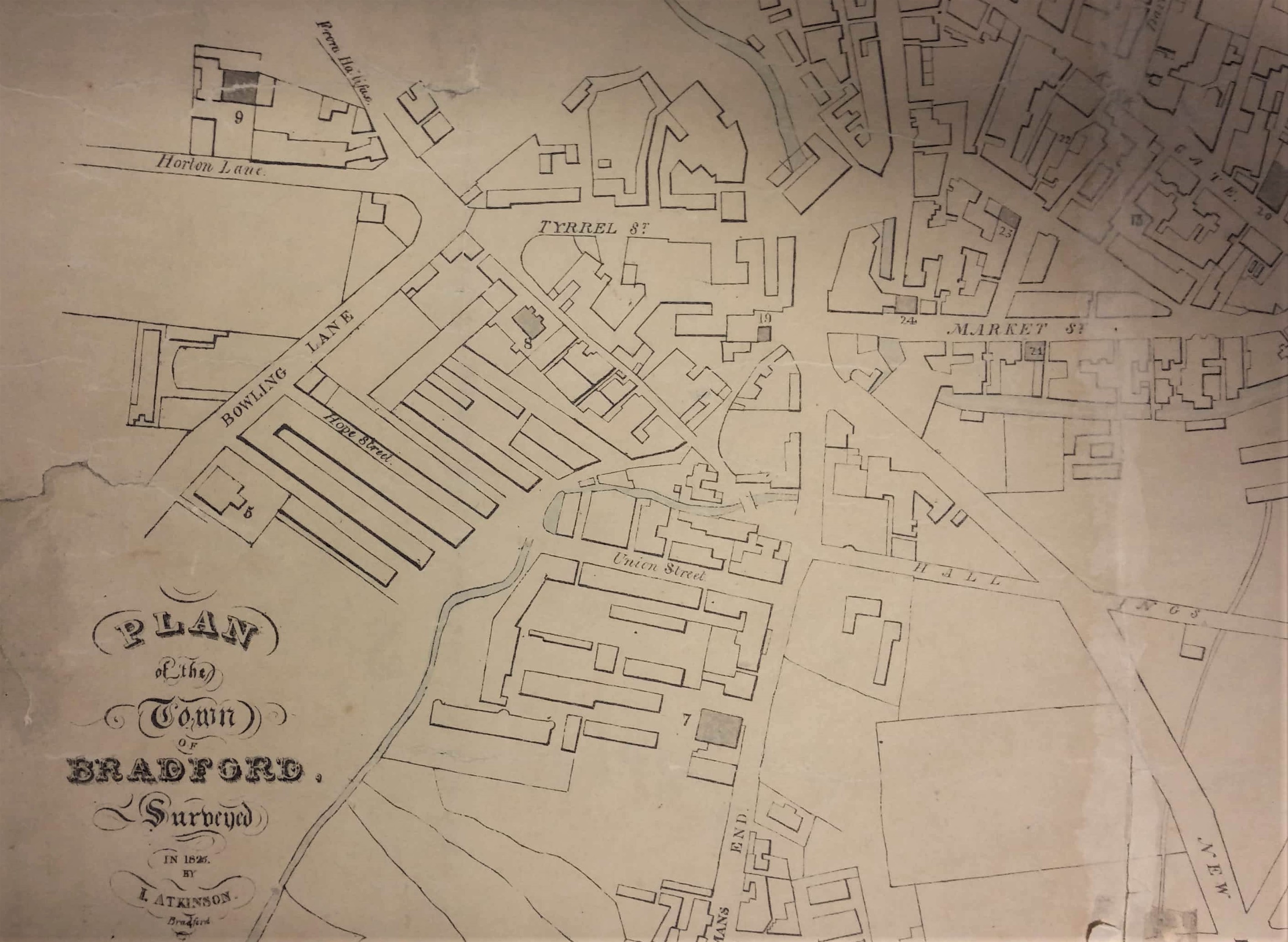
You can see that Hope Street existed as early as that date, in very much the same shape as in the OS map of a quarter of a century later. Possibly the plan with which I embarked on this investigation is a good deal earlier than I initially supposed.
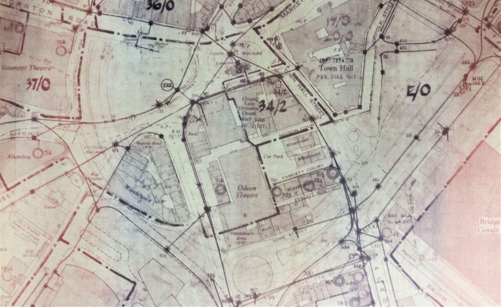
The second plan is from 1957. The LSL has a collection of plans drawn up when Bradford’s road system was being radically reorganised. You can just make out a shadowy Hope Street which confirms the position which I proposed. Please note that the Odeon Theatre just above it is not the present Odeon. This latter building is included on the plan but was then called the Gaumont Theatre.