X48 SHE c.1850 SMI
Size: 18” * 26” Material: paper
Condition: good
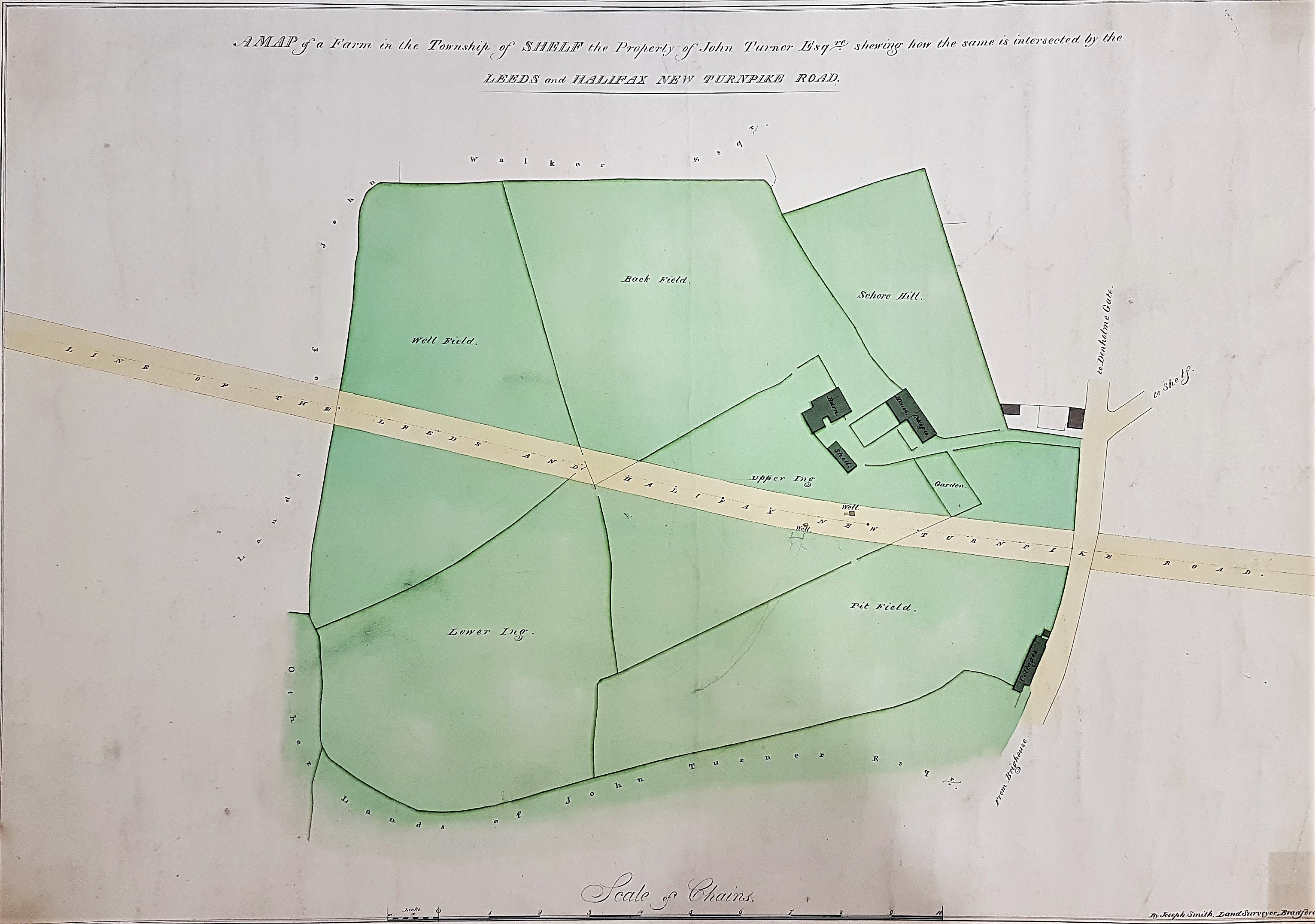
The full title of this item is ‘map of a farm in the township of Shelf, the property of John Turner’. The surveyor of this map was land agent Joseph Smith (1800-1858), father of George Belk Smith (1827-1902). Both men were living together in Little Horton Lane at the time of the 1851 census. We have other Joseph Smith maps in the Bradford Local Studies Library reserve collection, which have been dated to the period 1825-1855. I assume that the son was the ‘Smith’ in the 19th century surveying partnerships of Smith & Ingle and Smith & Gotthardt, but this identification is not relevant here.
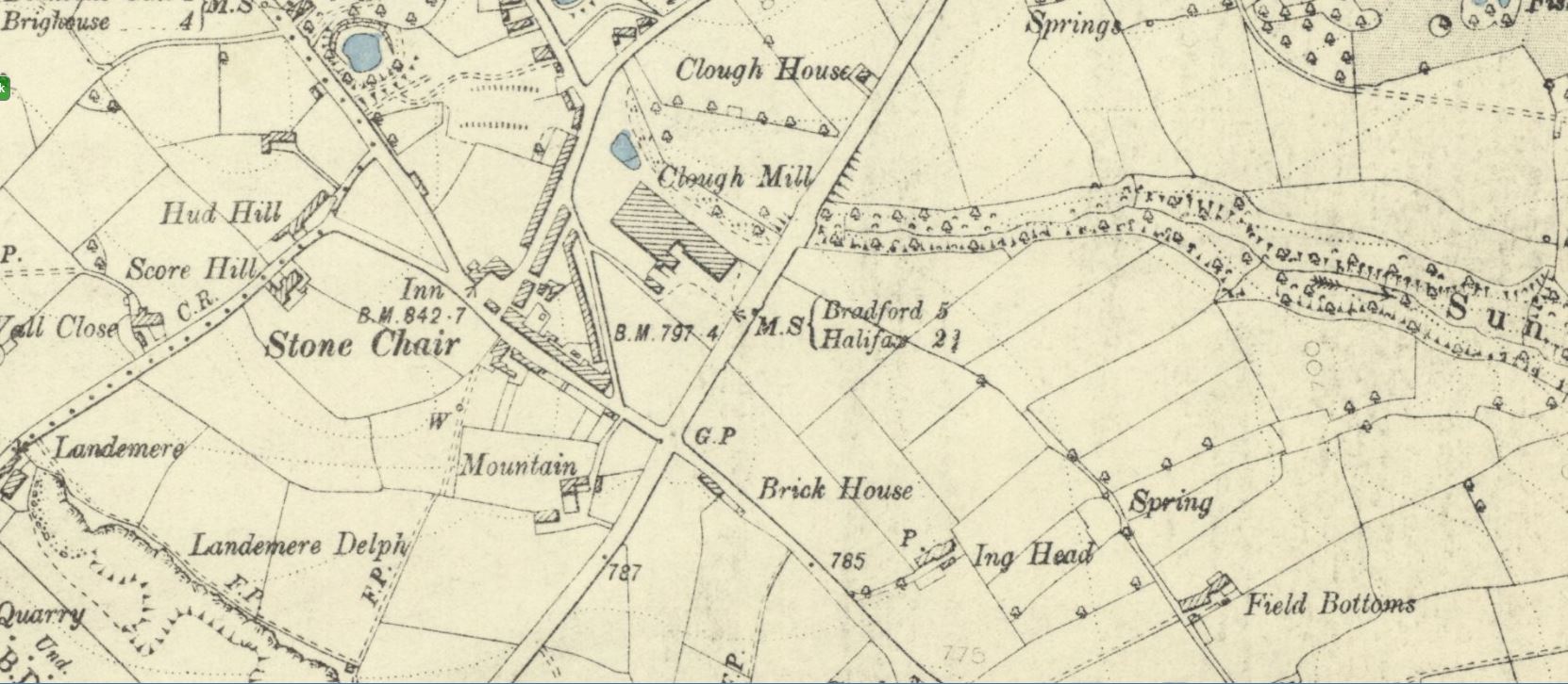
The intersection shown on this plan is with the Brighouse and Denholme Gate turnpike which fixes the location of the farm that is drawn. Unfortunately the National Library of Scotland, that treasury of on-line Ordnance Survey maps, cannot provide an example of the first OS map of the area (c.1850). By the time of the 1890s OS map the farm in question is marked as ‘Mountain’ and is south of Shelf itself.
The farm property mapped is evidently crossed by the ‘New’ Leeds & Halifax turnpike. Famous Bradford attorney Samuel Hailstone, and later his historical document collecting son Edward, were clerks to the trustees of Leeds & Halifax turnpike. I assume that, like most turnpikes, it was an 18th century creation, but the map suggests a change of route during the first half of the 19th century. Such changes might have been adopted to shorten the route, or to reduce its gradient. Looking at press advertisements Samuel Hailstone was requested to arrange a meeting to ‘repair and improve’ the turnpike in 1840, but in 1843 the trustees were leasing toll booths at Shelf and Stone Chair, and a straight line between these points would not cross John Turner’s farm. To establish the original course of the turnpike and the ‘new’ course needs more work. The property owner is given as John Turner which is too common a name for me to identify unambiguously, since I don’t know this area and its history. Can any reader help with either question?
I have become quite interested in field names, several of which are included on the plan. Pit field is likely to relate to coal exploitation, and various ‘coal pit closes’ are common in the Bradford area. Back field is self-explanatory. An ‘ing’ was marshy or swampy ground, which once must have been the state of Hall Ings in the city of Bradford itself. There is no problem dividing up a large field into upper and lower halves. Well Field must refer to water, but is more probably the position of a natural spring rather than a dug shaft. Schore Hill defeats me: could it be another variant of ‘shay’ or ‘shaw’ meaning a copse of trees? As ‘Score Hill’ it survives in a different location, northwest of the farm buildings, in the 1890 OS map.
