X43 MAN c.1845 WRI
Size: 15” * 42” Material: Paper
Date: unk Scale: 30’ to 1”
Condition: Good
Any reader with the most superficial interest in these reserve maps and plans of Bradford will soon appreciate how many of them relate to Rev Godfrey Wright, and his extensive estates in the city.
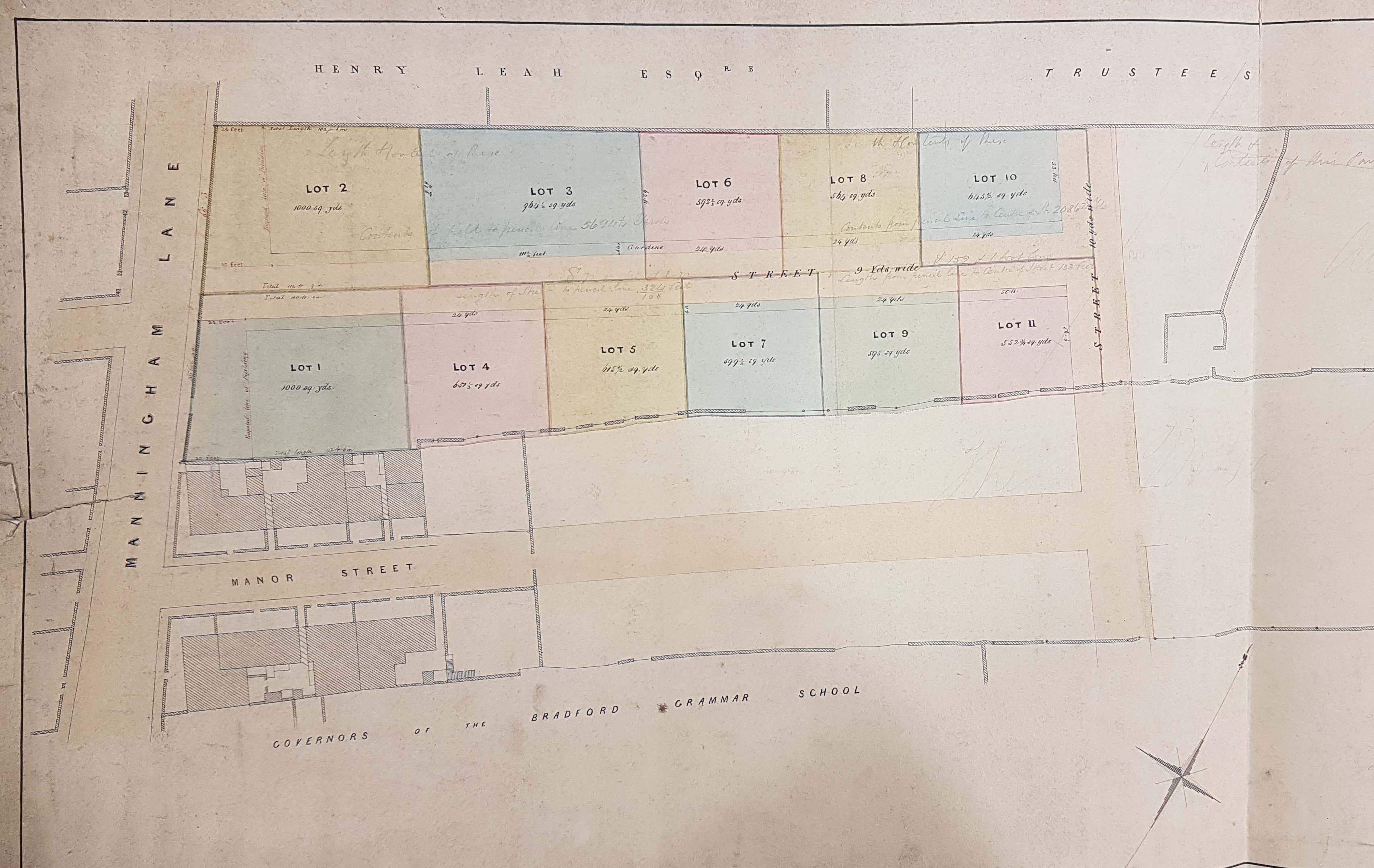
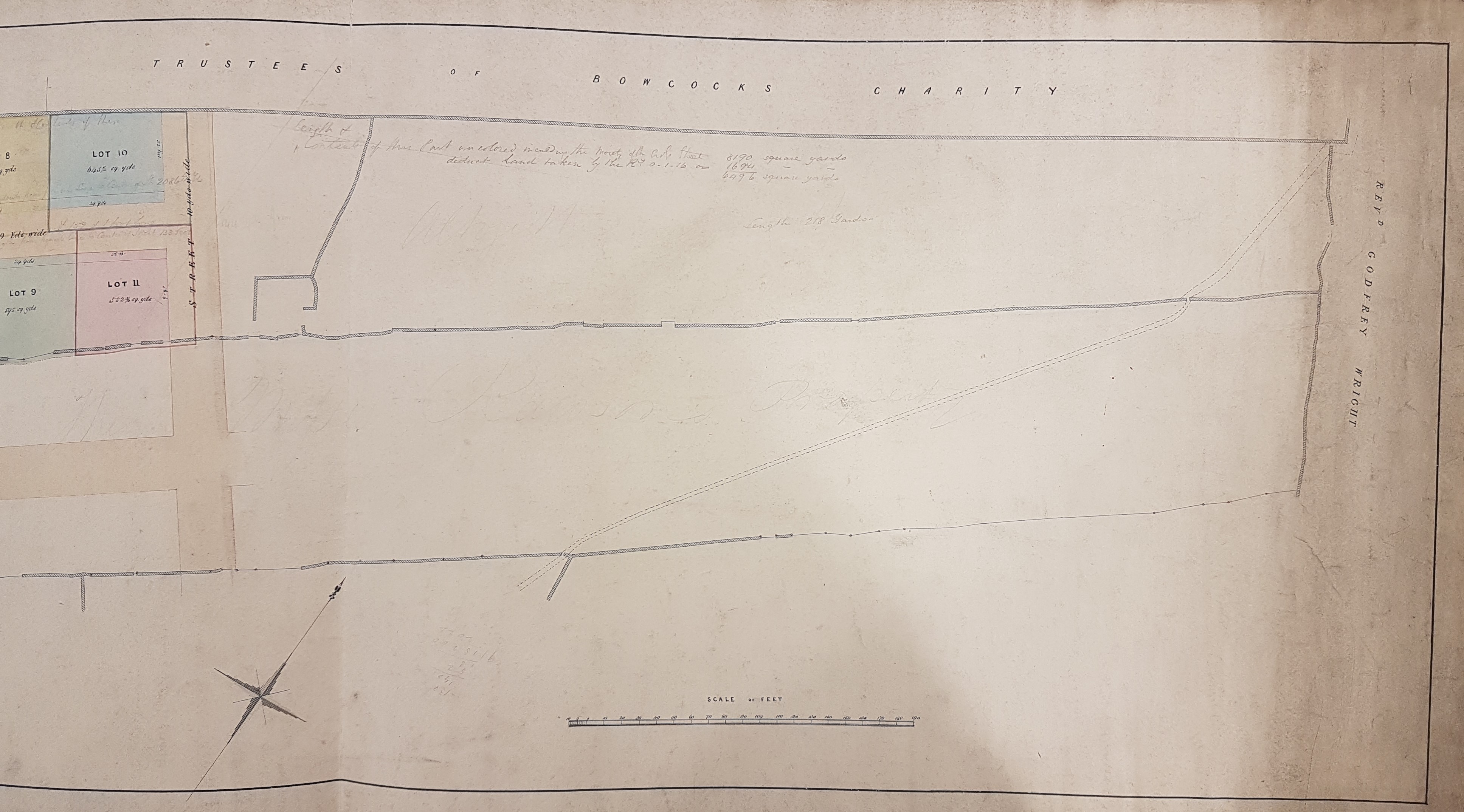
This plan falls conveniently into two halves. The western portion is very professionally drawn, and there is little doubt that it would have been prepared for a land auction. The eastern half displays a portion of the estate which is not for sale but is also owned by Godfrey Wright. It is presumably agricultural land which slopes down towards the Bradford Beck and the Bradford-Shipley railway track.
We have the usual problems of where are we, and when are we? There is no difficulty identifying the location of this map, but the creation of Hamm Strasse has swept every vestige of its Victorian appearance away. To place yourself walk up the right-hand side of Manor Row, which you can do in reality or using the invaluable Google Earth ‘street view’. Towards the top you will pass the old Salem Chapel and the entrance to Salem Street, then a building with a distinguished portico and finally Grammar School Street with a large car park immediately beyond it.
In the 19th century the car park was the site of Bradford (Boys) Grammar School which was followed by Manor Street, now obliterated by the new road. This links us to the map which at the bottom clearly shows the land belonging to ‘the governors of the Bradford Grammar School’ and the short Manor Street. If we continue across to Manningham Lane (and taking care of the traffic) on the right we pass the land that was to be auctioned and then the site once occupied by the Theatre Royal, which on our map is still owned by Henry Leah. Then there is then Snowden Street and Trafalgar Street. With Trafalgar Street we have finally reached a road that is present both today and in the 19th century.
What date is the map? The Henry Leah who is mentioned must be the wealthy iron-master of Bierley Iron Works, who at the time of the 1841 census lived in North Bierley. Nearby Hallfield House and its attendant cottages are on the 1852 OS map. It is called a ‘Mansion House’ when it and the cottages are advertised for sale in the Bradford Observer in 1856 and again in 1865. It is there described as ‘the late residence of Henry Leah’. It survived to become a Christian Science Reading Room.
Returning to our map, if Henty Leah is the same man who is buried in Bierley Church then he died in 1846. The appearance of this area soon after his death (in the 1849 Bradford map for example) look much the same as on our plan: so the early 1840s might be an approximate date for it. It could hardly be as late as the 1860s since Godfrey Wight died in 1862 and the Theatre Royal opened (although under a different name) in 1864.
The Ryburn map of Bradford (1871) suggests that only Lots 1 & 2 of our plan have actually been built on by that date and not much more development had occurred by 1876.
