X31 THO c.1830 PLA
Size: 20”*25” Material: Paper
Date: unk Scale: 6 chains to 1”
Condition: good
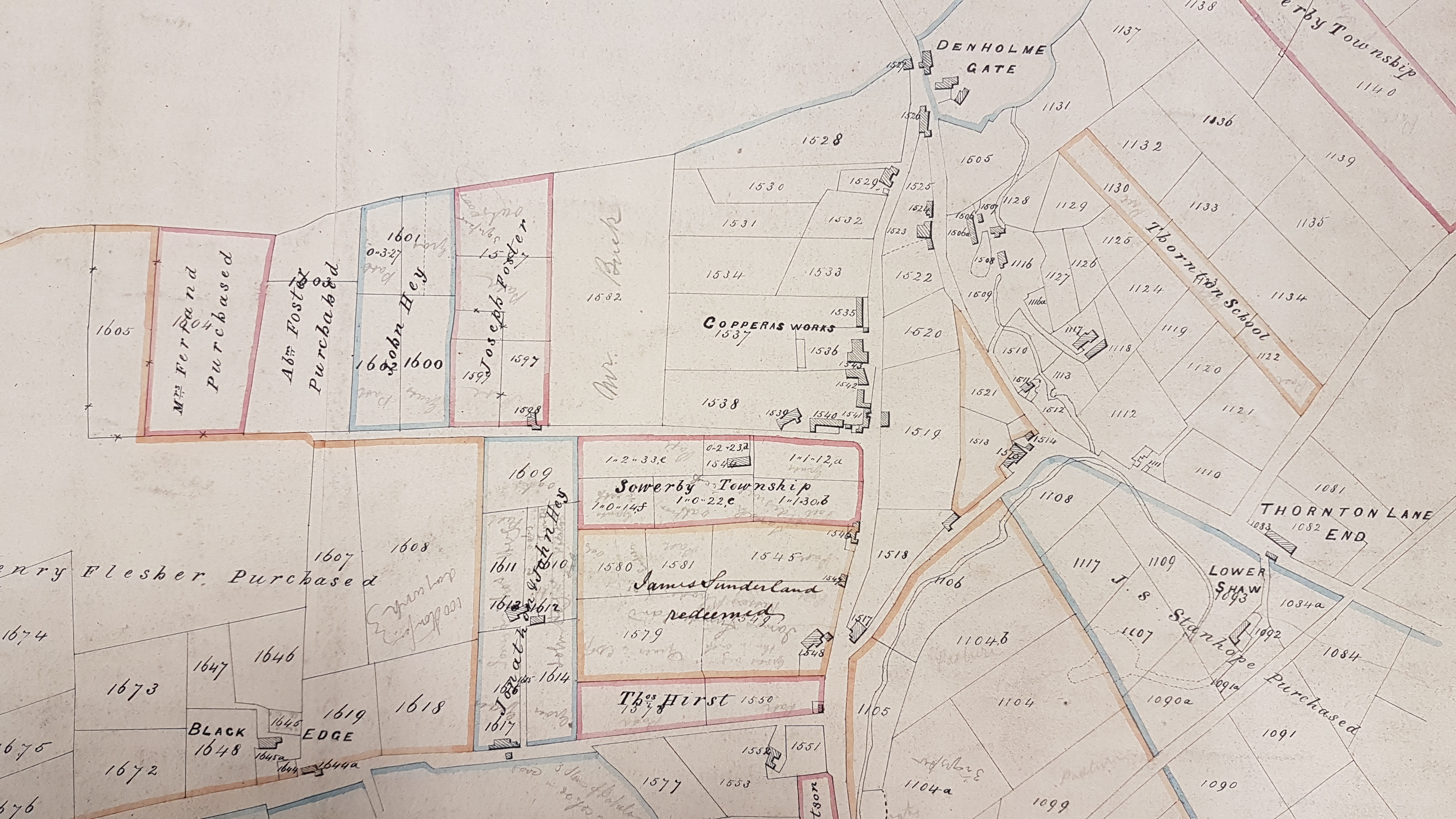
This temporary file card calls this map a ‘plan of new lands at Thornton’. An earlier map in this series dealt with the boundary between Thornton and Ovenden; on this occasion it’s the division between Thornton and Denholme Gate that matters, since it is Denholme Gate and the end of Thornton Lane has been surveyed, in considerable detail. The map would certainly be helpful to family historians researching the area. What constitutes a ‘new’ land: is this an enclosure map?
As so often the map is undated. It certainly seems to be earlier than the first OS map of the area, but the differences are not huge. The OS map is actually a better guide to the functions of the various buildings included. The principle feature absent here is the Denholme Brewery, which features on the OS map just north of the Copperas Works. Does anyone know when the brewery was erected? I can’t find it mentioned in the press, under this name at any rate until 1896, which is far too late. But its noted proprietor, Jonathan Knowles, wholesale brewer, starts to appear in local newspaper accounts in the 1830s. He contributed money to the building of St Paul’s Church in 1846. The fact that his name does not feature on the map would seem to push its date back to around 1830. The area known as Foreside is mentioned in the Leeds Mercury in 1822. The Brighouse & Denholme Gate Turnpike Road was certainly in existence by the mid-1820s.
The three major landowners mentioned here are Henry Flesher, Captain Reece and J S Stanhope, who I assume is John Spencer Stanhope of Cannon Hall near Barnsley. Unfortunately my usual recourse on these occasions, William Cudworth, doesn’t mention them in his interesting account of Denholme in Round About Bradford. So, without more information, at present I cannot make firmer identifications.
But I do know about Copperas, and the works. Copperas is a compound of iron, once known as green vitriol or ferrous sulphate. Copperas can be produced by the oxidation of iron (II) disulphide (pyrite, FeS2), also known as iron pyrites, brass lumps, or fool’s gold. When copperas is heated it decomposes, one product being sulphur trioxide which, when dissolved in water, produces the important industrial chemical sulphuric acid. Copperas making was carried on in Denholme during much of the nineteenth century, but the industry seems to have been forgotten almost as soon as it ceased. Pyrite is present in the Hard Bed coal seam which run through Denholme and extends beyond Halifax in the direction of Huddersfield. Coal containing pyrite has a brassy appearance and was considered inferior as fuel, so the copperas trade provided a potential side-line for some colliery owners. In the period of this map the works were associated with a family called Horsfall.