
X26 KEI c.1820 PLA
Plan of the town of Keighley with its environs (early 19th century)
Size: 28” * 30”
Material: Paper
Date: unk Scale: unk
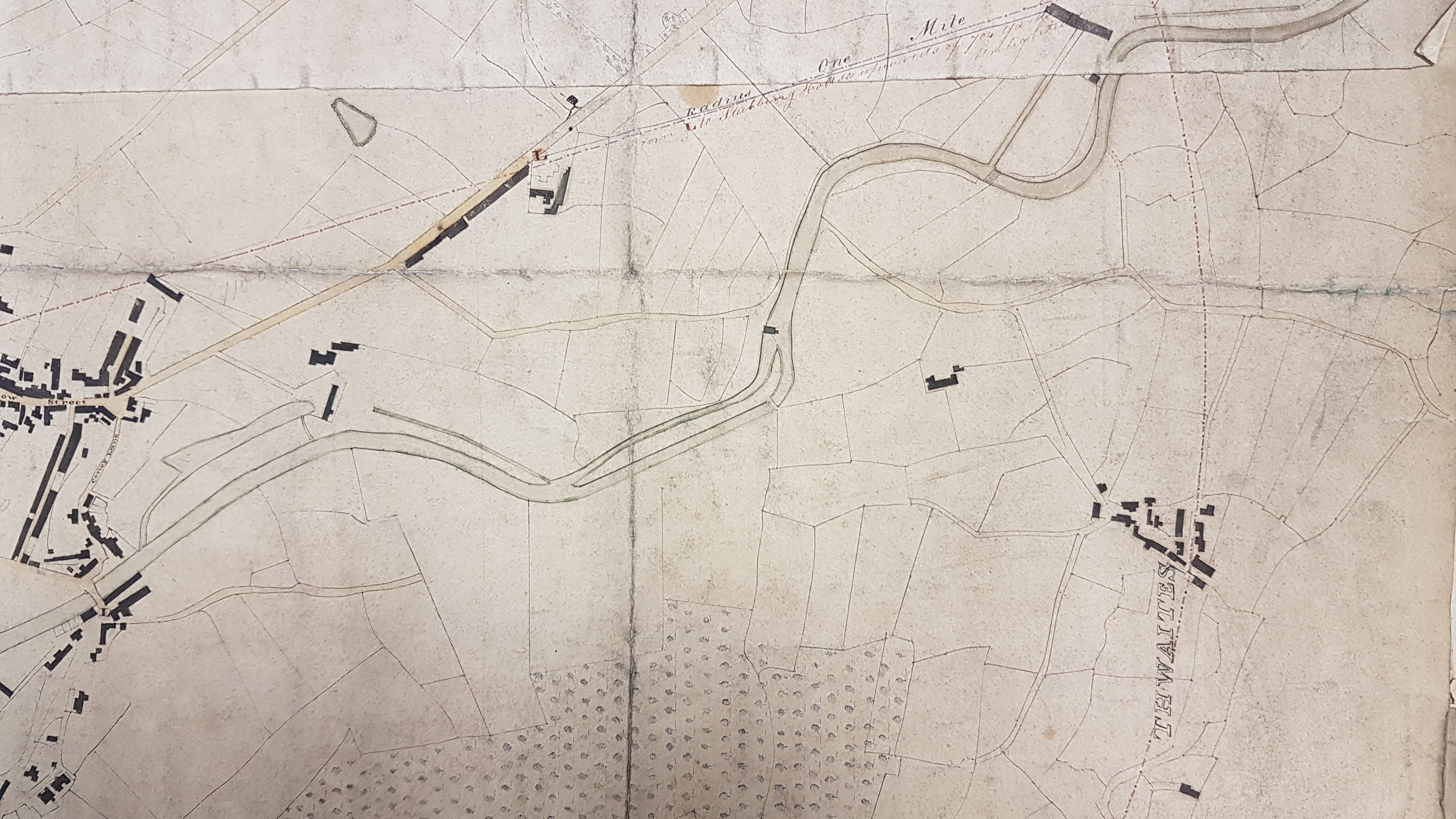
Drawn on this plan is a one mile radius circle, taking as its starting point the Devonshire Arms, Keighley. In addition to Keighley itself this boundary includes the then separate hamlets of Thwaites, Exlow Head and Ingrow. The river Worth and the North Beck are drawn, but not named. North Street, South Street and Low Street are named.
The map is undated. Globally there are far fewer buildings drawn that there are in the first OS map of 1852, which strongly suggests this map is at least a generation earlier. I thought that the best way of dating the map accurately was by looking at the textile mills that were present, and then checking on their construction dates. Unfortunately, I don’t know the history of Keighley well enough to do this from my own knowledge and I found getting such dates from on-line resources, such as Historic England, more difficult than I anticipated. Is there a Keighley historian who can help me out?
The best I can say at present is that it would appear, along the North Beck, the Castle Mill is built (1783) but the Northbrook Mill is not, although the mill ponds seem to be present. Calversyke Mill is definitely absent and this was constructed in the early 1830s. I’ve suggested a map date of around 1820 but this is not much better than a guess. I have no idea why the 1 mile circle was of importance.
Since I originally put this map on-line I appreciate that I can take the identification a little further. I now appreciate that I photographed a similar, but not identical, map several years ago which was also part of the Local Studies Library Reserve Collection.
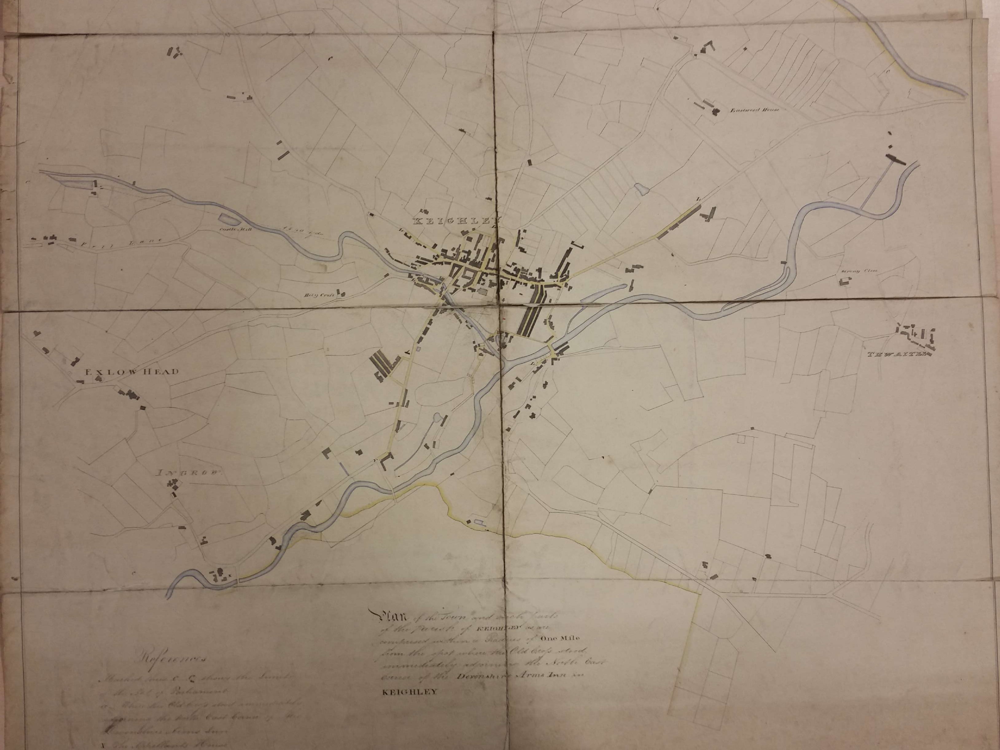
This map is annotated to the effect that the circle is drawn one mile from the NE corner of the Devonshire Arms, Keighley because this was the site of an old cross. This map was clearly evidence in some form of litigation since we learn that a line C-C marks the limit of the ‘Act of Parliament’. X is the appellant’s house and Z is Holme Mill. This previous map is slightly better labelled but does not have the large speckled areas which I interpreted as planted woodland.
There would appear to be a source map of Keighley which the surveyors drew on to create the maps we have, and possibly others. When I sent the earlier map to Keighley and Haworth historian Steven Wood he commented: ‘It is similar in style to a Keighley plan of which I have a photocopy. The original must be at Keighley Local Studies Library (unless theirs is a copy too). It has Keighley 1824 pencilled on it, but I have noted that it is actually c1840. That one has buildings on it which are not on yours so I wonder if yours is earlier – possibly the 1824 original?

I suggest that the one-mile circle is connected with the administration of the Poor Law prior to the 1841 reforms.
LikeLiked by 1 person