Index: CLA c1860 PLA
Clayton: Hirst Estate
Size: 20 * 29 inches
Material: Paper
Scale: 3 chains to an inch
Condition: good
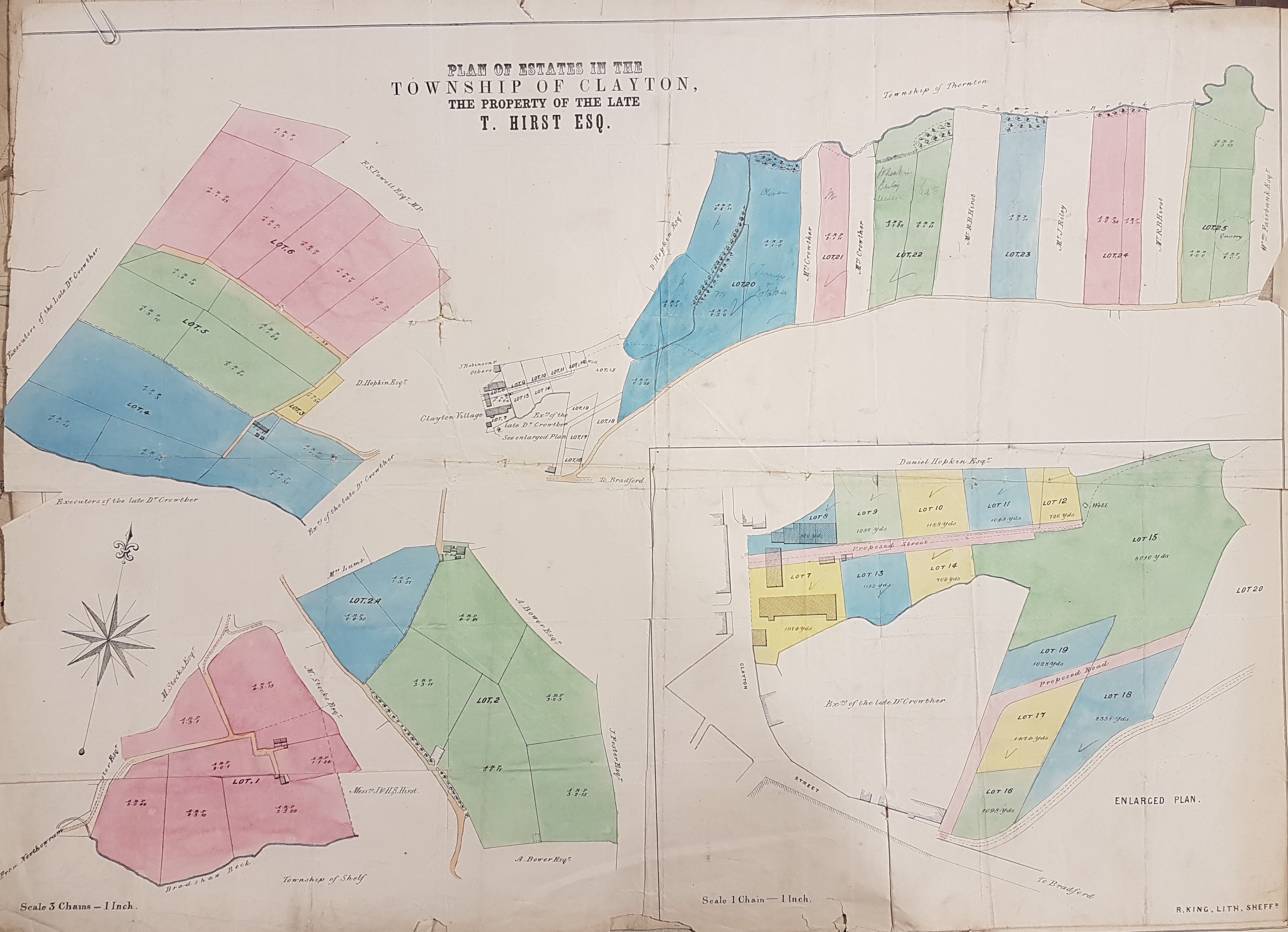
Comments: So far the reserve map collection has not generated a map of Clayton. This first example is an undated plan of part of the township – the property of the late T. Hirst (by R King, lithographer, Sheffield). The best opportunity of dating the map would seem to be the well-known name of landowner FS Powell MP. He must be Francis Sharp Powell. Our map must post-date 1857 (the year he first became an MP) but pre-date 1892, in which year Francis Sharp Powell MP (1827-1911) was created a Baronet and consequently became ‘Sir Francis’. The fact that our map closely resembles the first OS map of the area leads me to suggest around 1860 as its date. The lithographer who produced it was responsible for other maps in the 1850s, so that fits.
The Hirsts were an old established Clayton family. Was the ‘late T. Hirst’ the Thomas Hirst who built Clayton House, which is part of the C-shaped building in the centre of the map? But the Clayton History Group give his dates as 1763-1801. Would he have really needed executers in the life of his son John Hirst (1793-1852)? John Hirst provided the land on which Clayton Church was built. In view of John’s death date it would have been very convenient of the executors were for ‘the late J. Hirst’, but quite clearly they are not. Perhaps the property was owned by a different branch of the family.
Other landowners are recorded including the late Dr Crowther and Daniel Hopkin. Daniel Hopkin (1845-1913) was a Worsted Spinner & Manufacturer in Clayton and is a plausible landowner except for his youth at the likely time of the plan, but he had a father of the same name who could be our man. A Colonel Thomas George Fitzgerald, of Turlogh, Ireland (1778-1850) in 1819 had married Elizabeth (1788-1838), the daughter of a Dr James Crowther (Leeds). This Dr Crowther owned property in Bradford but he would also seem to be too early, and anyway I associate him with the Barkerend area of the city.
Can any Clayton local historian help me with the identifications please?

