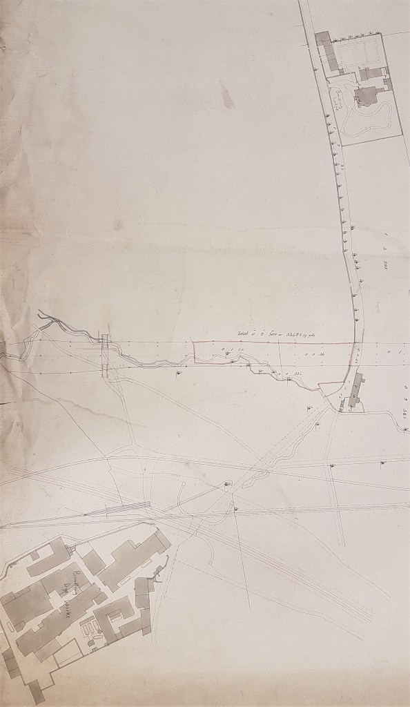
The file card associated with this map says that it is one of two copies and relates it to another map, BOW 1849 LIS. It is not possible to check these facts with the Local Studies Library shut, but there are several other maps of this area even in the reserve collection that I have studied. I admit that I have struggled to explain and date this particular map, but I shall explain my reasoning so far. To help understand the map I had to rotate it by 90˚ to the right, since north was on the left hand side. If the date of the map previously identified is correct then it should very closely resemble the first Ordnance Survey map of the area (published 1852), which was being surveyed in the late 1840s. I am absolutely certain that I can identify the building called Bowling Lodge. The plan of the building is virtually identical in the OS map, even down to the line of trees in the adjacent road. Oddly the lodge is called ‘Bowling House’ in the OS map, although I think that ‘Bowling Lodge’ was correct. The road on which the lodge is placed ends in three linked cottages. Bowling Lodge and Bowling dyeworks was the very famous concerns associated with the name Sir Henry William Ripley (1813-1881). There were two distinct branches of this dyeworks, and I shall illustrate the relationship of these with the Lodge by means of a detail from another map in the LSL reserve collection.
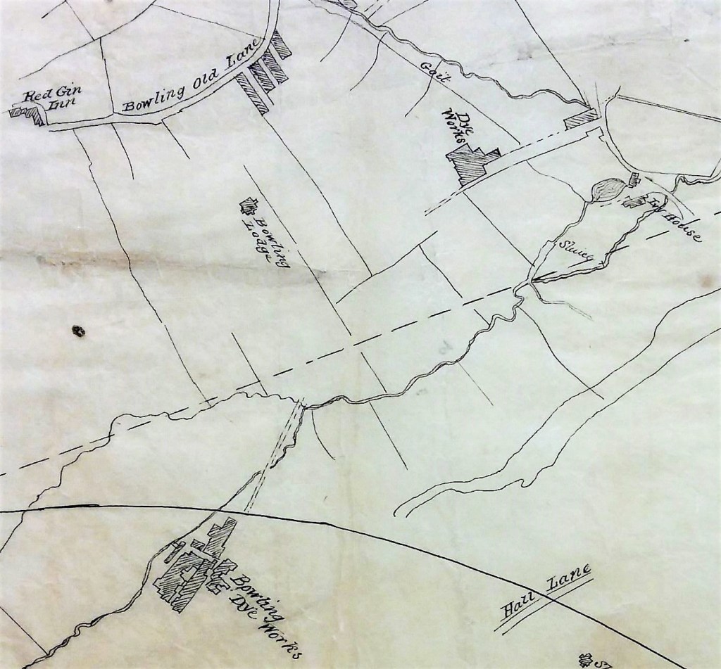
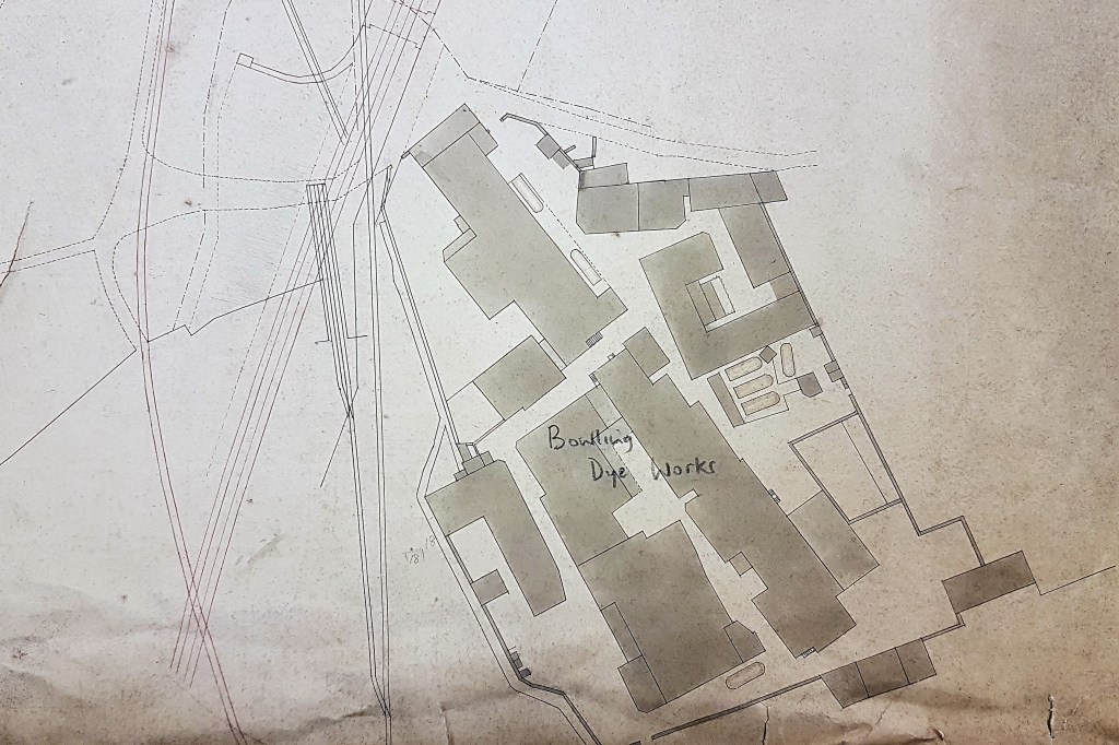
The second building mapped is mapped here is referred to as Bowling Dye House on the OS map and Bowling Dye Works on the above plan. The outline on the OS map and the current map are virtually identical. My problem is that it is impossible to get the Lodge and the Dye House into the correct alignment however you manipulate the map. My conclusion is that, confusingly, two separate buildings must have been drawn on the same map. Even finding the join is difficult. You can see the railway line from Bowling Junction curving round the building on its way to Laisterdyke and Leeds. Some of the complex network of associated linear map features will be mineral lines ending at Bowling Iron Works, others will be footpaths perhaps. Immediately outside the curve of the railway line should be the large ponds constructed for the works (which are missing from both maps here) and then the Halifax to Bradford branch of the Lancashire & Yorkshire railway. Have these simply been omitted, or is it possible they were not yet constructed?
Determining the map’s exact date is quite difficult. The Bowling Dye House had been built at Spring Wood (which is not mapped) in 1822 but the business had been founded much earlier by the grandfather of HW Ripley. Bowling Lodge was built for HW Ripley in 1836. The straight course of the Lancashire and Yorkshire Railway into Drake Street (Exchange) Station should be present in maps after 1850 but appears to be missing here. What are definitely missing on these maps are the Dye Works’s huge reservoir and several dye pits although these are clearly present on the 1849 Bradford borough map. I’m not sure exactly when the new second Dye Works was constructed but it was certainly also in existence by 1849. The curved track from Bowling Junction to Laisterdyke was opened in 1854: it enabled Halifax to Leeds trains to avoid delays caused by entering and reversing out of Bradford. Clearly it is not possible to derive a single date that explains the presence and absence of all these features.
