X11 Index: MOO c1850 ALL
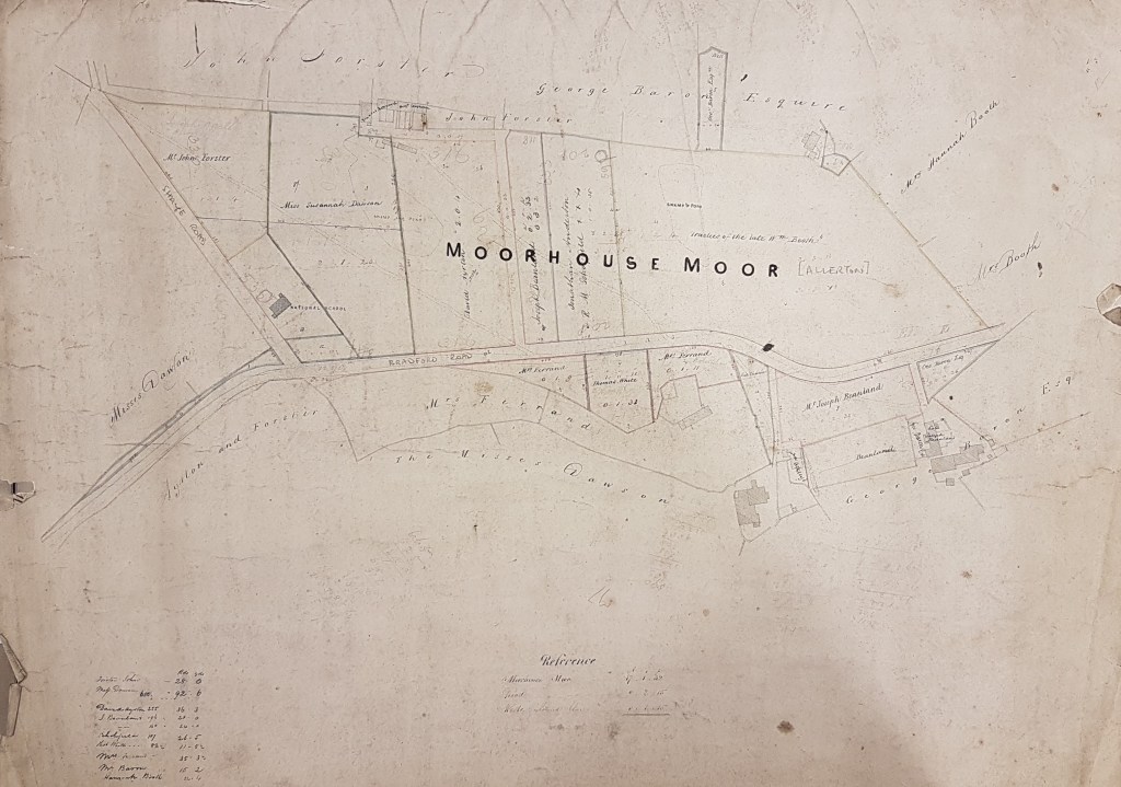
Land at Moorhouse Moor, Allerton
Size: 26” * 22”
Material: Paper
Scale: unk
Condition: good
This item is an undated manuscript plan of an area a little to the west of Allerton. It is correctly oriented west-east. The place name Moorhouse Moor was unfamiliar to me, but it is so designated on the first OS map (1852). The presence of a National School, near the Shaye Road – Bradford Road junction, makes it possible to locate the site with no possibility of error. A National School was associated with the ‘National Society for Promoting the Education of the Poor in the Principles of the Established Church in England and Wales’ founded in 1811. All schools founded by this society were called National Schools and were supervised by the local vicar and members of the Church of England. By the 1890s Bradford Road had become Allerton Road, and the ‘Shaye Lane’ still leads to Shay Farm (shay and shaw, OE a small wood, are common local place names). The Allerton Road – Prune Park Lane intersection is just east of the location of this plan.
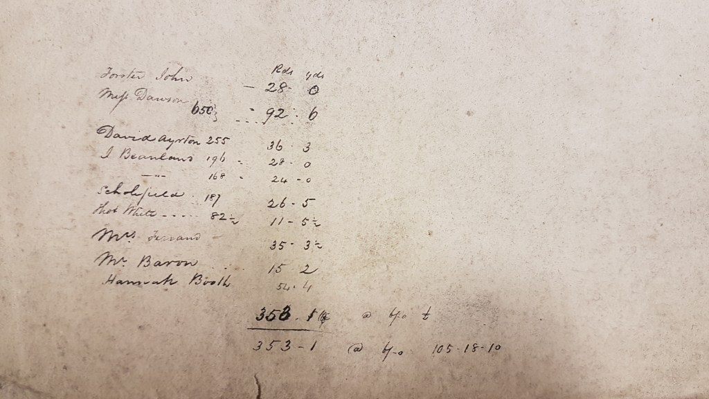
A search in the Bradford Observer has only been partially successful in explaining the reason for its existence. In the years 1839-1844 some property of the Joseph Beanland, whose name you can see, was sold after a case in the Chancery Court called Beanland v Halliwell. This case seemed to be concerned with whether a mortgage should be paid first after testator’s death. Papers concerning the case are in the National Archives if anyone is interested. The Moorhouse Moor estate was then sold, along with other estates, in 1850. I don’t know who the vendor was or whether the sale was connected to the Chancery case.
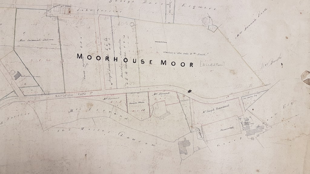
Building in this area has never been taken very far and I think it would be difficult to confirm the date of the map by referring to the farm buildings. The landowners may be easier. A Miss Eliza Dawson of Royds Hall 1814-1879, daughter of one of the Low Moor Iron Company partners, has appeared in this series before as an Allerton landowner. I assume Mrs Ferrand is Sarah Ferrand, of the famous Bingley family, who died in 1854. George Baron of Clockhouse Estate is a land-owner from 1840, until he also died in 1854. All in all I think 1850 is then a perfectly plausible date for the map. The land opposite was the location of Allerton & Wilsden Colliery at the end of the nineteenth century. A Google Earth aerial view suggests that most of the land in this area is disturbed. Both mining and quarrying, or both, are possible causes.