BRA c1828 PLA
Size: 22 * 24 inches
Material: Paper
Date: c.1830
Scale: unk
Condition: fair – shows water damage
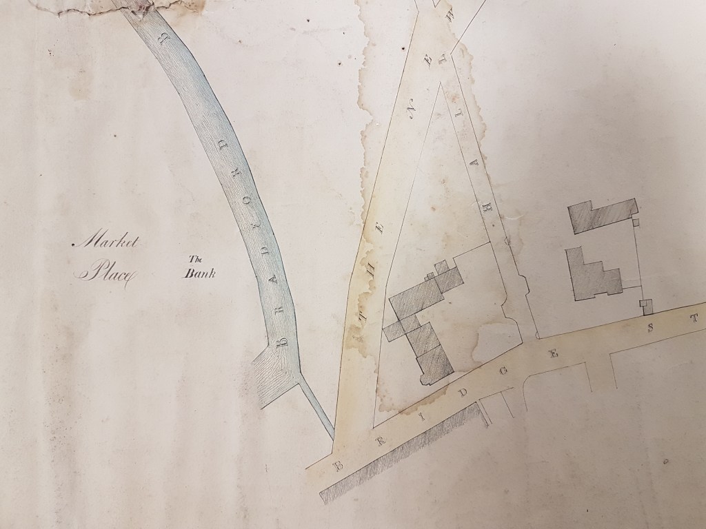
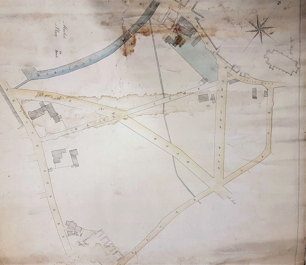
Comments: BRA/PLA. This is an early map of Bradford which has suffered quite severe water damage at some stage. The map is not easy to interpret since it differs very considerably from the modern street plan. At least St Peter’s Parish Church (now the Cathedral) is included which is a huge help in orientating yourself. I would suggest rotating the map so that north in the direction indicator points to 2 o’clock. The map is undated but helpful clues are the absence of the old GPO building (1886) and Exchange Station (1850). These omissions would certainly place the map in the first half of the nineteenth century which would fit stylistically. The absence of the first Mechanics Institute (1831) but the presence of the ‘New Road’, later Leeds Road and then Well Street (1825), suggests a date around the year 1830.
There is no internal evidence touching the use to which the map might have been intended except for the blue tinted plot off Well Street. Could it be a sale plan? The various pieces of property belonging to Rev. Godfrey Wright are well recorded in the reserve map collection and are mentioned frequently in this series. I don’t believe that this plot is one of them.

Evidently the Bradford Beck (called here Bradford Brook) was largely above ground when this map was surveyed but within 20 years everything visible would have been culverted. The thin watercourse joining the Bradford Beck is the East Brook I assume. North-west of the Bradford Beck is an area described as ‘The Bank’. I assume that this is a descriptive name and doesn’t refer to a financial institution, but even in the 1802 Bradford map this area is thickly populated with buildings together with a ‘new’ market-place. Another new street, which became Market Street, was at this location but is not drawn.
I would dearly like to know the function of the buildings that are drawn in as hatched blocks. At present I have the 1802 map and another reserve plan of a similar date for comparison purposes. This second plan places a coal staithe (supplied by Low Moor Iron Company) at the corner of Well Street and Hall Ings. Opposite was a house that did belong to Godfrey Wright. The buildings at the other end of Hall Ings, at its junction with Bridge Street, were also present in 1802 and I know that Godfrey Wright owned some of this property too although I cannot name it yet. The Sion Chapel was also in Bridge Street: but where? Some of the well to do of Bradford would have lived near the Parish Church and the buildings in Church Bank would have included the Old Vicarage, the Church Steps Inn and Old Grammar School.