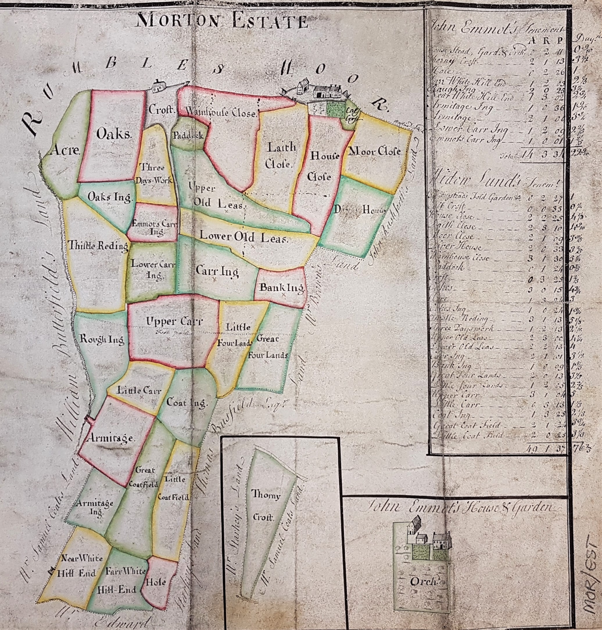
Morton Estate
Paper Undated Scale unknown 12*12 ins
This beautiful map of Morton, Bingley is undated although stylistically it would seem to be of the late eighteenth century. No compass point is provided although Rumbles (Rombald’s Moor) must surely indicate north. The area was known for a number of mills in the late eighteenth and early nineteenth century. Nothing of that sort is present here which suggests a date prior to 1790, I would assume.
There is an obvious watercourse on the left side of the map: is that intended to represent the How Beck in West Morton or the Morton Beck in East Morton? There is a north border field called Croft, and it has a house on it. Croft House survives to the present day, having been built in the seventeenth or early eighteenth century. The dwelling on our plan looks like a very modest cottage but the building to its right looks like a more plausible farmhouse, coach-house and barn. That would seem to put the map in East Morton. I’m not familiar with Croft House myself but I know where its listing document places it. I’ve tried to match surrounding field boundaries with those on Ordnance Survey maps but by the time of the first OS map of the area, surveyed in the late 1840s, the area looks so different that I have failed. The only shared name between the two maps is ‘Paddock’ but this is rather non-specific to be of much help.
Another approach is to consider the many land-owners’ names mentioned. This estate appears to be divided between John Emmott and the Widow Lund. Several adjacent owners are mentioned: William Butterfield, Samuel Coats or Coates, Edward Starkey, John Rushforth, Mr Brown and Thomas Busfield or Busfeild. I have been in touch with Bingley district historian Allan Mirfield who has kindly looked at the map. He tells me that the names are not familiar to him, which suggests that the Widow Lund and the others haven’t carved their names deeply into the fabric of the area. The exception is that there was a son of William Busfeild of Ryshworth Hall called Thomas (1669–1772): so could he be the Thomas Busfeild of the map? I’ve looked at Bingley Land Tax Records for 1753 and 1781. Thomas Busfeild features there too, but none of the others. Can anybody help?
