WES 1845 LIS B19 1366
Lister & Ingle
Paper 45*36 cm 1 chain = 5 inches Condition: fair
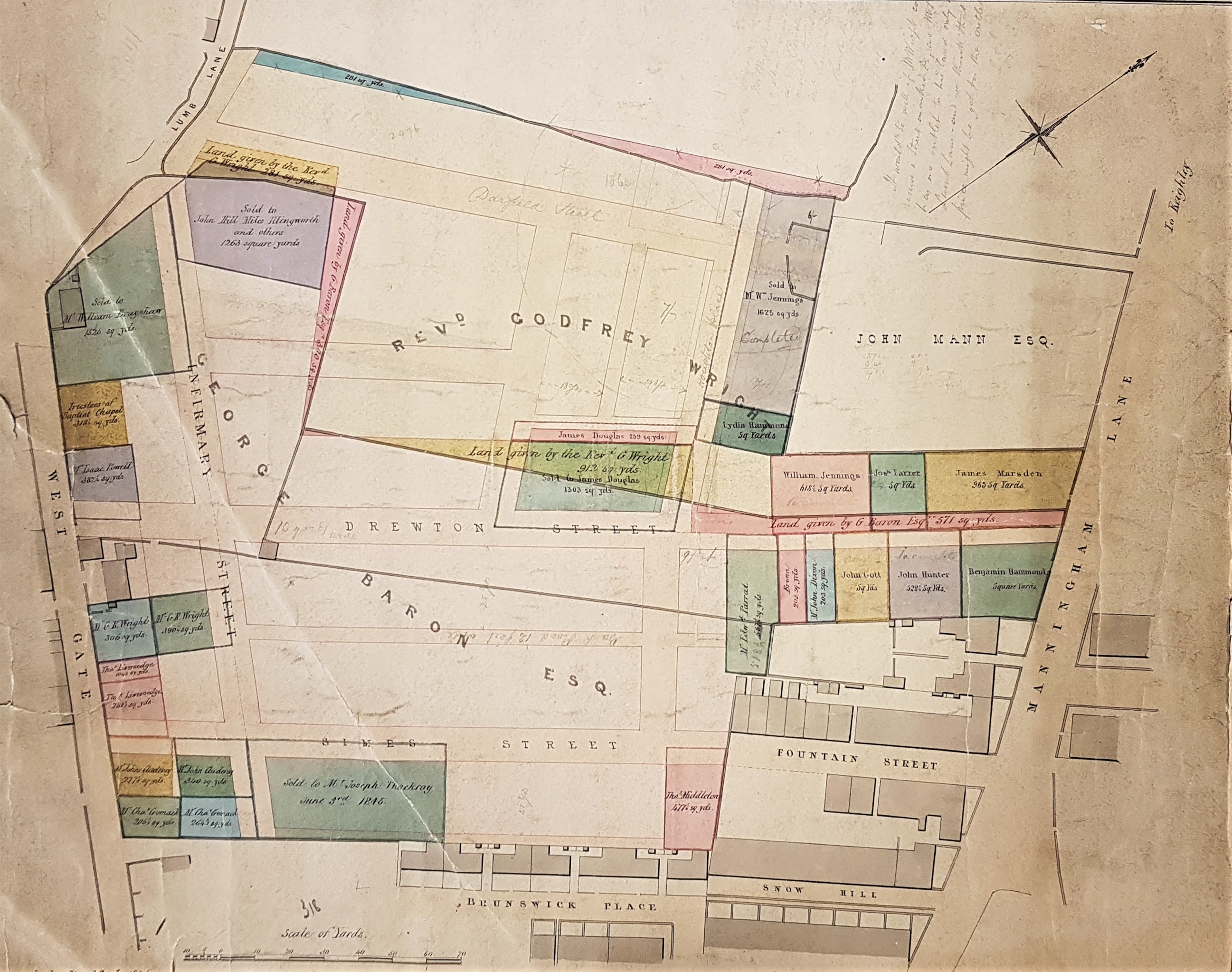
Jan Sykes suggested I look at this map from the Local Studies Library permanent map collection. There would be no difficulty then if you wanted to examine the original: there are a number of pencil annotations which are not likely to be clearly visible unless you do this. The top of the map is north-west and it is easy to see where we are since the branching of Lumb Lane off Westgate is locatable near the top left. At the extreme top left is a blank space but this was the location of the old Bradford Infirmary, in 1845 quite recently built. This area is still called Infirmary Field today and you can see Infirmary Street leading to it. Manningham Lane occupies the right side of the map. In the 1830s, according to William Scruton, the space reaching from Brunswick Place to the end of Lumb Lane was one stretch of green fields, in which were fixed posts or ‘tenters’, to dry and stretch cloth. I trust readers are now on tenterhooks waiting for the remainder of this article!
One reason for which I like this map is that it fits harmoniously with an article by Catherine Thackray in the Bradford Antiquary which you might also like to read since it is available on-line (Bradford Antiquary, 1986 third series, volume 2, pp. 1-14). This is a superb and detailed account of her husband’s family, and the personalities to be found in and around Brunswick Place, a location which you can see at the map bottom. As a whole the map shows a very clear pattern of new streets between Westgate and Manningham Lane, some of which have now been swept away. Drewton Street (now Road) still exists and is the extension of Hamm Strasse. GT Lister, one of the surveyors who drew up this map, lived there. Simes Steet and Fountain Street survive but they front on a car park now. Fountain Street is probably the oldest construction. When he was trying to make his way as an artist Branwell Bronte (1817-1848) had a studio here and lived at Fountain Street in 1838 and 1839 (a mere six years before the creation of the map). On the bi-centenary of his birth, his studio was celebrated by the unveiling of a permanent storyboard on North Parade, a process organised by local poet Bruce Barnes. Brunswick Place and the rather lovely sounding Snow Hill have disappeared under the market and other buildings. Only a stump of Infirmary Street remains. Very few of the buildings shown on the map can have continued to the present. Even the few obvious Victorian survivors seem to be of a later date. Possibly the building at the Manningham Lane – Fountain Street corner remains, in a neglected state, from that time. The nearby frontage of the old Fountain Hall has been protected by scaffolding as long as I can remember. The listing document explains that this was originally the Friends Meeting House at 11 Fountain Street. What’s left is a tall 2-storey sandstone ashlar front with heavy classical details. The suggested construction date is c. 1840-1850.
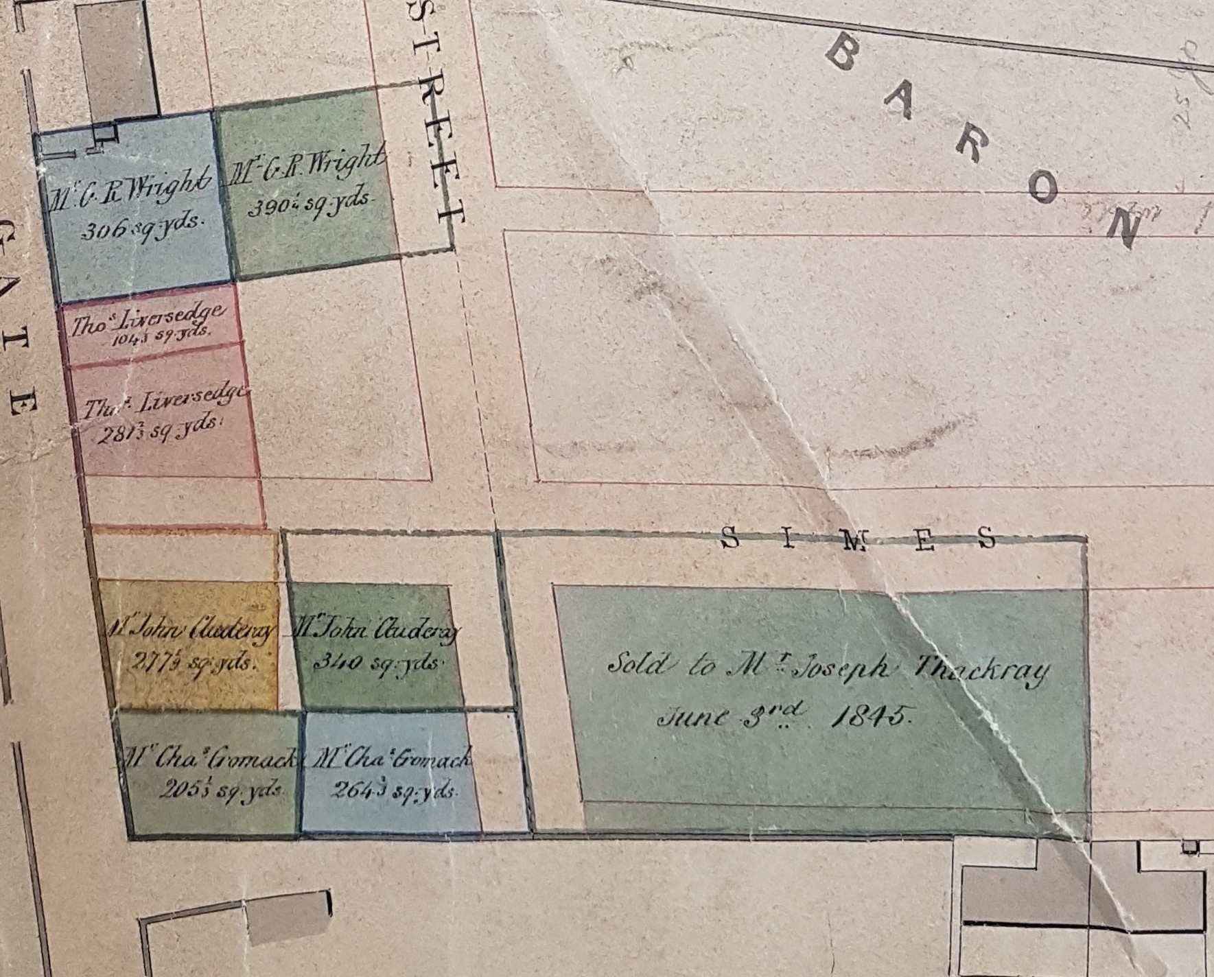
If you go to Brunswick Place at the bottom of the map you will see that a plot of land between it and Simes Street has been sold to a Mr Joseph Thackray. Joseph Thackray (1783-1851), was a stone merchant, and a partner in the firm Cousen & Thackray. He lived in Shelf but his counting-house was in Brunswick Place, Bradford, where he died of ‘a gradual decay of nature’. His story was most ably told by his descendant, Catherine Thackray (Bradford Antiquarian 1986 third series, volume 2, pp. 1-14). Just south-east of Brunswick Place was Cousen & Thackray’s Coppy Quarry which is now covered by a building which was until recently Morrisons supermarket. Joseph Thackray’s first partner was James Cousen, of Rawson, Clayton & Cousen, coal merchants. He and his wife lived at Miry Shay, a fine 17th century house off Barkerend Road, near his coal mine of Bunker Hill.
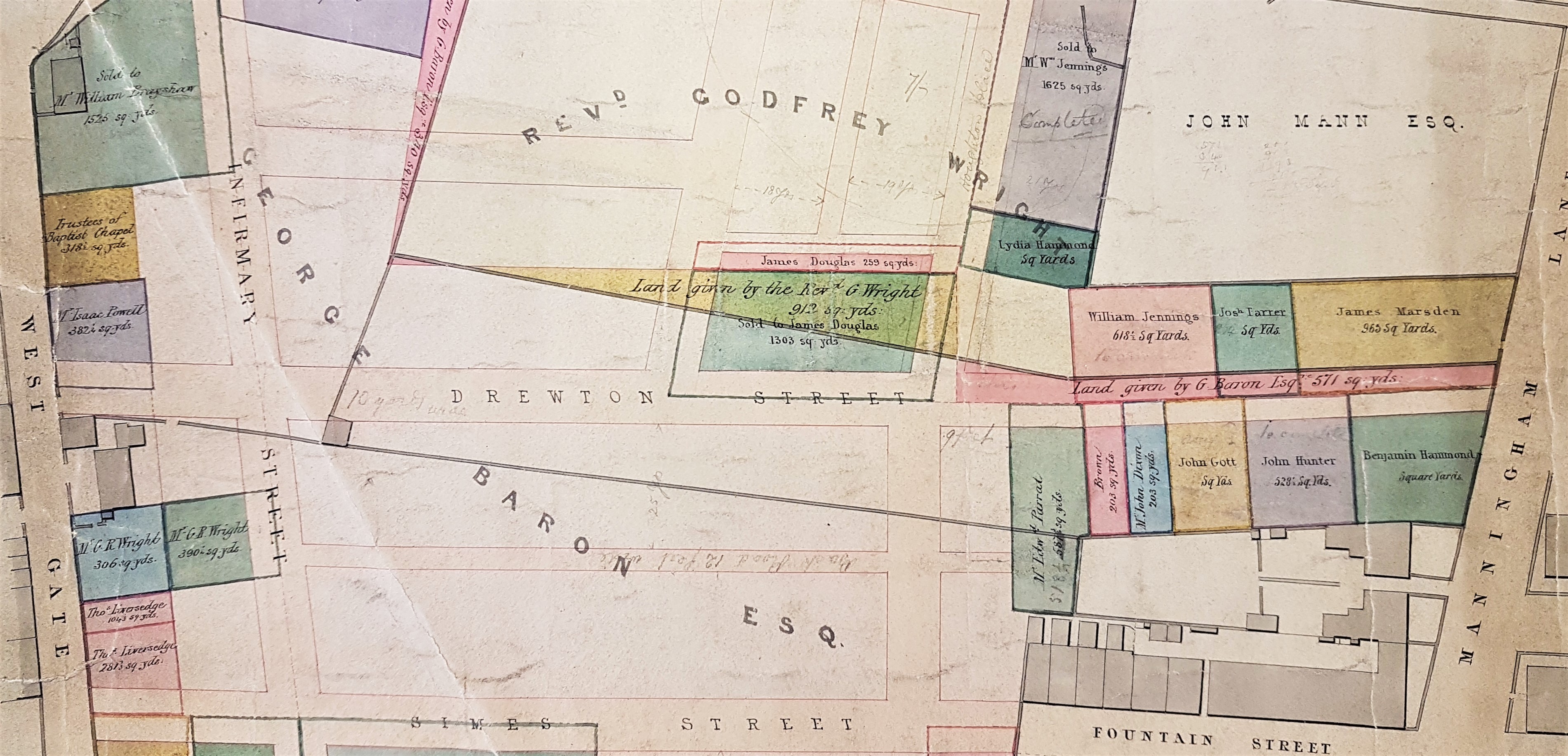
There are two big landowners on this map. The first is George Baron (of North Cave). At this time he possessed the Clockhouse Estate but his death, unmarried, in 1854 was to trigger the notorious ‘Clockhouse Case’. The Rev. Godfrey Wright is an obsession of mine. Godfrey Charles Wright (1780-1862), of Hooton Pagnall, Doncster, is a largely forgotten major landowner in Bradford. He possessed property in what would later become the the city centre but also at Horton, Manningham, Baildon, Eldwick and elsewhere. The first of his appearances in the local press that I can trace is from 1819, when he subscribes 2 guineas to Leeds General Infirmary. At that time he is already being referred to by his clerical title. Wright does not seem to have lived in Bradford for any prolonged period, if at all. His wife died in 1821 and certainly by 1822 he was resident at Bilham House, Hooton Pagnell, where he remained for the next 40 years. Later, in census reports, he described himself as a ‘clergyman without cure of souls’, and usually had an indoor and outdoor staff of a dozen or more. He was still living at Hooton Pagnall (with 10 servants) at the time of the 1861 census, and he died the following year. He was described after his death as a staunch Conservative and left £80,000 to his heirs in 1862 which equates, according to the National Archives currency converter, to £3,452,800 at 2005 values. It is very natural to wonder how a clergyman acquired all this wealth and property. Victorian Bradford historian William Cudworth believed that Godfrey Wright’s prosperity resulted from a relationship with three important local families: the Swaines, the Fields, and the Booths.
