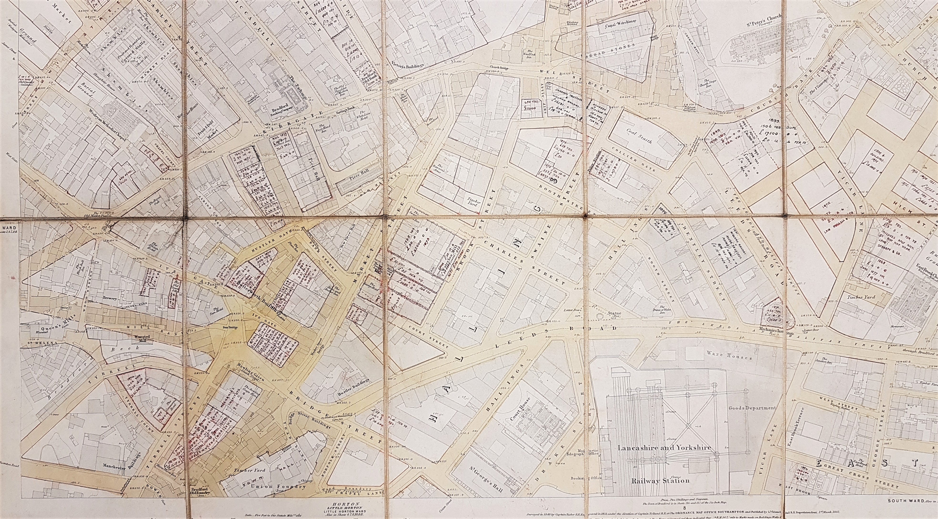
This map was kindly brought to my attention by Mick Birdsall. The sections reproduced are taken from sheet 5 of the 1852, 5 feet to 1 mile, town plan of Bradford. It is believed that plans like this were published for towns in Yorkshire & Lancashire with populations over 4000. This particular sheet has been over-lain with a more recent street grid. In addition to long established thoroughfares it includes more recent streets created in newly developed areas. To illustrate some of the locations I have also included some images taken from Old Bradford Views: from the Cudworth Collection (1897). The unique feature of this map is that annotations in some locations show quite detailed land and property sale prices, area in square yards, and what appears to be the names of contemporary owners. These additional entries are made in red ink and are often dated. As far as I can see the earliest date is 1865 and the latest 1900: the bulk are from the 1870s but the profusion of entries would make a mistake easy to make. I don’t find copperplate script easy but written in the bottom right corner of the map is a name which I think is Mawson & Hudson, architects. If I am correct this partnership was located at 2 Exchange Buildings, Market Street (see the 1891 and 1902 Bradford Directories). The original Mawson must have been William Mawson (of the more famous partnership of Lockwood & Mawson) but he had died in 1889. Mawson & Hudson designed Cleckheaton Town Hall, but who the partners were during the creation of this map I am uncertain. Presumably it represented a brief account of projects in which the partnership had been involved.
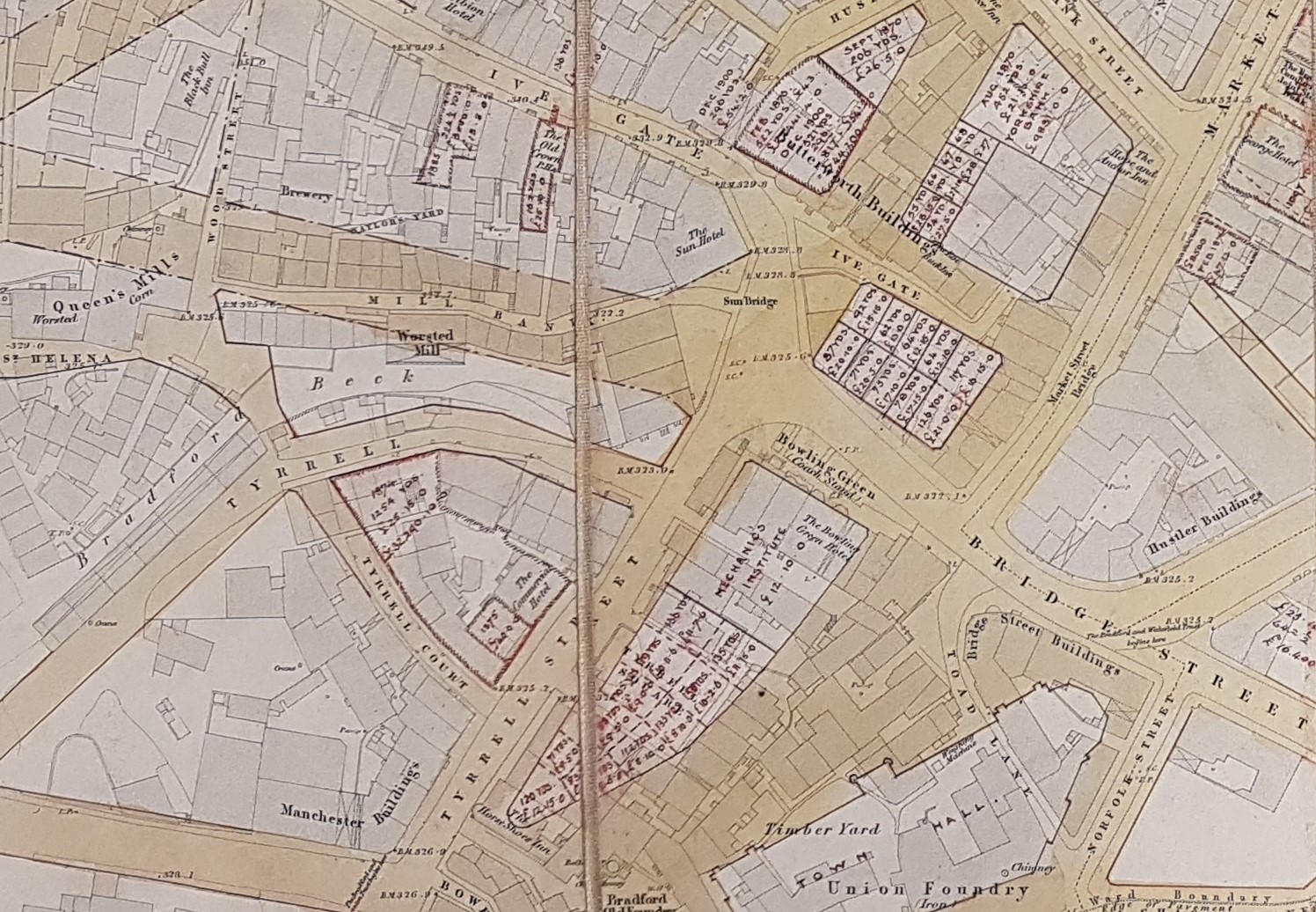
The map incorporates many interesting features. The point of origin of the trusts that built the various Bradford turnpikes is clearly indicated, as are the locations of the various Bradford inns. At the bottom left corner of the map you can see the Bradford Beck. Close to this is a forgotten district called St Helena and the Queens Mill (previously the Soke Mill) which is still divided between corn and worsted milling. Immediately above this dotted red boundary lines indicate the course of the planned, but as yet unnamed, Sunbridge Road. This was created as recently as 1875 which helps date the addition of the street plan.

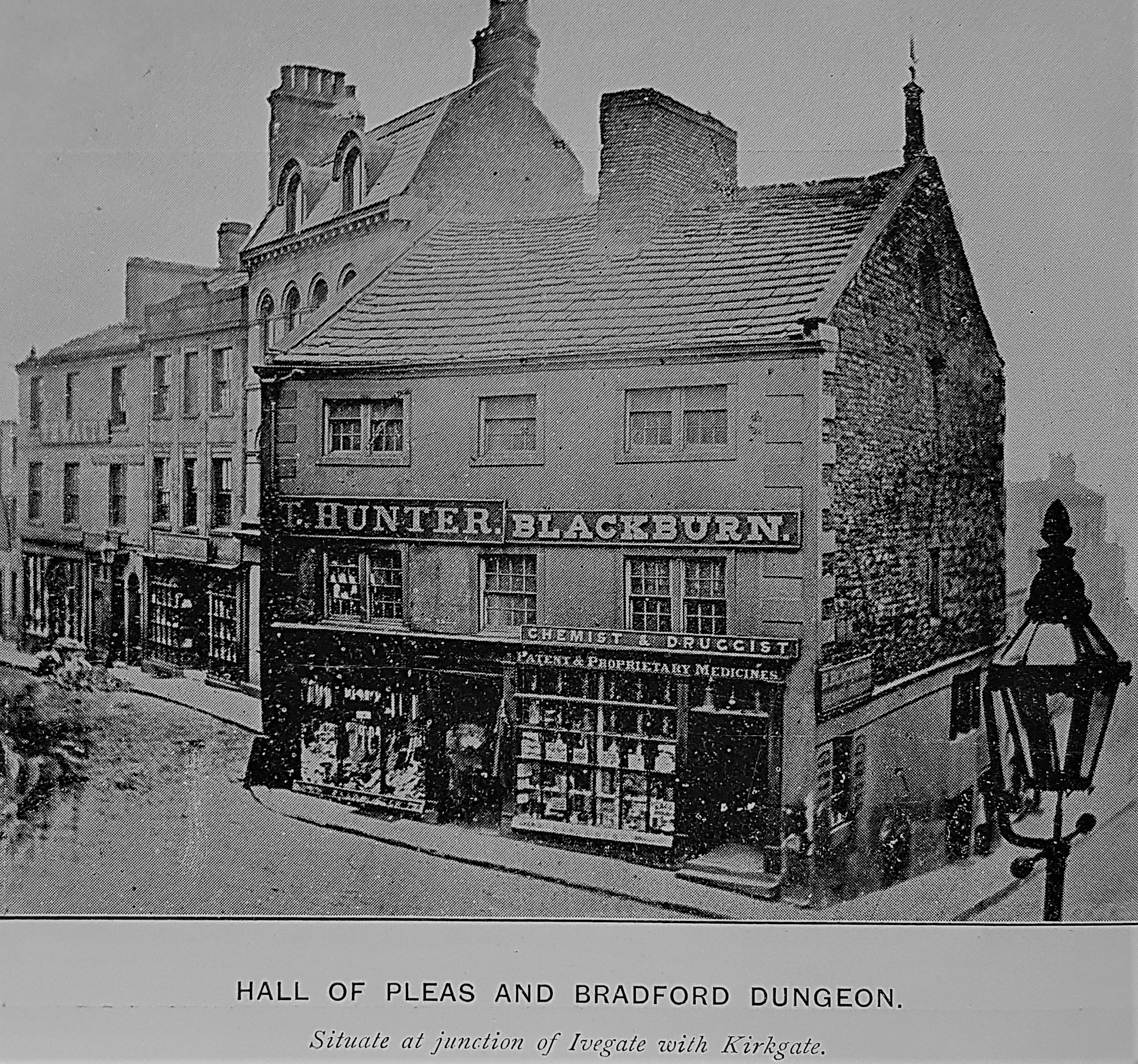
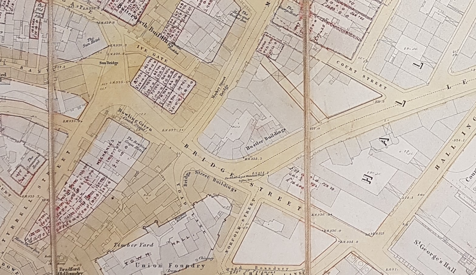
At the junction of Kirkgate and Ivegate you may just be able to read a note indicating that this was the site of the Old Market Place and the Toll Booth, which seems to have been a Hall of Pleas where the ancient courts baron and court leets were held. A dungeon is marked which was deep below the Toll Booth. Cells are still visible in Sunbridge Wells which must I think be from the dungeon. These cells seem to have incorporated a quarry edge which must date from an even earlier Bradford.
It appears that by 1852 the remains of the original market cross had been removed from this site to the Bank Street – Hustler Gate junction. Where is it now I wonder?
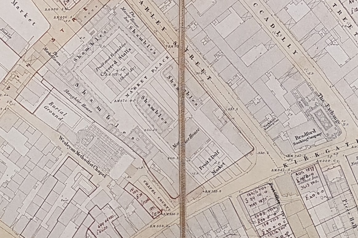
Nearby to the north-west is an extensive market place which appears to be surrounding the Manor House built by the Rawson family in 1705, probably at the site of an older building. It is immediately adjacent to an extensive Wesleyan (Methodist) Chapel and burial ground.

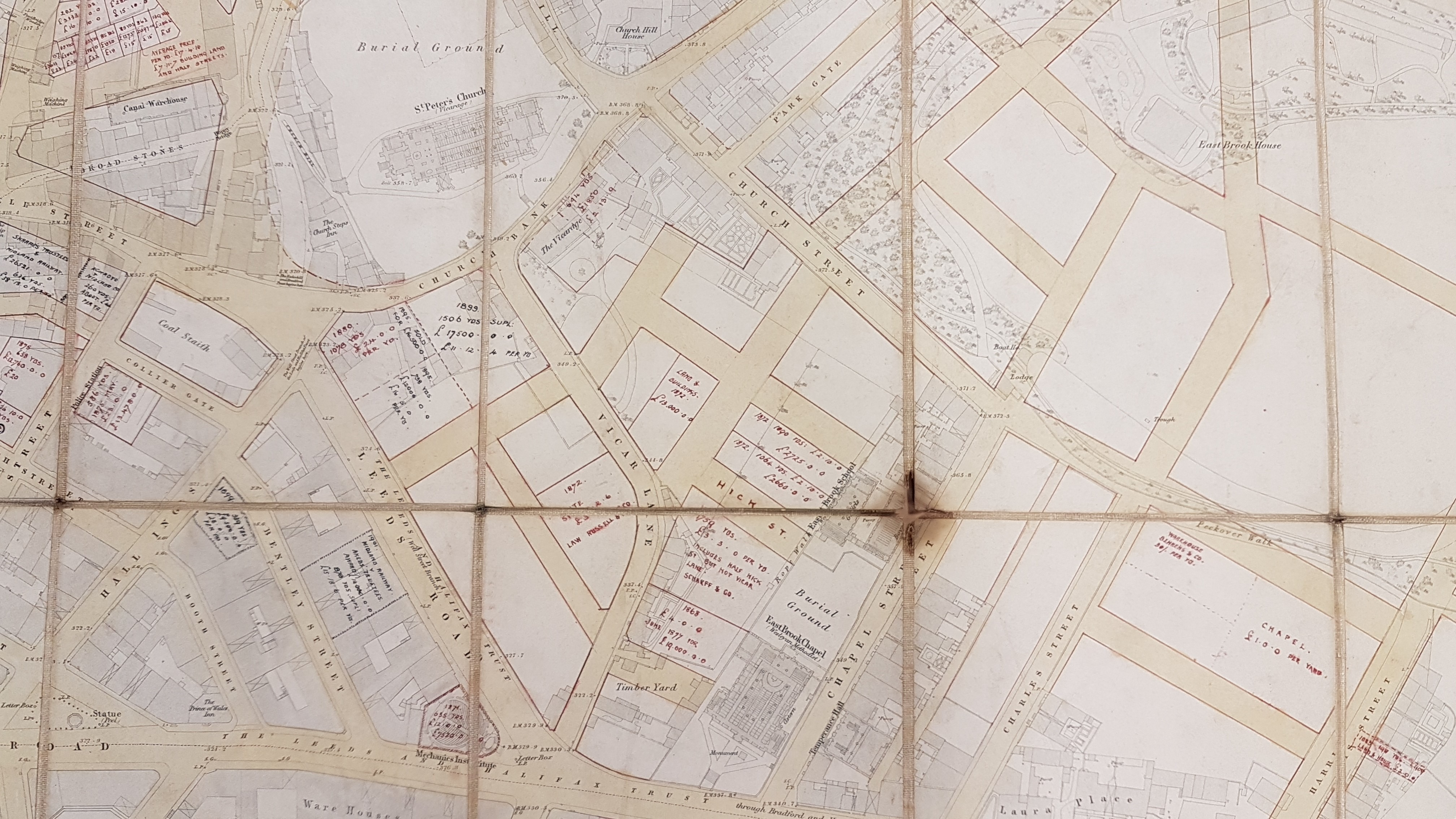
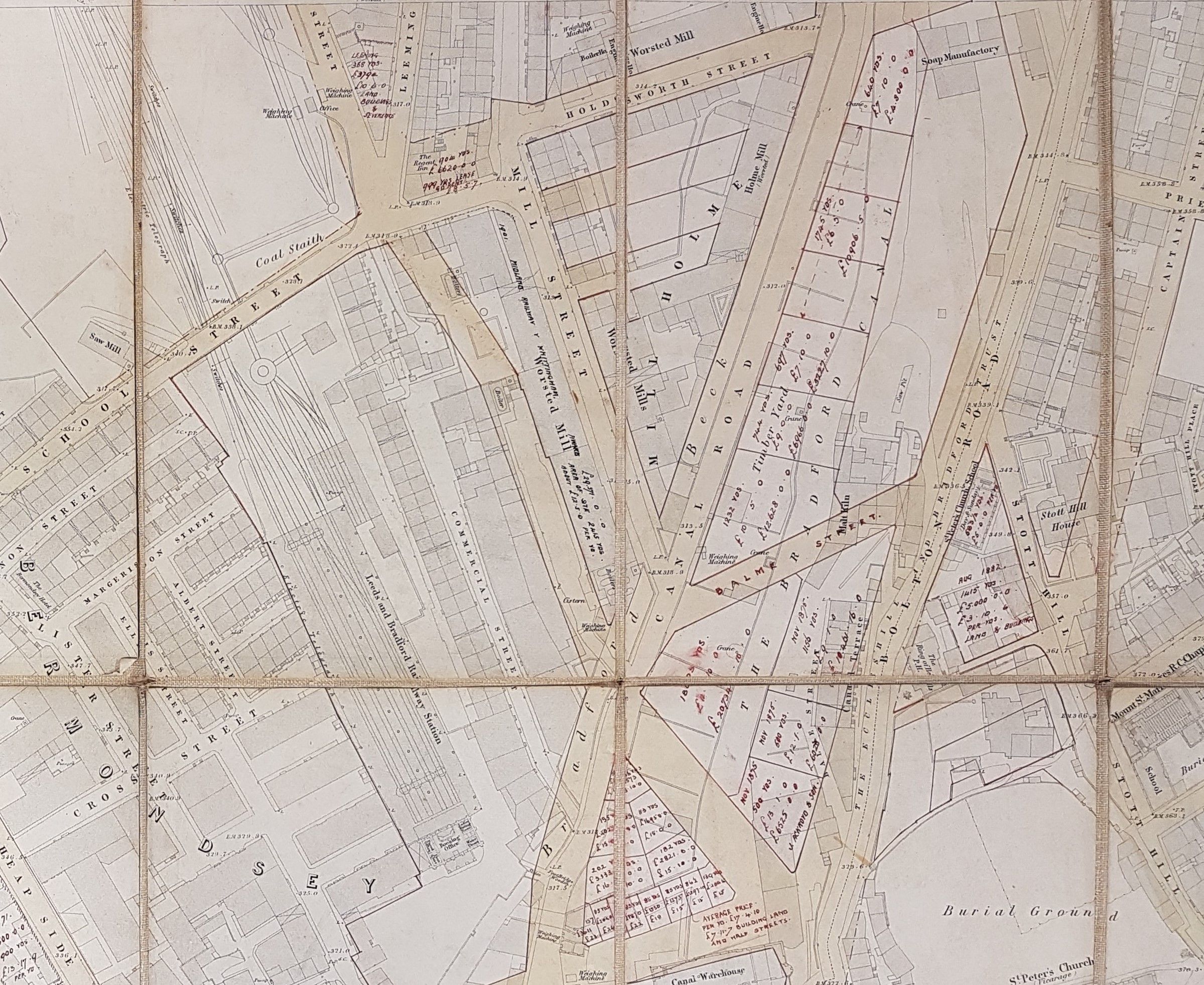
This portion of the map shows the area which became known as Little Germany. The original 1852 map shows East Brook Hall and the extensive park that surrounded it, including a lake and Peckover Walk. The Little Germany street grid, but without street names, is superimposed. There are no further annotations which leads me to suppose that these architects were not involved with its development. The area around the parish church (now Bradford Cathedral) is also entirely untouched. South-west of this is a coal staithe on Collier Gate. Another ‘old coal staithe’ is off Leeds Road and was supplied by a mineral tramway from Bolling Iron works.
Mawson & Hudson do seem to have been deeply involved with canal-side development. Incidentally I hadn’t appreciated that in 1852 there was a large malt kiln with a canal-side frontage here until it was destroyed by the creation of Balme Street.
At the left bottom edge of the map we can see very clearly how Bradford Town Hall (constructed 1873) was imposed on the existing buildings. There must have been wholesale demolition of earlier industrial premises.
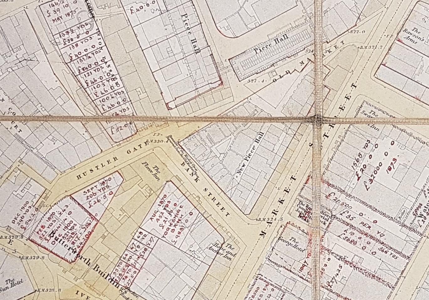
There are some puzzles. The old Market Hall was demolished and replaced by the Wool Exchange (constructed 1864-67).
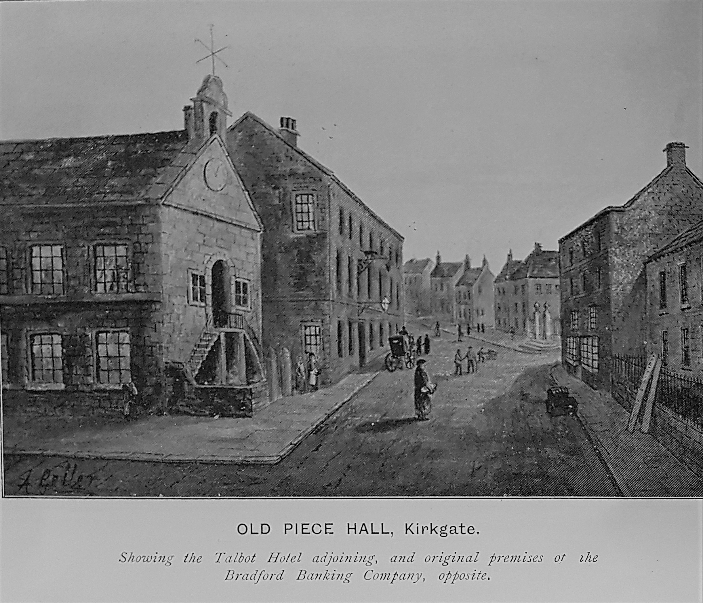
The perimeter of the Wool Exchange is drawn in red. On the 1852 map section above one of the cluster of subsequently demolished buildings is described as ‘New Piece Hall’. Immediately north of this is an unnamed narrow thoroughfare which is now Piece Hall Yard. I understood that this was the original location of an eighteenth century Piece Hall. The illustration must be the Kirkgate end of this building whose location is identified by the presence of the Talbot Inn. However on the map is a second Piece Hall at 90 degrees with a frontage on Old Market. Truthfully you could devote weeks of study to this map and still not exhaust its resources and I very much hope I might interest a reader in doing exactly that.
